File:Belgium-walkingroutes-boechout-vremde.png
Jump to navigation
Jump to search
Size of this preview: 600 × 600 pixels. Other resolutions: 240 × 240 pixels | 480 × 480 pixels | 768 × 768 pixels | 1,024 × 1,024 pixels | 1,600 × 1,600 pixels.
Original file (1,600 × 1,600 pixels, file size: 383 KB, MIME type: image/png)
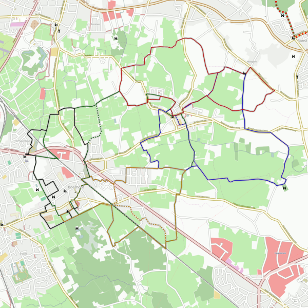
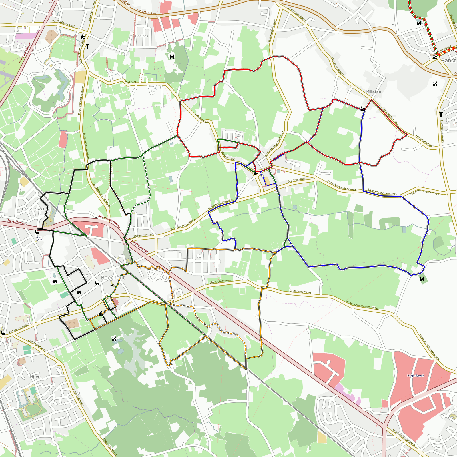
Walking routes in Boechout and Vremde, near Antwerp, Belgium.
green: Jef Van Hoofpad
blue: Bloemenhofpad (incomplete)
red: Millegempad
orange: Boshoekpad (incomplete)
black: Veldkantpad
Shortcuts and alternative routes are dashed.
File history
Click on a date/time to view the file as it appeared at that time.
| Date/Time | Thumbnail | Dimensions | User | Comment | |
|---|---|---|---|---|---|
| current | 13:08, 13 April 2009 | | 1,600 × 1,600 (383 KB) | Eimai (talk | contribs) | |
| 20:11, 31 July 2008 | 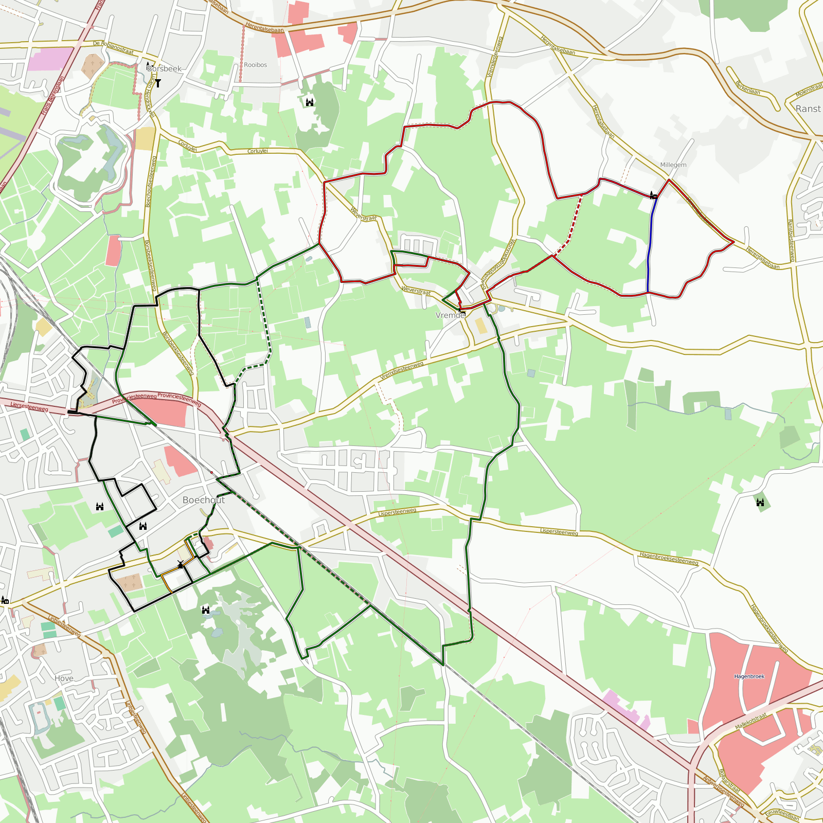 | 1,600 × 1,600 (353 KB) | Eimai (talk | contribs) |
You cannot overwrite this file.
File usage
The following page uses this file: