File:Bild - Flussdiagramm für Adressen, die nur in OpenStreetMap vorhanden sind.png
Jump to navigation
Jump to search

Size of this preview: 800 × 566 pixels. Other resolutions: 320 × 226 pixels | 640 × 453 pixels | 1,024 × 724 pixels | 1,123 × 794 pixels.
Original file (1,123 × 794 pixels, file size: 59 KB, MIME type: image/png)
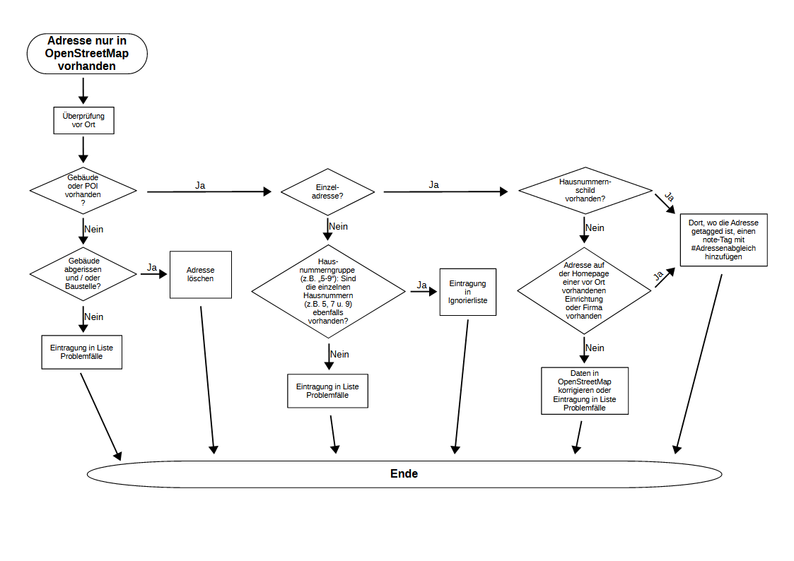
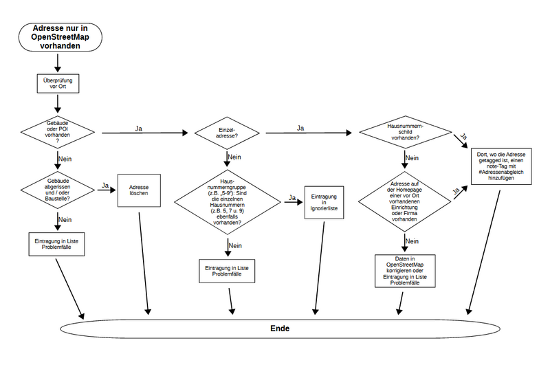
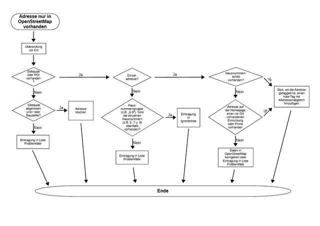
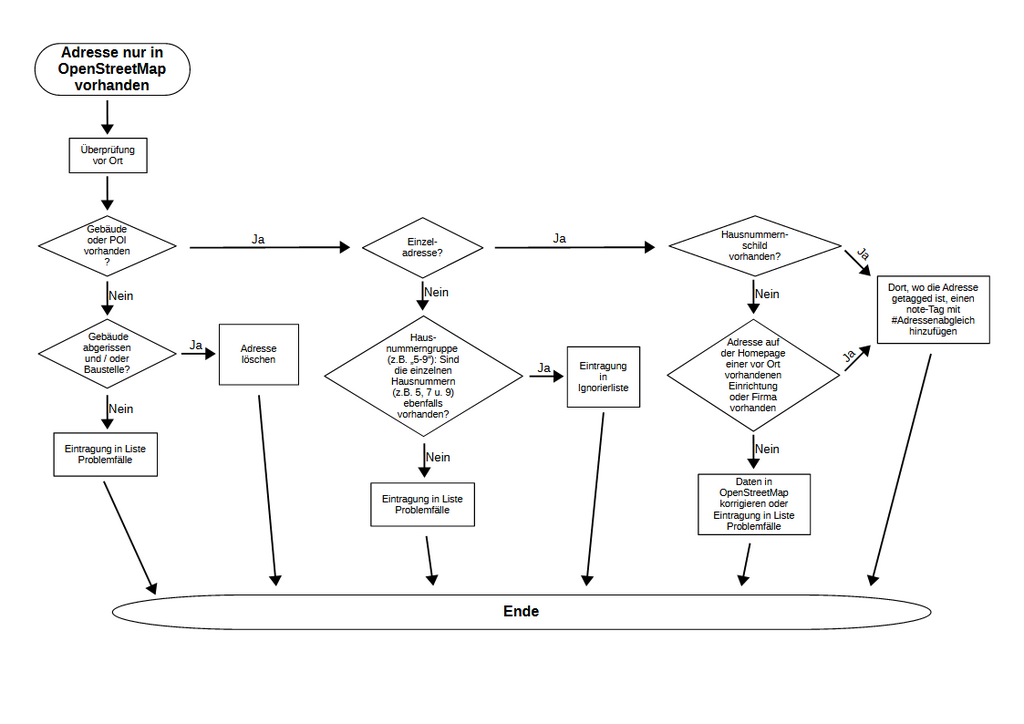
Vorschlag zum Vorgehen bei Adressen, die nur in OpenStreetMap vorhanden sind und nicht im Datensatz des GeodatenService der Stadt München
Licensing
![]()
![]()
![]()
This work is licensed under the Creative Commons Attribution-ShareAlike 2.0 License.
Attribution: Geo-d
Attribution: Geo-d
File history
Click on a date/time to view the file as it appeared at that time.
| Date/Time | Thumbnail | Dimensions | User | Comment | |
|---|---|---|---|---|---|
| current | 19:26, 4 August 2024 | | 1,123 × 794 (59 KB) | Geo-d (talk | contribs) | Änderung des Umgangs mit Adressen auf Baustellen |
| 19:17, 15 July 2024 | 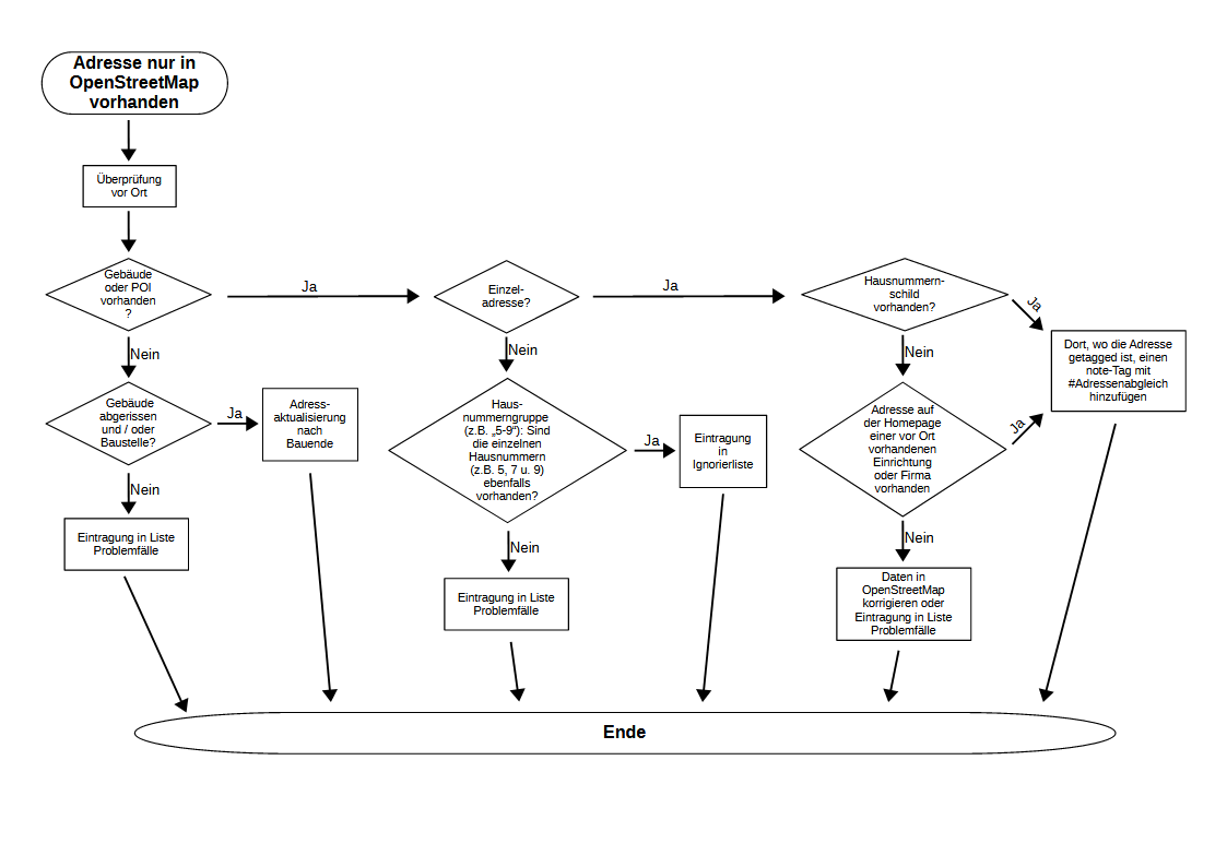 | 1,123 × 794 (59 KB) | Geo-d (talk | contribs) |
You cannot overwrite this file.
File usage
The following page uses this file: