File:Island of highway=track.png
Jump to navigation
Jump to search

No higher resolution available.
Island_of_highway=track.png (421 × 433 pixels, file size: 257 KB, MIME type: image/png)
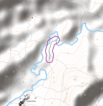
An island of highway=track that is not connected to the main network of 4-wheel accessible roads (sceenshot from QGIS with background © OpenTopoMap
- This media file was uploaded by author of the work and its copyright holder.
![]()
![]()
![]()
This work is licensed under the Creative Commons Attribution-ShareAlike 4.0 License.
Attribution: Privatemajory
Attribution: Privatemajory
File history
Click on a date/time to view the file as it appeared at that time.
| Date/Time | Thumbnail | Dimensions | User | Comment | |
|---|---|---|---|---|---|
| current | 09:22, 20 July 2022 | | 421 × 433 (257 KB) | Privatemajory (talk | contribs) |
You cannot overwrite this file.
File usage
The following page uses this file: