File:Laranjal Paulista - teste QGIS.png
Jump to navigation
Jump to search


Size of this preview: 800 × 384 pixels. Other resolutions: 320 × 154 pixels | 640 × 307 pixels | 1,024 × 492 pixels | 1,920 × 922 pixels.
Original file (1,920 × 922 pixels, file size: 2.89 MB, MIME type: image/png)
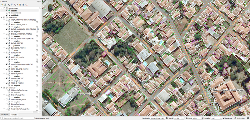
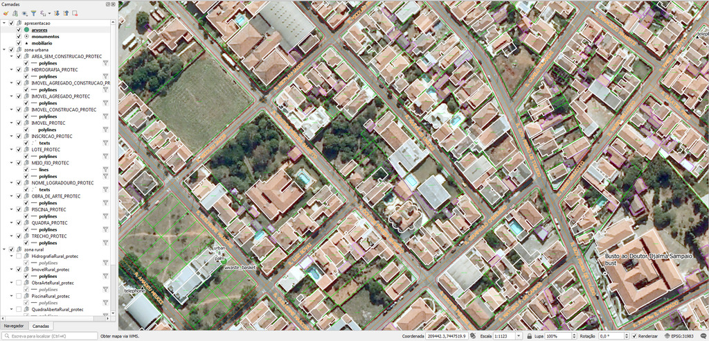
Captura de tela da interface QGIS com material de Laranjal Paulista
See https://wiki.openstreetmap.org/w/index.php?title=User_talk:IgorEliezer&curid=279765&diff=2344057&oldid=2343817 for copyright info provided by uploader
imagery:
- Author: Empresa Paulista de Planejamento Metropolitano S.A. - EMPLASA. (a public/state-owned company of State of São Paulo, Brazil)
- Source: DataGEO/Secretaria do Meio Ambiente do Estado de São Paulo. (site: https://datageo.ambiente.sp.gov.br/, secretary of environment, State of São Paulo, Brazil)
- License: free to use, according to Federal Act nº 12 527/2011/Brazil (cited here https://datageo.ambiente.sp.gov.br/sobre), and as explained here.
And about the shapefiles:
- Author and source: Prefeitura Municipal de Laranjal Paulista.
- License: Public Domain/CC0 according to this.
File history
Click on a date/time to view the file as it appeared at that time.
| Date/Time | Thumbnail | Dimensions | User | Comment | |
|---|---|---|---|---|---|
| current | 22:35, 23 September 2020 | | 1,920 × 922 (2.89 MB) | IgorEliezer (talk | contribs) |
You cannot overwrite this file.
File usage
The following 2 pages use this file: