File:MSF approval zgis buildings.png
Jump to navigation
Jump to search


Size of this preview: 800 × 397 pixels. Other resolutions: 320 × 159 pixels | 896 × 445 pixels.
Original file (896 × 445 pixels, file size: 31 KB, MIME type: image/png)
Summary
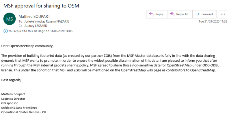
MSF approval for sharing building footprint data created by their partner ZGIS. Approval given 31/03/2020
File history
Click on a date/time to view the file as it appeared at that time.
| Date/Time | Thumbnail | Dimensions | User | Comment | |
|---|---|---|---|---|---|
| current | 11:45, 6 May 2020 | | 896 × 445 (31 KB) | Jorieke (talk | contribs) | MSF approval for sharing building footprint data created by their partner ZGIS. Approval given 31/03/2020 |
You cannot overwrite this file.
File usage
The following 3 pages use this file: