File:Map of Pyongyang - 1946 - Glossary.jpg
Jump to navigation
Jump to search

No higher resolution available.
Map_of_Pyongyang_-_1946_-_Glossary.jpg (240 × 400 pixels, file size: 108 KB, MIME type: image/jpeg)
This file and its description are from Wikimedia Commons.
Summary
| Description |
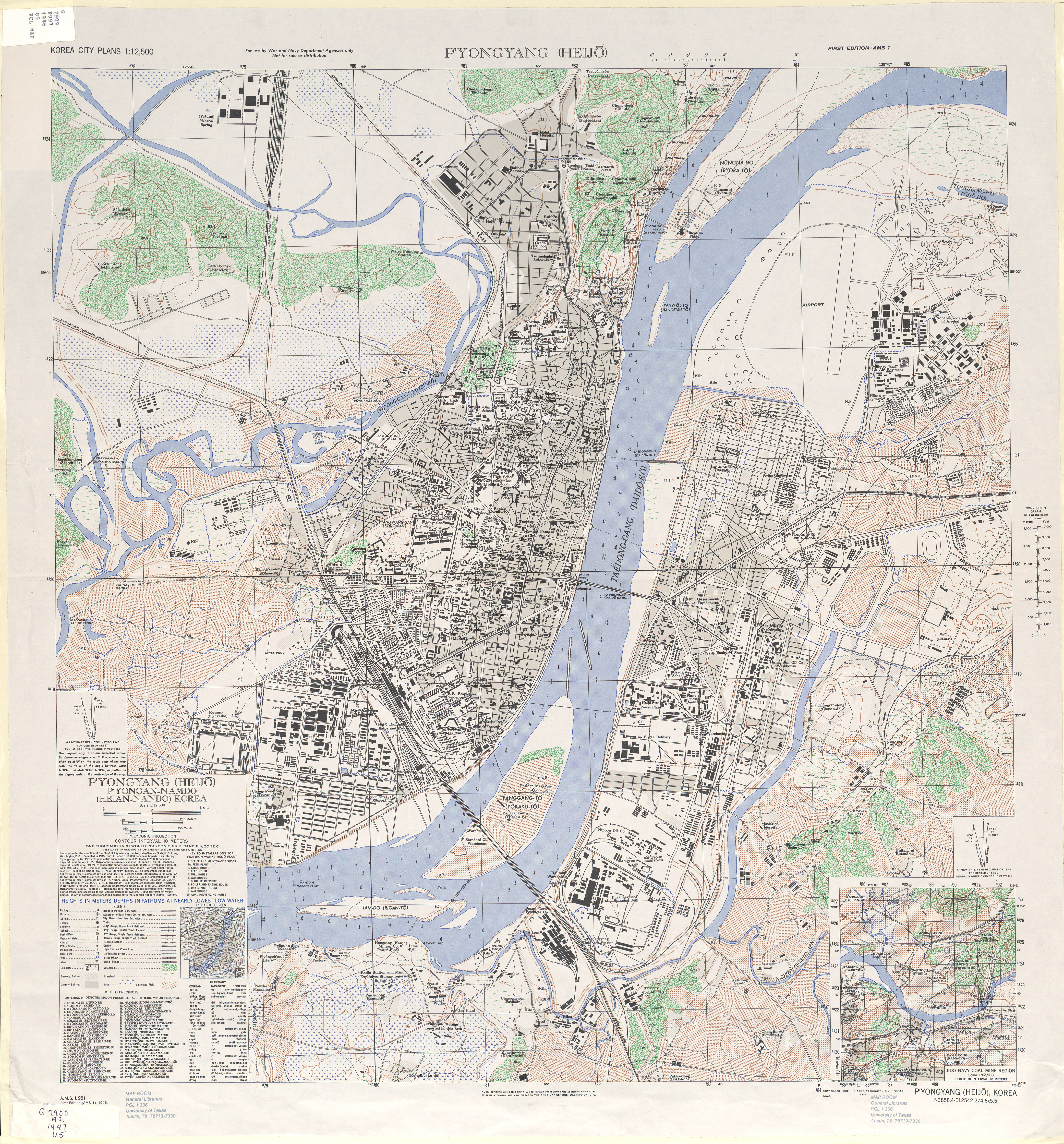
English: 1946 Map of Pyongyang (Heijo), North Korea by the Army Map Service, U.S. Army |
| Date | |
| Source | http://www.lib.utexas.edu/maps/ams/korea_city_plans/txu-oclc-6565231.jpg |
| Author | Army Map Service, U.S. Army, Washington D.C. |
| Other versions |

Licensing
This file is a work of a U.S. Army soldier or employee, taken or made as part of that person's official duties. As a work of the U.S. federal government, it is in the public domain in the United States.
|
 |
File history
Click on a date/time to view the file as it appeared at that time.
| Date/Time | Thumbnail | Dimensions | User | Comment | |
|---|---|---|---|---|---|
| current | 12:17, 4 July 2023 | | 240 × 400 (108 KB) | wikimediacommons>Koreller | File:Pyongyangarmymapservice1946.jpg cropped 94 % horizontally, 91 % vertically using CropTool with precise mode. |
File usage
The following 2 pages use this file: