File:PR Legal Boundaries.PNG
Jump to navigation
Jump to search

No higher resolution available.
PR_Legal_Boundaries.PNG (724 × 258 pixels, file size: 144 KB, MIME type: image/png)
Summary
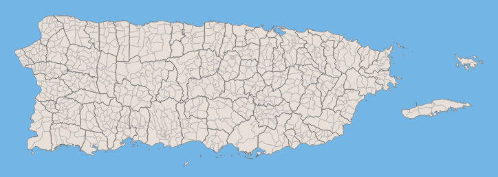
Image shows municipios and barrios as delineated by the Puerto Rico Planning Board on 2009.
Licensing
![]()
This file has been released into the public domain by the copyright holder, its copyright has expired, or it is ineligible for copyright. This applies worldwide.
Please, please use more specific template such as {{PD-self}} / {{PD-creator}} / {{PD-shape}} / {{PD-USGov}} / {{PD-old}} / {{PD-RU-exempt}} ... This template is not making clear why this work is in the public domain.
Please, please use more specific template such as {{PD-self}} / {{PD-creator}} / {{PD-shape}} / {{PD-USGov}} / {{PD-old}} / {{PD-RU-exempt}} ... This template is not making clear why this work is in the public domain.
File history
Click on a date/time to view the file as it appeared at that time.
| Date/Time | Thumbnail | Dimensions | User | Comment | |
|---|---|---|---|---|---|
| current | 02:32, 25 September 2014 | 724 × 258 (144 KB) | Igeopr (talk | contribs) | ||
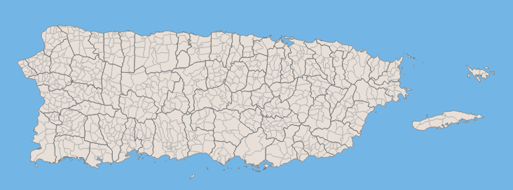
| 12:22, 23 September 2014 | 732 × 272 (107 KB) | Igeopr (talk | contribs) | Image shows municipios and barrios as delineated by the Puerto Rico Planning Board on 2009. |
You cannot overwrite this file.
File usage
The following page uses this file: