File:Panneaux avec symbole indication pl 7,5 t Vichy D 434.jpg
Jump to navigation
Jump to search


Size of this preview: 800 × 572 pixels. Other resolutions: 320 × 229 pixels | 640 × 458 pixels | 1,024 × 733 pixels | 1,174 × 840 pixels.
Original file (1,174 × 840 pixels, file size: 224 KB, MIME type: image/jpeg)
This file and its description are from Wikimedia Commons.
Summary
| Description |
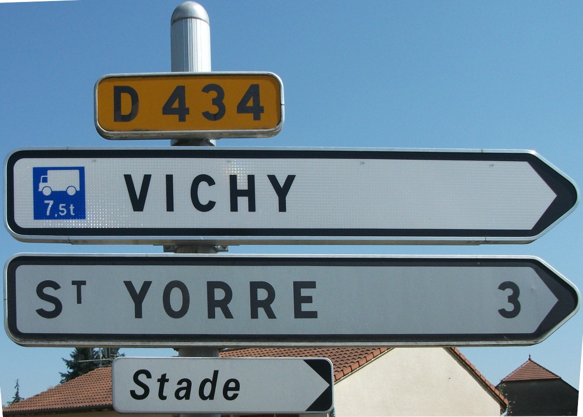
Français : Panneaux de la route départementale 434 à La Poivrière (commune de Saint-Sylvestre-Pragoulin, Puy-de-Dôme, Auvergne, France). Retouche avec GIMP (perspective, matrice de transformation {0.9012, 0.10052, 58; -0.03263, 1.02886, 58; -3E-5, 1.3E-4, 1}) Le premier panneau indique que la direction de Vichy est atteinte par la même route qui permet de rejoindre Saint-Yorre. Ici, la direction de Vichy est conseillée pour les véhicules de transport de marchandises dont le poids total autorisé en charge ou le poids total roulant autorisé excède 7,5 tonnes. Or ce symbole ne respecte pas les dimensions imposées… Pour illustrer Symbole routier en France |
| Date | |
| Source | Own work |
| Author | Tabl-trai |
| Camera location | | View this and other nearby images on: OpenStreetMap |
|---|
| Panneaux en évidence | Fabricant | Année |
|---|---|---|
| E43 : Cartouche (route départementale) Indication : D 434 |
||
| D21b : Signalisation directionnelle de position sans indication de distance contient SC1b : direction conseillée pour les véhicules de transport de marchandises dont le poids excède 7,5 tonnes Indication : Vichy |
Franche-Comté signaux | 2009 (type SD2 : SD2 90) |
| D21a : Signalisation directionnelle de position avec indication de distance Indication : St Yorre 3 (Saint-Yorre 3 km) |
SES (Sécurité et Signalisation) | 1997 (type SD2 : D2 05) |
| D29b : Signalisation des lieux-dits Indication : Stade (le stade n’est pas un lieu-dit…) |
Signature | 2000 (type SD2 : D2 59) |
Licensing
I, the copyright holder of this work, hereby publish it under the following license:
This file is licensed under the Creative Commons Attribution-Share Alike 3.0 Unported license.
- You are free:
- to share – to copy, distribute and transmit the work
- to remix – to adapt the work
- Under the following conditions:
- attribution – You must give appropriate credit, provide a link to the license, and indicate if changes were made. You may do so in any reasonable manner, but not in any way that suggests the licensor endorses you or your use.
- share alike – If you remix, transform, or build upon the material, you must distribute your contributions under the same or compatible license as the original.
File history
Click on a date/time to view the file as it appeared at that time.
| Date/Time | Thumbnail | Dimensions | User | Comment | |
|---|---|---|---|---|---|
| current | 18:00, 28 July 2011 | | 1,174 × 840 (224 KB) | wikimediacommons>Tabl-trai | {{Information |Description ={{fr|1=Panneaux de la route départementale 434 à La Poivrière (commune de Saint-Sylvestre-Pragoulin, Puy-de-Dôme, Auvergne, France).<br />''Retouche avec GIMP (perspective, matrice de transformation {0.9012, 0.10052, 58; |
File usage
The following page uses this file: