File:Pgelines.jpg
Jump to navigation
Jump to search


Size of this preview: 800 × 450 pixels. Other resolutions: 320 × 180 pixels | 640 × 360 pixels | 1,024 × 576 pixels | 1,280 × 720 pixels | 1,920 × 1,080 pixels.
Original file (1,920 × 1,080 pixels, file size: 295 KB, MIME type: image/jpeg)
Summary
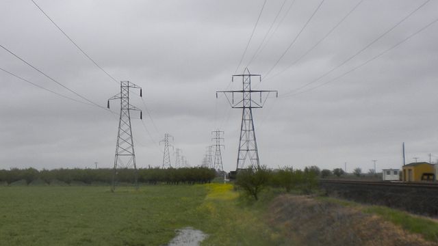
Steel lattice power towers, apparently carrying one (left line) and two (right line) 115 kV three-phase 60 Hz circuits and operated by PG&E; the nearest towers are OSM nodes 975628733 and 441502881.
Licensing
![]()
This file has been released into the public domain by the copyright holder, its copyright has expired, or it is ineligible for copyright. This applies worldwide.
Please, please use more specific template such as {{PD-self}} / {{PD-creator}} / {{PD-shape}} / {{PD-USGov}} / {{PD-old}} / {{PD-RU-exempt}} ... This template is not making clear why this work is in the public domain.
Please, please use more specific template such as {{PD-self}} / {{PD-creator}} / {{PD-shape}} / {{PD-USGov}} / {{PD-old}} / {{PD-RU-exempt}} ... This template is not making clear why this work is in the public domain.
File history
Click on a date/time to view the file as it appeared at that time.
| Date/Time | Thumbnail | Dimensions | User | Comment | |
|---|---|---|---|---|---|
| current | 00:15, 17 April 2011 | | 1,920 × 1,080 (295 KB) | T99 (talk | contribs) | Steel lattice power poles, apparently carrying one (left line) and two (right line) 115 kV three-phase 60 Hz circuits and operated by PG&E; the nearest towers are OSM nodes 975628733 and 441502881. |
You cannot overwrite this file.
File usage
The following 2 pages use this file: