File:Rnm ref and rpn ref in Boonervliet.JPG
Jump to navigation
Jump to search


Size of this preview: 247 × 600 pixels. Other resolutions: 99 × 240 pixels | 197 × 480 pixels | 835 × 2,027 pixels.
Original file (835 × 2,027 pixels, file size: 379 KB, MIME type: image/jpeg)
Summary
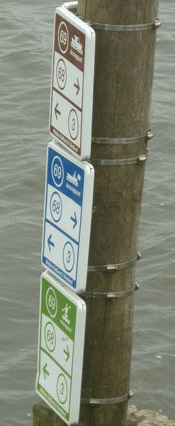
A node in a junction network for canoes and motorboats. It can be tagged using the rmn_ref tag and rpn_ref tag in Openstreetmap. Location: Boonervliet, Maasland, Netherlands
File history
Click on a date/time to view the file as it appeared at that time.
| Date/Time | Thumbnail | Dimensions | User | Comment | |
|---|---|---|---|---|---|
| current | 19:02, 11 July 2018 | 835 × 2,027 (379 KB) | A67-A67 (talk | contribs) | Cropped to relevant part | |
| 17:51, 11 July 2018 | 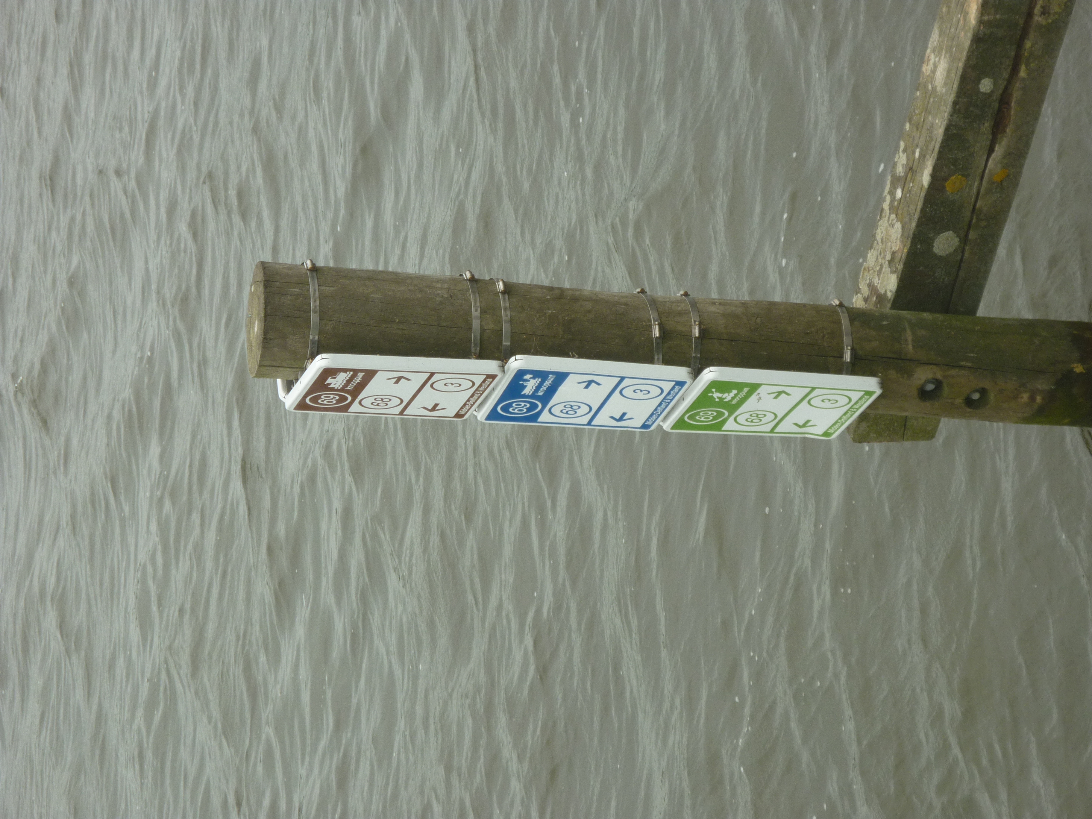 | 2,736 × 3,648 (4.54 MB) | A67-A67 (talk | contribs) | A node in a junction network for canoes and motorboats. It can be tagged using the rmn_ref tag and rpn_ref tag in Openstreetmap. Location: Boonervliet, Maasland, Netherlands |
You cannot overwrite this file.
File usage
The following 3 pages use this file: