File:Slate roof at St Beuno's Church, Trefdraeth, nr Bodorgan, Ynys Mon, Wales. 12.jpg
Jump to navigation
Jump to search


Size of this preview: 800 × 600 pixels. Other resolutions: 320 × 240 pixels | 640 × 480 pixels | 1,024 × 768 pixels | 1,280 × 960 pixels | 2,560 × 1,920 pixels | 4,896 × 3,672 pixels.
Original file (4,896 × 3,672 pixels, file size: 5.55 MB, MIME type: image/jpeg)
This file and its description are from Wikimedia Commons.
Summary
| Description |
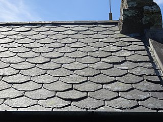
Cymraeg: To llechi.
Mae Eglwys Sant Beuno yn eglwys plwyf, ganoloesol a cheir cofnod gan Angharad Llwyd (1780–1866) i'r egwlys wreiddiol gan ei godi yma yn 616.
English: St Beuno's Church, Trefdraeth is the medieval parish church of Trefdraeth, a hamlet in Anglesey, north Wales. Although one 19th-century historian recorded that the first church on this location was reportedly established in about 616.
|
||
| Date | |||
| Source | Own work | ||
| Author | Monsyn |
| Camera location | | View this and other nearby images on: OpenStreetMap |
|---|

|
This file was generated using equipment from Wikimedia UK, a Wikimedia local chapter.
|
Licensing
I, the copyright holder of this work, hereby publish it under the following license:
This file is licensed under the Creative Commons Attribution-Share Alike 4.0 International license.
- You are free:
- to share – to copy, distribute and transmit the work
- to remix – to adapt the work
- Under the following conditions:
- attribution – You must give appropriate credit, provide a link to the license, and indicate if changes were made. You may do so in any reasonable manner, but not in any way that suggests the licensor endorses you or your use.
- share alike – If you remix, transform, or build upon the material, you must distribute your contributions under the same or compatible license as the original.

|
This image was uploaded as part of Wiki Loves Monuments 2018.
|
File history
Click on a date/time to view the file as it appeared at that time.
| Date/Time | Thumbnail | Dimensions | User | Comment | |
|---|---|---|---|---|---|
| current | 14:45, 4 September 2018 | | 4,896 × 3,672 (5.55 MB) | wikimediacommons>Monsyn | User created page with UploadWizard |
File usage
The following 4 pages use this file: