File:VE-T-Portuguesa.svg
Jump to navigation
Jump to search

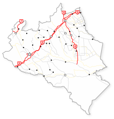
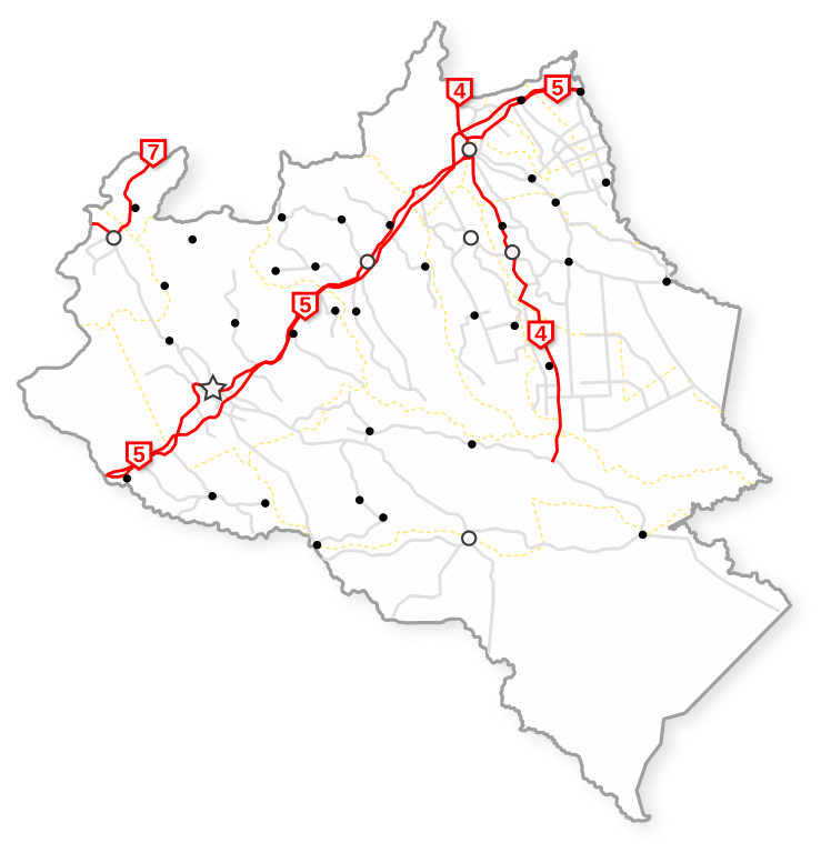
Mapa representativo del Estado Portuguesa (Venezuela), mostrando la red de carreteras Troncales de ésta entidad federal.
Se utilizó la fuente de texto Arimo licenciada bajo la Apache License, Version 2.0

Size of this PNG preview of this SVG file: 516 × 536 pixels. Other resolutions: 231 × 240 pixels | 462 × 480 pixels | 739 × 768 pixels | 986 × 1,024 pixels.
Original file (SVG file, nominally 516 × 536 pixels, file size: 193 KB)
Licensing
![]()
I, the creator of this work, hereby release it into the public domain. This applies worldwide.
In case this is not legally possible, I grant anyone the right to use this work for any purpose, without any conditions, unless such conditions are required by law.
Notice to creator or uploader: Please consider using {{CC0-self}} instead for your work.
"Releasing work to public domain" has some issues, as it is not well defined in some jurisdictions and/or it is not actually possible to "release to public domain". Using CC0 license achieves the intended effect while avoiding such problems and is well suited for media files.
File history
Click on a date/time to view the file as it appeared at that time.
| Date/Time | Thumbnail | Dimensions | User | Comment | |
|---|---|---|---|---|---|
| current | 13:58, 3 July 2019 | | 516 × 536 (193 KB) | Wguayana (talk | contribs) |
You cannot overwrite this file.
File usage
The following 2 pages use this file: