File:WMSplugin-screenshot.jpg
WMSplugin-screenshot.jpg (610 × 596 pixels, file size: 72 KB, MIME type: image/jpeg)
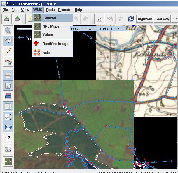
Screenshot to illustrate the use of JOSM/Plugins/WMSPlugin
This shows tracing woodland areas over Landsat imagery (bottom left), and comparing road layouts with 1950s NPE maps (top right)
(area shown is near Langsett, Yorkshire, UK)
JOSM preferences have been modified from the default, to show data lines in a lighter colour (This tends to show up better against the Lansat imagery) Also showing direction arrows. These options are all on 'Edit' menu -> 'Preferences' -> The first 'Display Settings' tab.
Licensing
![]()
![]()
License of imagery not specified! [→ template]
Data displayed: noneFile history
Click on a date/time to view the file as it appeared at that time.
| Date/Time | Thumbnail | Dimensions | User | Comment | |
|---|---|---|---|---|---|
| current | 14:56, 19 January 2008 | | 610 × 596 (72 KB) | Harry Wood (talk | contribs) | Screenshot showing JOSM/Plugins/WMSPlugin |
You cannot overwrite this file.
File usage
The following 5 pages use this file: