Key:hiking
Jump to navigation
Jump to search
| Description |
|---|
| Information for hikers here. |
| Group: tourism |
| Used on these elements |
| Useful combination |
| Status: de facto |
| Tools for this tag |
|
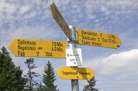
The tag hiking=yes is mainly used in combination with tourism=information and information=* to signify that these have something to do with hiking. E.g. a map with hiking routes of the region information=map or a guidepost for hikers information=guidepost.
With amenity=parking, it is also used to mark trailhead parking spaces.
