Uploads by 80n
Jump to navigation
Jump to search
This special page shows all uploaded files.
| Date | Name | Thumbnail | Size | Description | Versions |
|---|---|---|---|---|---|
| 07:52, 20 September 2011 | Shere cake.jpg (file) |  |
115 KB | The cake for the Surrey Hills Mapping Party on 25th September 2011 | 1 |
| 18:42, 9 August 2008 | MapMyTracksLogo.gif (file) | 3 KB | Logo for MapMyTracks affiliate scheme. | 1 | |
| 16:45, 8 September 2007 | Shoho-day1.png (file) |  |
14 KB | Track logs from day 1 of the ShoHo mapping party | 1 |
| 16:07, 17 June 2007 | FillTheGap-tracks-20070617.png (file) |  |
23 KB | Fill the gap track logs - day 2 | 1 |
| 23:03, 16 June 2007 | FillTheGap-tracks-20070616.png (file) |  |
14 KB | Tracklogs from the first day of the Fill the Gap mapping party in Richmond-on-Thames. | 1 |
| 13:35, 23 May 2007 | RichmondCake.png (file) |  |
229 KB | Cake for the Richmond fill the gap mapping party | 1 |
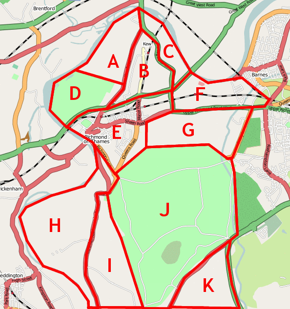
| 20:04, 9 April 2007 | Richmond-on-Thames.png (file) |  |
281 KB | Richmond-on-Thames Mapping Party, target area. | 1 |
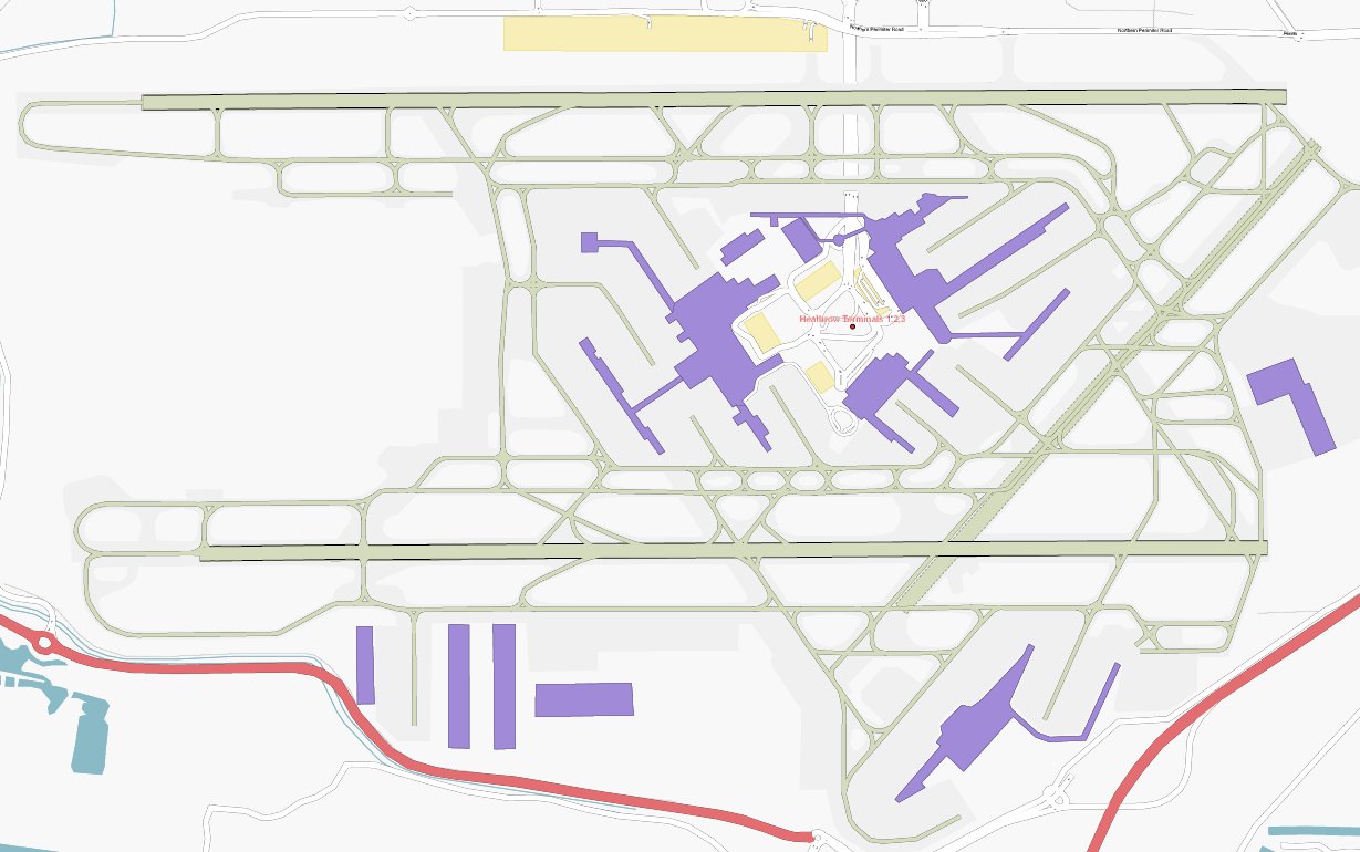
| 00:54, 19 March 2007 | Heathrow aeroways.jpg (file) |  |
120 KB | 4 | |
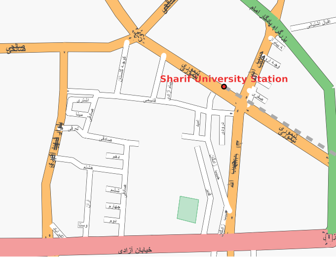
| 07:49, 2 March 2007 | Tehran-university-persian.png (file) |  |
100 KB | The area around the University in Tehran, rendered using arabic script. This was done using a custom version of the osm-map-features-z16.xml rules file with k="name:fa" substituted for k="name" for all street names. It was then rendered using the standa | 1 |
| 09:50, 31 December 2006 | ValThorens TrackLogs.png (file) |  |
11 KB | Composite of tracklogs from Val Thorens mapping party. | 1 |
| 10:15, 28 November 2006 | Z12 test4.png (file) |  |
24 KB | Another Zoom 12 style | 1 |
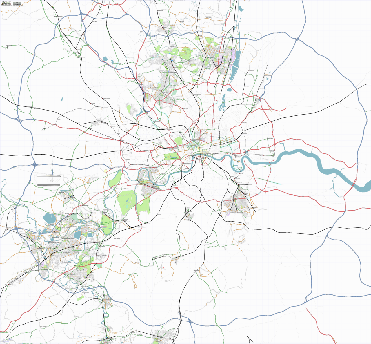
| 22:44, 24 November 2006 | London-20061121-bounded.png (file) |  |
1.21 MB | Osmarender of London as at 21/11/2006 | 1 |
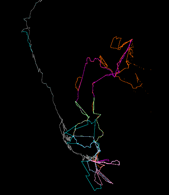
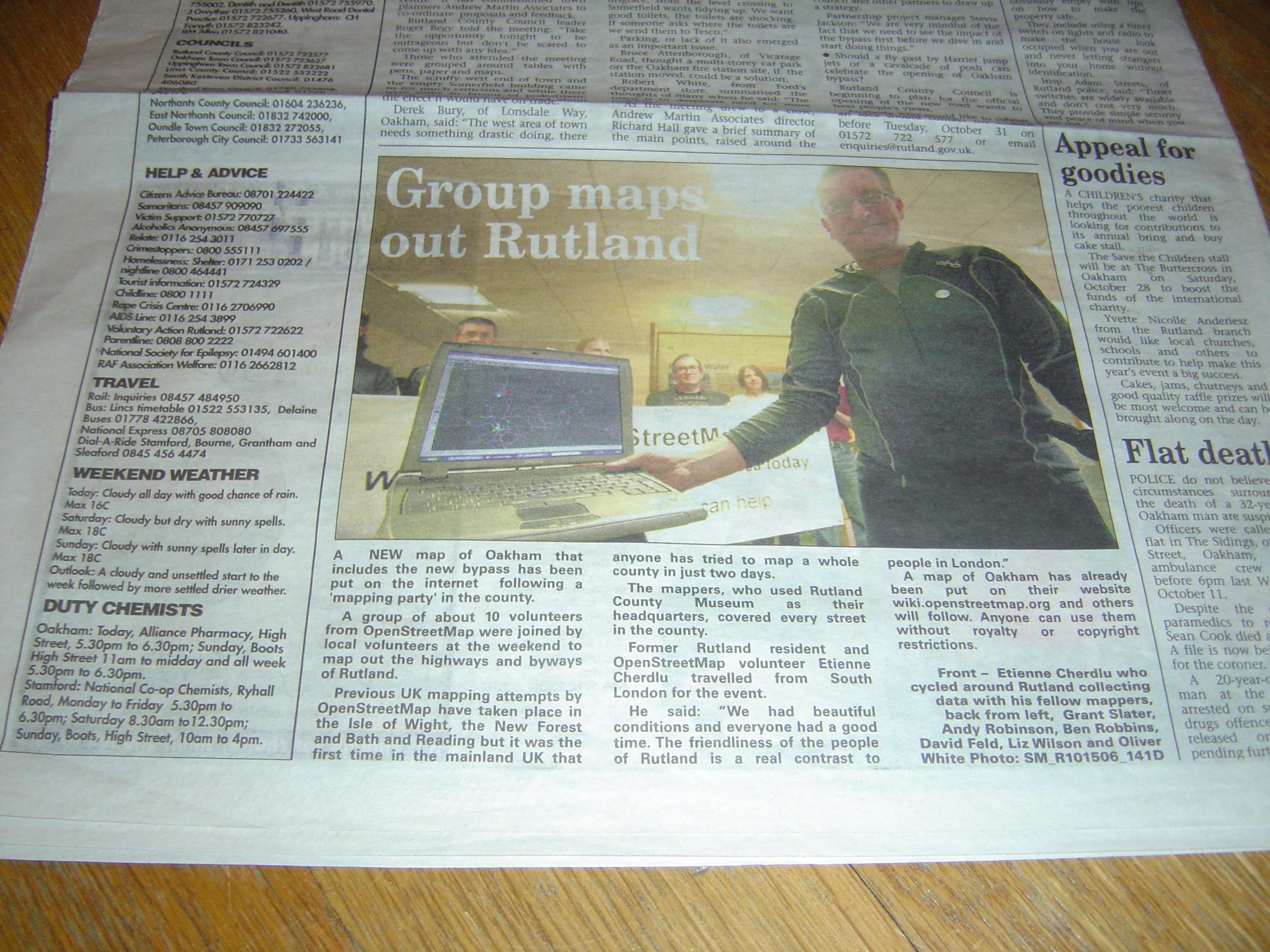
| 19:52, 3 November 2006 | RutlandMercury-2006-10-20.jpg (file) |  |
485 KB | Article in Rutland Mercury on 2006-10-20, reporting on the Rutland Mapping Party the previous weekend. | 1 |
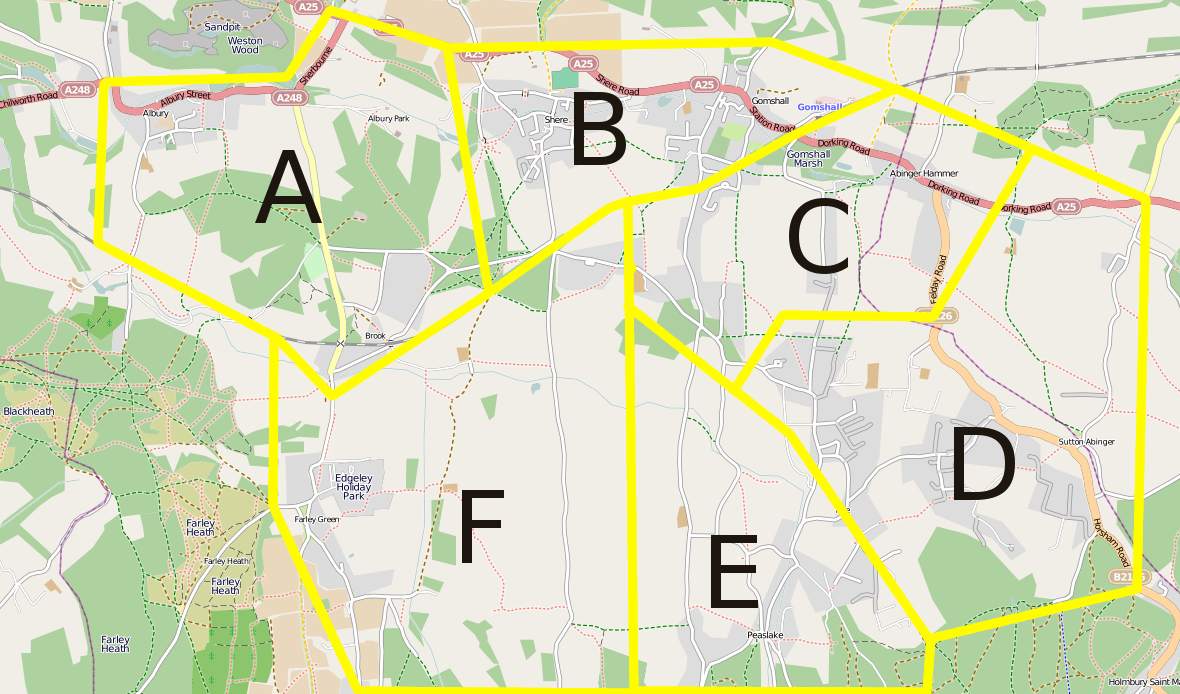
| 22:56, 19 October 2006 | Osm-poster-surreyhills-lowres.jpg (file) |  |
681 KB | 2 | |
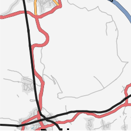
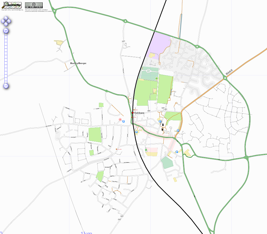
| 20:08, 18 October 2006 | Oakham 20061019.png (file) |  |
202 KB | As at 19-10-2006 | 1 |
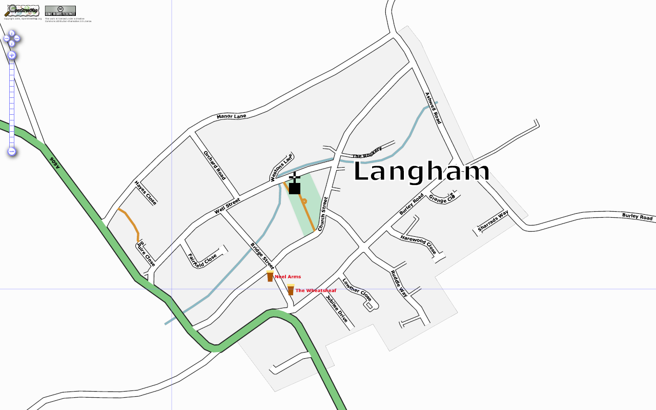
| 08:24, 18 October 2006 | Langham.png (file) |  |
160 KB | 1 | |
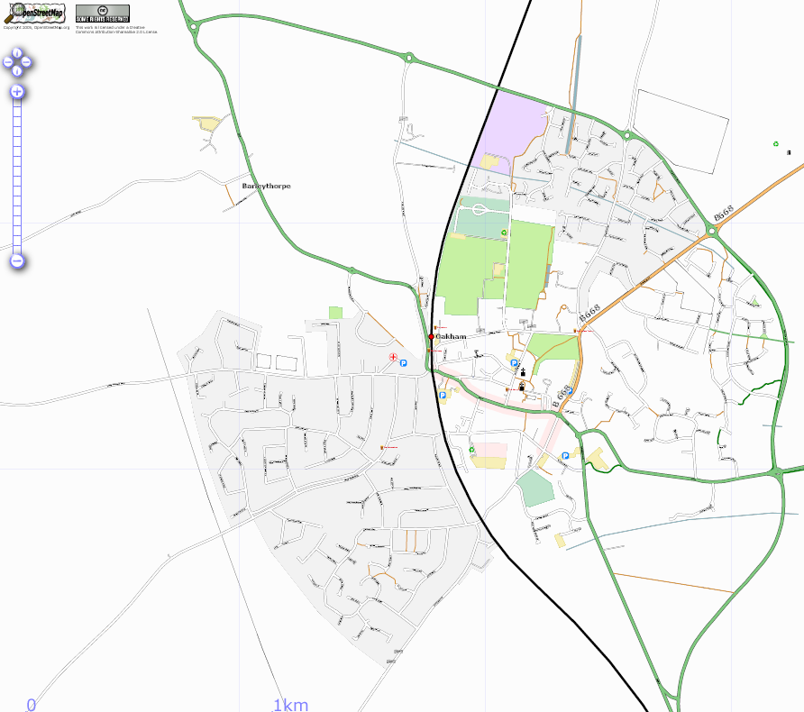
| 21:59, 17 October 2006 | Oakham 20061018.png (file) |  |
211 KB | Oakham as at 18-10-2006 | 1 |
| 08:59, 17 October 2006 | Oakham 20061017.png (file) |  |
187 KB | Oakham as at 2006-10-17 | 1 |
| 10:47, 3 October 2006 | Mag map-120x120.png (file) |  |
24 KB | OSM Logo | 1 |
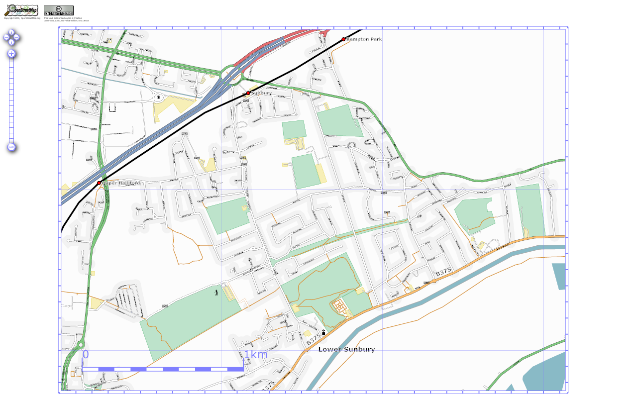
| 10:39, 24 September 2006 | LowerSunbury.png (file) |  |
327 KB | Lower Sunbury rendered with Osmarender 3.0 | 1 |
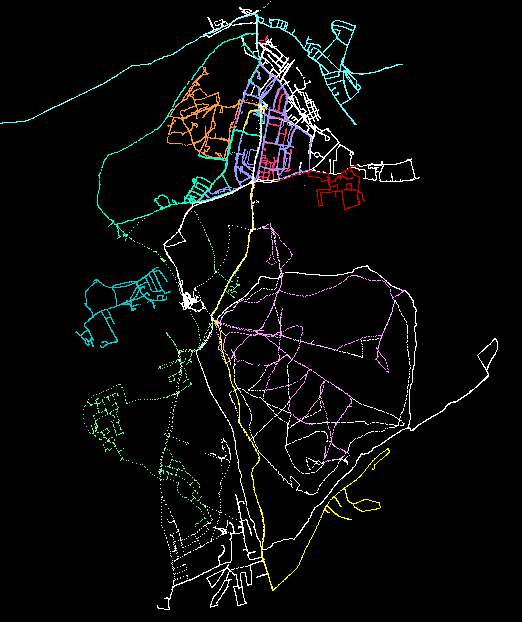
| 14:29, 12 September 2006 | SurreyHillsCakeComposite.png (file) |  |
1.39 MB | Composite map showing Surrey Hills mapping weekend with cake-zoned areas over OS New Popular Edition 1950, digitized by Nick Hill (CC-BY-SA 2.0). | 1 |
| 12:58, 11 September 2006 | Power-line-example.png (file) |  |
2 KB | Rendered example of a power line and pylons | 1 |
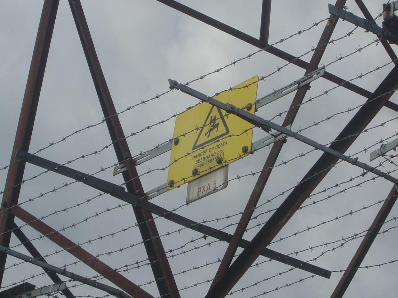
| 11:15, 11 September 2006 | Power-tower-ref-uk.jpg (file) |  |
113 KB | Example of a UK National Grid pylon identification label. | 1 |
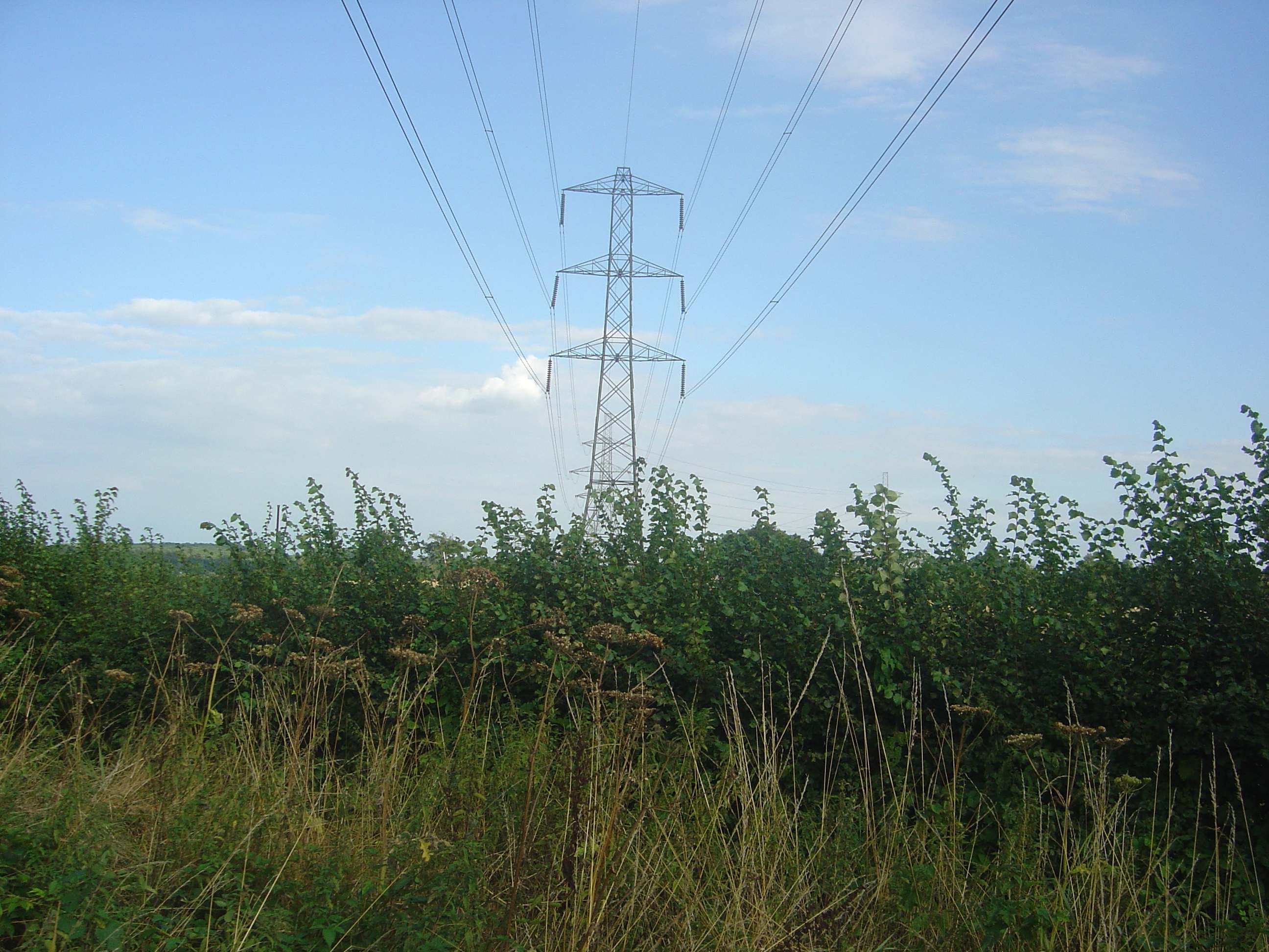
| 11:11, 11 September 2006 | Power-tower.JPG (file) |  |
478 KB | Example of an electricity pylon. | 1 |
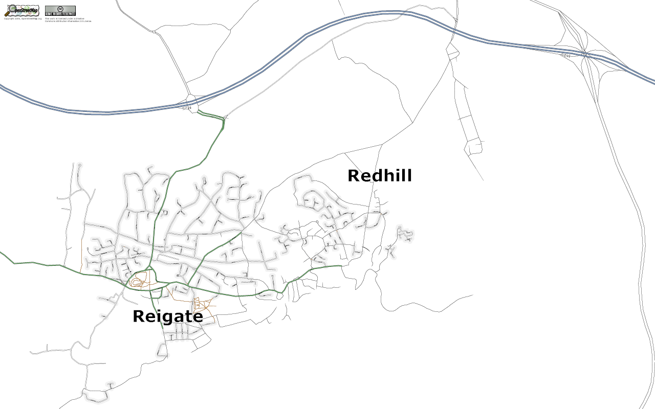
| 12:34, 2 September 2006 | Reigateandredhill.png (file) |  |
188 KB | Osmarender of Reigate and Redhill, Surrey, England | 1 |
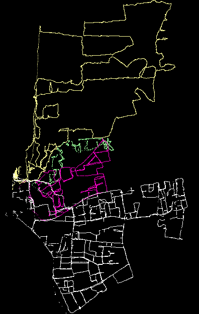
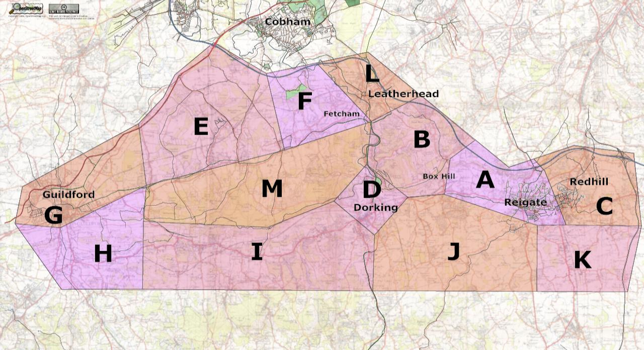
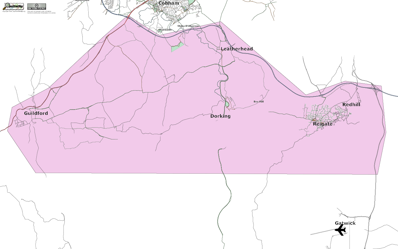
| 11:59, 2 September 2006 | SurreyHills.png (file) |  |
182 KB | Map showing target area of Surrey Hills mapping weekend | 1 |
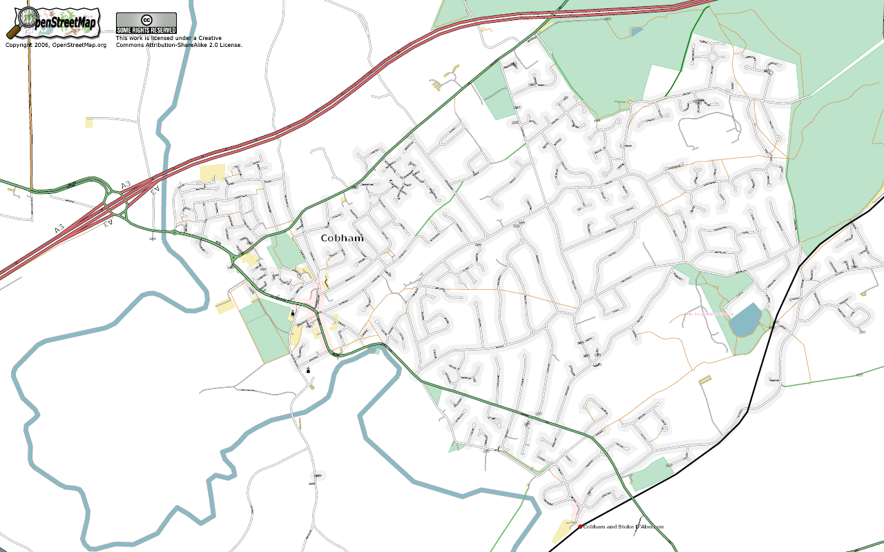
| 09:38, 29 August 2006 | Cobham.png (file) |  |
423 KB | Osmarender of Cobham, Surrey, UK | 1 |
| 14:55, 26 August 2006 | Lintel ban sml.gif (file) |  |
16 KB | Recycle4Charity logo. | 1 |
| 02:05, 24 August 2006 | Rutland 20060824.png (file) |  |
76 KB | Rutland as at August 24, 2006 | 1 |
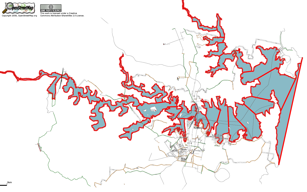
| 20:35, 23 August 2006 | SydneyShowingSegmentedCoastline.png (file) |  |
304 KB | 1 | |
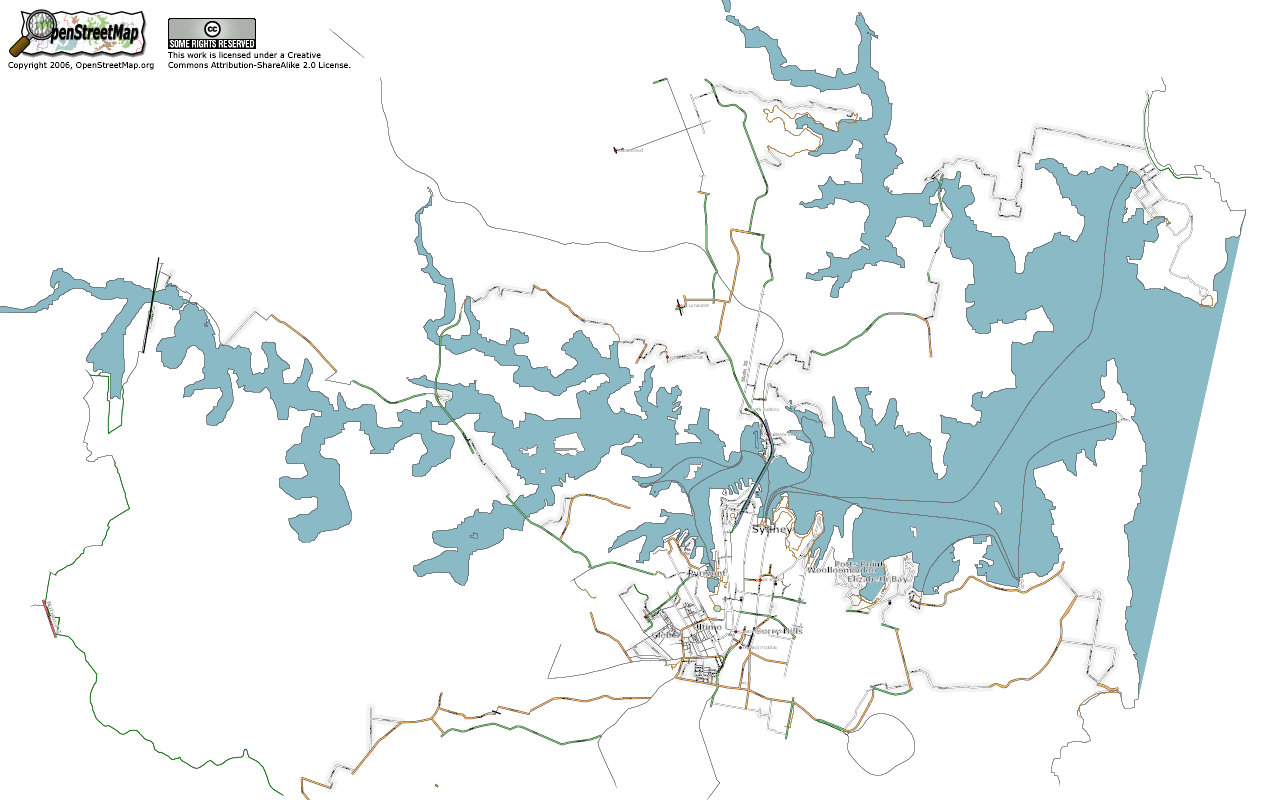
| 19:46, 23 August 2006 | Sydney.png (file) |  |
259 KB | Osmarender of Sydney as at August 23, 2006. | 1 |
| 13:39, 23 August 2006 | SydneyOperaHouse PGSshifted JOSM.png (file) |  |
40 KB | A comparison of the tracklog from the perimeter of Sydney Opera House (in red) against the PGS coastline (in white) shifted south by about 60m to achive the best fit. Viewed using JOSM. | 1 |
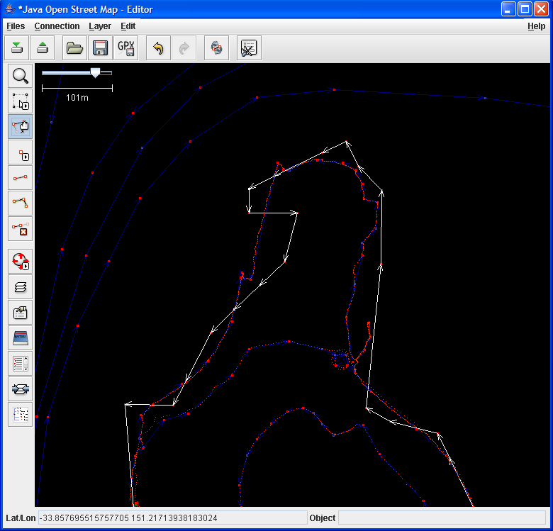
| 13:30, 23 August 2006 | SydneyOperaHouse PGS JOSM.png (file) |  |
40 KB | A comparison of the tracklog from the perimiter of Sydney Opera House (in red) against the PGS coastline (in green). Viewed using JOSM. | 1 |
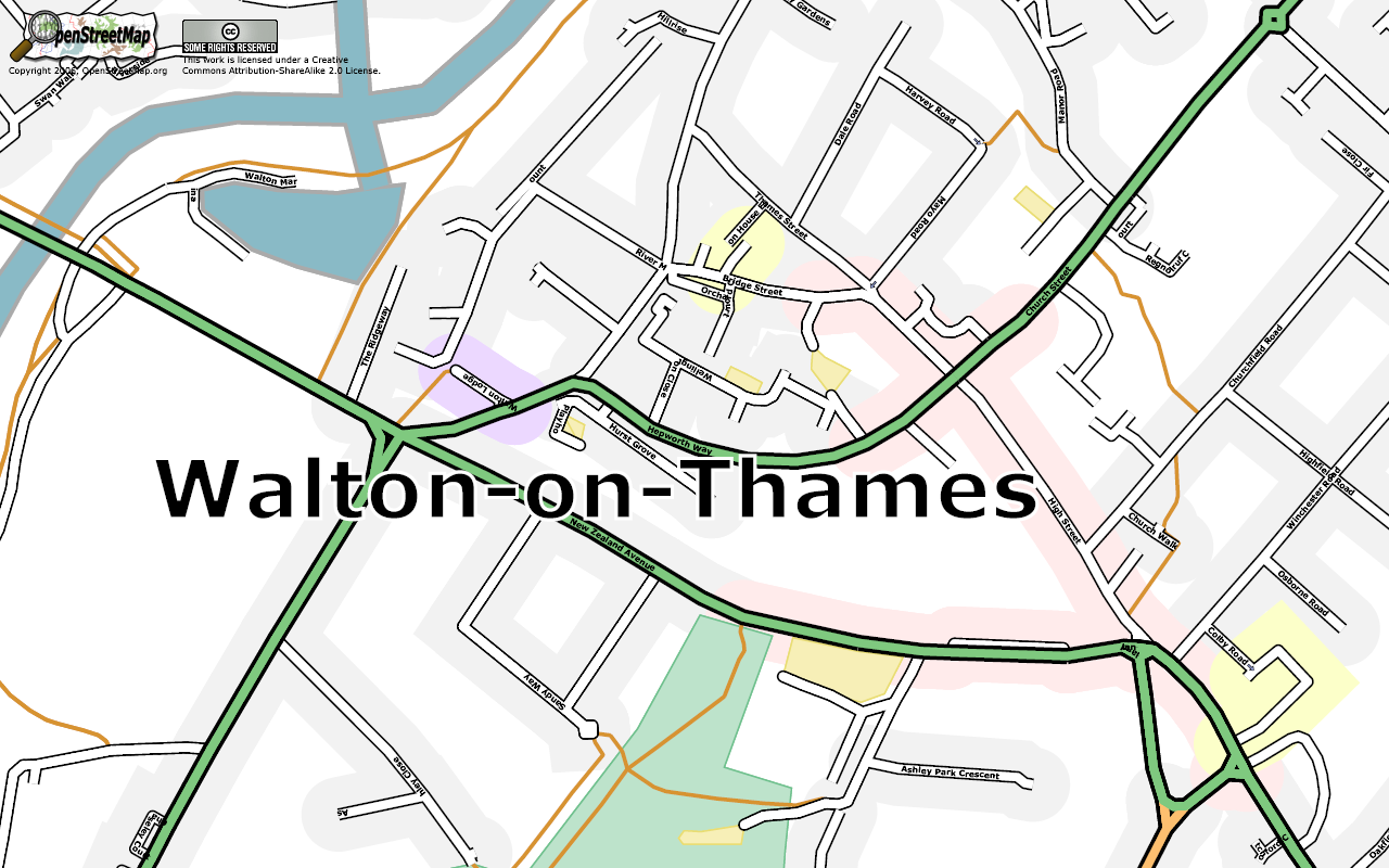
| 09:35, 20 August 2006 | WaltonOnThames Centre.png (file) |  |
330 KB | 1 | |
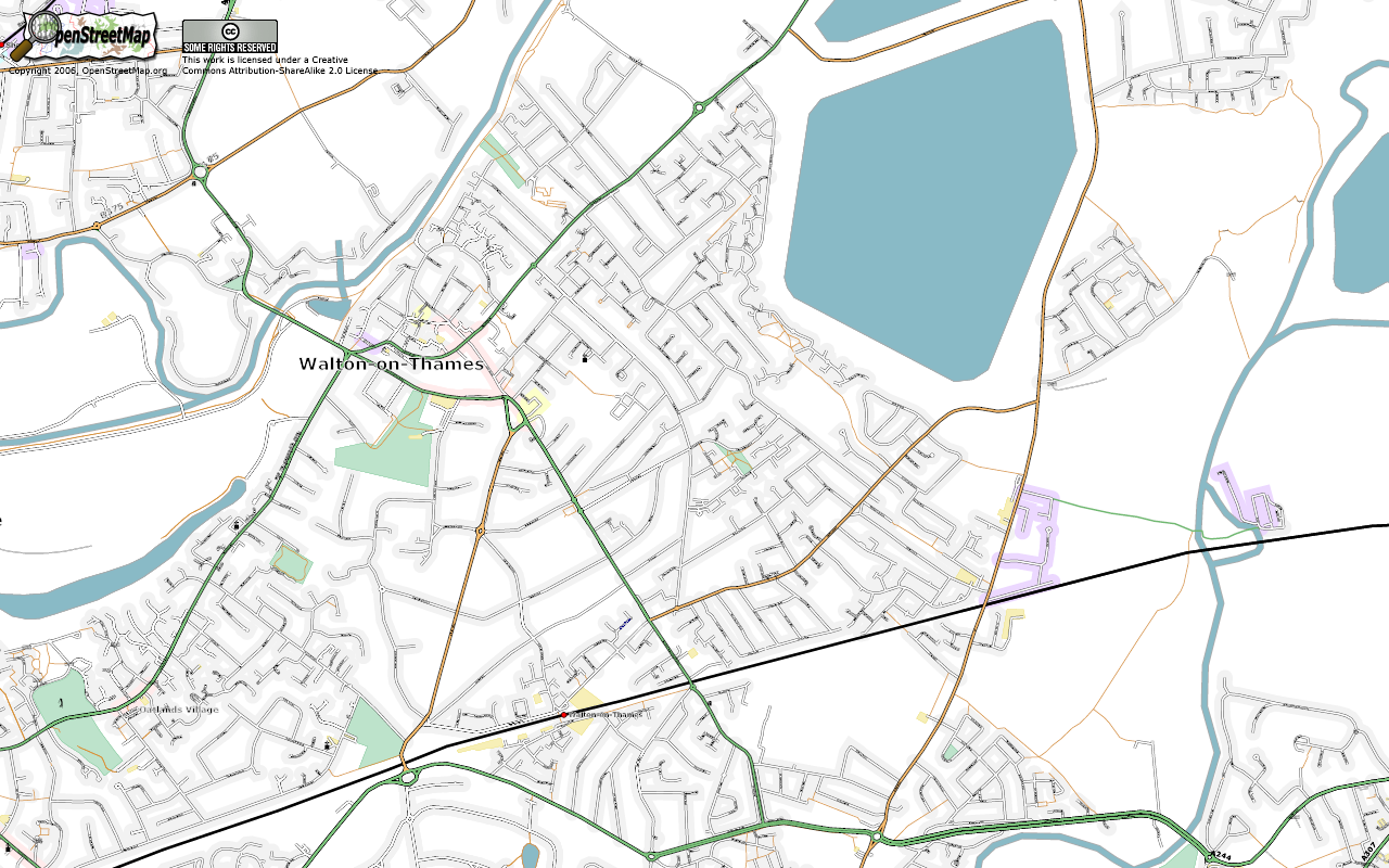
| 09:30, 20 August 2006 | WaltonOnThames.png (file) |  |
611 KB | Rendered using Osmarender | 1 |
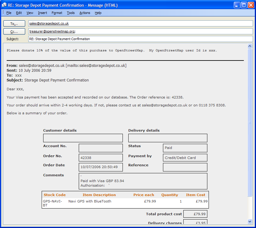
| 10:43, 2 August 2006 | StorageDepotEmail.png (file) |  |
46 KB | Example email claiming 10% donation from Storage Depot | 1 |
| 00:34, 1 August 2006 | ThamesExample.png (file) |  |
289 KB | Example of a wide river rendered with Osmarender using an area rule. | 1 |
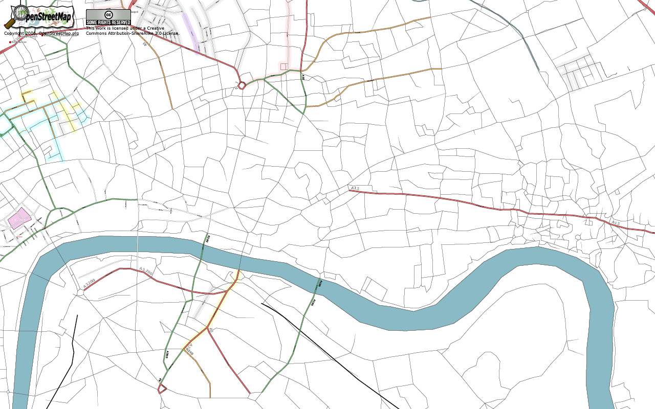
| 15:52, 26 July 2006 | SouthLondon.png (file) |  |
361 KB | South London as at July 24, 2006. | 1 |
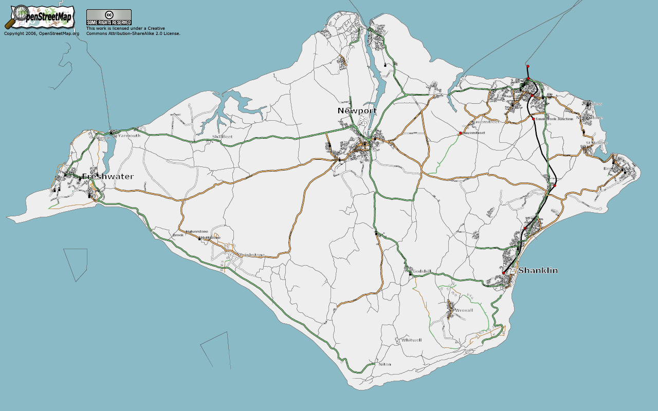
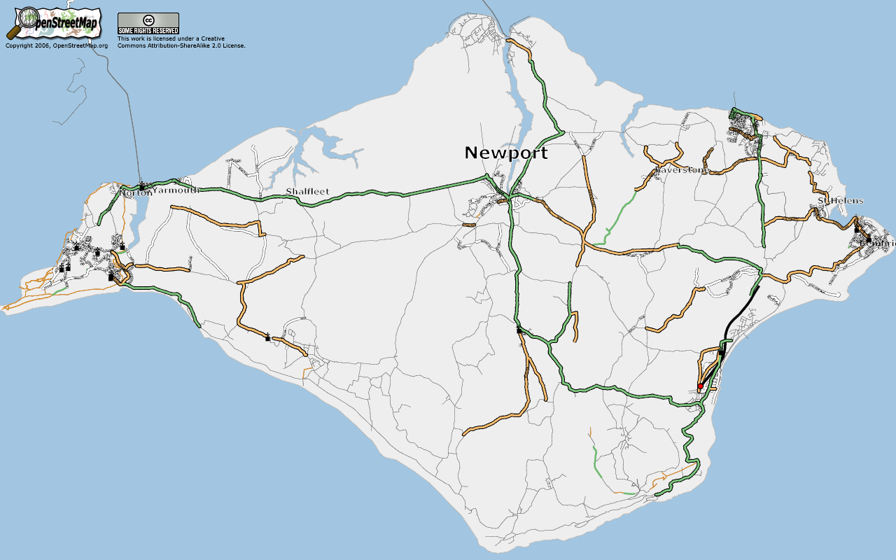
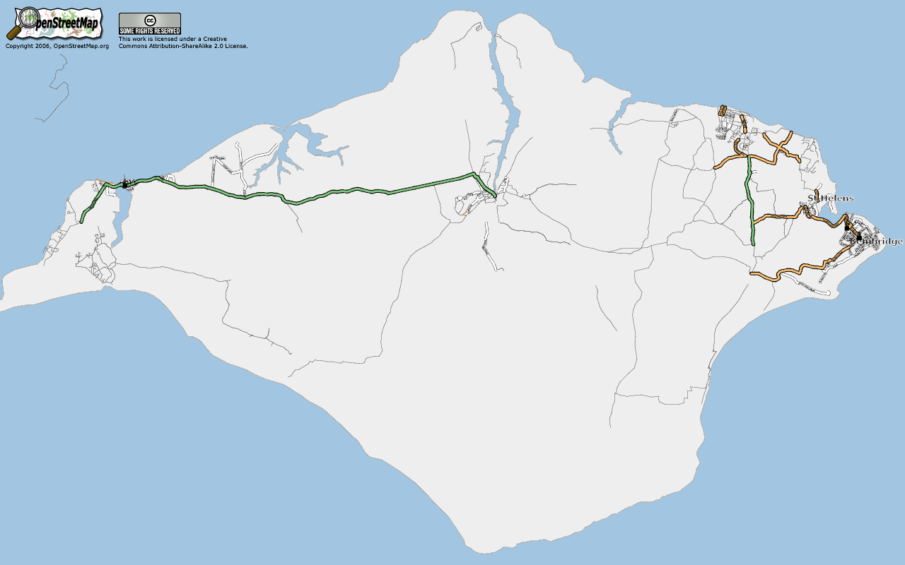
| 22:48, 14 July 2006 | IsleOfWight20060713.png (file) |  |
313 KB | Isle of Wight as at July 13, 2006 | 1 |
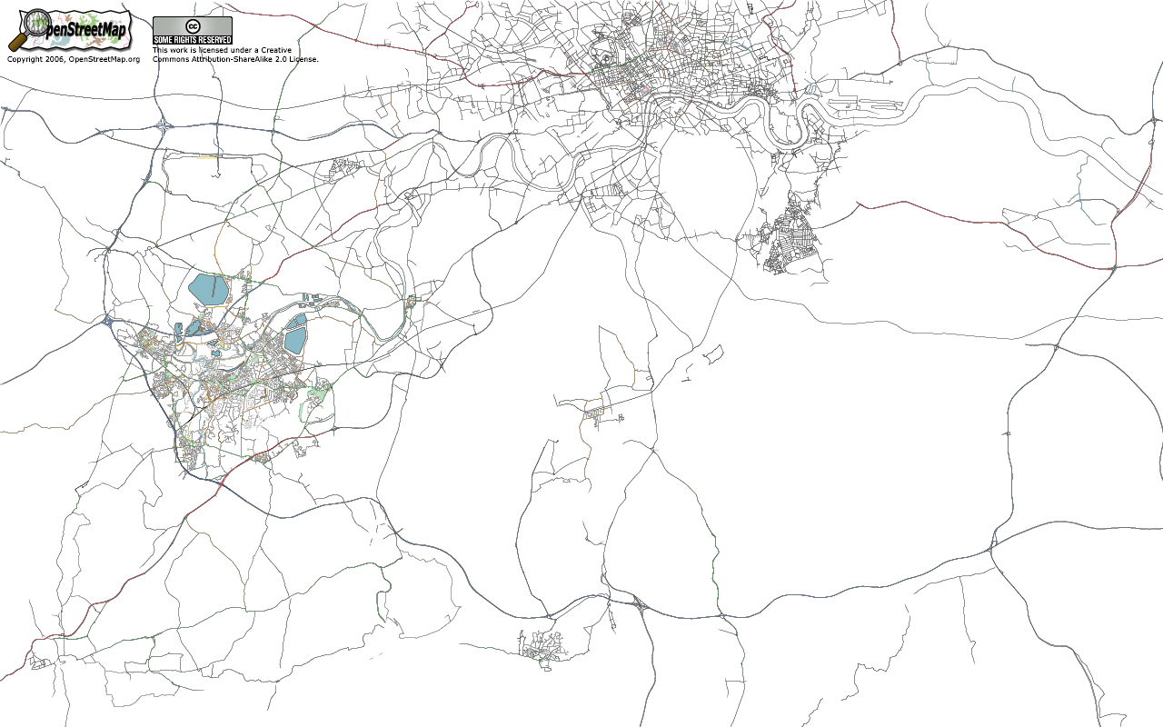
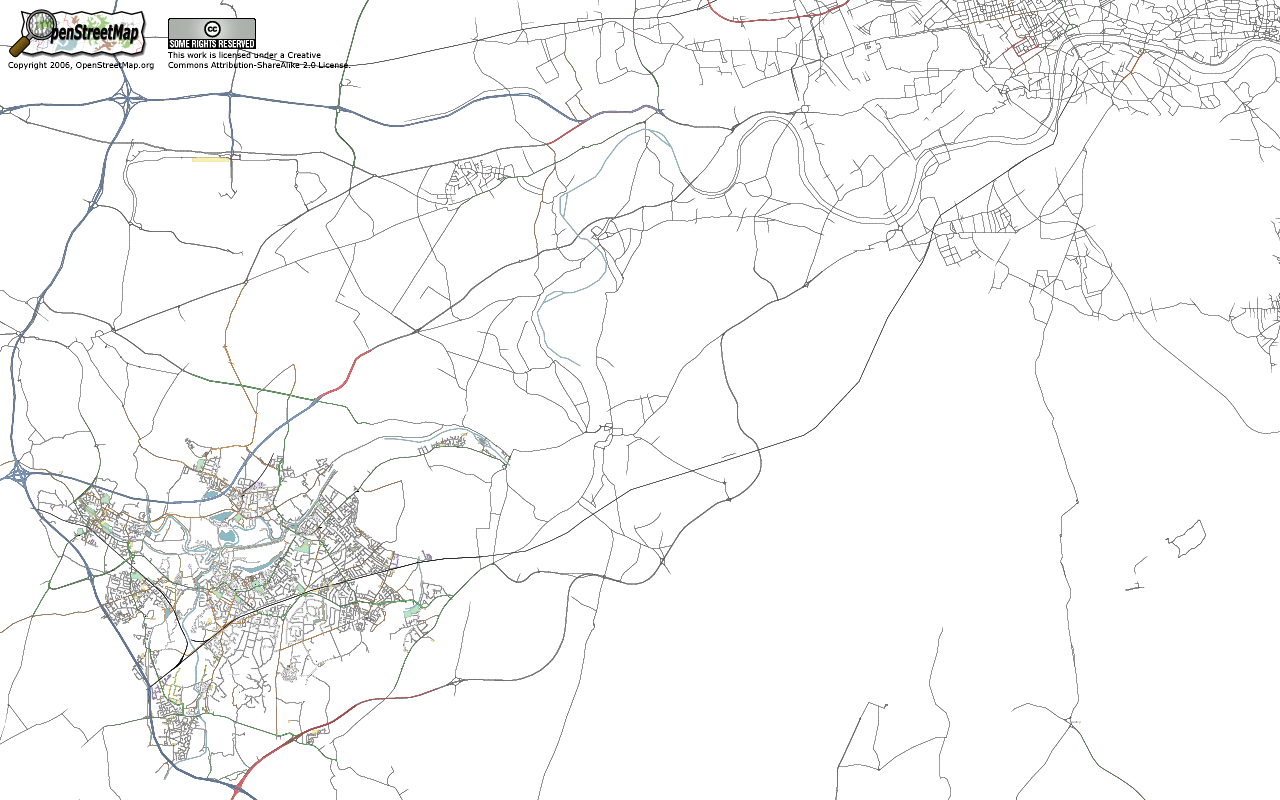
| 22:16, 14 July 2006 | SouthWestLondon.png (file) |  |
379 KB | South West London | 1 |
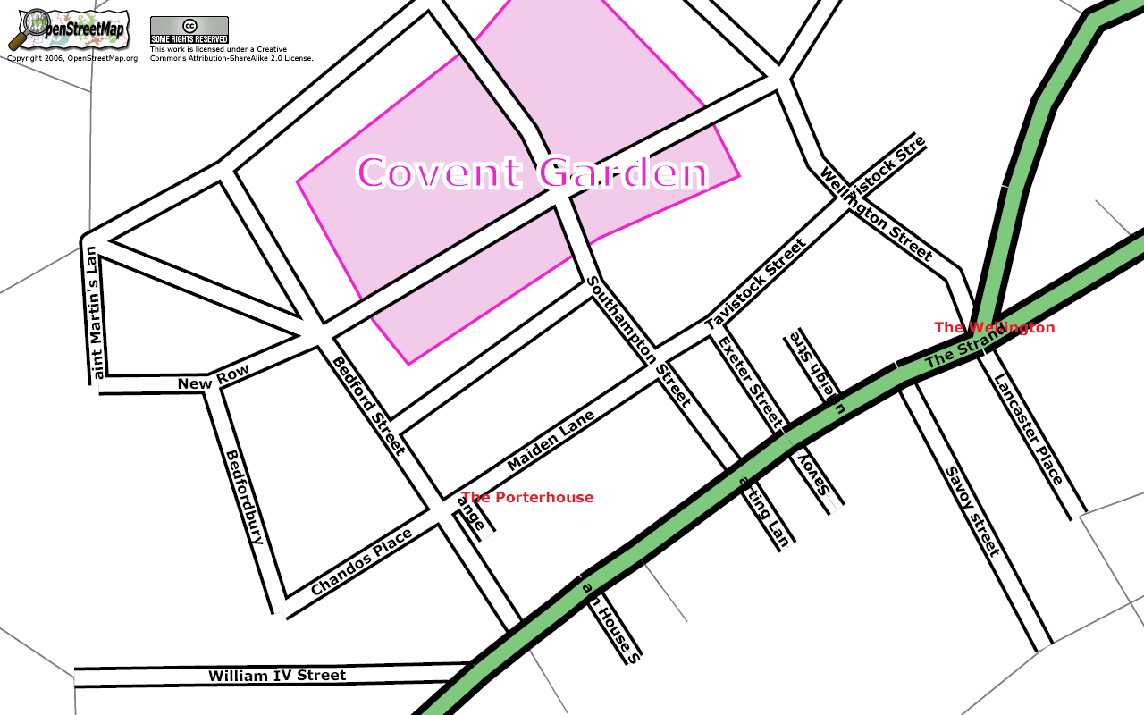
| 22:10, 14 July 2006 | CoventGarden.png (file) |  |
208 KB | Covent Garden showing location of the Porterhouse pub. | 1 |
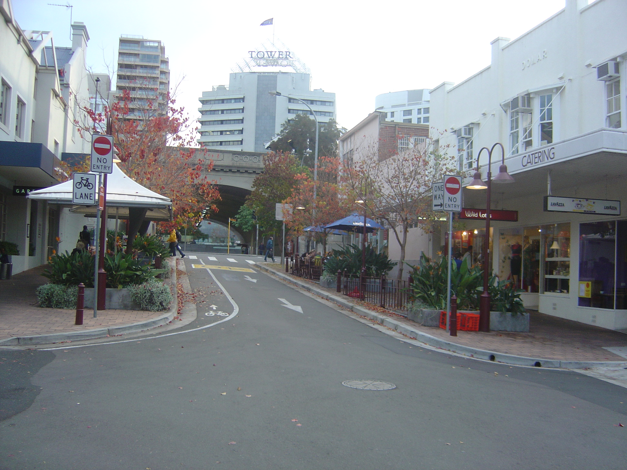
| 19:26, 30 June 2006 | DSC04143.JPG (file) |  |
1.35 MB | Example of a one-way street with a one-way cycle lane in the opposite direction. | 1 |
| 14:11, 19 May 2006 | IsleOfWight20060519.png (file) |  |
284 KB | Isle of Wight rendered with Osmarender as at May 19, 2006 | 1 |
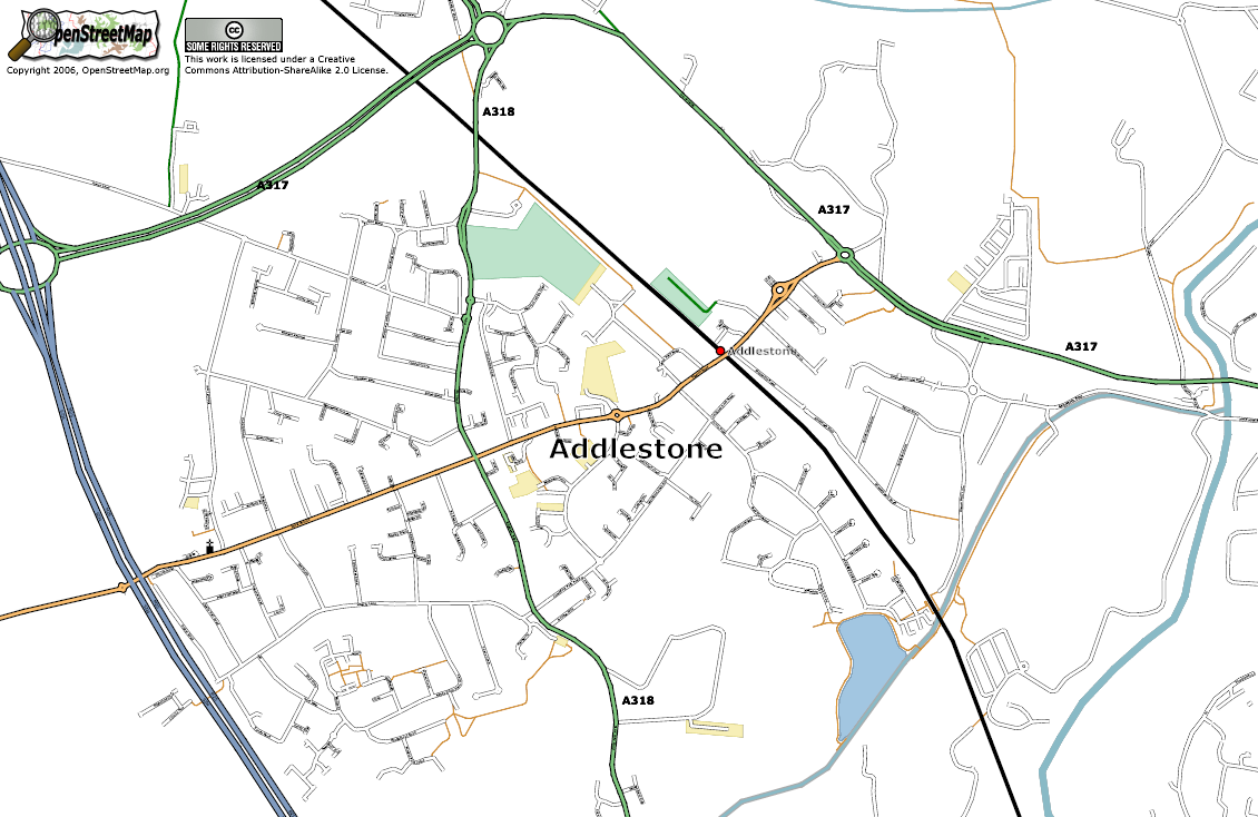
| 09:33, 19 May 2006 | KT15 Addlestone.png (file) |  |
345 KB | Postal area KT15. The town of Addlestone, Surrey. | 1 |
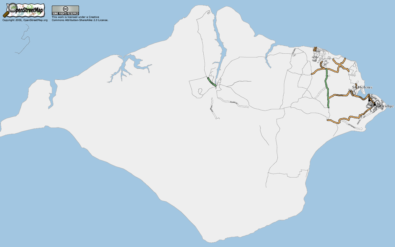
| 00:12, 12 May 2006 | IsleOfWight20060512.png (file) |  |
227 KB | Isle of Wight as at 12 May, 2006 | 1 |
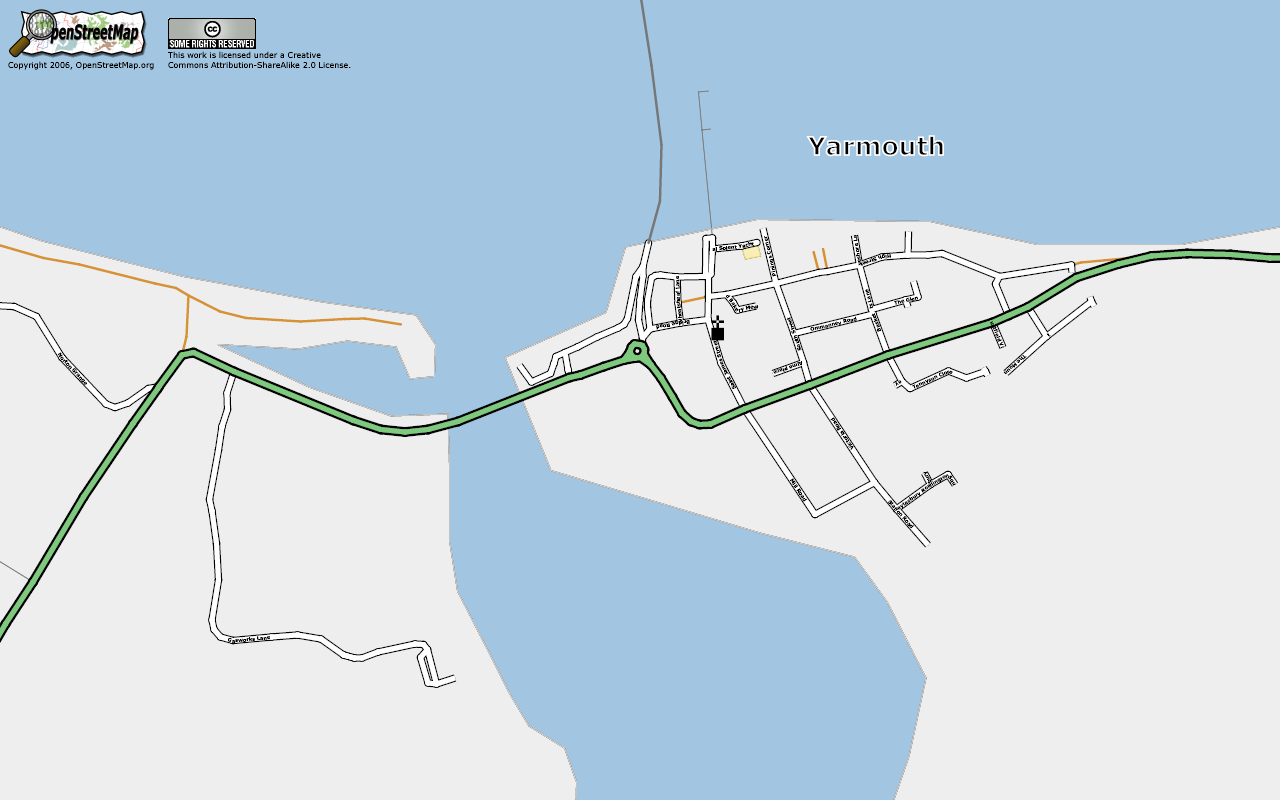
| 11:33, 9 May 2006 | Yarmouth.png (file) |  |
114 KB | An Osmarender of Yarmouth after the IoW workshop. | 1 |
| 21:58, 8 May 2006 | IsleOfWight20060508.png (file) |  |
143 KB | Osmarender view of Isle of Wight on May 8, 2006. | 1 |
| 10:25, 6 May 2006 | IsleOfWight20060504a.png (file) |  |
115 KB | 2 | |
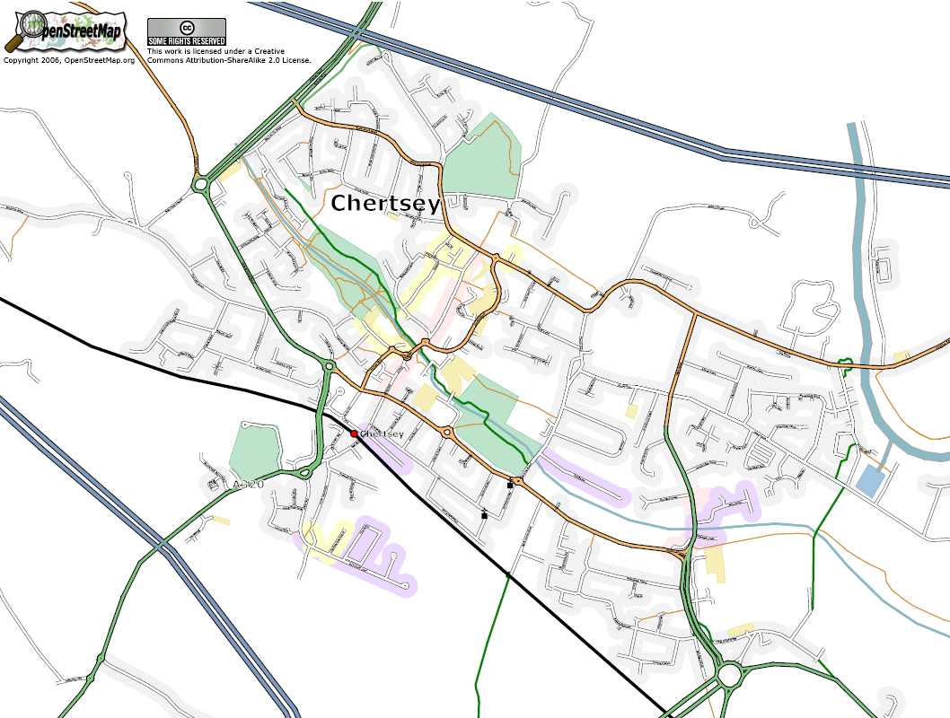
| 08:28, 5 May 2006 | Kt16 chertsey 20060505.png (file) |  |
394 KB | Post code area KT16, Chertsey as at May 5, 2006 | 1 |
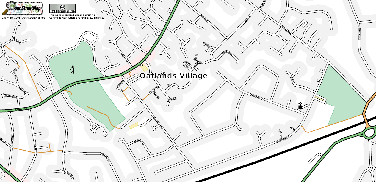
| 18:31, 4 May 2006 | OatlandsVillage.png (file) |  |
290 KB | The Oatlands village area of Weybride as at May 4, 2006 | 1 |