Uploads by Adavidson
Jump to navigation
Jump to search
This special page shows all uploaded files.
| Date | Name | Thumbnail | Size | Description | Versions |
|---|---|---|---|---|---|
| 11:05, 25 August 2021 | Usa street numbers.svg (file) |  |
11 KB | Frequency of street numbers (1-19) from the U.S. Department of Transportation (USDOT) National Address Database. | 1 |
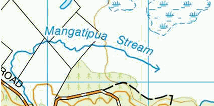
| 04:15, 5 March 2021 | Linz topo50 soakhole.png (file) |  |
26 KB | LINZ Topo50 symbol for a soakhole. CC BY 4.0 Land Information New Zealand. | 1 |
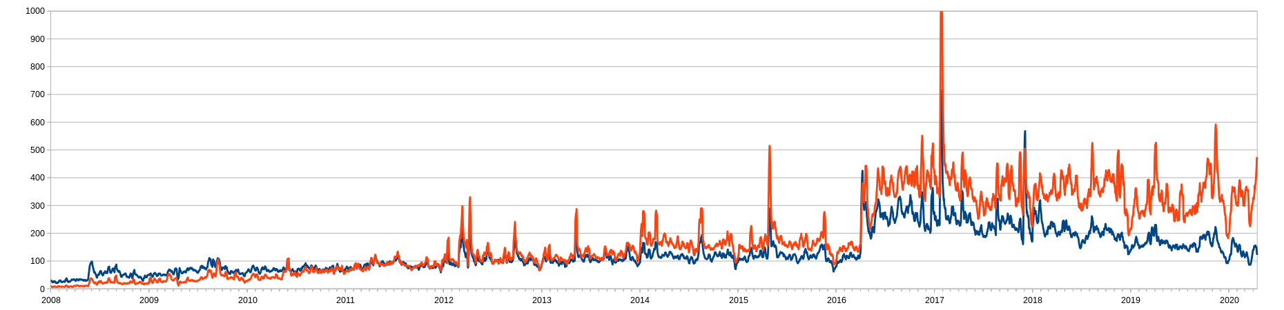
| 09:56, 23 April 2020 | New users.png (file) | 121 KB | A graph of new user accounts 2008-April 2020. Split into single day (red) and multi day (blue) user accounts and 7 day moving average. | 1 | |
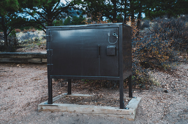
| 22:00, 21 August 2019 | Bear box small.jpg (file) |  |
149 KB | A metal bear food storage box at Estes Park Campground at Mary's Lake, Estes Park, Colorado. | 1 |
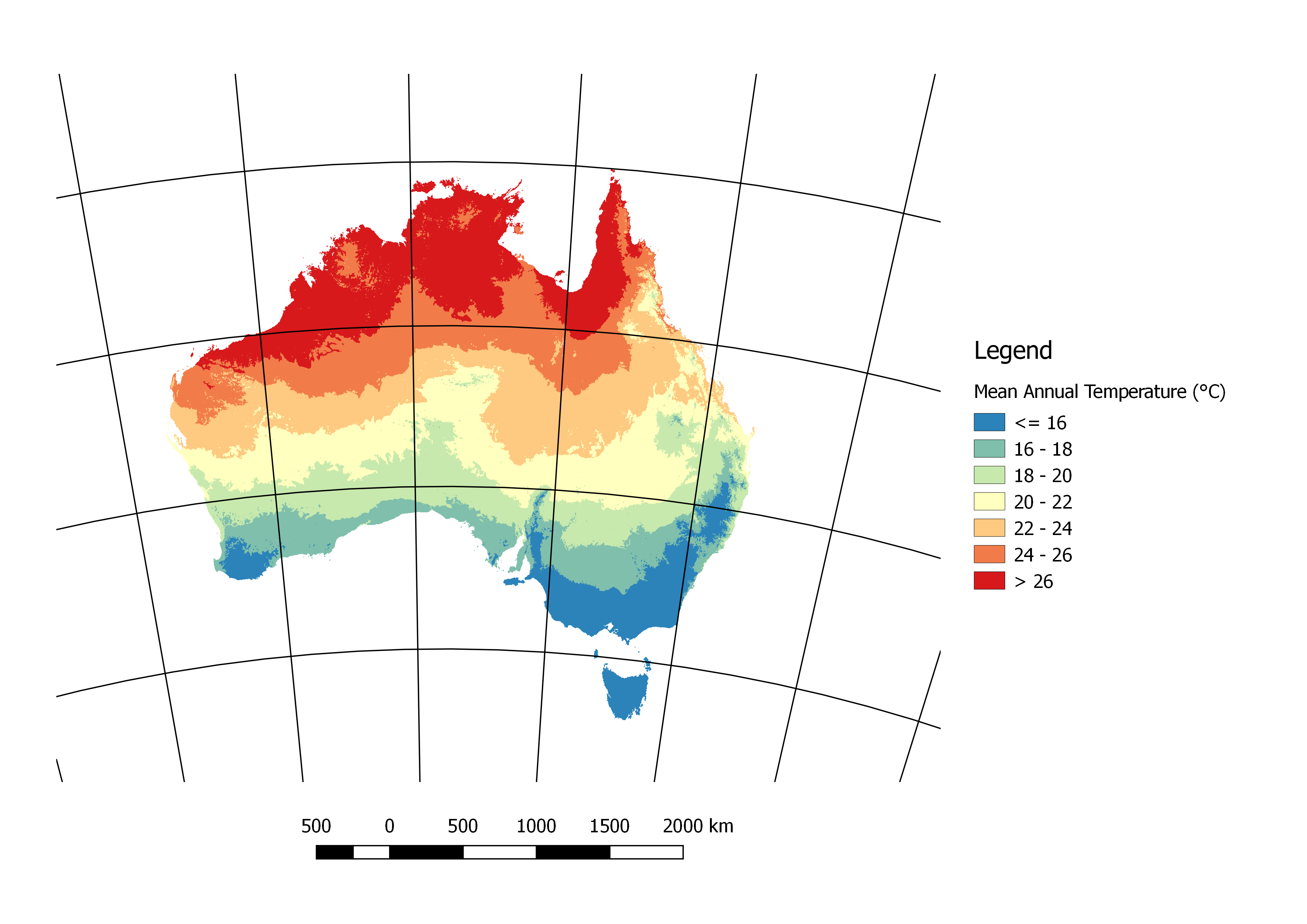
| 08:10, 20 February 2018 | MeanAnnTemp.png (file) |  |
356 KB | Mean annual temperature in degrees Celsius. Period of record 1961-1990. | 1 |
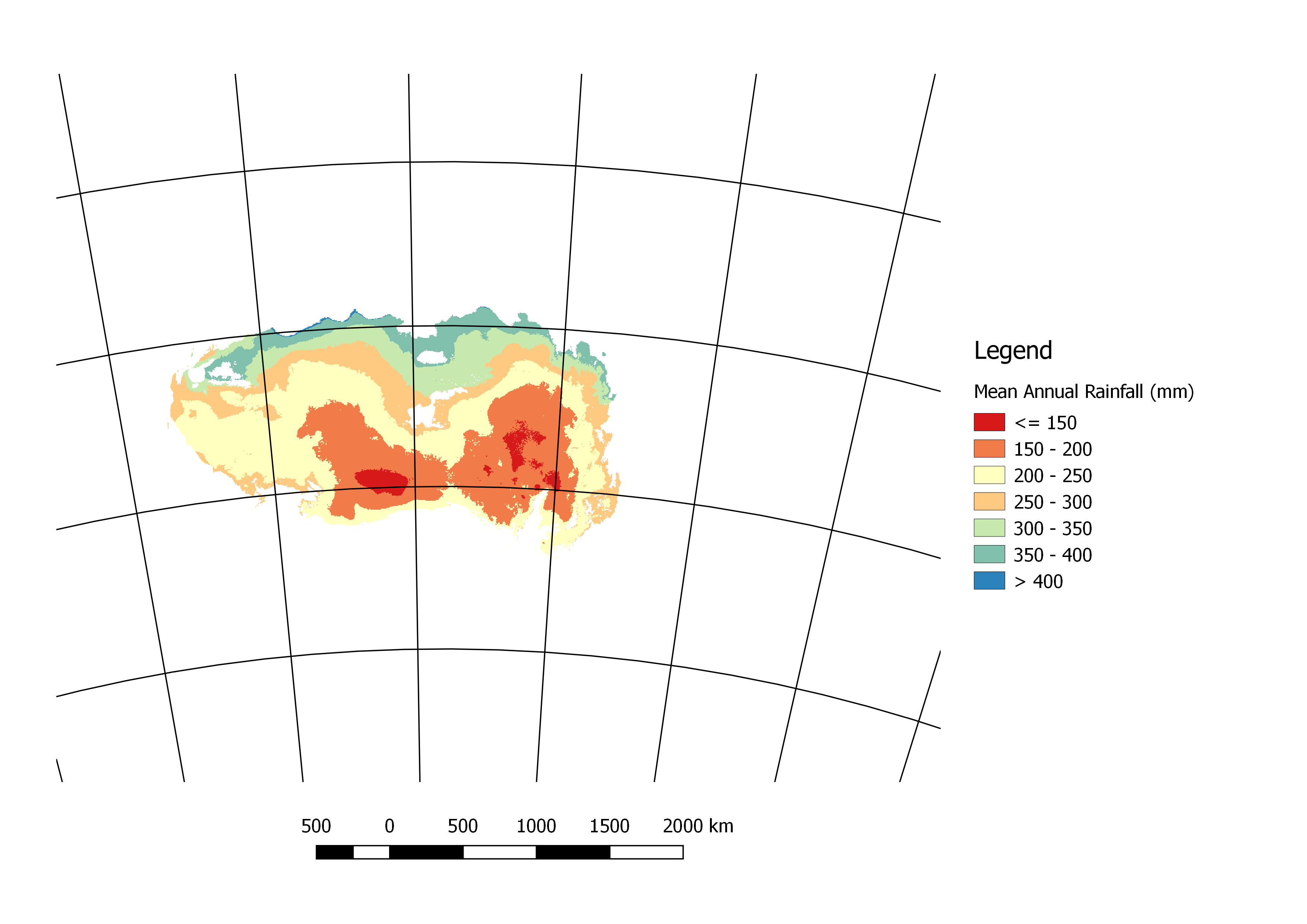
| 00:51, 20 February 2018 | DesertRainfall.png (file) |  |
289 KB | Mean annual rainfall (mm) in the desert areas of Australia. Based on the 1961-1990 period. | 1 |
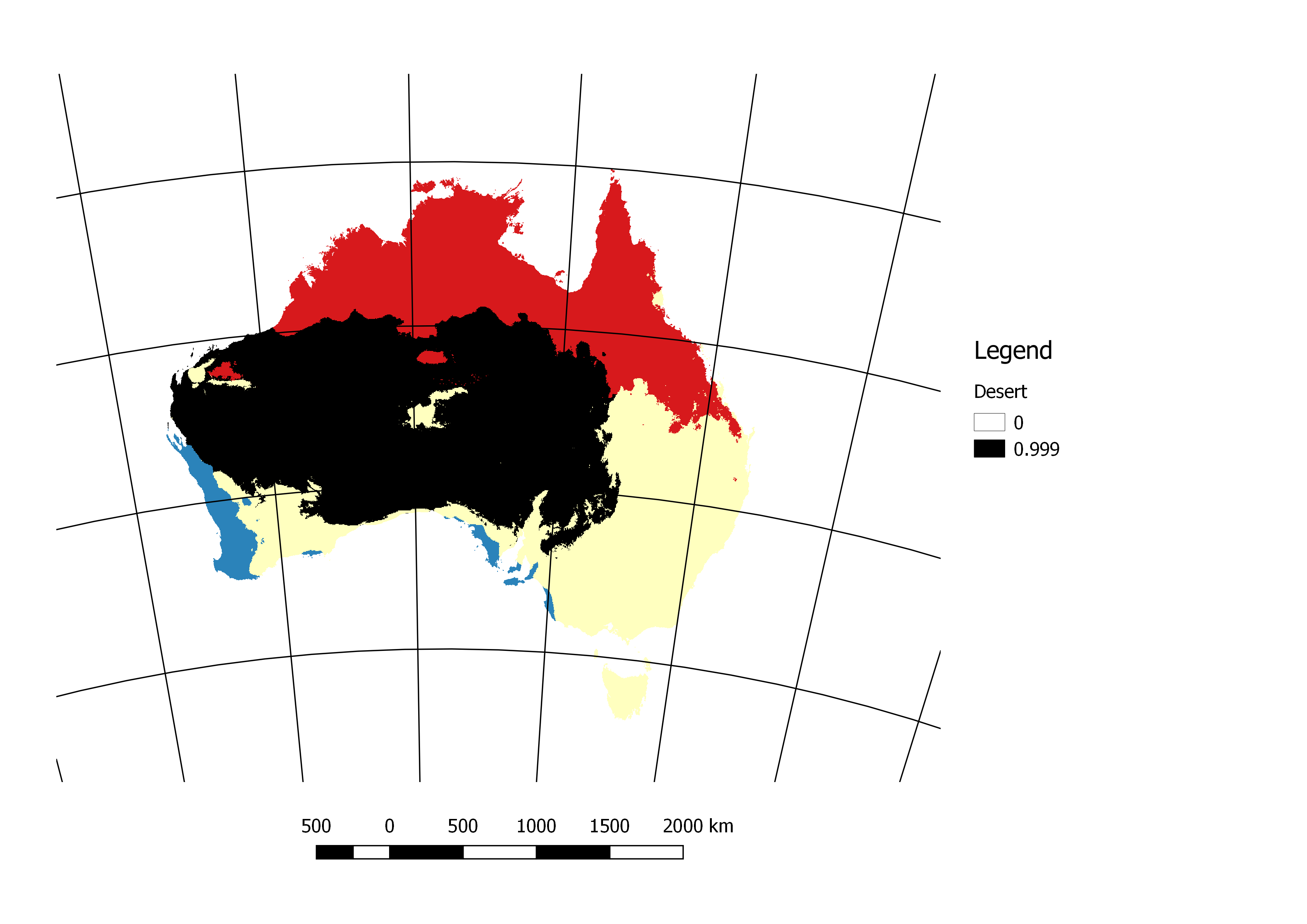
| 22:39, 19 February 2018 | Desert.png (file) |  |
262 KB | Australia's desert areas (in black). Deserts being defined as BW in the Köppen-Geiger climate classification system. | 1 |
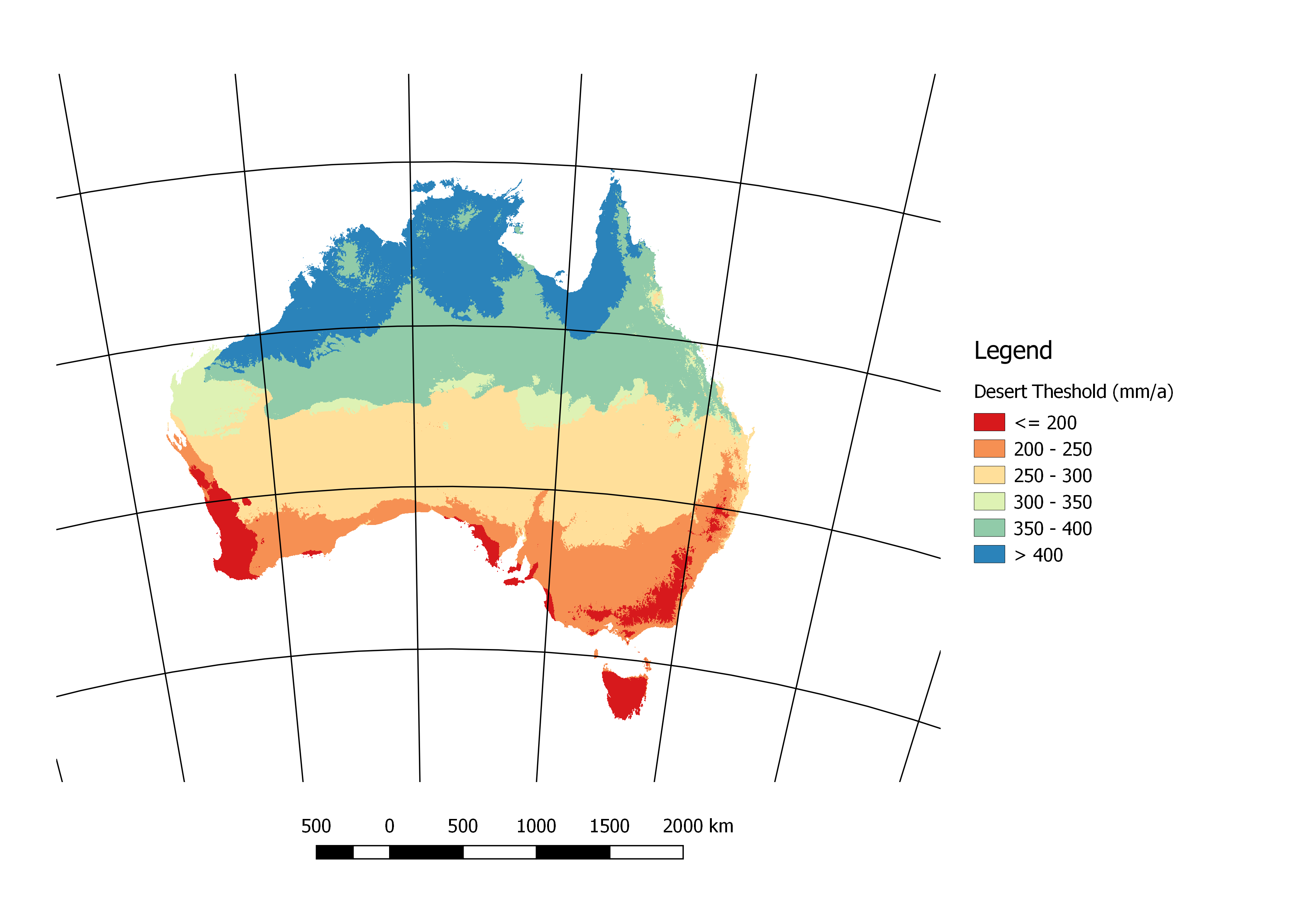
| 22:30, 19 February 2018 | DesertThreshold.png (file) |  |
332 KB | The mean annual rainfall (mm) that defines the BW class in the Köppen-Geiger climate classification system. Based on the period 1961-1990. | 1 |
| 22:21, 19 February 2018 | WarmSeasonRainfall.png (file) |  |
275 KB | Ratio of the mean rainfall in the months October-March to the annual rainfall. For the period 1961-1990. | 1 |
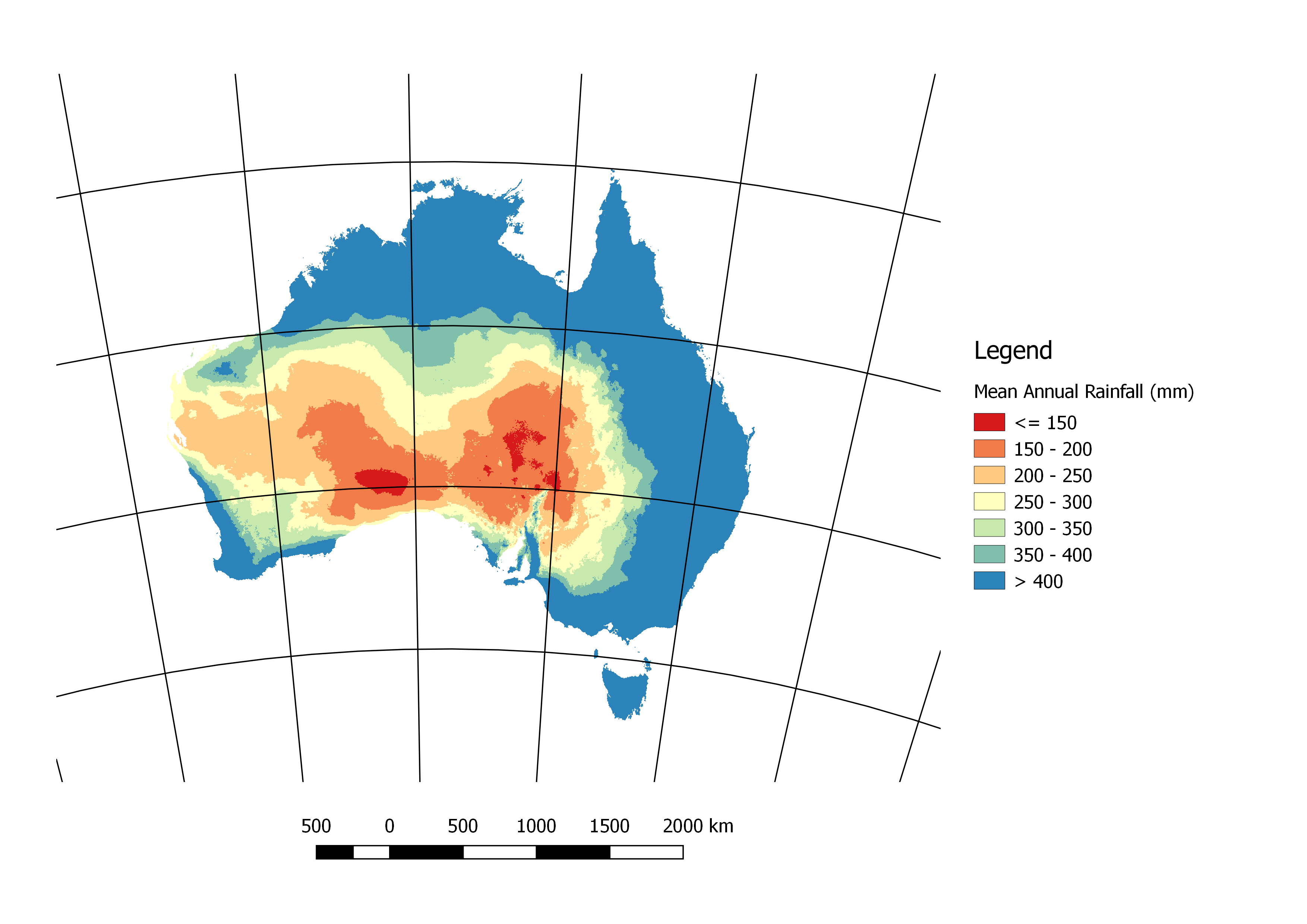
| 22:09, 19 February 2018 | MeanAnnRainfall.png (file) |  |
318 KB | Mean annual rainfall in mm for the period 1961-1990. Original data is available here: http://www.bom.gov.au/web01/ncc/www/climatology/rainfall/rainan.zip | 1 |
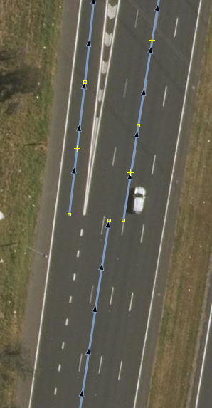
| 23:47, 31 January 2018 | LanesAtPointOfWidening.png (file) |  |
114 KB | Background imagery is from the NSW LPI (https://data.nsw.gov.au/data/dataset/lpi-web-services-spatial-data) released under a CC-BY licence. | 1 |
| 23:42, 31 January 2018 | LanesAtPointOfLegalSeperation.png (file) |  |
150 KB | Background imagery is from the NSW LPI (https://data.nsw.gov.au/data/dataset/lpi-web-services-spatial-data) released under a CC-BY licence. | 1 |
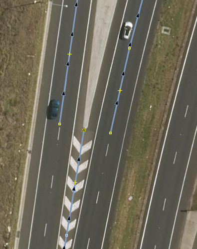
| 23:39, 31 January 2018 | LanesAtPointOfSeperation2.png (file) |  |
175 KB | Background imagery is from the NSW LPI (https://data.nsw.gov.au/data/dataset/lpi-web-services-spatial-data) released under a CC-BY licence. | 1 |
| 23:01, 31 January 2018 | LanesAtPointOfSeperation.png (file) |  |
209 KB | Bacground imagery is from the NSW LPI (https://data.nsw.gov.au/data/dataset/lpi-web-services-spatial-data) released under a CC-BY licence. | 1 |
| 09:32, 30 January 2017 | By.png (file) | 4 KB | The Creative Commons Attribution Button. (Image is licensed as CC-BY 4.0 but there is no option in the drop down for this) | 1 |