Uploads by Bgo eiu
Jump to navigation
Jump to search
This special page shows all uploaded files.
| Date | Name | Thumbnail | Size | Description | Versions |
|---|---|---|---|---|---|
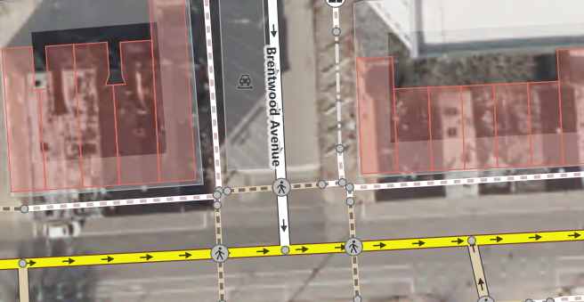
| 22:22, 30 September 2022 | Brentwood Ave Barrier iD.png (file) |  |
431 KB | {{Information | description=Barrier on Brentwood Avenue in Baltimore, Maryland, United States | source=Screenshot by uploader | date=2022-09-30 | author=Uploader | permission=ISC license per iD screenshot guidelines | other_versions= }} | 1 |
| 22:21, 30 September 2022 | E Biddle St Brownfields OSM Carto.png (file) |  |
441 KB | {{Information | description=Example of some mapped brownfield land in Baltimore, Maryland, United States | source=Screenshot taken by uploader | date=2022-09-30 | author=Uploader | permission=CC0 per OSM Carto screenshot guidelines | other_versions= }} | 1 |
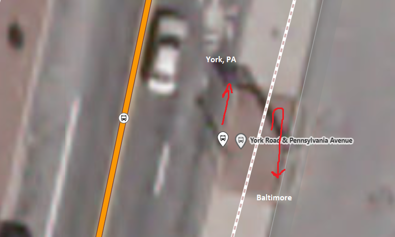
| 20:11, 25 May 2022 | York-Pennsylvania not in Pennsylvania.png (file) |  |
467 KB | {{Information | description=York & Pennsylvania Ave bus stop in Towson, MD shown in iD editor | source=OSM data in iD editor | date=2022-05-25 | author=Self | permission=ISC License (iD screenshot) | other_versions= }} | 1 |
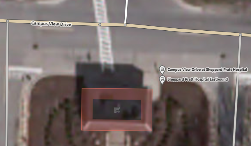
| 17:30, 25 May 2022 | TowsonTownCenterBusBay.png (file) |  |
1.26 MB | {{Information | description=Screen shot of Towson Town Center Bus Bay in Towson, MD in iD | source=Screenshot of OSM in iD | date=2022-05-25 | author=Self | permission=ISC license per iD screenshot guideline | other_versions= }} | 1 |
| 00:19, 23 May 2022 | MTA and BaCo Loop shared bus stop in Towson, MD, USA.png (file) |  |
597 KB | {{Information | description=Screenshot in iD of an example scenario of a shared bus stop served by two operators/networks. | source=Original screenshot of collaborative OSM data. | date=2022-05-22 | author=Self | permission=ISC License per option given for iD editor screenshots | other_versions= }} | 1 |
| 16:38, 15 May 2022 | Brownfields, 400-600 East Biddle Street, Baltimore, MD, USA.png (file) |  |
101 KB | {{Information | description=Examples of {{Tag|landuse|brownfield}} with buildings in disrepair on them. | source=Screenshot with OSM Carto theme on OSM.org main page map | date=2022-05-15 | author=Self User:Bgo eiu | permission=Open Database License per OSM Wiki & OSM.org standard policy | other_versions= }} | 1 |
| 07:50, 5 May 2022 | Name-left-right-OSM example Adams-Jay County Border Indiana USA.png (file) |  |
1.23 MB | Original image by jbthemilker on Mapillary: https://www.mapillary.com/app/?pKey=457909311938504 Original on Wikimedia Commons: https://commons.wikimedia.org/wiki/File:Indiana_East_1200_South--East_900_North_at_Adams_County_-_Jay_County_border,_United_States.jpg Annotated version of image uploaded to OSM wiki due to its specific relevance to the project / illustrative purposes (meaning of name:left or name:right could be confusing in other contexts) | 1 |