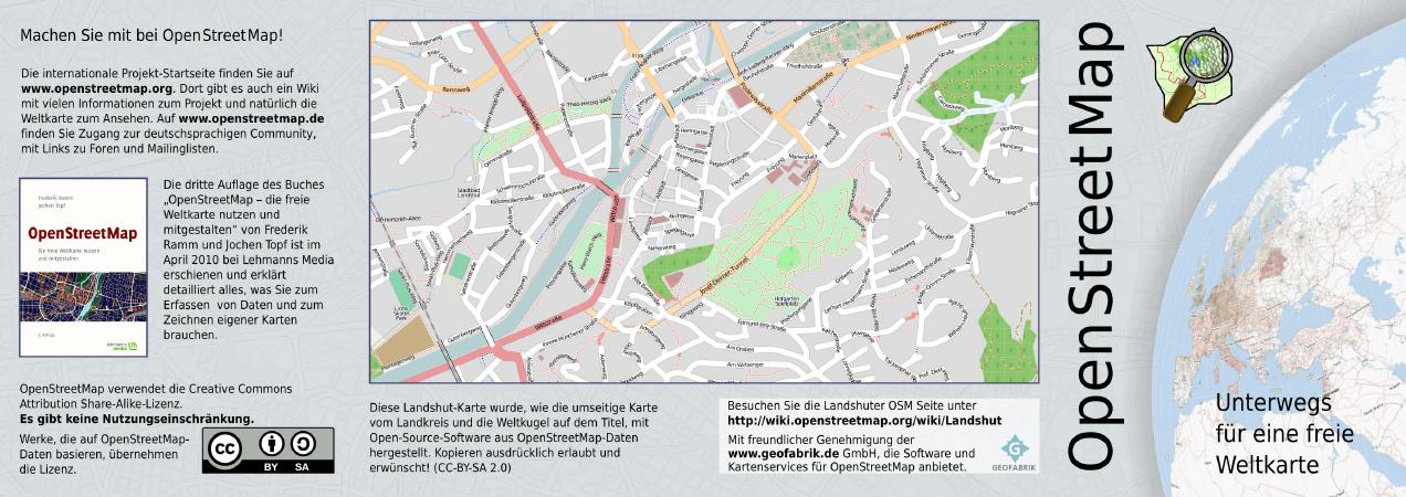
Uploads by Blutsauger
Jump to navigation
Jump to search
This special page shows all uploaded files.
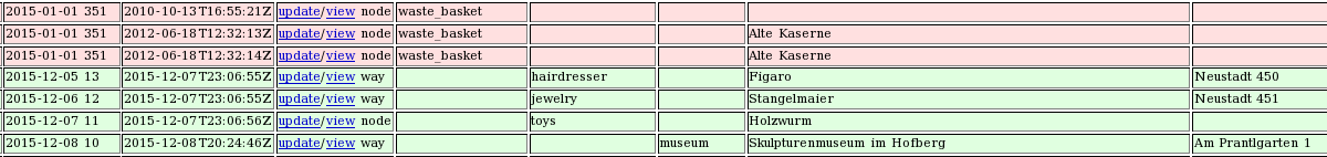
| Date | Name | Thumbnail | Size | Description | Versions |
|---|---|---|---|---|---|
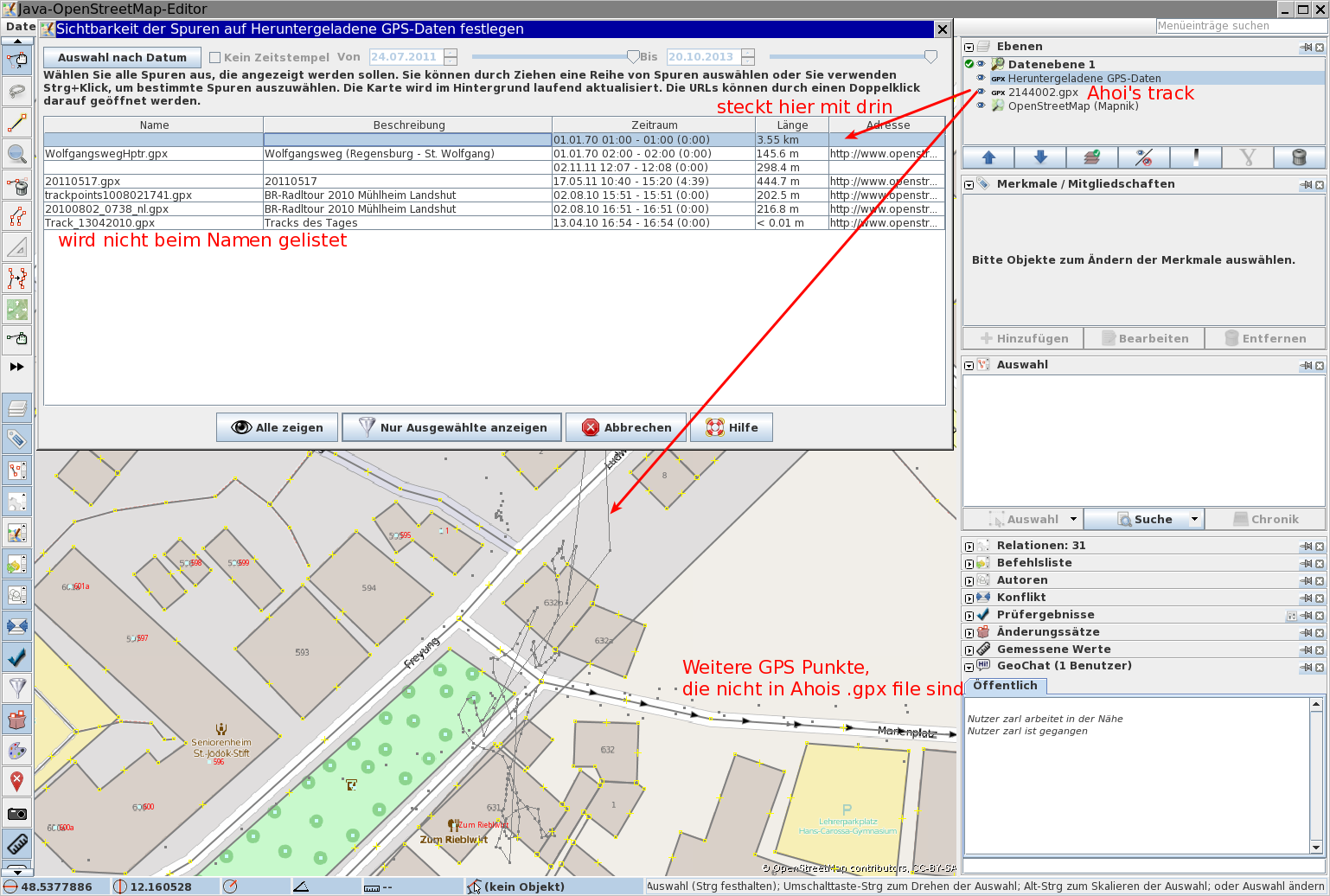
| 11:05, 14 April 2016 | AhoiAnonymousTracks.png (file) |  |
384 KB | Screenshot of JOSM, showing a locally loaded .gpx file which is also public visible in OSM. But it's not shown as own trace in the list. It's rather hidden inside an anonymous GPS trace with lots more points. | 1 |
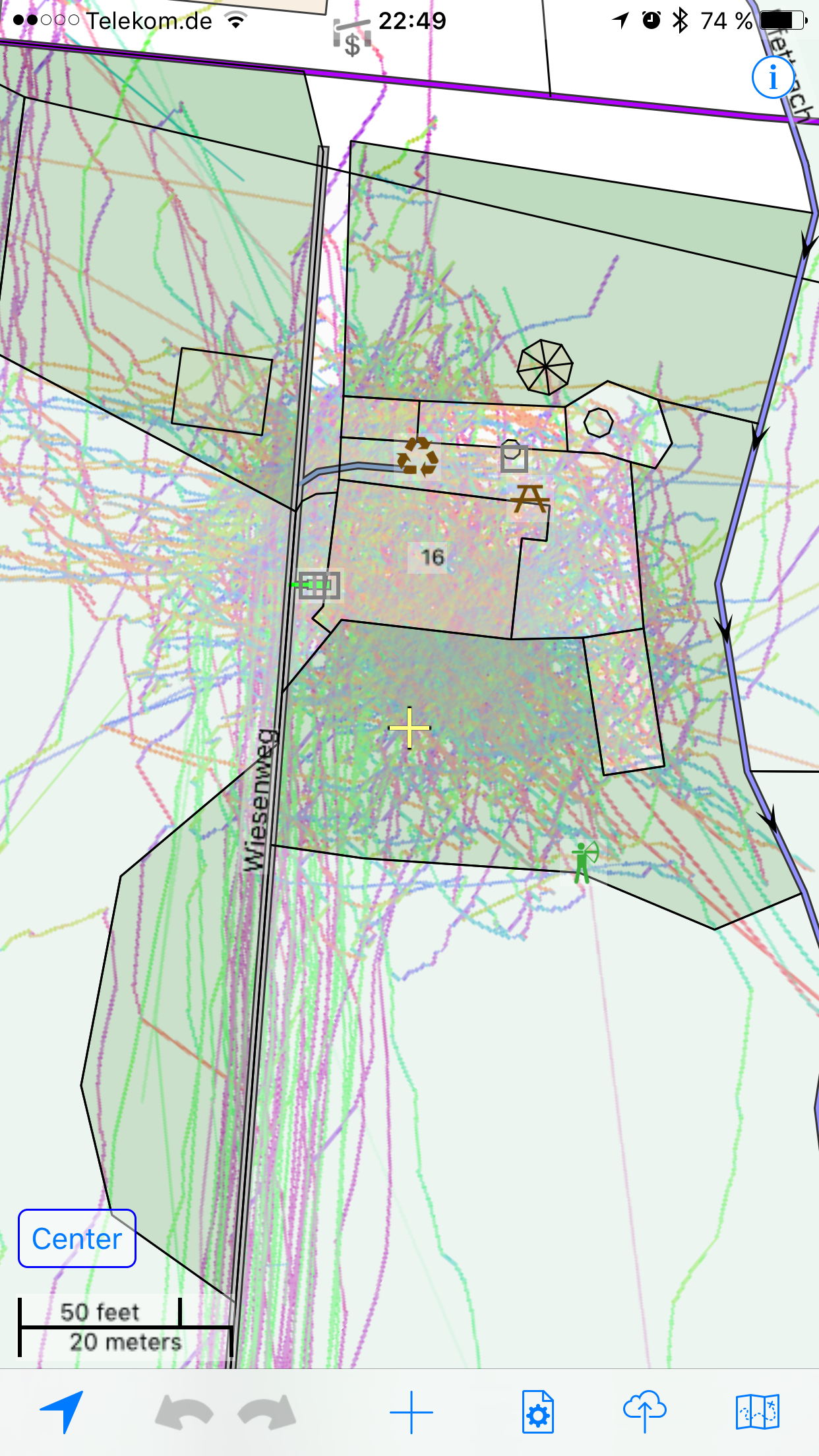
| 09:09, 13 April 2016 | Gomap gpstracks.png (file) |  |
2.77 MB | Screenshot of GoMap! showing a LOT of GPS tracks around a location with free WiFi. | 1 |
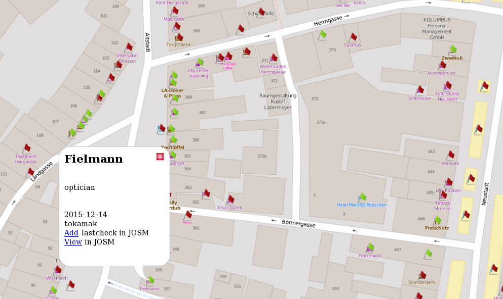
| 10:00, 17 December 2015 | POI Auswertung LA JOSM.png (file) |  |
92 KB | Auswertung POIs in Landshut: Verlinkung auf JOSM's RemoteControl Funktion aus einer OpenLayer Karte heraus. | 1 |
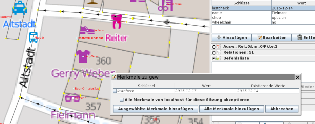
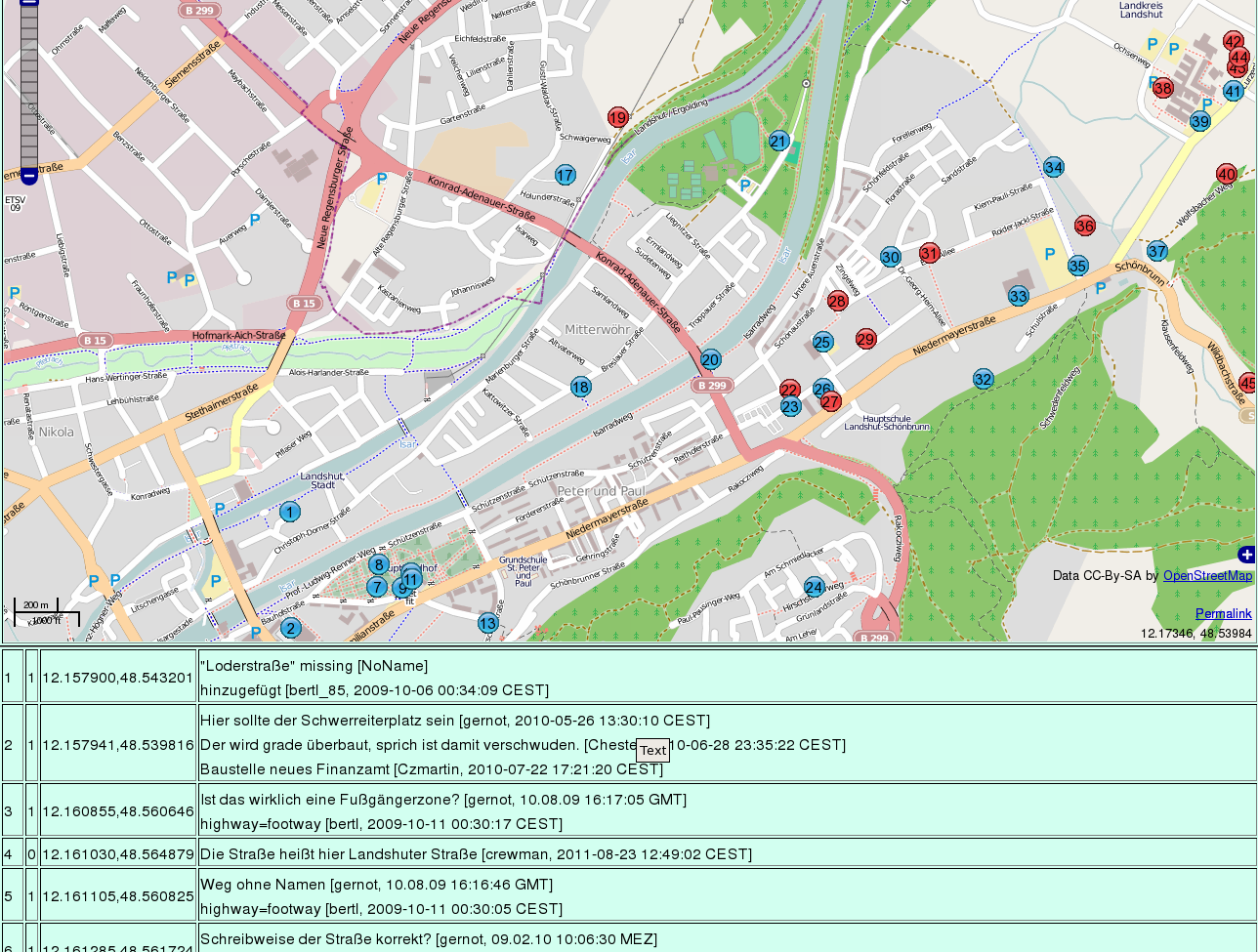
| 09:43, 17 December 2015 | POI Auswertung LA Karte.png (file) |  |
244 KB | Interaktive Karte basierend auf OpenLayers mit Anzeige der ausgewählter POIs in Landshut. Farbliche Markierung anhand des 'lastcheck' Tags und Links zur Weiterverarbeitung in JOSM. | 1 |
| 09:27, 17 December 2015 | POI Auswertung LA Tabelle.png (file) | 30 KB | Tabellarische Auswertung des 'lastcheck' Tags für Landshut | 1 | |
| 23:42, 17 February 2015 | Ergebnis entzerrt-mit-Hugin.jpg (file) |  |
778 KB | New parameters without truncating border | 3 |
| 11:41, 17 February 2015 | Drohne-LA-undistort-small.png (file) |  |
3.56 MB | undistorted picture of a DJI Phantom done by handwritten code from user Peda | 1 |
| 15:14, 11 February 2015 | LA-Drohne-Baeckerei.png (file) | 3.22 MB | Another example of drone-mapping | 1 | |
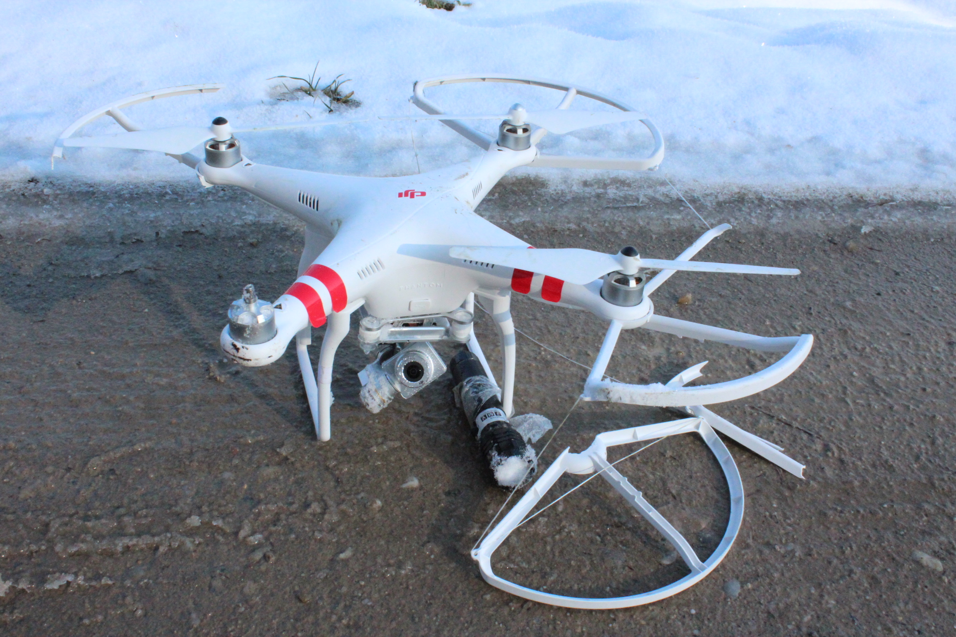
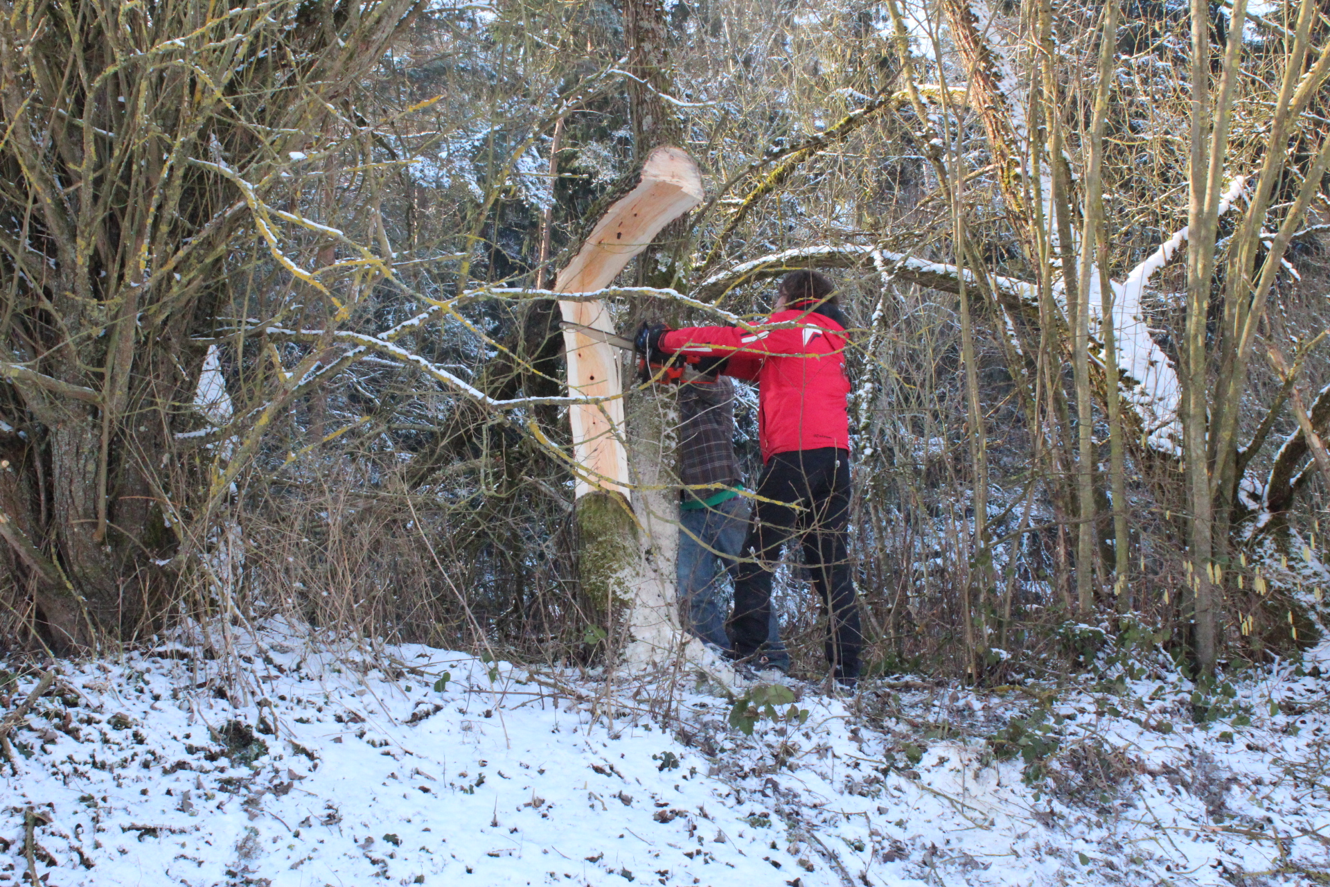
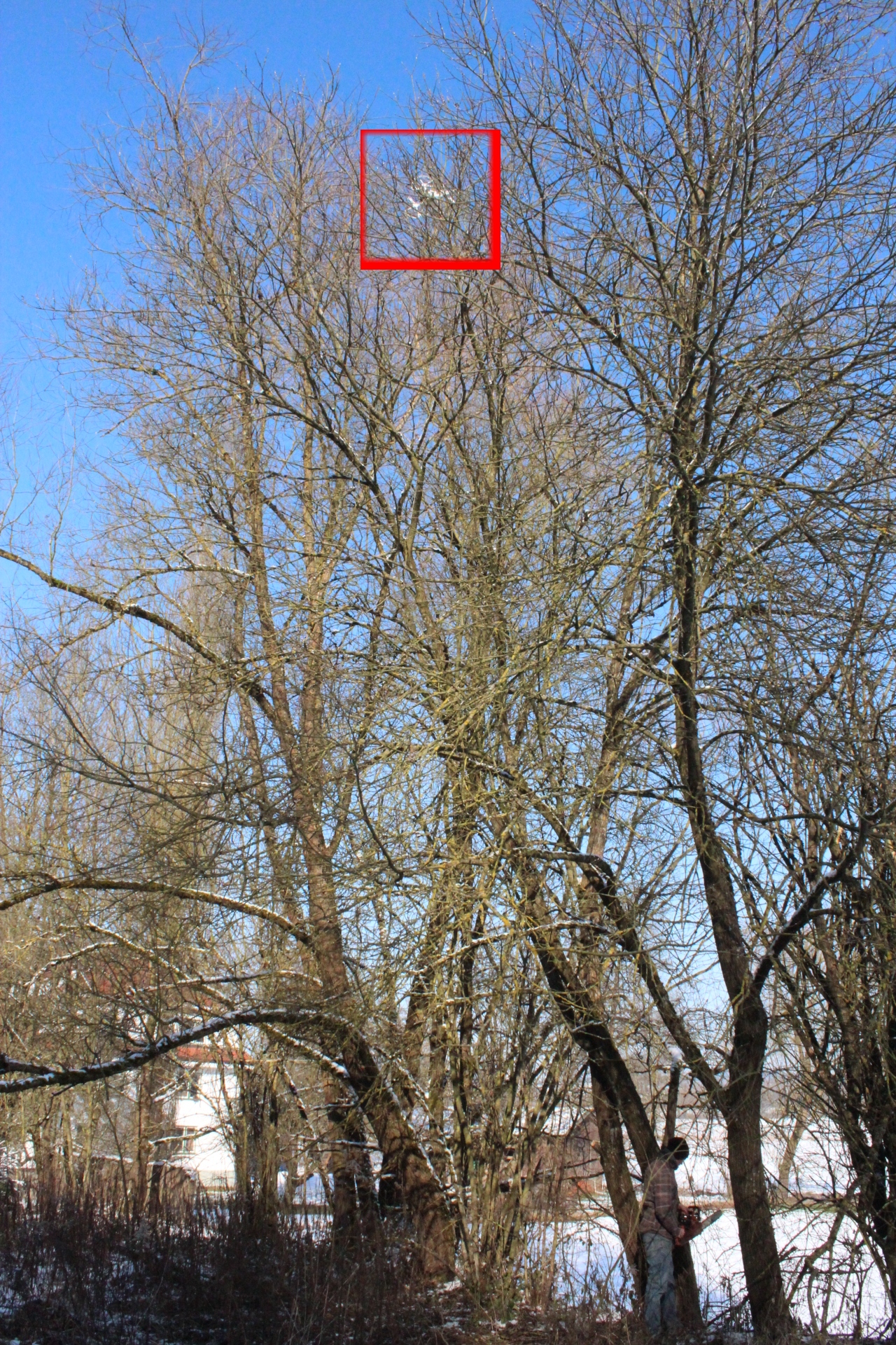
| 16:12, 4 February 2015 | Drohne crash3.jpg (file) |  |
1.26 MB | 1 | |
| 16:12, 4 February 2015 | Drohne crash2.jpg (file) |  |
2.18 MB | 1 | |
| 16:10, 4 February 2015 | Drohne crash1.jpg (file) |  |
1.9 MB | 1 | |
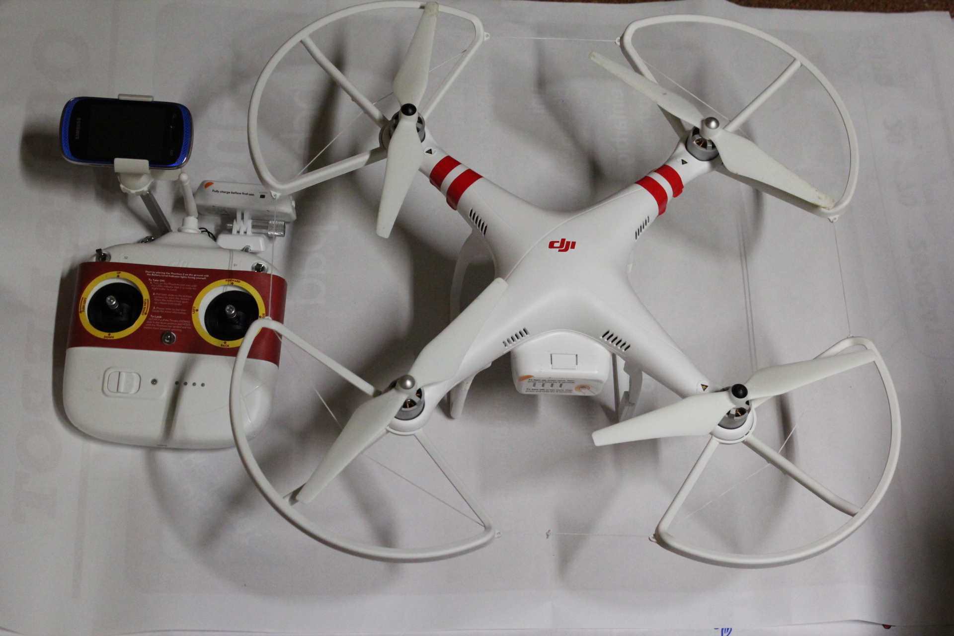
| 23:07, 30 January 2015 | Drohne-DJI-Phantom-Vision2Plus.jpg (file) |  |
1,013 KB | Home-made photo of my Phantom drone with remote control, used for drone-mapping. | 1 |
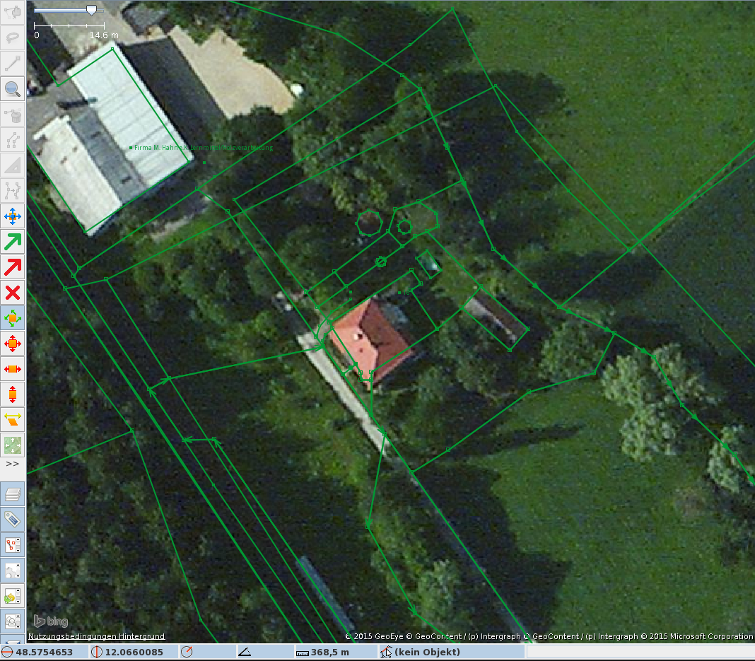
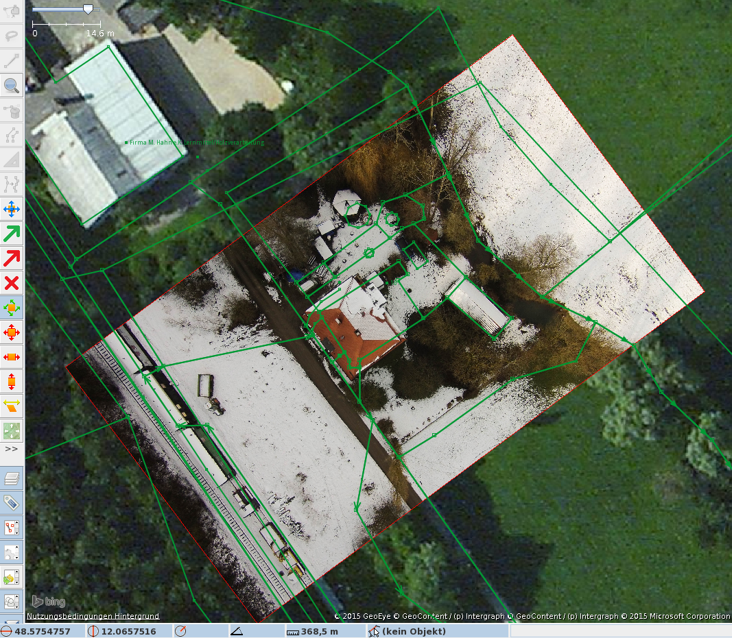
| 14:54, 30 January 2015 | Drohne-LA-JOSM-bing.png (file) |  |
1,016 KB | JOSM with bing background, see the image Drohne-LA-JOSM-Drohne.png for comparison. | 1 |
| 14:53, 30 January 2015 | Drohne-LA-JOSM-Drohne.png (file) |  |
1.49 MB | JOSM With drone image as background | 1 |
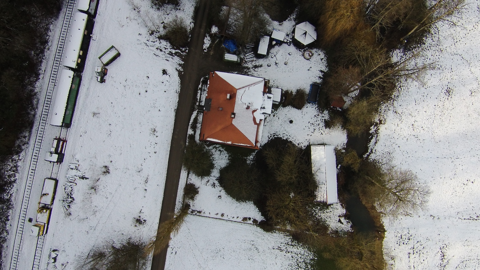
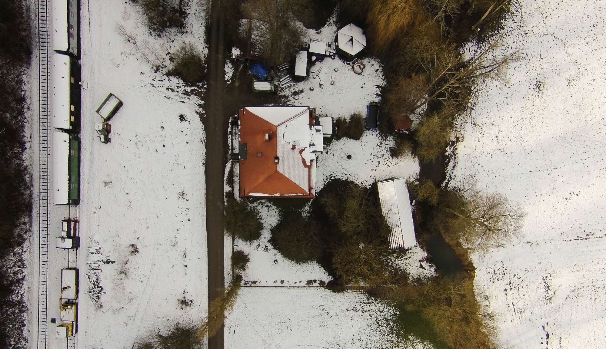
| 14:37, 30 January 2015 | Drohne-LA-entzerrt-small.png (file) |  |
3.5 MB | Drone-image without lens distortion, see the original distorted image under Drohne-LA-small.png | 1 |
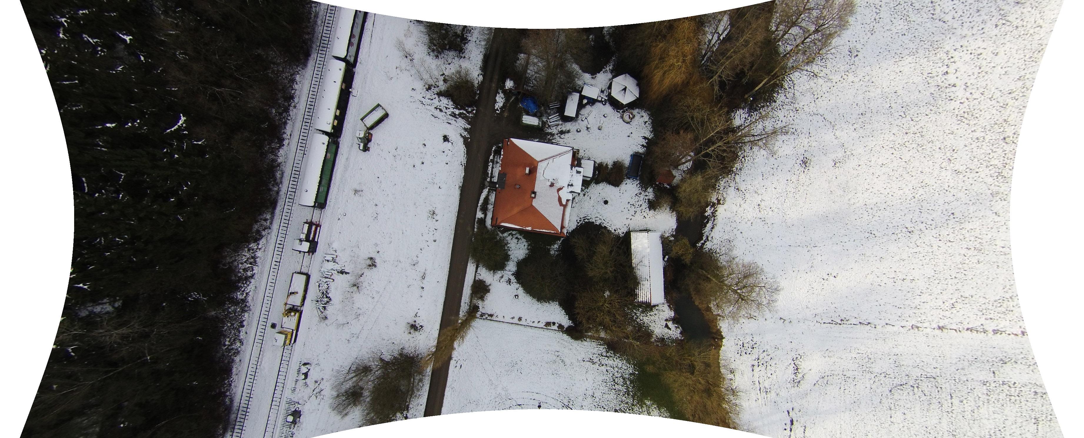
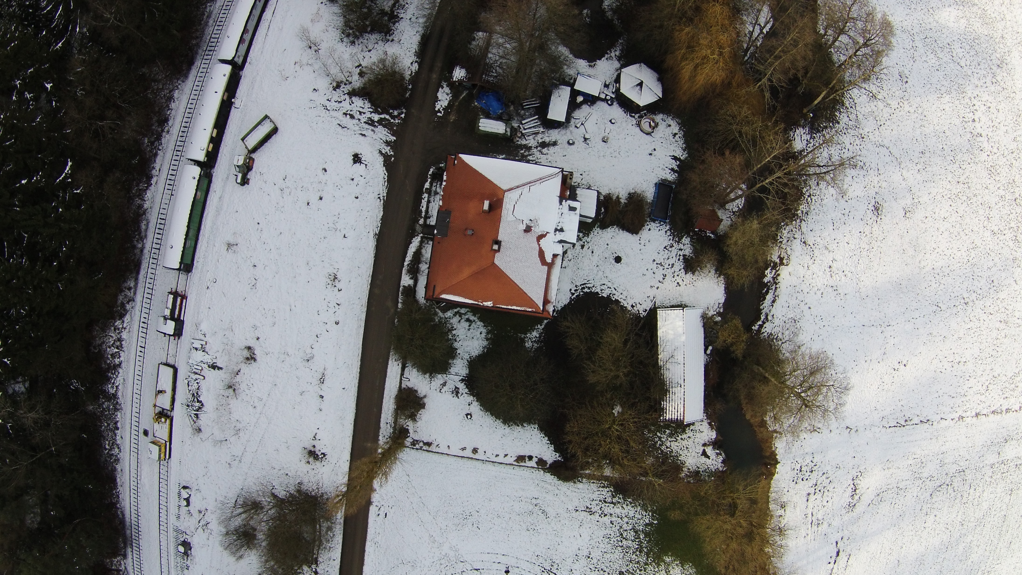
| 14:25, 30 January 2015 | Drohne-LA-small.png (file) |  |
3.54 MB | Drone-picture made by a DJI Phantom Vision 2+ No lens-correction done yet, that's why it has a strong 'fish-eye' effect and is unusable for mapping. | 1 |
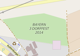
| 21:53, 8 October 2014 | B3DorffestAltdorf2014.png (file) |  |
19 KB | 08/2014 - Altdorf bei Landshut hat den Zuschlag für das Bayern3 Dorffest erhalten und das Festival-Gelände wurde auch sofort getagged ;) Über die 'Entsorgung' des tags werden wir am nächsten Stammtisch entscheiden. | 1 |
| 16:59, 9 August 2014 | MappingParty10YearsOSMInPassau.jpg (file) |  |
3.43 MB | 10th birthday mapping party in Passau | 1 |
| 14:55, 7 May 2014 | Ankara 3D.png (file) |  |
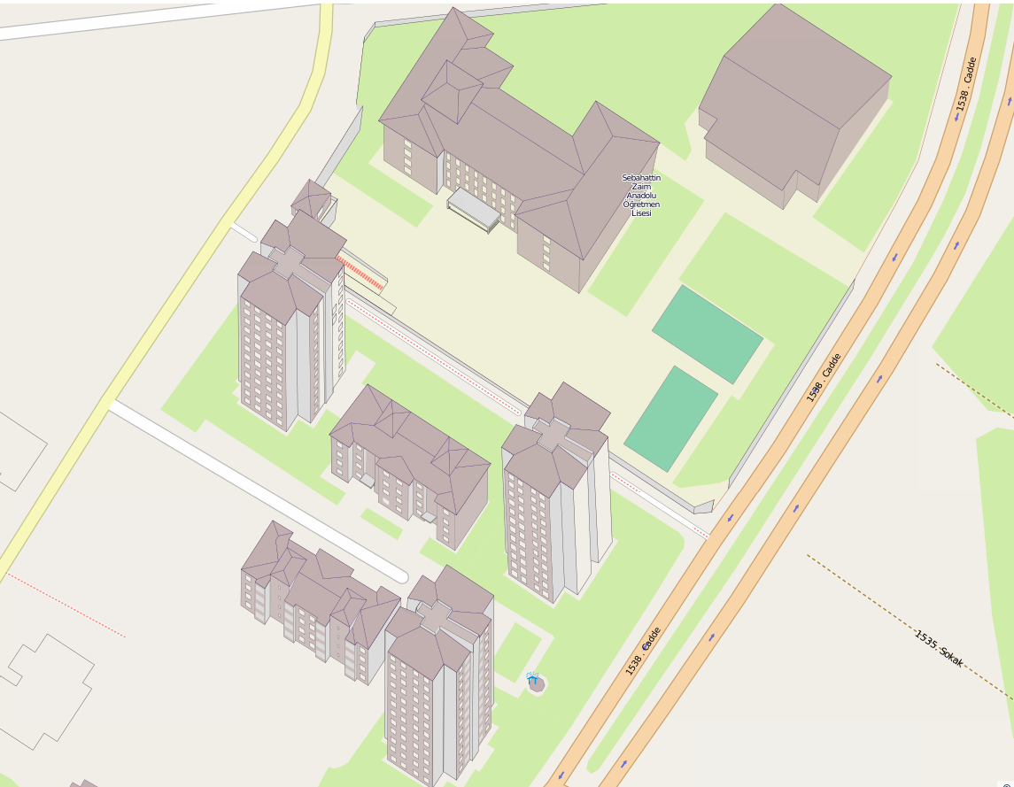
266 KB | Pseudo 3D-mapping of buildings, very funny! | 1 |
| 10:20, 24 March 2014 | OSM flyer LA 2 Dienstag beideSeiten.jpg (file) |  |
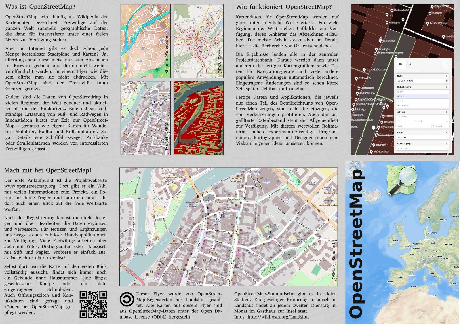
545 KB | Localized flyer for the city Landshut/Bavaria/Germany. Text and layout mainly created by user 'Peda'. The sources are available as scribus files. Feel free to contact for re-use. | 1 |
| 15:38, 28 February 2014 | LAZ-OSM-2014-02-28.png (file) |  |
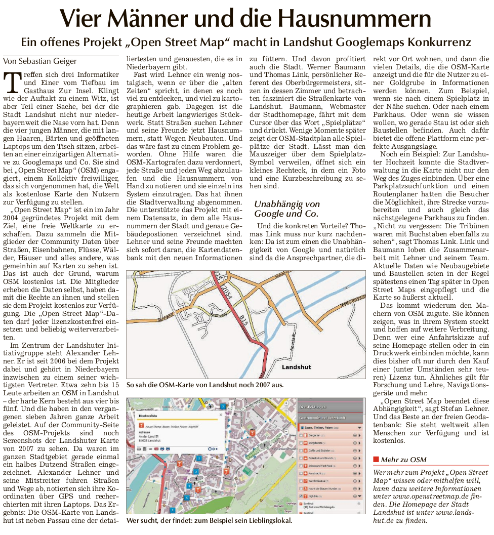
652 KB | German newspaper article about activities in Landshut/Bayern/Germany. Housenumbermapping, history of OSM in Landshut, usage of OSM in the gouvernemnt of the city. With friendly contribution of author Sebastian Geiger, idowa, Landsuter Zeitung. | 1 |
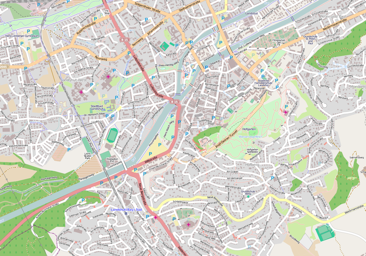
| 02:38, 20 May 2013 | Landshut 2013.png (file) |  |
1.12 MB | Mapnik rendering of the same area as Landshut1.png from the year 2013. | 1 |
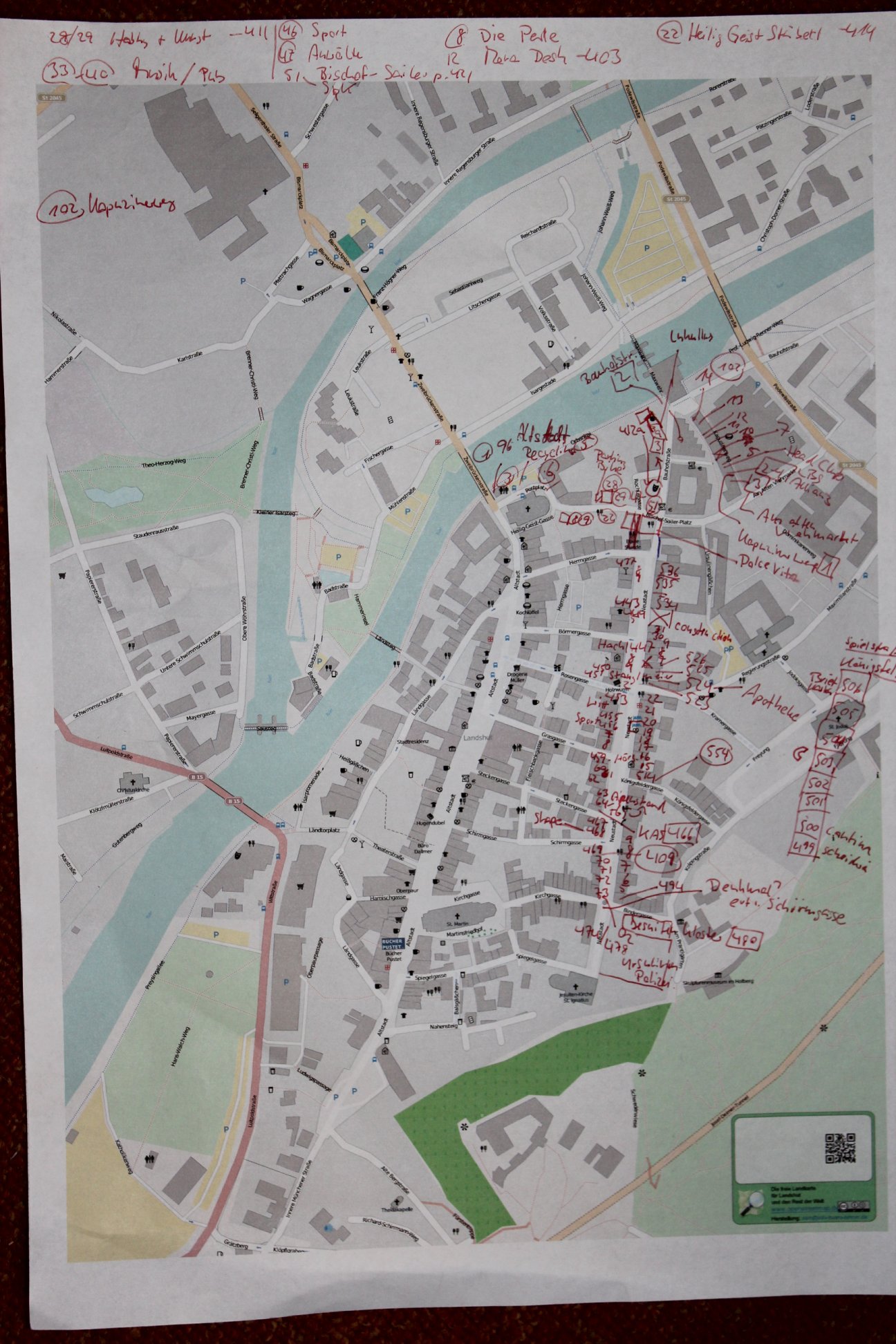
| 23:32, 18 May 2013 | LandshutMapping.jpg (file) |  |
427 KB | Printed DIN-A3 map of Landshut (Germany) with lots of notes concerning housenumbering and shops. Result of one afternoon city mapping. | 1 |
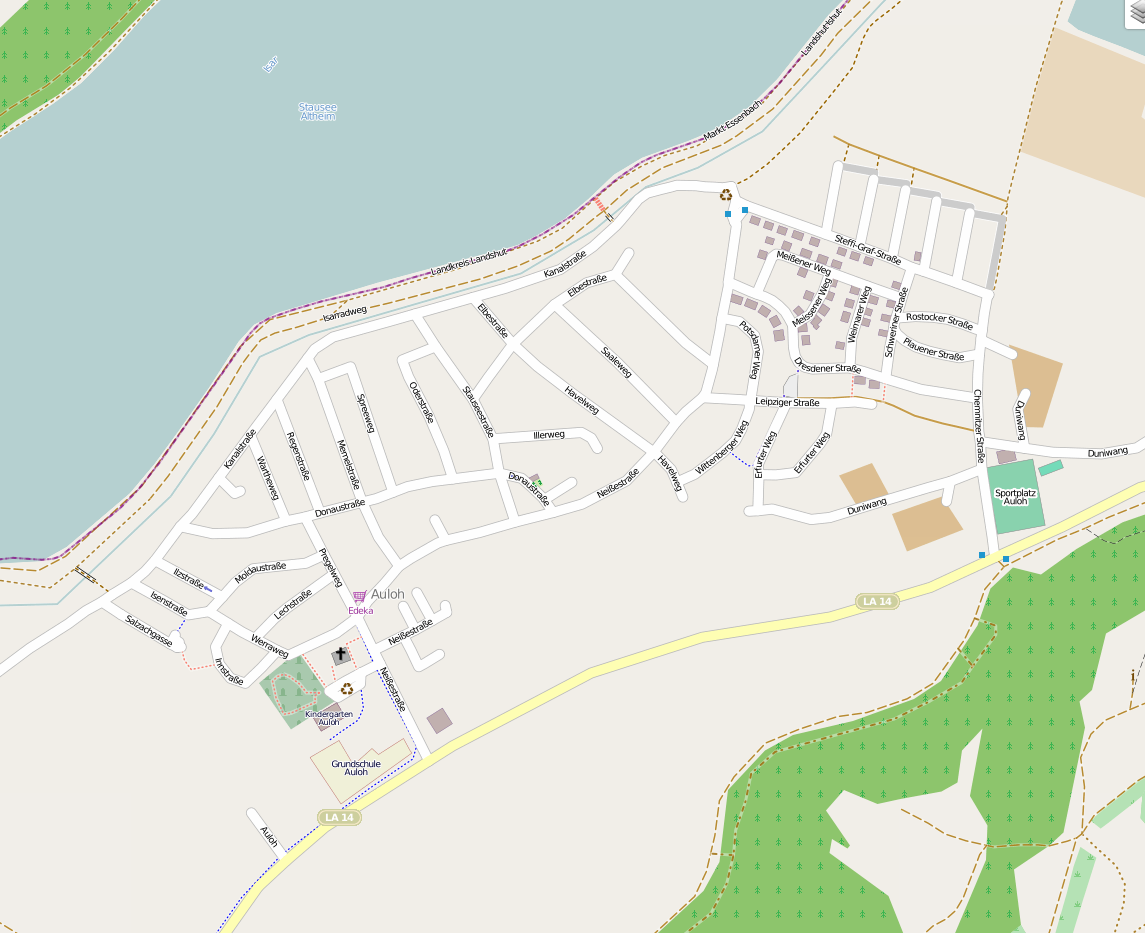
| 23:40, 11 May 2013 | Auloh neu.png (file) |  |
397 KB | Auloh mapathron before/after - new image | 1 |
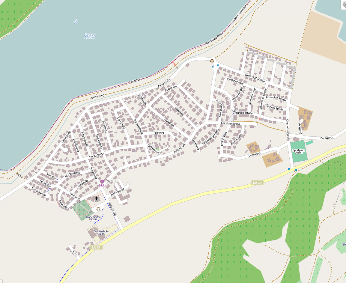
| 23:34, 11 May 2013 | Auloh alt.png (file) |  |
287 KB | before/after picture - before mapathron | 1 |
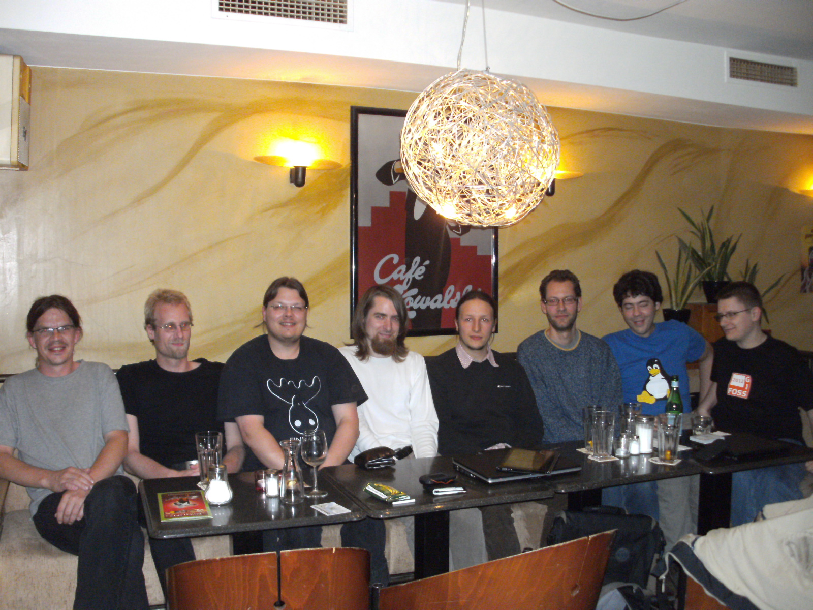
| 00:03, 12 June 2012 | NdbPALA 2012-06.jpg (file) |  |
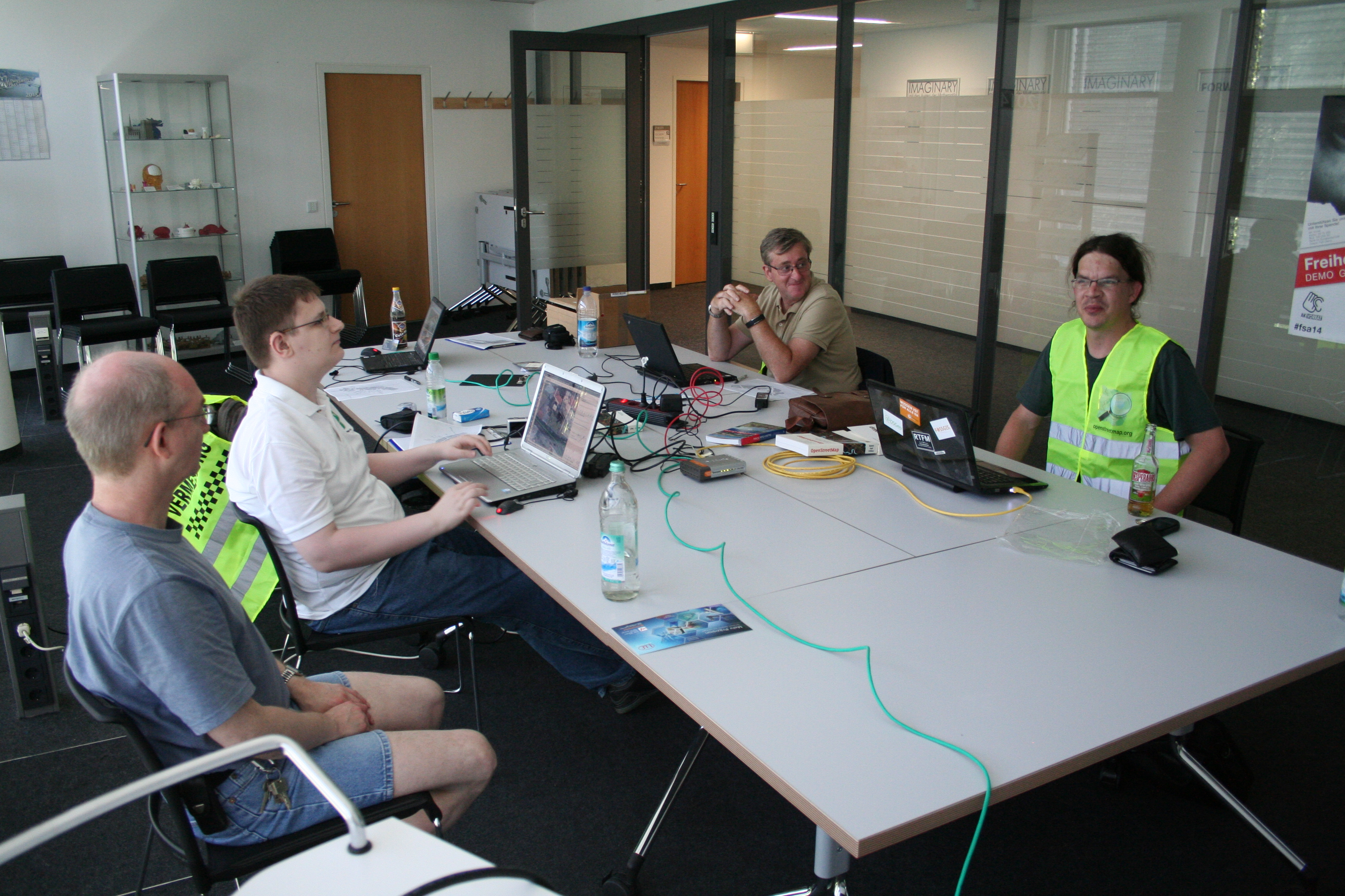
819 KB | 'Stammtisch' at Passau with OSM'ler form Landshut. | 1 |
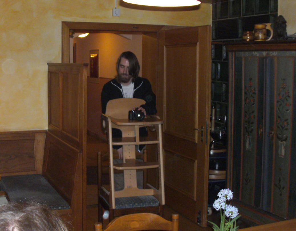
| 00:03, 13 March 2012 | Osm photo la.png (file) |  |
1.09 MB | picture of a typical OSM'er making a picture of typical OSM'ers. | 1 |
| 19:57, 3 November 2011 | Karlos OSB.png (file) |  |
622 KB | screenshot of Karlos OpenStreetBug enumerating page | 1 |
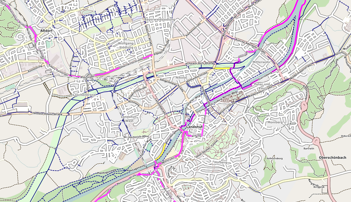
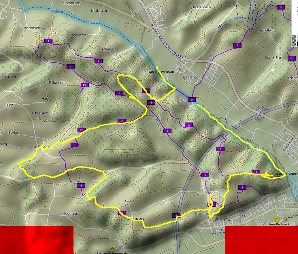
| 11:28, 3 November 2011 | LA Radlplan 2011.png (file) |  |
888 KB | Maperitive rendering of Landshut in Oct/2011 | 1 |
| 08:40, 28 April 2011 | JosmWithHillshadingLayer.png (file) |  |
1.08 MB | Hillshading, hike route layer and track shown in JOSM | 1 |
| 13:58, 14 April 2011 | Osmflyer1 A4 thumb.jpg (file) |  |
125 KB | Modified flyer of Frederik Ramm with images around Landshut (Bayern, Germany) | 1 |