Uploads by Ceyockey
Jump to navigation
Jump to search
This special page shows all uploaded files.
| Date | Name | Thumbnail | Size | Description | Versions |
|---|---|---|---|---|---|
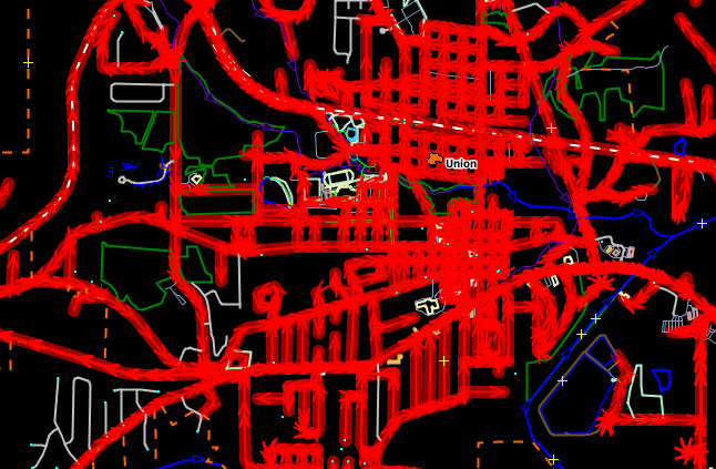
| 18:21, 29 December 2015 | Union tigerreviewed-no.png (file) |  |
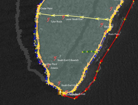
181 KB | Screenshot of Union, Franklin County, Missouri from JOSM showing result of search for "tiger:reviewed"="no" where results are selected and show in red. | 1 |
| 23:52, 9 April 2014 | Screenshot from 2014-04-09 19-50-08.png (file) |  |
2 KB | original filename "Screenshot_from_2014-04-09_19:50:08.png", captured from main OSM map, standard settings, coordinate link https://www.openstreetmap.org/#map=19/10.05448/-10.73072 . | 1 |
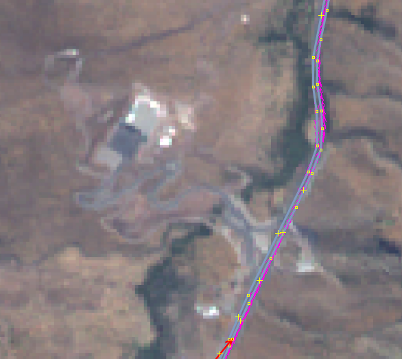
| 17:09, 30 December 2012 | Guardrail example Bing.png (file) |  |
32 KB | Guard rail shown in Bing aerial imagery, resolution at snap-to-tile size with size bar, cars and roadside sign included in image to provide context. | 1 |
| 16:56, 30 December 2012 | Guardrail example mapquest.png (file) |  |
42 KB | Screenshot taken from Potlatch MapQuest view settings showing guard rail rendered between north and south ways of a major highway. | 1 |
| 16:55, 30 December 2012 | Guardrail mapexample.png (file) |  |
15 KB | Screenshot taken from Potlatch standard view settings showing guard rail rendered between north and south ways of a major highway. | 1 |
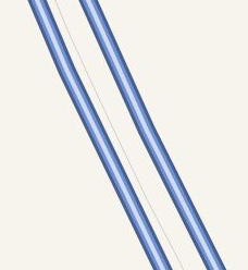
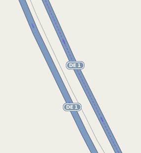
| 16:00, 26 December 2012 | Delaware nonamemap incontext.jpeg (file) |  |
68 KB | screenshot of NoName map focusing on Delaware, specifically the view available via http://qa.poole.ch/?zoom=8&lat=39.23144&lon=-74.82446&layers=TFB0 . The NoName map is maintained by user:SimonPoole. | 1 |
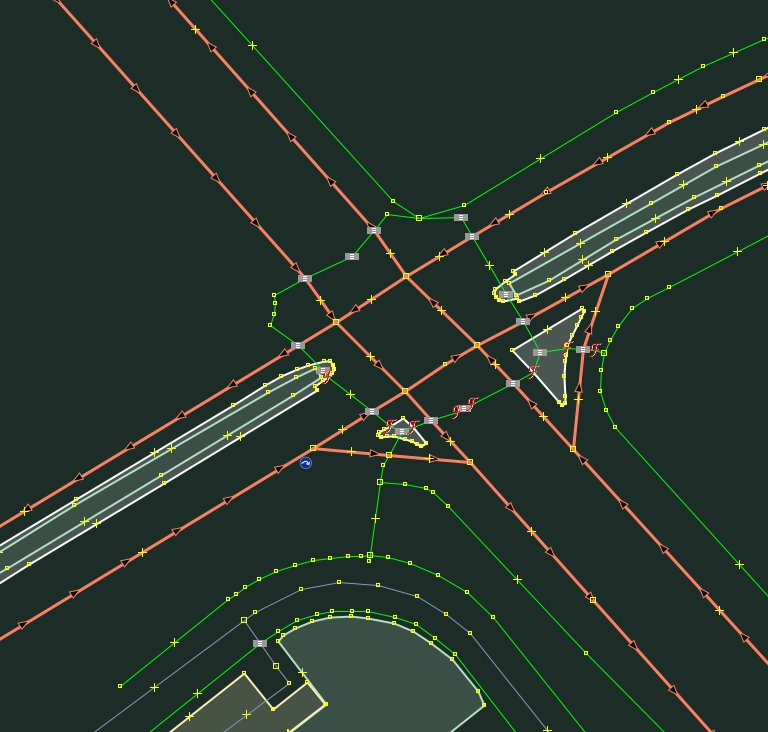
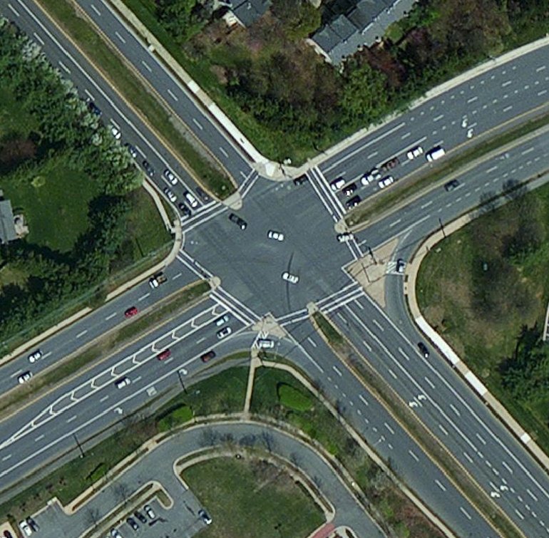
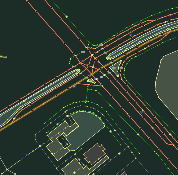
| 01:43, 23 March 2012 | SpaghettiJunction example4 after.jpeg (file) |  |
86 KB | post editing | 1 |
| 00:54, 23 March 2012 | SpaghettiJunction example2 before imagery.jpeg (file) |  |
150 KB | Imagery of area with an example spaghetti junction, Bing in JOSM | 1 |
| 00:53, 23 March 2012 | SpaghettiJunction example3 after.jpeg (file) |  |
117 KB | Screenshot of JOSM after a relatively minor revision to an example spaghetti junction. | 1 |
| 00:52, 23 March 2012 | SpaghettiJunction example1 before.jpeg (file) |  |
115 KB | screenshot of JOSM of one example spaghetti junction prior to any revisions. | 1 |
| 01:50, 27 January 2012 | BingImagery 3utilitypoles alongtertiaryway.png (file) |  |
182 KB | Bing imagery showing three utility poles in succession along a tertiary road. The nature of the lines supported by the poles cannot be determined by inspection of aerial imagery, but the existence of the poles can be. I've chosen the CC-SA license as th | 1 |
| 02:55, 21 July 2011 | Stop sign problem.PNG (file) |  |
2 KB | Graphic created in MS PowerPoint 2003 and MS Paint 5 to illustrate a discussion regarding {{tag|highway|stop}}. I composed this and release it to the public domain. | 1 |
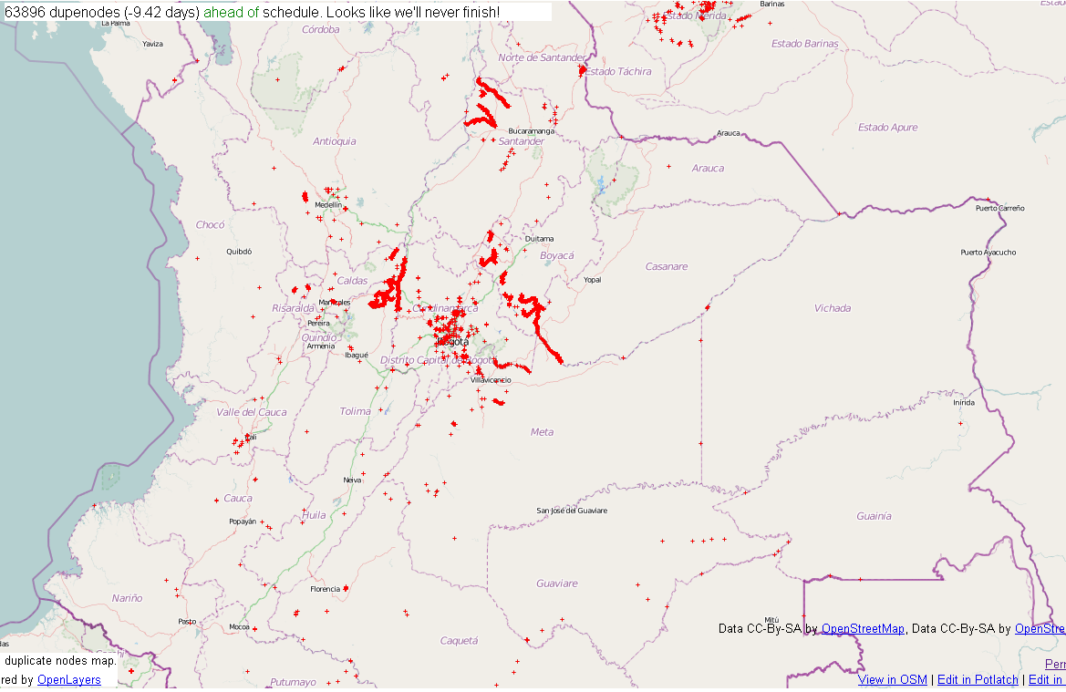
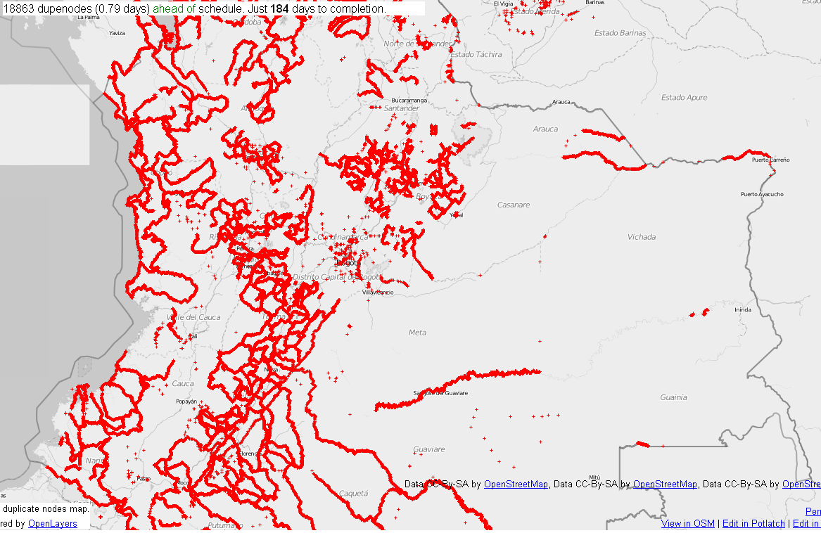
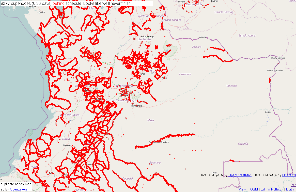
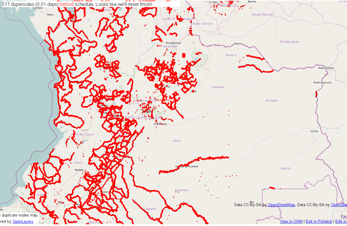
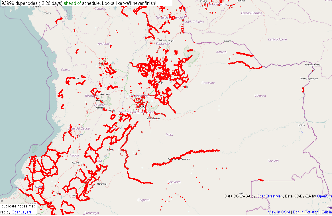
| 04:31, 22 February 2011 | Dupenode 20110221 2330EST.png (file) |  |
268 KB | Central Colombia dupenode map from permalink http://matt.dev.openstreetmap.org/dupe_nodes/?zoom=7&lat=4.55938&lon=-73.20834&layers=BT collected on 02/21/2010 at 1131 PM EST. {{PD-creator|ceyockey}} Category:Screenshots [[Category:2010 Colombia floods] | 1 |
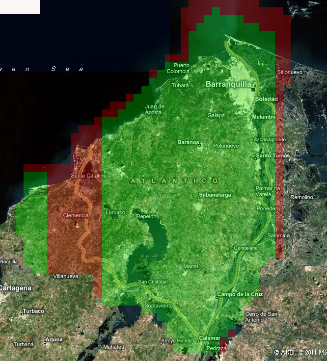
| 12:26, 8 February 2011 | BingAreaMap Atlantico.png (file) |  |
856 KB | Screenshot of Bing Analyzer II using permalink http://ant.dev.openstreetmap.org/bingimageanalyzer/?lat=10.699059549939122&lon=-74.9646653439298&zoom=10 . Used to illustrate example coverage result, focusing on the Atlantico Department in Colombia. Licen | 1 |
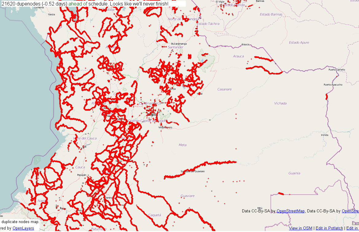
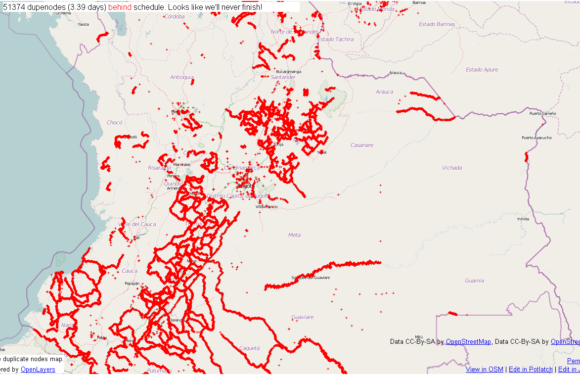
| 15:42, 6 February 2011 | Dupenode 20110206 1041EST.png (file) |  |
232 KB | Central Colombia dupenode map from permalink http://matt.dev.openstreetmap.org/dupe_nodes/?zoom=7&lat=4.55938&lon=-73.20834&layers=BT collected on 02/06/2010 at 1041 AM EST. {{PD-creator|ceyockey}} Category:Screenshots [[Category:2010 Colombia floods] | 1 |
| 15:23, 30 January 2011 | Dupenode 20110130 1021EST.png (file) |  |
236 KB | Central Colombia dupenode map from permalink http://matt.dev.openstreetmap.org/dupe_nodes/?zoom=7&lat=4.55938&lon=-73.20834&layers=BT collected on 01/30/2010 at 1023 AM EST. {{PD-creator|ceyockey}} Category:Screenshots [[Category:2010 Colombia floods] | 1 |
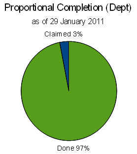
| 16:40, 29 January 2011 | Dept proportional completion pie chart colombia floods 2010.png (file) |  |
10 KB | update as of 29 January 2011 | 4 |
| 03:01, 24 January 2011 | Bing imagery boundaries for Colombia.png (file) |  |
30 KB | updated for more way additions to relation. {{PD-creator|ceyockey}} | 2 |
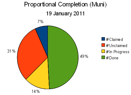
| 11:21, 19 January 2011 | Proportional completion pie chart 20101226 2320 EST.png (file) |  |
13 KB | Updated 19 January 2011, 0624 EST {{PD-Creator|ceyockey}} | 6 |
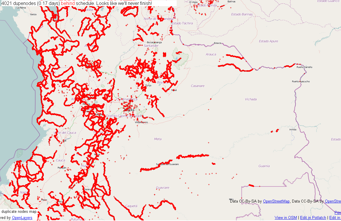
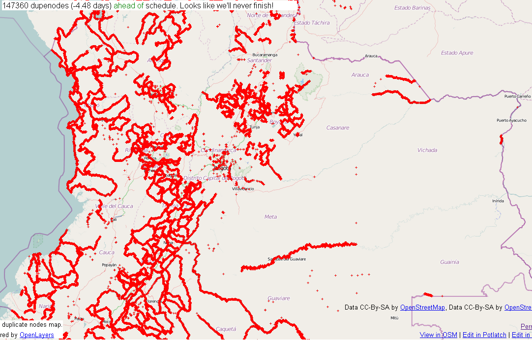
| 01:54, 8 January 2011 | Dupenode map Columbia permalink 20110701 2052 EST.png (file) |  |
191 KB | Central Colombia dupenode map from permalink http://matt.dev.openstreetmap.org/dupe_nodes/?zoom=7&lat=4.55938&lon=-73.20834&layers=BT collected on 01/07/2011 at 2052 AM EST. {{PD-creator|ceyockey}} Category:Screenshots [[Category:2010 Colombia floods] | 1 |
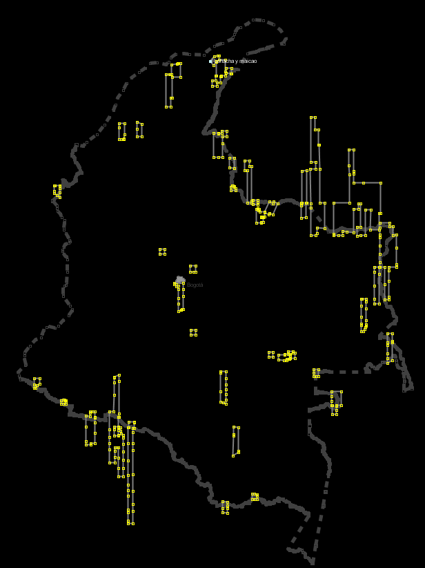
| 13:04, 6 January 2011 | Vaupes progress in pink.png (file) |  |
72 KB | simple update | 2 |
| 13:54, 4 January 2011 | Dupenode map Columbia permalink 20110401 0852 EST.png (file) |  |
205 KB | Central Colombia dupenode map from permalink http://matt.dev.openstreetmap.org/dupe_nodes/?zoom=7&lat=4.55938&lon=-73.20834&layers=BT collected on 01/04/2011 at 0852 AM EST. {{PD-creator|ceyockey}} Category:Screenshots [[Category:2010 Colombia floods] | 1 |
| 12:35, 1 January 2011 | Dupenode map Columbia permalink 20110101 0733 EST.png (file) |  |
240 KB | Central Colombia dupenode map from permalink http://matt.dev.openstreetmap.org/dupe_nodes/?zoom=7&lat=4.55938&lon=-73.20834&layers=BT collected on 01/01/2011 at 0733 AM EST. {{PD-creator|ceyockey}} Category:Screenshots [[Category:2010 Colombia floods] | 1 |
| 11:33, 30 December 2010 | Dupenode map Columbia permalink 20101230 0632 EST.png (file) |  |
242 KB | Central Colombia dupenode map from permalink http://matt.dev.openstreetmap.org/dupe_nodes/?zoom=7&lat=4.55938&lon=-73.20834&layers=BT collected on 12/30/2010 at 0632 AM EST. {{PD-creator|ceyockey}} Category:Screenshots [[Category:2010 Colombia floods] | 1 |
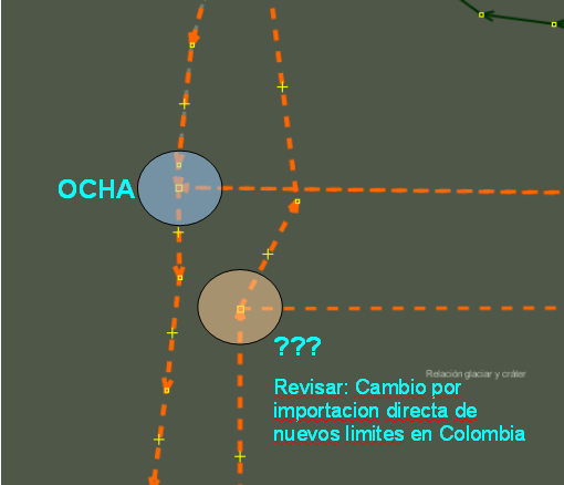
| 10:19, 30 December 2010 | OCHA versus prior import boundary discrepancy.png (file) |  |
26 KB | croppped version of prior upload, removing whitespace | 2 |
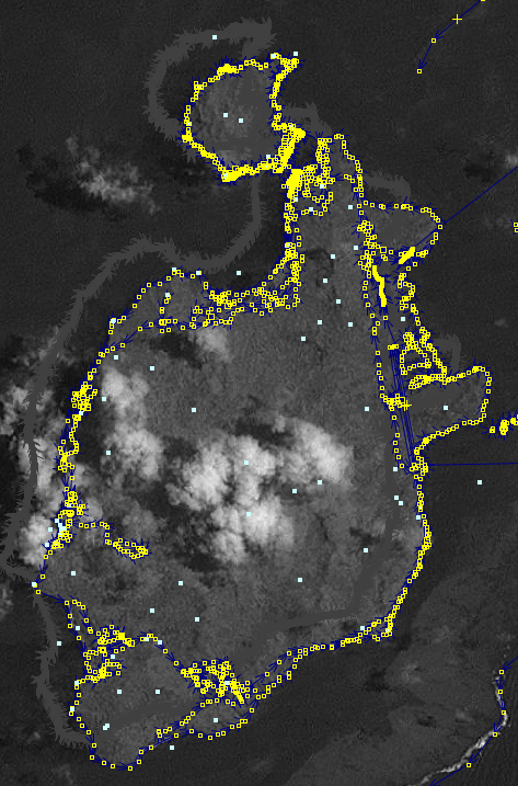
| 00:04, 29 December 2010 | Providencia and Santa Catalina - landsat and OCHA and OSM data.png (file) |  |
360 KB | This image is centered around 13.36N-81.38W showing the entirety of Providencia and Santa Catalina, Colombia. The grey line is the proposed OCHA boundary import for the respective municipalities; the imagery is Landsat. Note the offset of OCHA boundary | 1 |
| 21:35, 28 December 2010 | San Andreas southern margin - landsat and OCHA and OSM data.png (file) |  |
131 KB | This image is centered around 12.5N-81.7W showing the southern margin of San Andreas, Colombia. The grey line is the proposed OCHA boundary import for the San Andreas Municipality; the imagery is Landsat. Note the offset of OCHA boundary vs. Landsat+OSM | 1 |
| 15:27, 28 December 2010 | Dupenode map Columbia permalink 20101228 1026 EST.png (file) |  |
240 KB | Central Colombia dupenode map from permalink http://matt.dev.openstreetmap.org/dupe_nodes/?zoom=7&lat=4.55938&lon=-73.20834&layers=BT collected on 12/28/2010 at 1026 AM EST. {{PD-creator|ceyockey}} Category:Screenshots [[Category:2010 Colombia floods] | 1 |
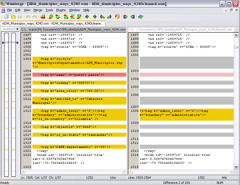
| 18:06, 27 December 2010 | Perl processing of muniicipality osm data for Colombia (Dec 2010) - section of way data before and after.png (file) | _-_section_of_way_data_before_and_after.png) |
45 KB | {{PD-creator|ceyockey}} Snapshot of a section of way data from .osm file provided for the uploading of municipality data proxmial to the late 2010 Colombia floods (see 2010 Colombia floods/ImportMuni for accessible .osm files). On the left, before pr | 1 |
| 14:27, 26 December 2010 | Dupenode map Columbia permalink 20101226 0925 EST.png (file) |  |
238 KB | Central Colombia dupenode map from permalink http://matt.dev.openstreetmap.org/dupe_nodes/?zoom=7&lat=4.55938&lon=-73.20834&layers=BT collected on 12/26/2010 at 0925 AM EST. {{PD-creator|ceyockey}} Category:Screenshots [[Category:2010 Colombia floods] | 1 |
| 16:59, 24 December 2010 | Dupenode map Columbia permalink 20101224 1157 EST.png (file) |  |
230 KB | Central Colombia dupenode map from permalink http://matt.dev.openstreetmap.org/dupe_nodes/?zoom=7&lat=4.55938&lon=-73.20834&layers=BT collected on 12/24/2010 at 11:57 AM EST. {{pd-self}} | 1 |
| 01:06, 15 December 2010 | BingAnalyzerShot.png (file) |  |
8 KB | Screen snapshot taken from default landing page on 14 December 2010 illustrating the main feature ... a date associated with a tile. | 1 |
| 01:50, 30 November 2010 | Basic lightening with rod.png (file) |  |
274 bytes | proposed icon for lightening rod proposed feature | 1 |
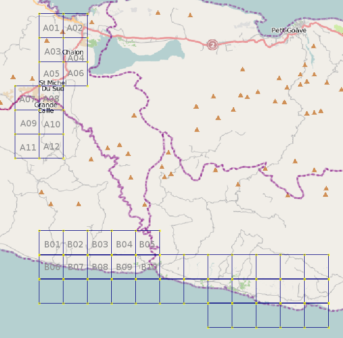
| 13:37, 27 March 2010 | NOAA-20 1-Haiti-ASection labeled.png (file) |  |
31 KB | 1 | |
| 13:33, 27 March 2010 | NOAA 2010-01-20 imagery OSMMatrix Grid overlap.png (file) |  |
22 KB | 1 | |
| 00:51, 27 March 2010 | NOAA-20 1-Haiti-WestGridSet labeled.png (file) |  |
114 KB | 1 | |
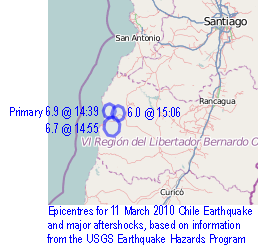
| 01:31, 22 March 2010 | Chile earthquake of March 2010 epicentres.png (file) |  |
41 KB | 3 | |
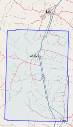
| 03:18, 15 March 2010 | Chile imagery for San Javier Digital Globe, Worldview-1, 2010-02-28.png (file) |  |
62 KB | 1 | |
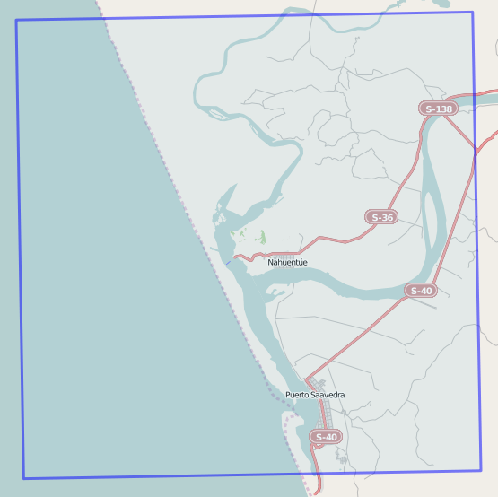
| 03:18, 15 March 2010 | Chile imagery for Puerto Saavedra Digital Globe, Worldview-1, 2010-02-28.png (file) |  |
70 KB | 1 | |
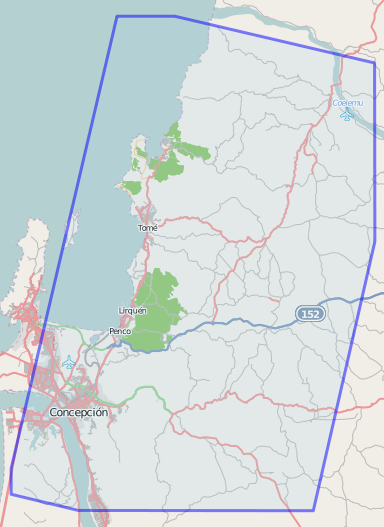
| 01:16, 10 March 2010 | Chile imagery JAXA-ALOS-pan-sharpend, 2007-05-27.png (file) |  |
100 KB | View in Potlatch of {{way|52049833}}, showing Concepción, Chile and points north. Released into the public domain by the author to the extent allowed by law. | 1 |
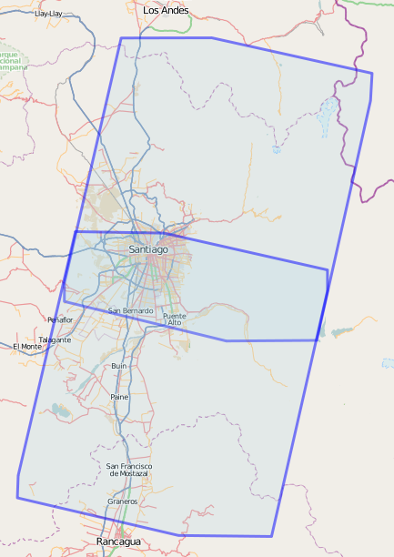
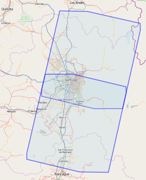
| 01:00, 10 March 2010 | Santiago, Chile - JAXA-ALOS-pan-sharpend, 2009-08-24.png (file) |  |
168 KB | View of {{way|52049727}} in Potlatch. This way is the boundary of imagery designated "JAXA/ALOS/pan-sharpened, 2009-08-24". The file is released into the public domain by the author to the extent allowed by law. | 1 |
| 00:45, 10 March 2010 | Chile imagery JAXA-ALOS-AVNIR-2 2010-02-27 n-s-combined.png (file) |  |
121 KB | View in Potlatch of {{relation|446801}}, which is effectively a collection of the two ways contributing to {{relation|419494}} and {{relation|419516}}. Image captured using MWSnap 3. Image release by author into Public Domain, or relinquishing copyright | 1 |
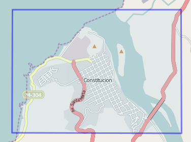
| 12:39, 5 March 2010 | Chile imagery EROS-B-SCANEX.png (file) |  |
41 KB | {{relation|443329}}, for attribution to "EROS-B/SCANEX, 2010-03-02", covering Constitución, Chile after 2010 earthquake. | 1 |
| 11:39, 1 March 2010 | Chile imagery JAXA-ALOS-AVNIR-2 2010-02-24.png (file) |  |
144 KB | depiction of {{relation|420909}} showing boundaries of north and south panels of imagery from JAXA, to be attributed with {{tag|source||JAXA/ALOS/AVNIR-2, 2009-02-24}} when used. | 1 |
| 17:57, 28 February 2010 | Chile jax imagery shot 188mRes c-32 92712by-70 68092.png (file) |  |
162 KB | screenshot of JOSM to show what level of detail might be achieved with JAX/ALOS imagery ... is it good enough? | 1 |
| 13:25, 28 February 2010 | Chile imagery JAXA-ALOS-AVNIR-2 2010-02-27 south.png (file) |  |
134 KB | uploading the correct image now | 2 |
| 13:08, 28 February 2010 | Chile HighResolutionImagery asof 20100227.png (file) |  |
22 KB | cropped image to reduce footprint | 6 |
| 12:51, 28 February 2010 | Chile 20100227 earthquake epicentres with imagery boundary.png (file) |  |
105 KB | imagery boundary removed -- leaving only annotated epicentres | 6 |
| 12:39, 28 February 2010 | Chile imagery JAXA-ALOS-AVNIR-2 2010-02-27.png (file) |  |
149 KB | screenshot of {{relation|419494}}. High-resolution imagery boundary, Feb 2010 Chile, contributed by Japan Aerospace Exploration Agency | 1 |
| 00:14, 11 February 2010 | Noaa20100120.jpg (file) |  |
28 KB | 2 |