Uploads by Cmuelle8
Jump to navigation
Jump to search
This special page shows all uploaded files.
| Date | Name | Thumbnail | Size | Description | Versions |
|---|---|---|---|---|---|
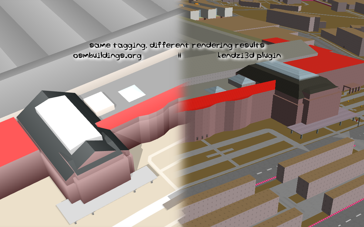
| 17:35, 31 May 2019 | Leipzig Hbf osmbuildings.org vs kendzi3d roof-shape support 20190531.png (file) |  |
391 KB | Because of the lack of standards (or reference implementation??) and different level of support and/or implementation in apps it's hard to do 3D stuff in accordance to reality (or anywhere near to) across current interpreting apps. From a mappers pers... | 1 |
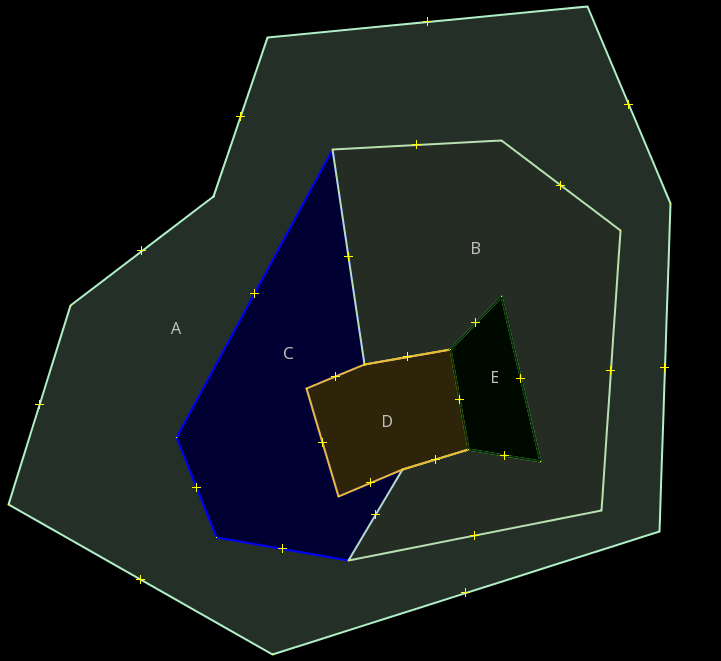
| 17:53, 19 January 2016 | Multipolygon Illustration 8 non-overlapping non-touching.svg (file) |  |
18 KB | 1 | |
| 02:52, 19 January 2016 | Illustration Multipolygon Touching Inner Rings.png (file) |  |
40 KB | This illustrates that it is not beneficial per se to declare touching inner rings as valid multipolygons. Usually you would either draw a ring around B and C (overlapping some parts of their boundaries) to have a single inner ring to define A. Another... | 1 |
| 04:04, 15 January 2016 | Sanderd17 Area Proposal Antarctica Coding Sample.svg (file) |  |
50 KB | 1 | |
| 01:49, 13 January 2016 | Multipolygon Illustration 8 non-overlapping non-touching de.svg (file) |  |
18 KB | 1 | |
| 21:01, 12 January 2016 | Multipolygon Illustration 3 de plus benachbarte fläche.svg (file) |  |
16 KB | Deutsche Übersetzung von Multipolygon_Illustration_3.svg, im Original von Frederik Ramm, erweitert um die Darstellung einer benachbarten Fläche. | 1 |
| 20:59, 12 January 2016 | Multipolygon Illustration 3 de.svg (file) |  |
13 KB | Deutsche Übersetzung von Multipolygon_Illustration_3.svg, im Original von Frederik Ramm. | 1 |
| 16:44, 9 January 2016 | Osm-defining-the-inside-of-an-area-by-coding-solely-if-it-lies-to-the-left-or-right-of-a-way.svg (file) |  |
74 KB | synchronize text descriptions above and below table to the updated ones in Osm-defining-the-inside-of-an-area-by-coding-solely-if-it-lies-to-the-left-or-right-of-a-way_extended.svg | 3 |
| 15:38, 9 January 2016 | Osm-defining-the-inside-of-an-area-by-coding-solely-if-it-lies-to-the-left-or-right-of-a-way extended.svg (file) |  |
105 KB | final version, with updated text in lower left | 3 |
| 05:59, 7 January 2016 | Way-left-right-area-clockwise-counter-clockwise-orientation.svg (file) |  |
508 KB | 1 | |
| 12:45, 5 January 2016 | Multipolygon Illustration 1b.svg (file) |  |
12 KB | 1 | |
| 09:45, 3 January 2016 | Osm data structures - future of areas - supermultipolygon.svg (file) |  |
279 KB | missing space fixed.. | 5 |
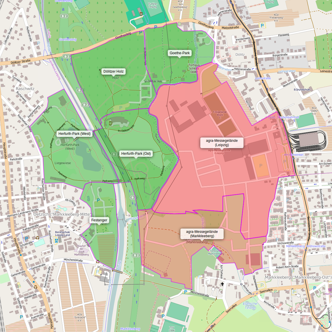
| 09:08, 18 June 2014 | Leipzig - agra-Park und -Messegelände.png (file) |  |
926 KB | Deutlichere Labels | 2 |
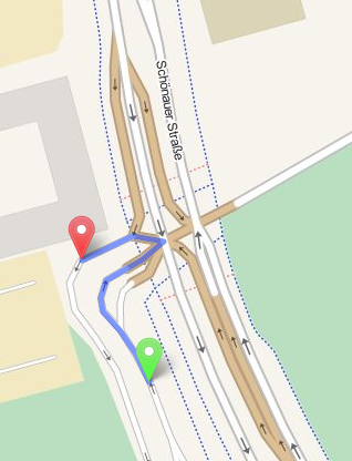
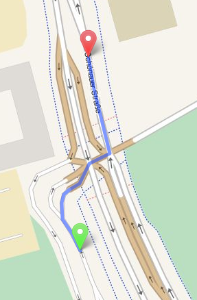
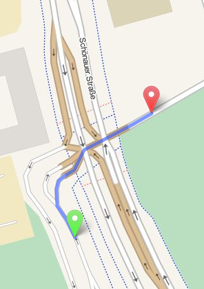
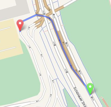
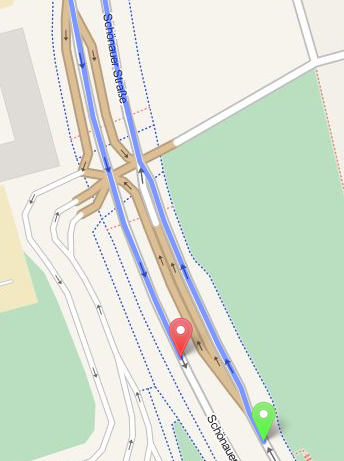
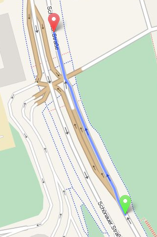
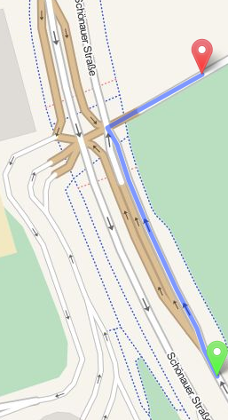
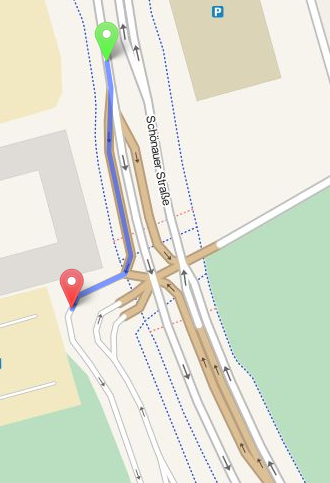
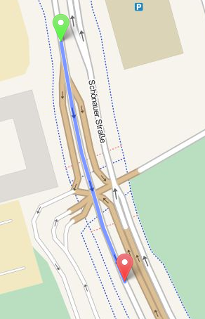
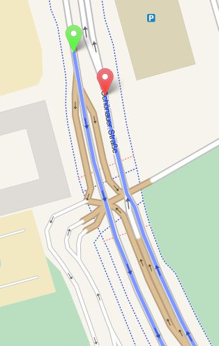
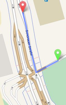
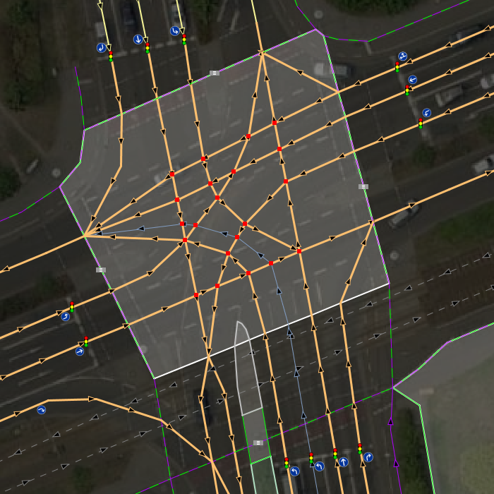
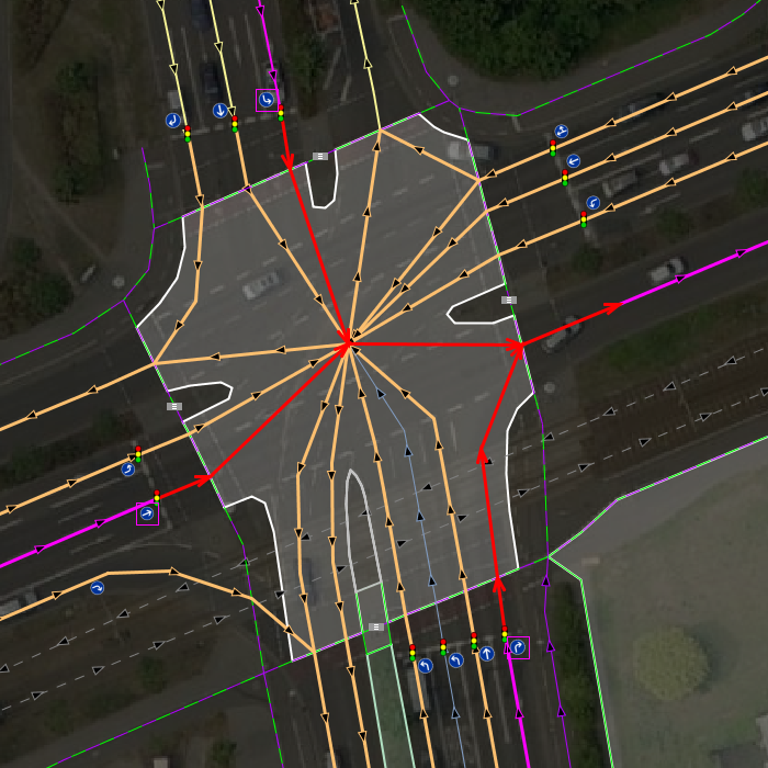
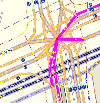
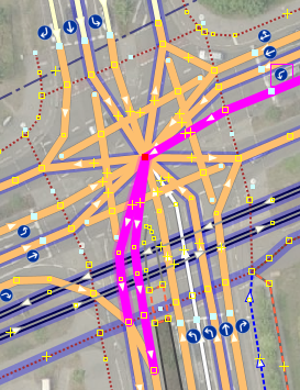
| 07:33, 5 November 2013 | OSRM Example Leipzig-Gruenau W2W TR misinterpretation.png (file) |  |
130 KB | This is the last in a series of 16 files giving examples of how http://map.project-osrm.org/ handles routing over a lane-mapped, TR-enabled intersection. In 15 of 16 cases it does a superb job. This image here is the _only_ example where the routing ... | 1 |
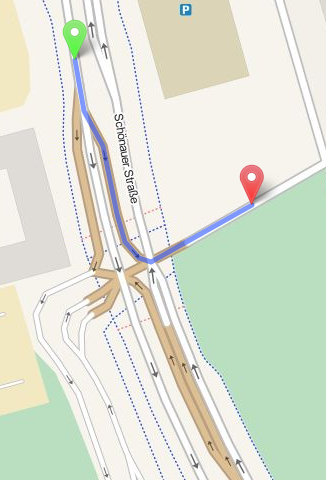
| 07:19, 5 November 2013 | OSRM Example Leipzig-Gruenau W2S.png (file) |  |
143 KB | 1 | |
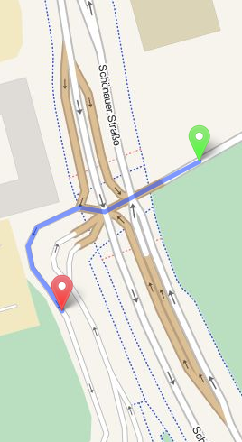
| 07:18, 5 November 2013 | OSRM Example Leipzig-Gruenau W2N.png (file) |  |
129 KB | 1 | |
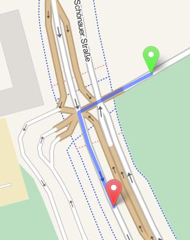
| 07:18, 5 November 2013 | OSRM Example Leipzig-Gruenau W2E.png (file) |  |
127 KB | 1 | |
| 07:17, 5 November 2013 | OSRM Example Leipzig-Gruenau S2W.png (file) |  |
140 KB | 1 | |
| 07:16, 5 November 2013 | OSRM Example Leipzig-Gruenau S2S.png (file) |  |
155 KB | 1 | |
| 07:15, 5 November 2013 | OSRM Example Leipzig-Gruenau S2N.png (file) |  |
165 KB | 1 | |
| 07:15, 5 November 2013 | OSRM Example Leipzig-Gruenau S2E.png (file) |  |
149 KB | 1 | |
| 07:14, 5 November 2013 | OSRM Example Leipzig-Gruenau N2W.png (file) |  |
148 KB | 1 | |
| 07:14, 5 November 2013 | OSRM Example Leipzig-Gruenau N2S.png (file) |  |
130 KB | 1 | |
| 07:13, 5 November 2013 | OSRM Example Leipzig-Gruenau N2N.png (file) |  |
148 KB | 1 | |
| 07:13, 5 November 2013 | OSRM Example Leipzig-Gruenau N2E.png (file) |  |
146 KB | 1 | |
| 07:12, 5 November 2013 | OSRM Example Leipzig-Gruenau E2W.png (file) |  |
142 KB | 1 | |
| 07:12, 5 November 2013 | OSRM Example Leipzig-Gruenau E2S.png (file) |  |
107 KB | 1 | |
| 07:11, 5 November 2013 | OSRM Example Leipzig-Gruenau E2N.png (file) |  |
92 KB | 1 | |
| 07:11, 5 November 2013 | OSRM Example Leipzig-Gruenau E2E.png (file) |  |
154 KB | 1 | |
| 07:10, 5 November 2013 | OSRM Bad Example Leipzig-Gruenau Routing errors due to conventional mapping no-TR no-Lanes.png (file) |  |
58 KB | 1 | |
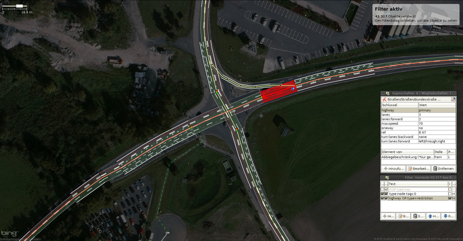
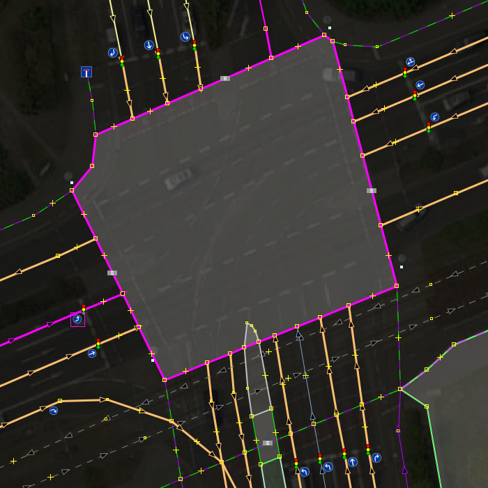
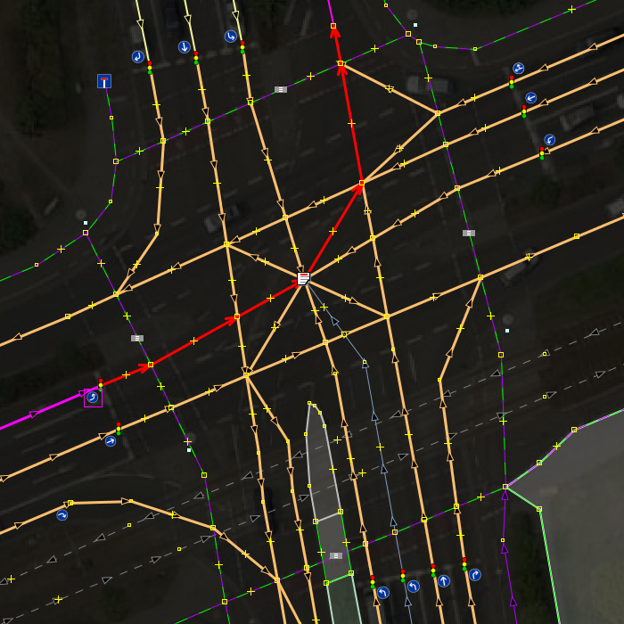
| 15:24, 14 March 2013 | Screenshot JOSM Lanes Style with Lanes Tagging Scheme at Junction.jpg (file) |  |
140 KB | An example to show Lanes features and caveats at a junction. Note that there is a need to map the shortcut link in the north-east separately, since drivers may skip the traffic light using it. The detail would be lost if it is omitted. This does... | 1 |
| 14:17, 19 March 2012 | Intermix-lanes.png (file) |  |
47 KB | 1 | |
| 15:29, 14 March 2012 | Complex isect7 reality mapped lanes in intersection area.png (file) |  |
312 KB | 1 | |
| 23:49, 13 March 2012 | Complex isect6 outline of area highway junction.png (file) |  |
373 KB | 1 | |
| 23:48, 13 March 2012 | Complex isect5 area-as-via-in-turn-restriction.png (file) |  |
244 KB | 1 | |
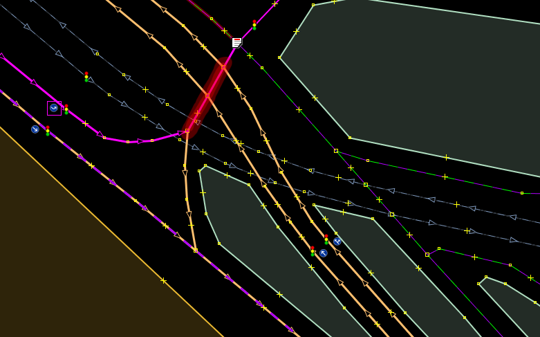
| 20:11, 11 March 2012 | Complex isect4 negative example.png (file) |  |
281 KB | I do not propose it. It serves as a negative example to show that compatibility to mapnik and old routing engines not using TR is not manageable. Mapping this takes far more time, than drawing a star topology with a single node in the center and breakin | 1 |
| 01:50, 6 March 2012 | Complex-isect3.png (file) |  |
253 KB | 1 | |
| 04:23, 5 March 2012 | NO-type turn restriction multiple-TOs-needed.png (file) |  |
72 KB | 2 | |
| 04:15, 5 March 2012 | ONLY-type turn restriction multiple-TOs-needed.png (file) |  |
165 KB | 1 | |
| 04:07, 4 March 2012 | Complex isect2.png (file) |  |
104 KB | 3 | |
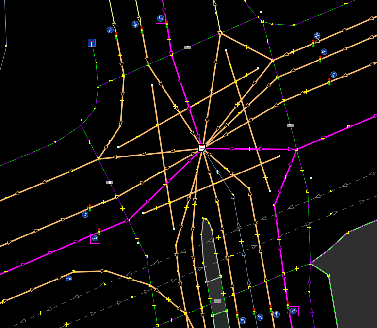
| 03:17, 4 March 2012 | Complex isect1.png (file) |  |
140 KB | JOSM http://www.openstreetmap.org/?lat=51.324517&lon=12.291185&zoom=18&layers=M | 2 |
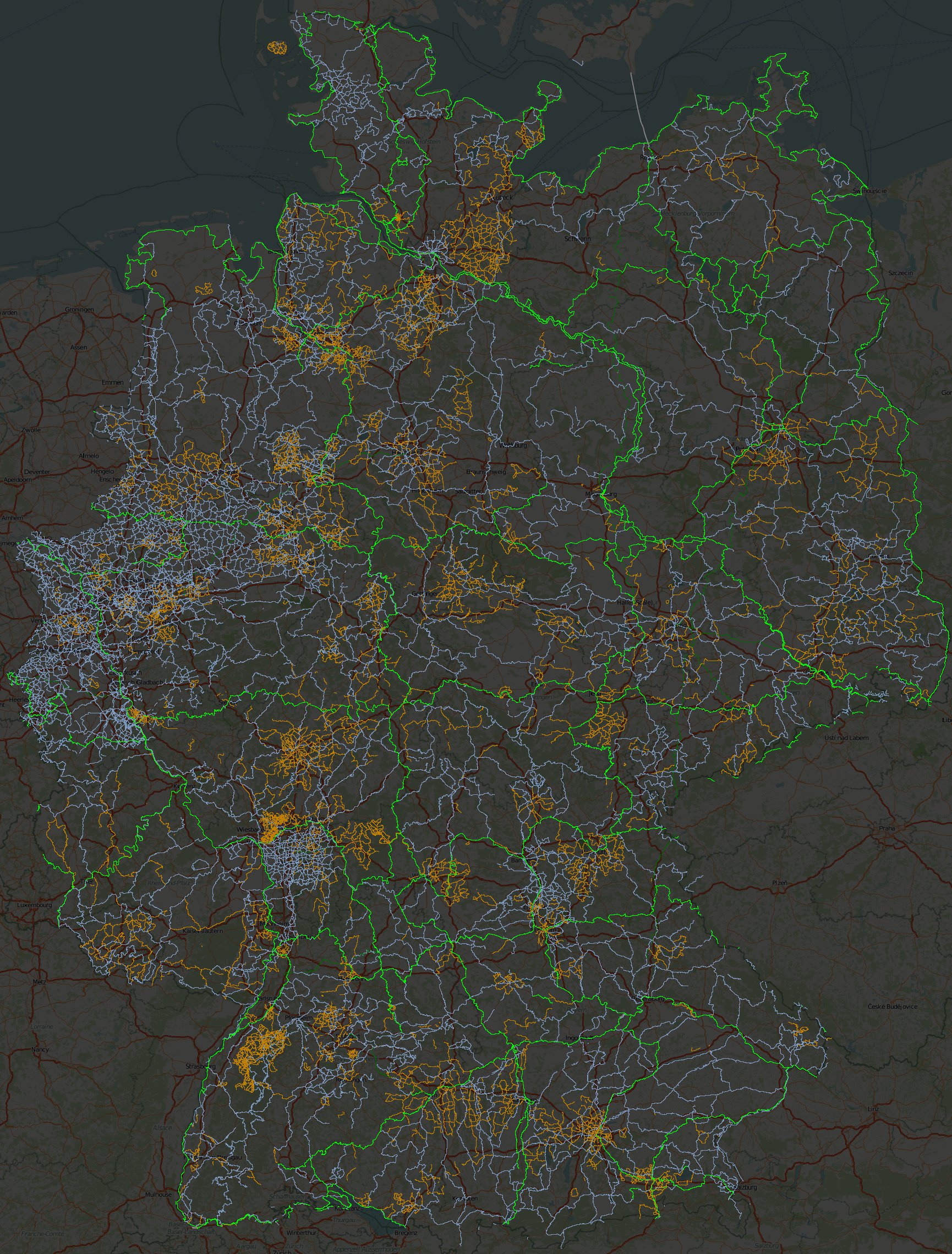
| 15:24, 16 August 2011 | GermanyCycleRoutes.jpg (file) |  |
1.03 MB | Visualisierung der Radrouten-Relationen für Deutschland - je nach network=* unterschiedlich koloriert. Legende: hellgrün :: icn, ncn (D-Routen) blau :: rcn braun :: lcn dunkelgrün :: radweit | 1 |
| 16:29, 15 August 2011 | SachsenCycleRoutes.png (file) |  |
865 KB | Visualisierung der Radrouten-Relationen in Sachsen - je nach network=* unterschiedlich koloriert. Legende: breites blau :: ncn (D-Routen) blau :: rcn braun :: lcn grün :: radweit | 1 |
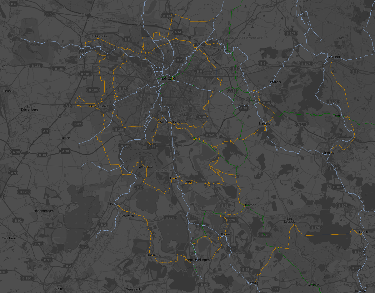
| 16:21, 15 August 2011 | LeipzigCycleRoutes.png (file) |  |
648 KB | Visualisierung der Radrouten-Relationen im Leipziger Raum - je nach network=* unterschiedlich koloriert. Legende: breites blau :: ncn (D-Routen) blau :: rcn braun :: lcn grün :: radweit | 1 |
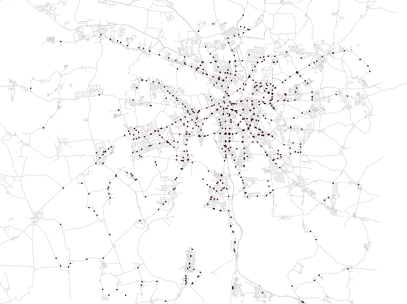
| 09:24, 26 November 2010 | Leipzig stop positions.png (file) |  |
377 KB | public_transport=stop_position visualization for the area of and around Leipzig, Saxony | 1 |
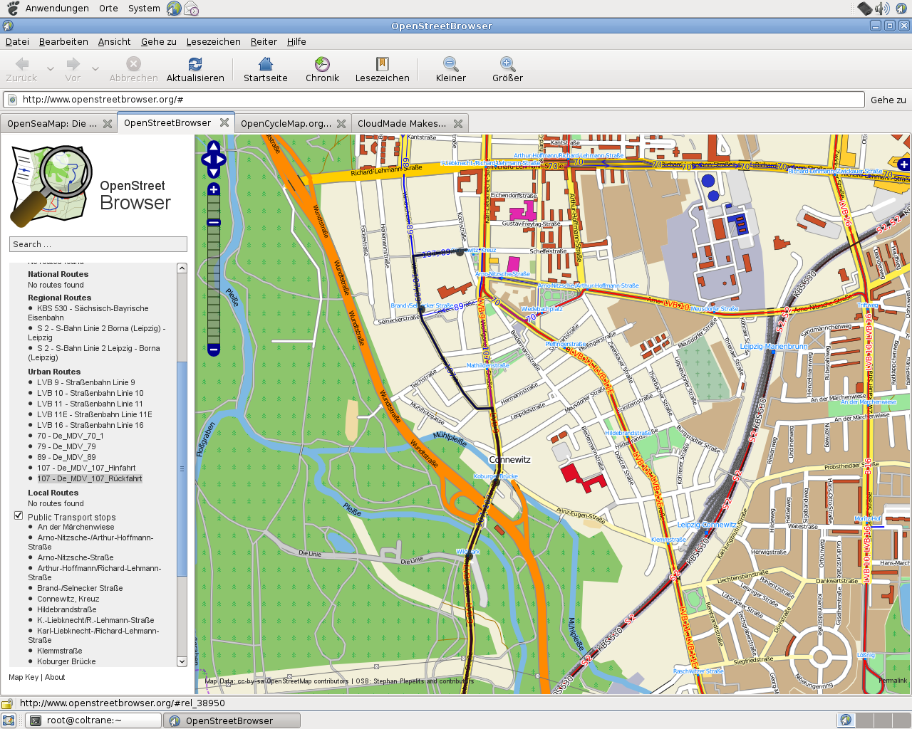
| 04:38, 2 June 2009 | OSMBrowser PublicTransportRoutes.png (file) | 771 KB | 1 | ||
| 00:20, 29 October 2008 | Potlatch-bugs-leipzig.png (file) |  |
114 KB | 1 |