Uploads by Dutch
Jump to navigation
Jump to search
This special page shows all uploaded files.
| Date | Name | Thumbnail | Size | Description | Versions |
|---|---|---|---|---|---|
| 00:06, 26 March 2008 | OSM-streamer.jpg (file) | 33 KB | OSM Bumper-Sticker produced for fun, and now prominently featured on SteveC's Macbook, and DutchDK's CityScooter. | 1 | |
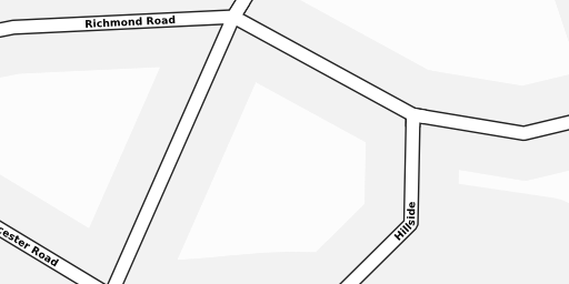
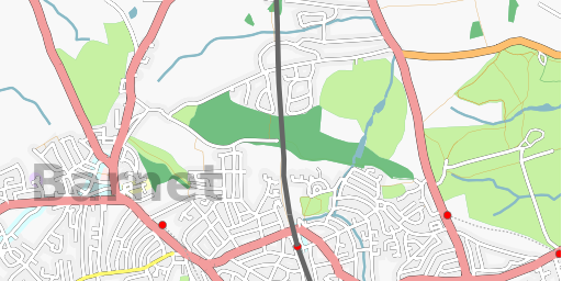
| 15:05, 4 March 2007 | Tile65471-65472.43503-z17.png (file) |  |
25 KB | Example of highdensity level 16 bezier and nonbezier hinted tiles tiled together | 1 |
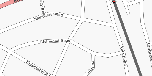
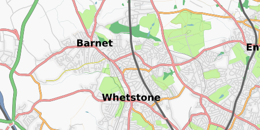
| 15:05, 4 March 2007 | Tile32735-21751.21751-z16.png (file) |  |
44 KB | Example of highdensity level 16 bezier and nonbezier hinted tiles tiled together | 1 |
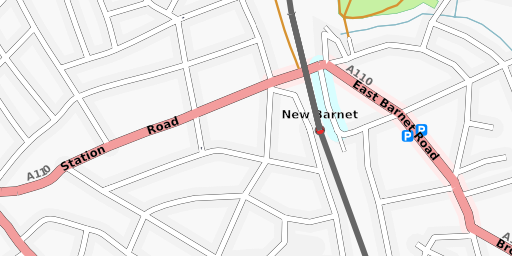
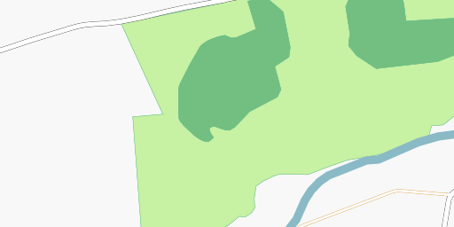
| 15:04, 4 March 2007 | Tile16367-16368.10875-z15.png (file) |  |
82 KB | Example of highdensity level 15 bezier and nonbezier hinted tiles tiled together | 1 |
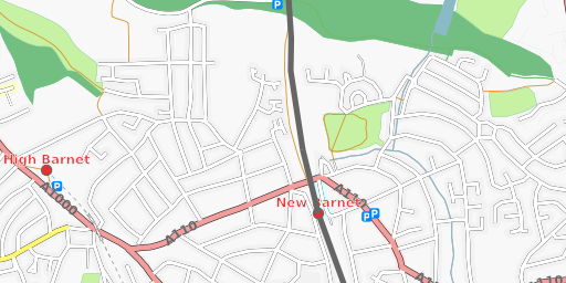
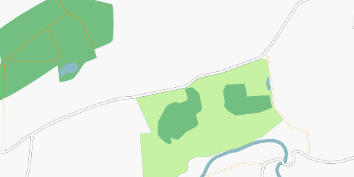
| 15:03, 4 March 2007 | Tile8183-8184.5437-z14.png (file) |  |
106 KB | Example of highdensity level 14 bezier and nonbezier hinted tiles tiled together | 1 |
| 15:02, 4 March 2007 | Tile4091-4092.2718-z13.png (file) |  |
109 KB | Example of highdensity level 13 bezier and nonbezier hinted tiles tiled together | 2 |
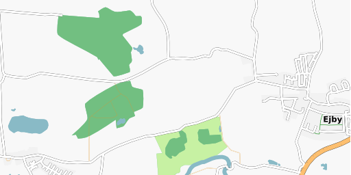
| 14:06, 4 March 2007 | Tile2045-2046.1359-z12.png (file) |  |
141 KB | Example of highdensity level 12 bezier and nonbezier hinted tiles tiled together | 1 |
| 14:04, 4 March 2007 | Tile34959-34960.20574-z16.png (file) |  |
12 KB | Example of Level 16 bezier and nonbezier tiles tiled together | 1 |
| 14:03, 4 March 2007 | Tile17479-17480.10287-z15.png (file) |  |
16 KB | Example of level 15 bezier and nonbezier hinted tiles tiled together | 1 |
| 14:02, 4 March 2007 | Tile8739-8740.5143-z14.png (file) |  |
26 KB | Example of level 14 bezier and nonbezier hinted tiles tiled together | 1 |
| 14:01, 4 March 2007 | Tile4369-4370.2571-z13.png (file) |  |
42 KB | Example of bezier and nonbezier hinted tiles tiled together | 1 |
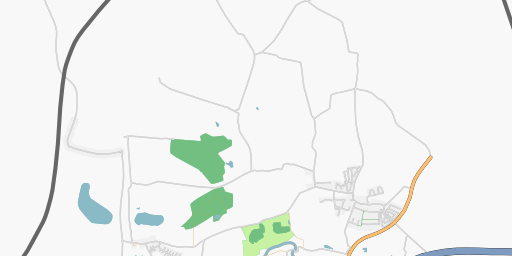
| 13:58, 4 March 2007 | Tile2184-2185.1285-z12.png (file) |  |
31 KB | Example of Level 12 tiles bezierhinted and non bezierhinted, when tiled together | 1 |
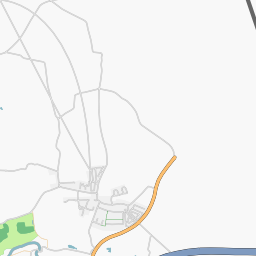
| 13:57, 4 March 2007 | Tile 12 2185 1285.png (file) |  |
17 KB | example of erroneous bezierhinted tile rendered on Gentoo AMD64 architecture boxes | 1 |
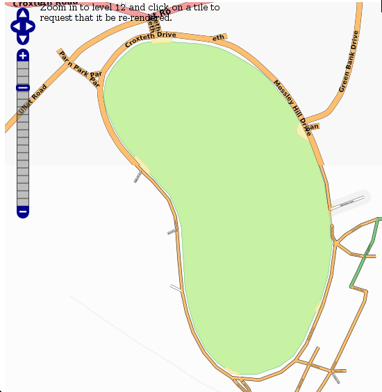
| 20:35, 2 March 2007 | BezierVSnonbezierTilesAtHome.png (file) |  |
72 KB | Top half of Sefton Park, Liverpool rendered with Beziercurvehinting T@H client. Lower half of Sefton Park, Liverpool rendered with non-Beziercurvehinting T@H client. | 1 |
| 23:33, 28 February 2007 | 3374-newOsmAtHomeClient2.png (file) |  |
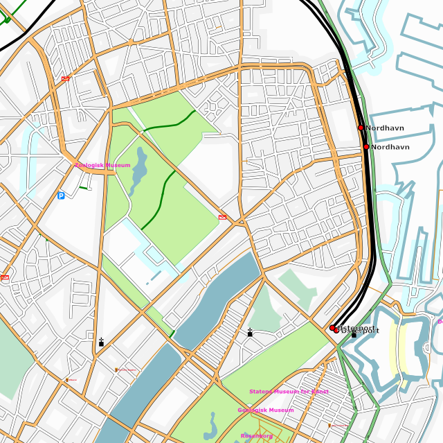
262 KB | Render of place number 3374 - Østerbro suburb of Copenhagen with the new OsmAtHome client, incorporating the lines2curves Bezier curves and using osmarender4. Tweaking of stylesheets not done yet. | 1 |
| 23:29, 28 February 2007 | 3374-OldOsmAtHomeclient.png (file) |  |
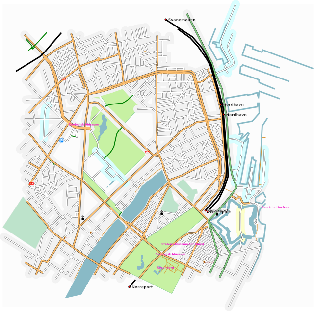
208 KB | Render of place number 3374 - Østerbro suburb of Copenhagen with the old OsmAtHome client. | 1 |
| 18:50, 20 February 2007 | USAF-Nav-Map.gif (file) |  |
15 KB | Why OSM might have problems getting interest in the US ;) | 1 |
| 16:10, 29 January 2007 | LMP26-27-28.gif (file) |  |
120 KB | 5 | |
| 11:59, 28 January 2007 | LMP26-27-28noon.gif (file) |  |
214 KB | London map showing data added from London Mapping Party 27 January 2007 through to 28 January 2007 at noon UTC | 1 |
| 17:41, 27 January 2007 | LMP26-27.gif (file) |  |
144 KB | London map showing data added from London Mapping Party 27 January 2007 | 1 |
| 21:55, 6 October 2006 | Osmarender-copenhagen-04-oct-2006.GIF (file) |  |
657 KB | 2 | |
| 21:43, 14 September 2006 | Osmarender-EKCH-Airport.gif (file) |  |
312 KB | New version for Featured image usage, pr OJW's request on IRC | 1 |
| 16:53, 4 September 2006 | Osmarender-Copenhagen-04Sept2006.gif (file) |  |
601 KB | Osmarendered image of Greater Copenhagen, showing current progress of adding coastal lines, parks, lakes, and graveyards. | 1 |
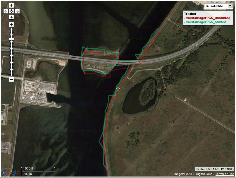
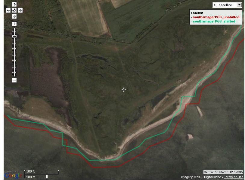
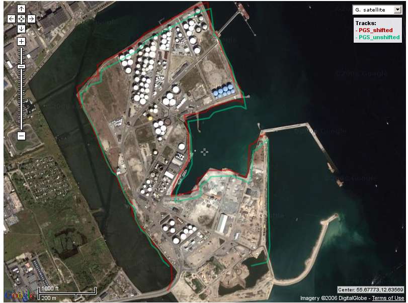
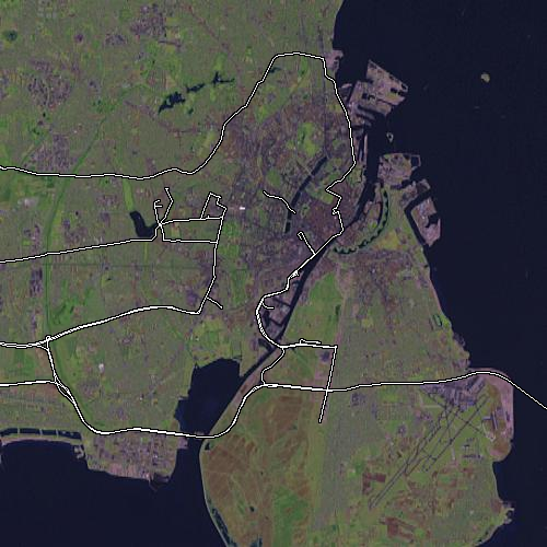
| 03:04, 22 August 2006 | Coastline3.jpg (file) |  |
61 KB | Plot of PGS coastlinedata shifted by 1 arcsecond north and 1 arcsecond west vs unshifted PGS coastlinedata on high res Digital Globe sat imagery (courtesy of GoogleMaps), to show the discrepancy which also has been verified via danish governmental cartogr | 1 |
| 03:03, 22 August 2006 | Coastline2.jpg (file) |  |
48 KB | Plot of PGS coastlinedata shifted by 1 arcsecond north and 1 arcsecond west vs unshifted PGS coastlinedata on high res Digital Globe sat imagery (courtesy of GoogleMaps), to show the discrepancy which also has been verified via danish governmental cartogr | 1 |
| 03:00, 22 August 2006 | Coastline1.jpg (file) |  |
63 KB | Plot of PGS coastlinedata shifted by 1 arcsecond north and 1 arcsecond west vs unshifted PGS coastlinedata on high res Digital Globe sat imagery (courtesy of GoogleMaps), to show the discrepancy which also has been verified via danish governmental cartogr | 1 |
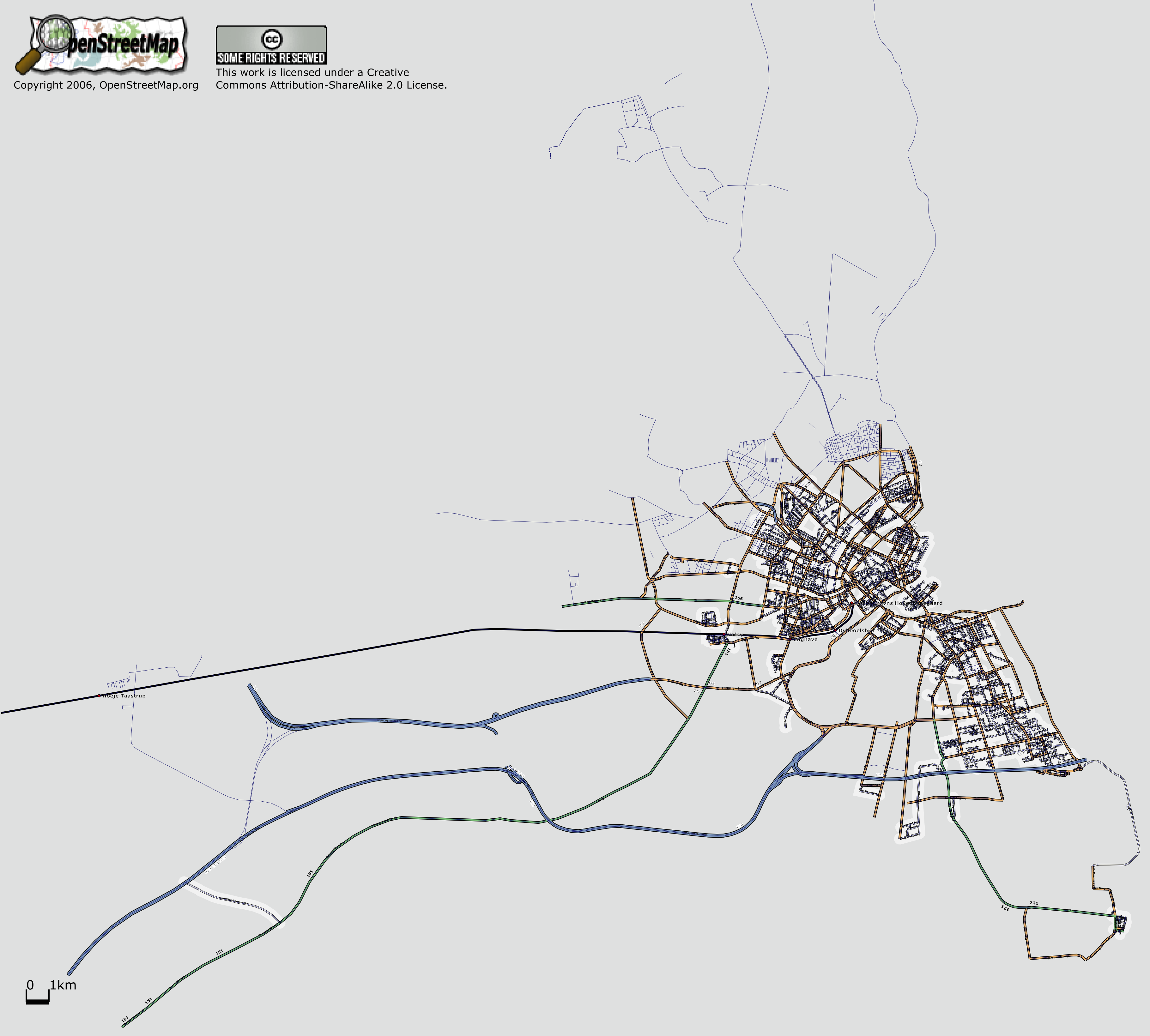
| 21:18, 20 August 2006 | Copenhagen-osmarender-17aug2006.gif (file) |  |
326 KB | Greater Copenhagen coverage as of August 17, 2006. Untagged segments are shown with a red line, all other streets shown according to highway tags. Railway station, city, town names, primary highway refs and motorway refs displayed, streetnames suppressed. | 2 |
| 09:04, 20 August 2006 | Osmarender-airport-EKCH.gif (file) |  |
91 KB | 3 | |
| 13:50, 17 August 2006 | Copenhagen-osmarender-17aug2006-big.gif (file) |  |
152 KB | Greater Copenhagen coverage as of August 17, 2006. Untagged segments are shown with a red line, all other streets shown according to highway tags. Railway station, city, and town names displayed, streetnames suppressed. Big version. | 1 |
| 07:56, 13 July 2006 | Storkbh.png (file) |  |
1.88 MB | osmarendered map of greater Copenhagen, with 80% of the named ways correctly tagged with type. Remaining ways rendered as single tracks. | 1 |
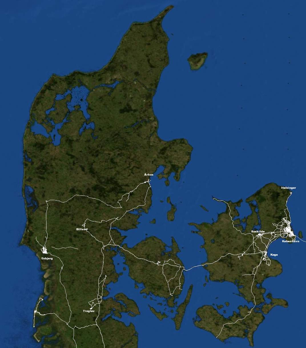
| 07:51, 5 July 2006 | DK-planet-osm-july2006.jpg (file) |  |
94 KB | Hi-Res of Denmark pr July 2006 (planet.osm data 07 July 2006) | 1 |
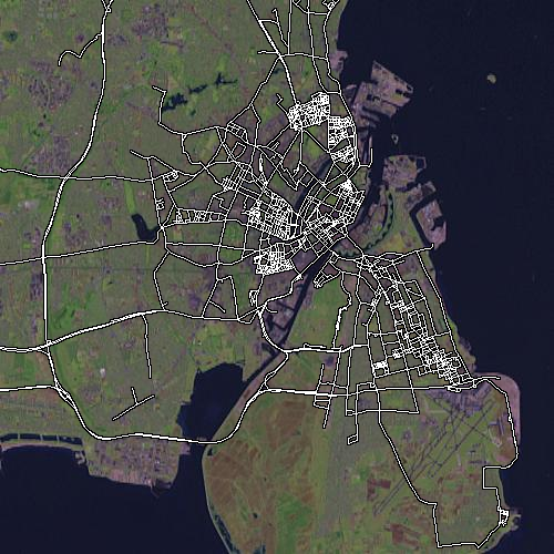
| 14:05, 18 June 2006 | OSM-Copenhagen - June17 2006 - Small.png (file) |  |
439 KB | 500x500 picture of OSM dataset for Copenhagen, June 17'th 2006. | 1 |
| 14:00, 18 June 2006 | OSM-Copenhagen - April 2006 - Small.png (file) |  |
456 KB | 500x500 picture of OSM dataset for Copenhagen, taken from osm.planet april 2006. | 1 |