Uploads by Fghj753
Jump to navigation
Jump to search
This special page shows all uploaded files.
| Date | Name | Thumbnail | Size | Description | Versions |
|---|---|---|---|---|---|
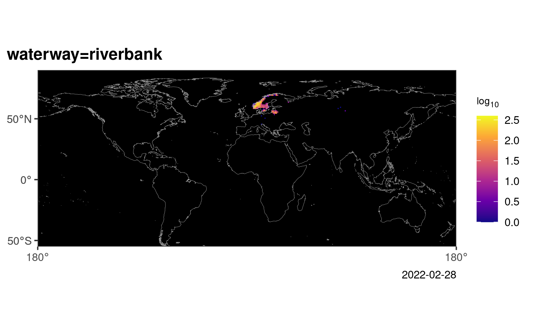
| 13:40, 28 February 2022 | Waterwayriverbank.png (file) |  |
212 KB | 6 | |
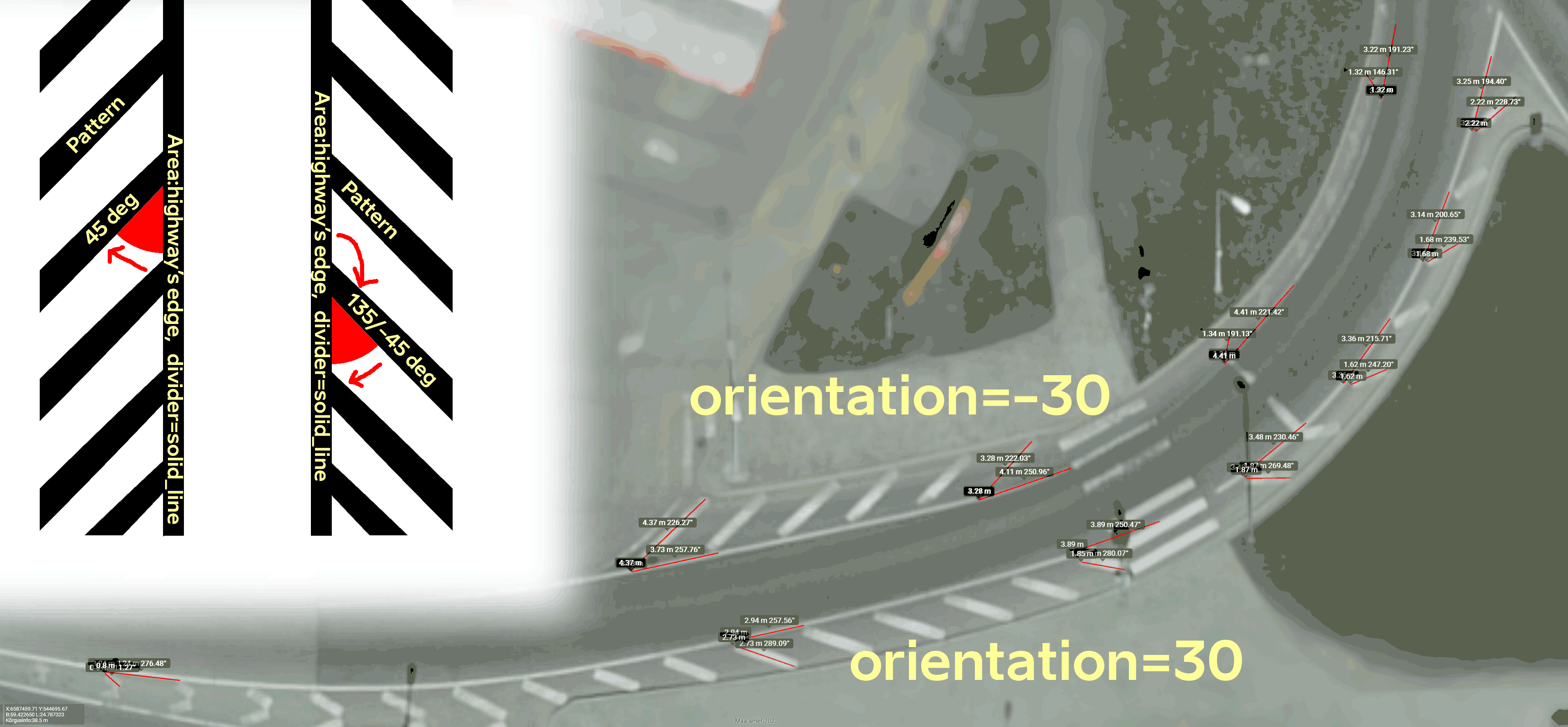
| 15:26, 6 February 2022 | Pattern-orientation-59.42264-24.78724.png (file) |  |
615 KB | Added more readable font | 2 |
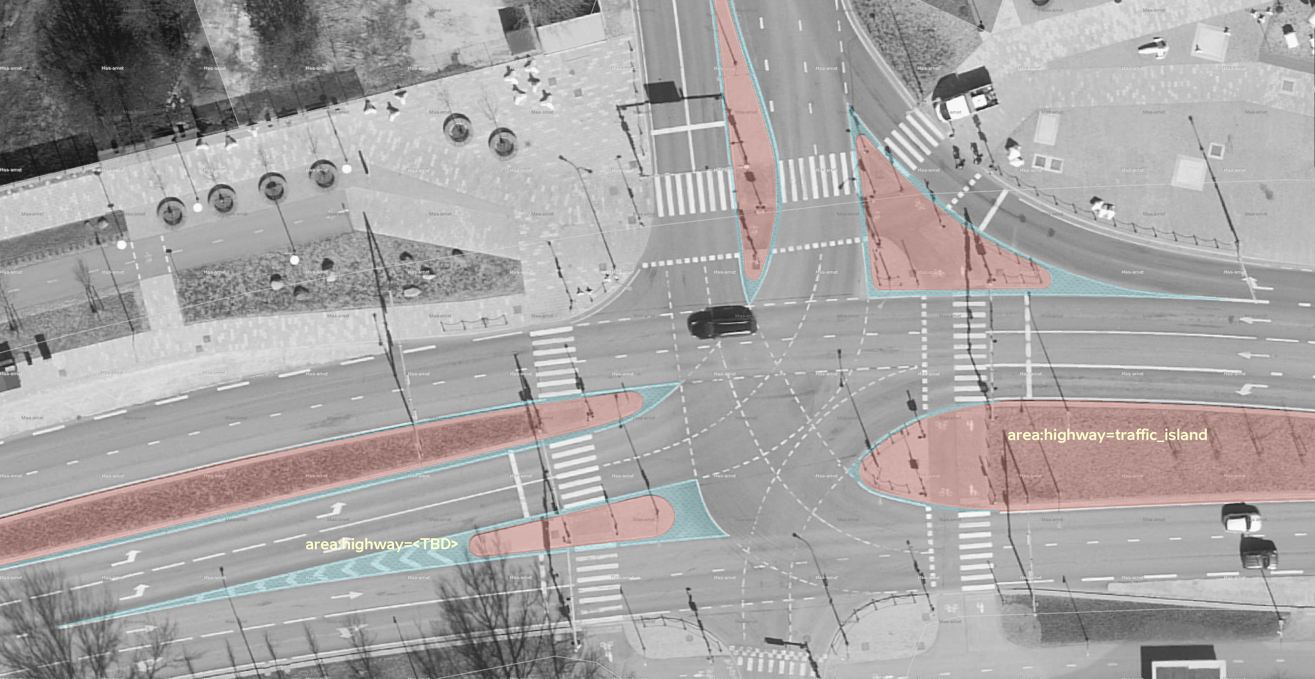
| 12:24, 6 February 2022 | Reidi-tee-59.44358-24.78134.jpg (file) |  |
680 KB | Licensing same as File:Kanama-59.312497-24.583196_tagging.jpg, screenshot from iD editor using Maa-amet Cadastre imagery layer, but this time doesn't include real OSM data. | 1 |
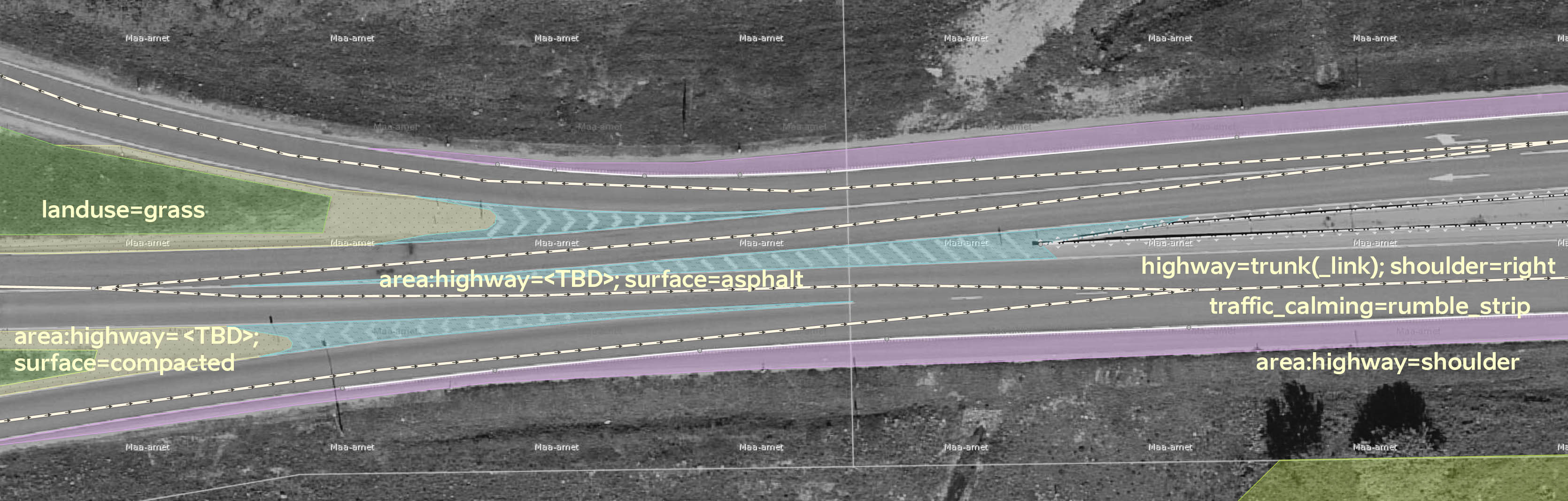
| 11:41, 6 February 2022 | Kanama-59.312497-24.583196 tagging.jpg (file) |  |
392 KB | Screenshot from iD editor. Background imagery: Estonia Maa-amet Cadastre. Map data from OSM website. Imagery as of spring 2020. | 1 |
| 12:12, 5 February 2022 | Kanama-59.312497-24.583196-2021-05-30.jpg (file) |  |
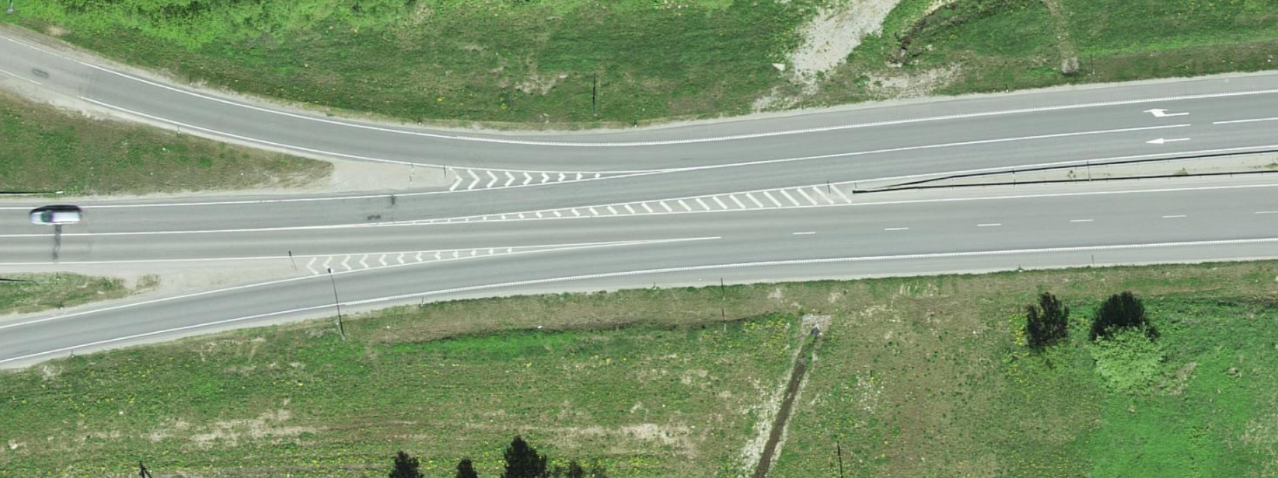
378 KB | JPG version of similarly named PNG. Screenshot of aerial imagery from eastern end of Kanama cloverleaf highway junction, Estonia (#map=19/59.31251/24.58324). Aerial image made by Maa-amet, licensed under ETAK Opendata license (available at https://geoportaal.maaamet.ee/docs/Avaandmed/ETAK_ruumiandmete_litsentsileping.pdf), which is considered to be OSM-compatible since 2009. Imagery date: 2021-05-30 | 1 |
| 12:09, 5 February 2022 | Kanama-59.312497-24.583196-2021-05-30.png (file) |  |
2.48 MB | Screenshot of aerial imagery from eastern end of Kanama cloverleaf highway junction, Estonia (#map=19/59.31251/24.58324). Aerial image made by Maa-amet, licensed under ETAK Opendata license (available at https://geoportaal.maaamet.ee/docs/Avaandmed/ETAK_ruumiandmete_litsentsileping.pdf), which is considered to be OSM-compatible since 2009. Imagery date: 2021-05-30 | 1 |
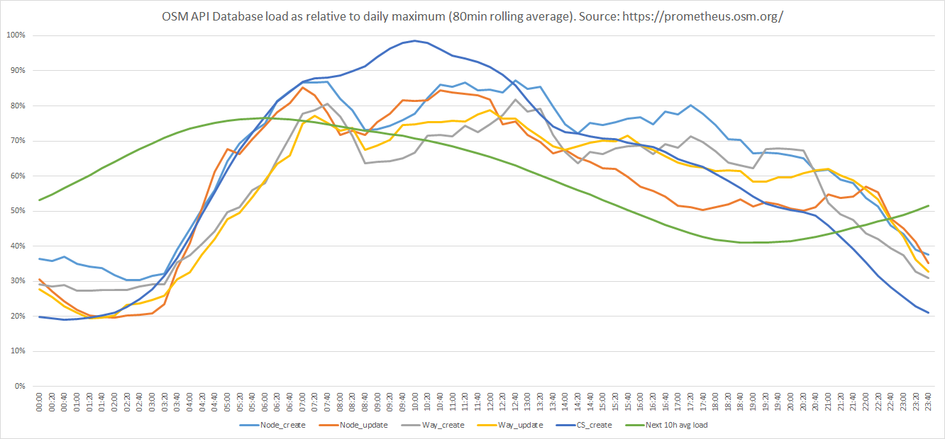
| 19:23, 21 May 2021 | OSM API DB load 2021-05-21.png (file) |  |
65 KB | 1 | |
| 09:40, 21 May 2021 | Verbatium import changesets.png (file) |  |
116 KB | 1 |