Uploads by Jotam
Jump to navigation
Jump to search
This special page shows all uploaded files.
| Date | Name | Thumbnail | Size | Description | Versions |
|---|---|---|---|---|---|
| 14:12, 24 April 2018 | Shop religion.jpg (file) |  |
3.78 MB | Product range of a [https://www.openstreetmap.org/node/4107546589 shop selling devotional objects, religious literature, and liturgical supplies in Münster, Germany]. | 1 |
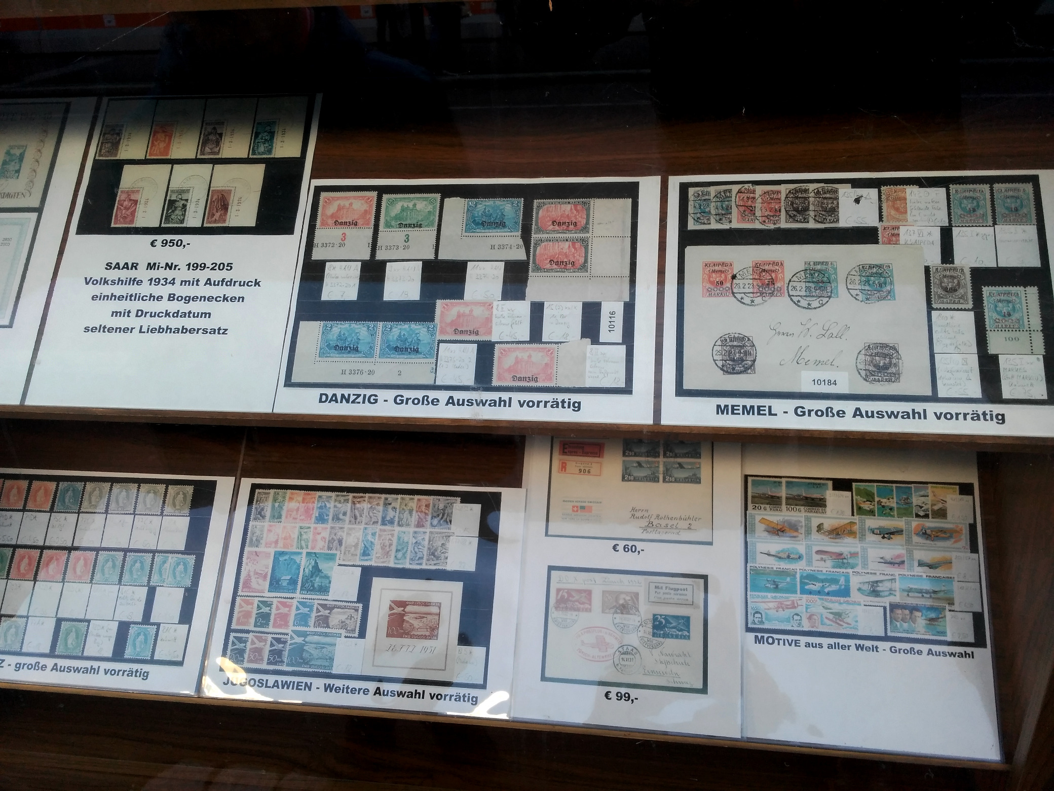
| 18:46, 31 October 2017 | Shop collector.jpg (file) |  |
798 KB | Window display of a [https://www.openstreetmap.org/node/3938212547 stamp collector shop in Freiburg], Germany. | 1 |
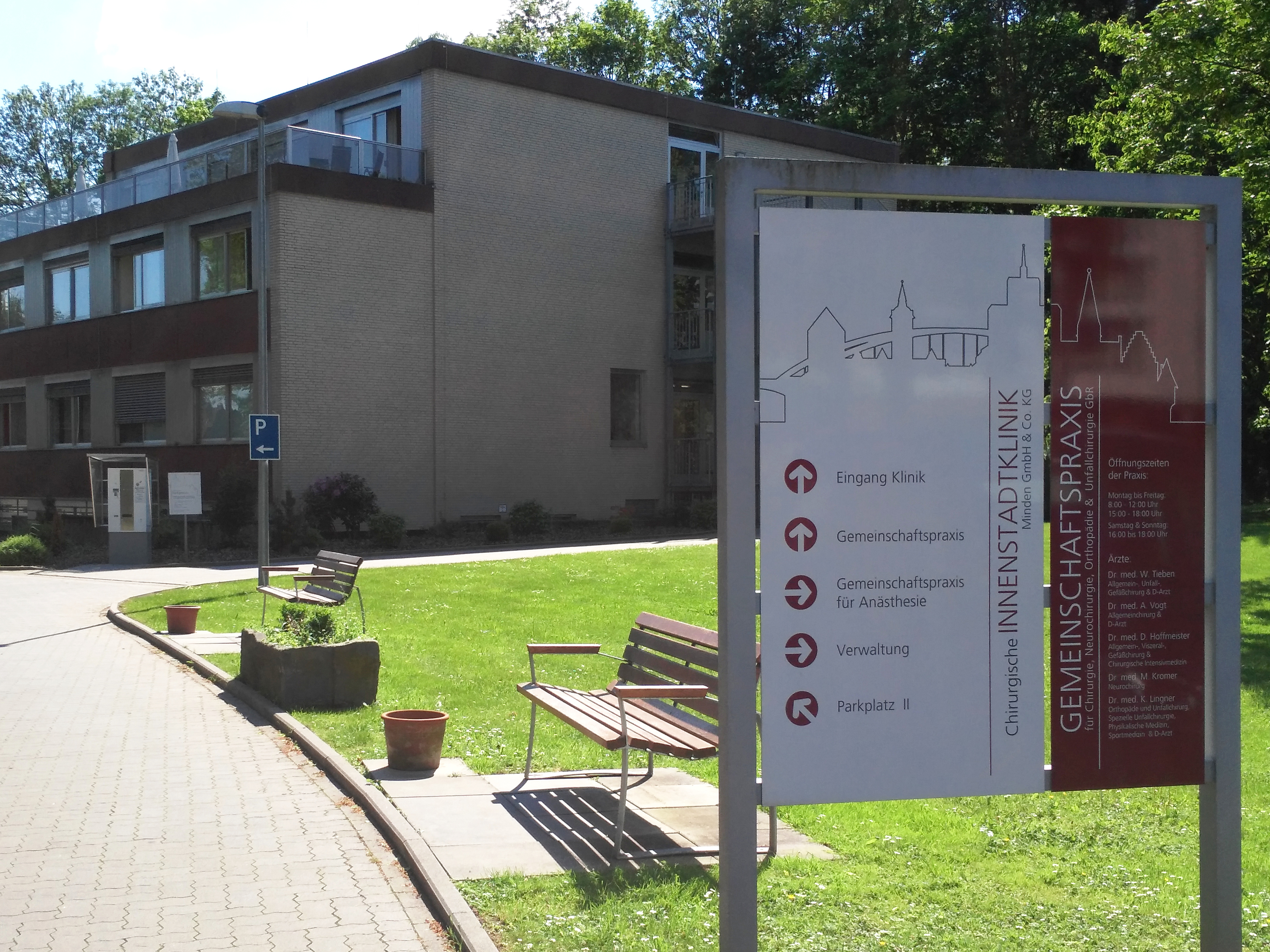
| 22:16, 22 May 2017 | Clinic de.jpg (file) |  |
3.54 MB | Eingangsbereich einer chirurgischen Klinik in Minden (https://www.openstreetmap.org/way/41018893) | 1 |
| 12:29, 9 May 2017 | Shop party.jpg (file) |  |
2.4 MB | Window front of a shop for party supplies in Minden, Germany | 1 |
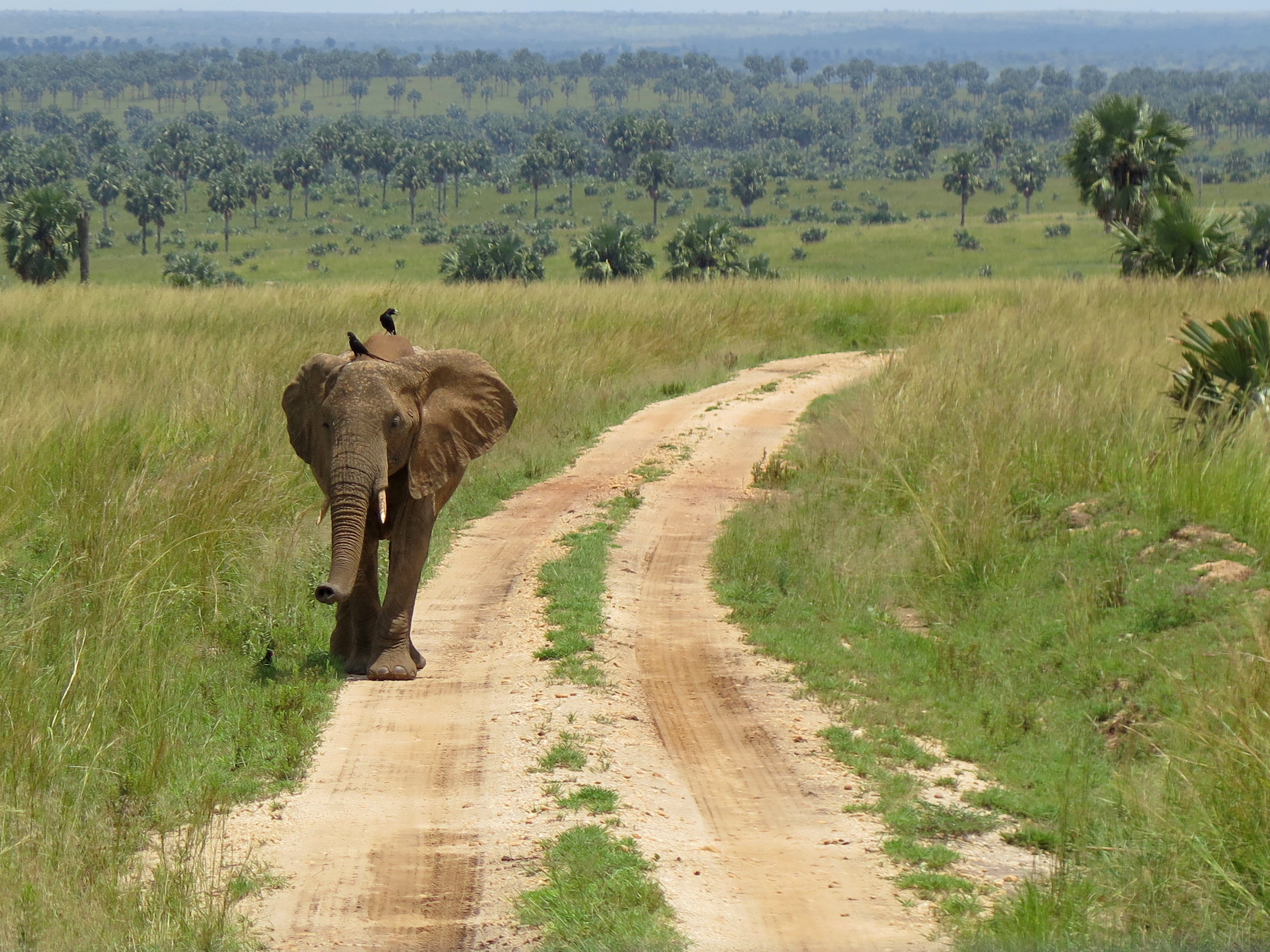
| 19:54, 18 August 2016 | EA highway track.jpg (file) |  |
1.18 MB | An example for a game track in a National Park in East Africa. This picture shows a [https://www.openstreetmap.org/way/437872132 track inside Murchison Falls National Park], Uganda. | 1 |
| 17:44, 31 July 2015 | Shop coffee2.svg (file) |  |
2 KB | Alternative icon for shop=coffee. | 1 |
| 17:31, 31 July 2015 | Shop coffee.svg (file) |  |
2 KB | Proposed icon for shop=coffee. | 1 |
| 15:54, 31 July 2015 | Amenity social-facility-2.svg (file) |  |
5 KB | Alternative Proposal for amenity=social_facility | 1 |
| 15:21, 31 July 2015 | Amenity social-facility.svg (file) |  |
8 KB | Icon proposal for social facilities. | 1 |
| 10:10, 20 July 2015 | Shop deli.svg (file) |  |
9 KB | Proposed icon for shop=deli | 1 |
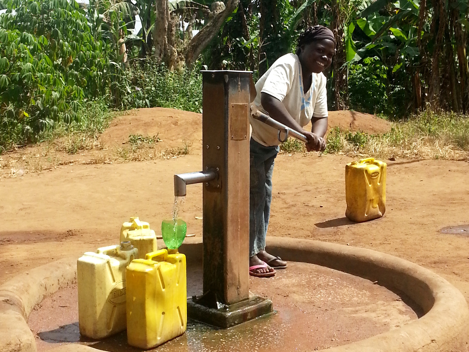
| 13:07, 16 July 2015 | Ea water well.jpg (file) |  |
616 KB | An example for a manually operated water well in East Africa. The pump in this picture is situated in Luweero, Uganda (http://www.openstreetmap.org/node/3654146588) and was donated by the Christian development agency "Hilfe für Brüder", Stuttgart, Ge... | 1 |
| 21:47, 4 July 2015 | Shop dairy-32x32.svg (file) |  |
6 KB | Icon for shop=dairy | 1 |
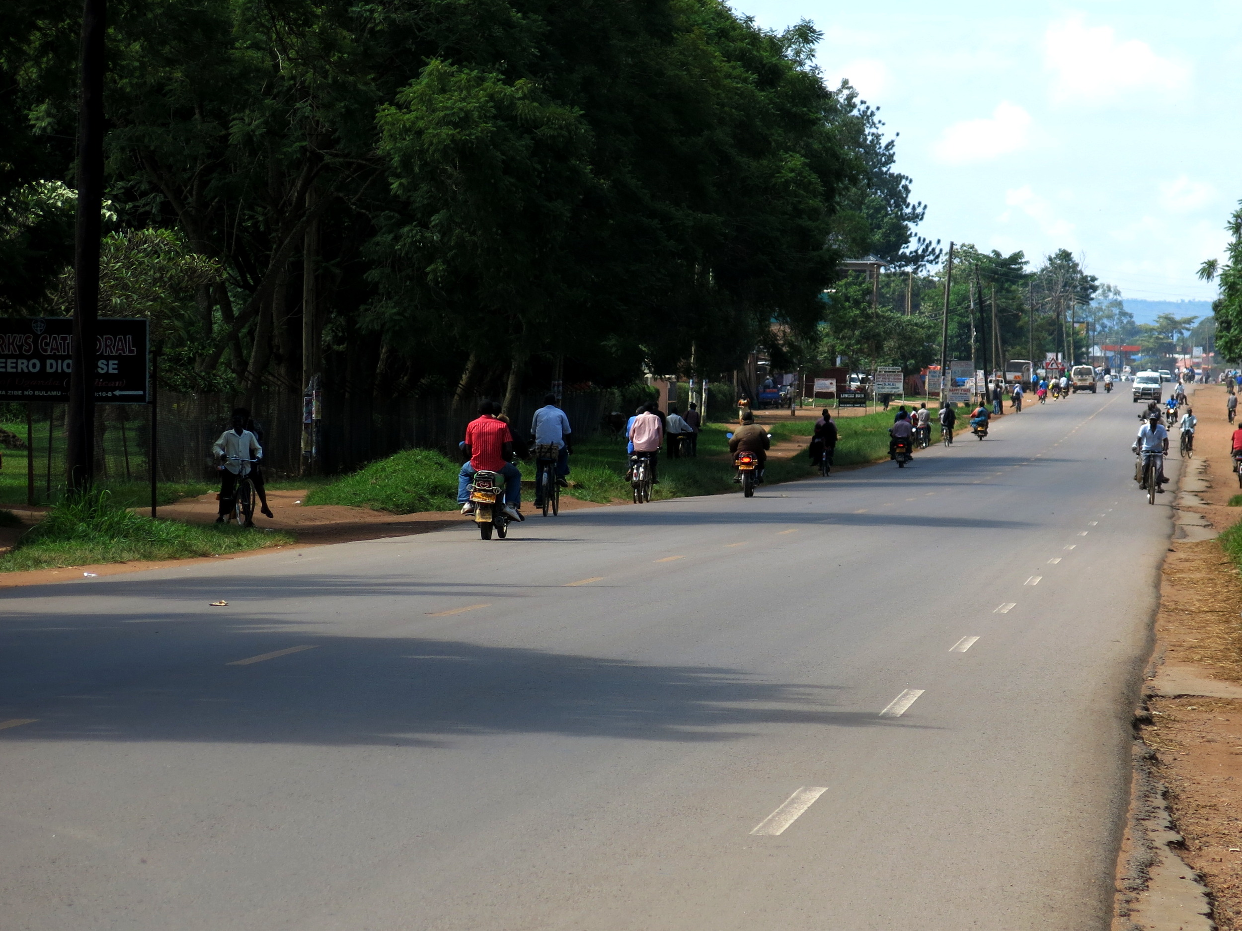
| 18:21, 19 June 2015 | EA highway trunk.jpg (file) |  |
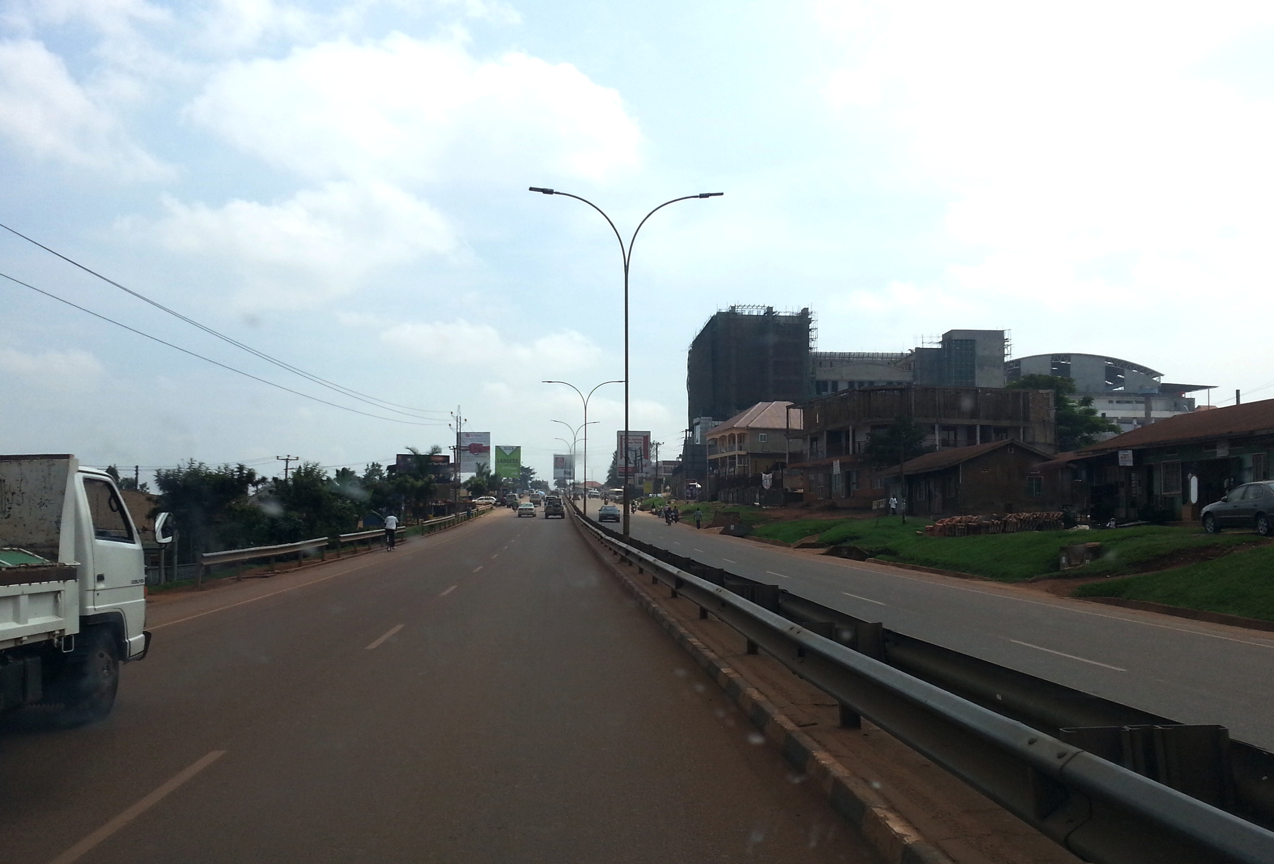
570 KB | An example for a trunk road in East Africa. This picture shows the Kampala-Entebbe-Highway between Katwe and Zana in Uganda. | 1 |
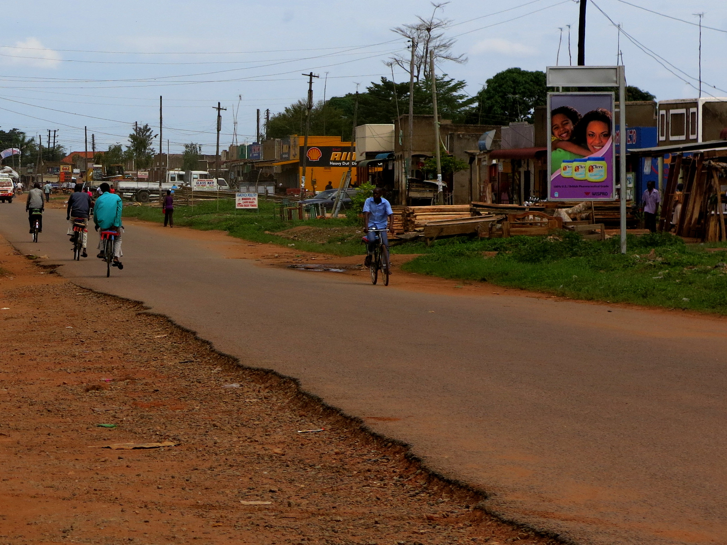
| 10:43, 30 May 2015 | Ea highway unclassified.JPG (file) |  |
1.58 MB | An example for an unclassified road in East Africa. This picture shows a road linking two suburbs of Luweero, Uganda. | 1 |
| 10:14, 30 May 2015 | Ea highway secondary rural.JPG (file) |  |
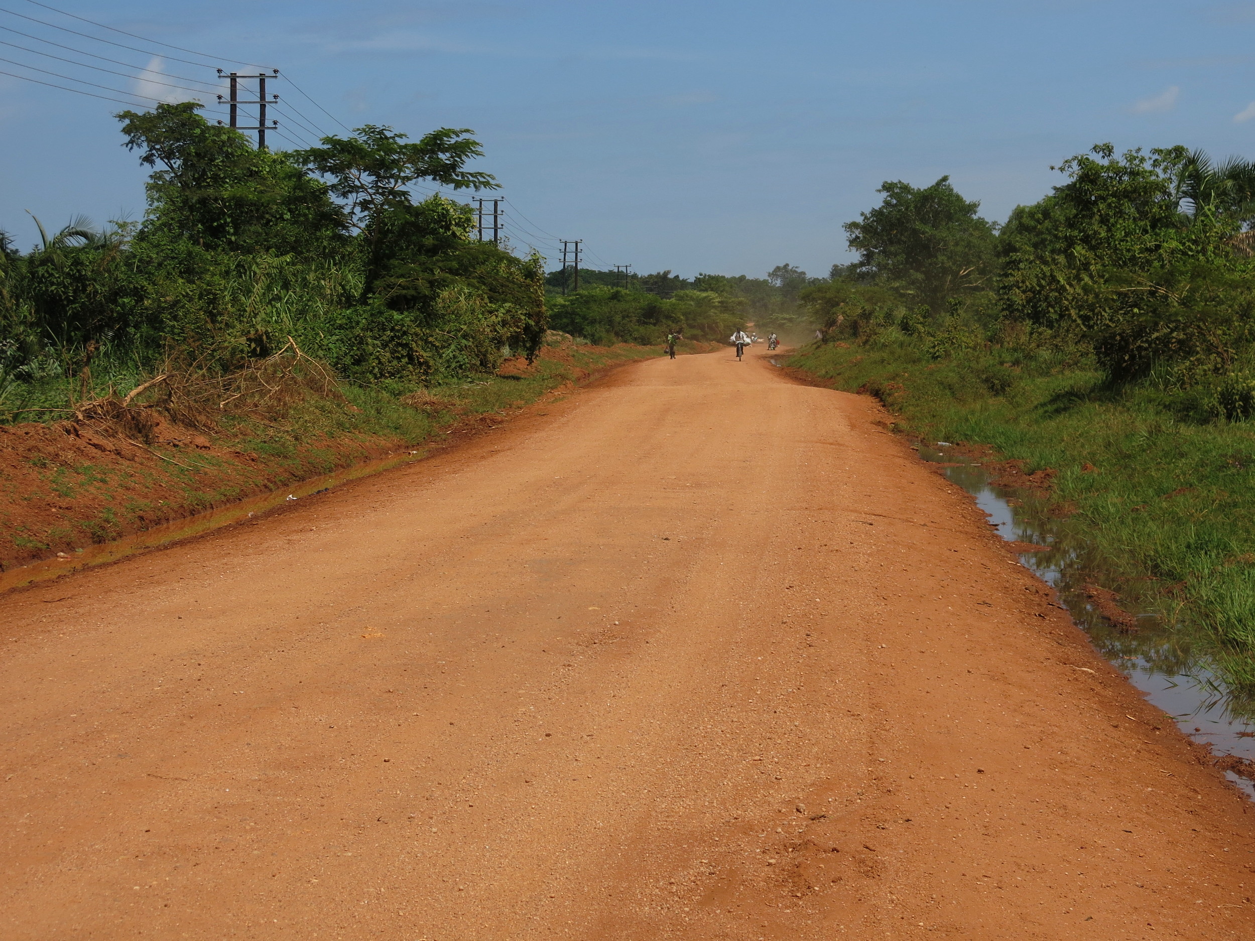
1.31 MB | An example for a rural secondary road in East Africa. This picture shows the Luweero - Kiwoko Road in Luweero District, Uganda. | 1 |
| 10:12, 30 May 2015 | Ea highway primary rural.JPG (file) |  |
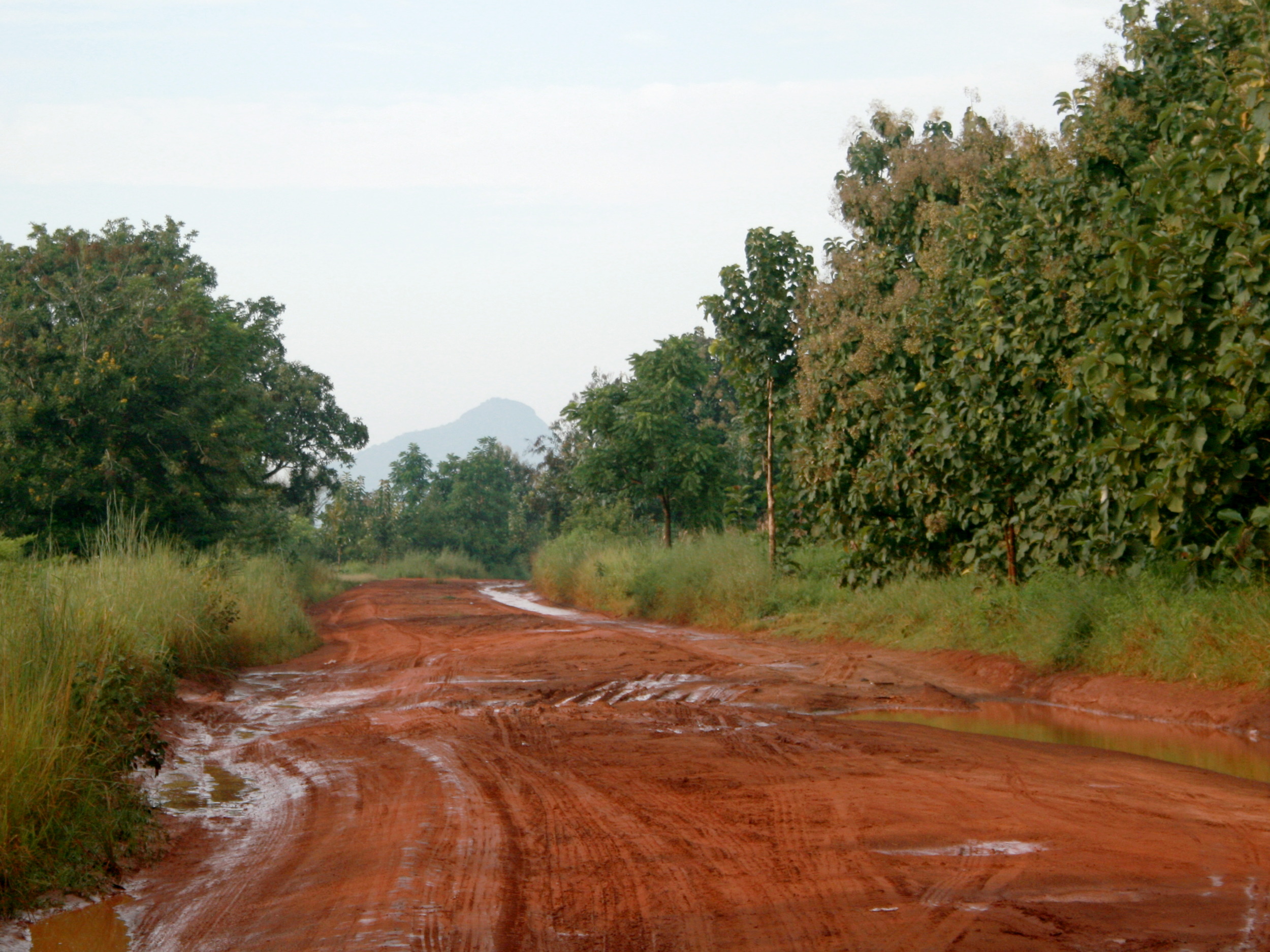
1,017 KB | An example for a rural primary road in poor condition in East Africa. This picture shows the road from Yei to the Ugandan border at Kaya in South Sudan. | 1 |
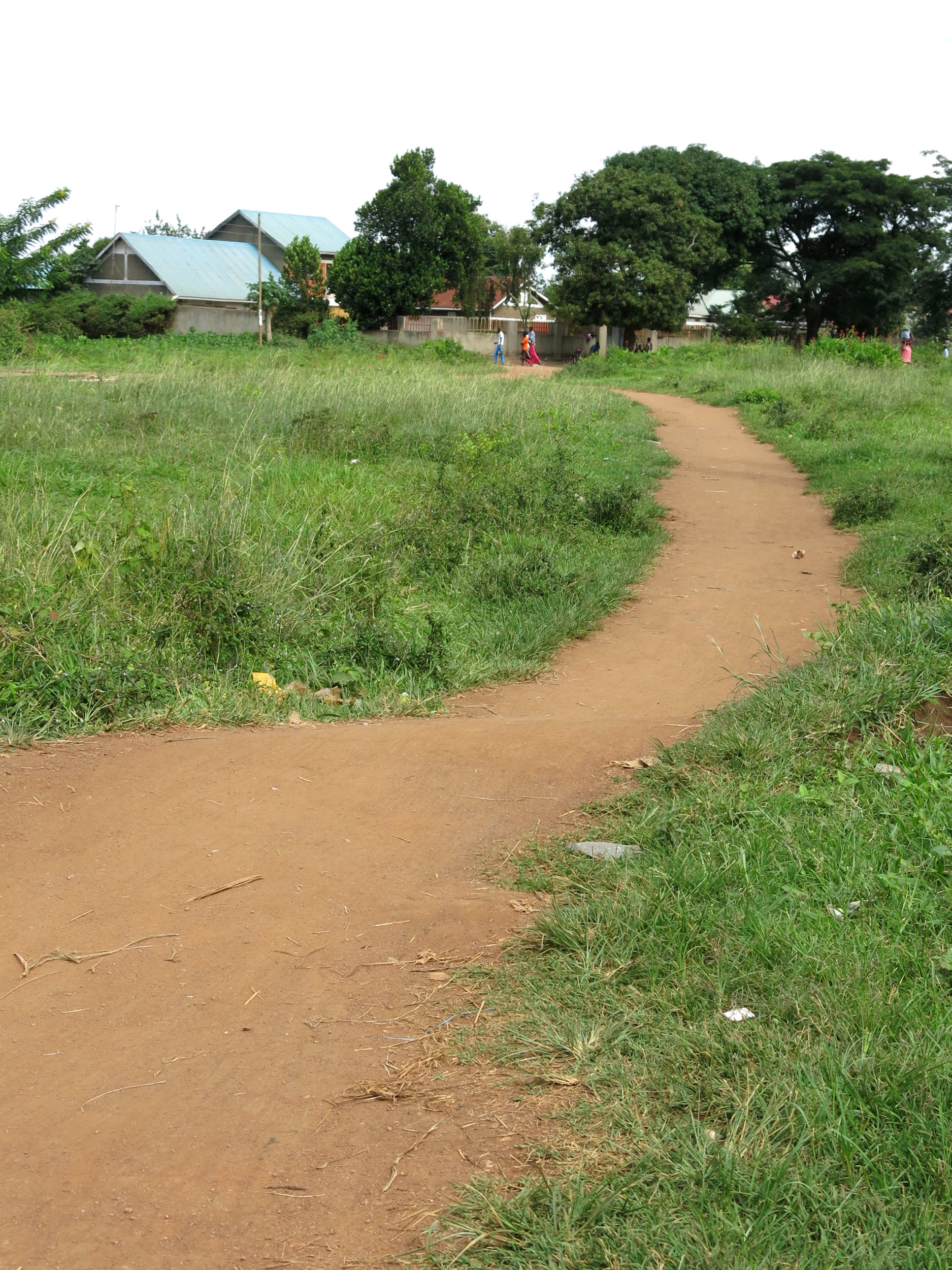
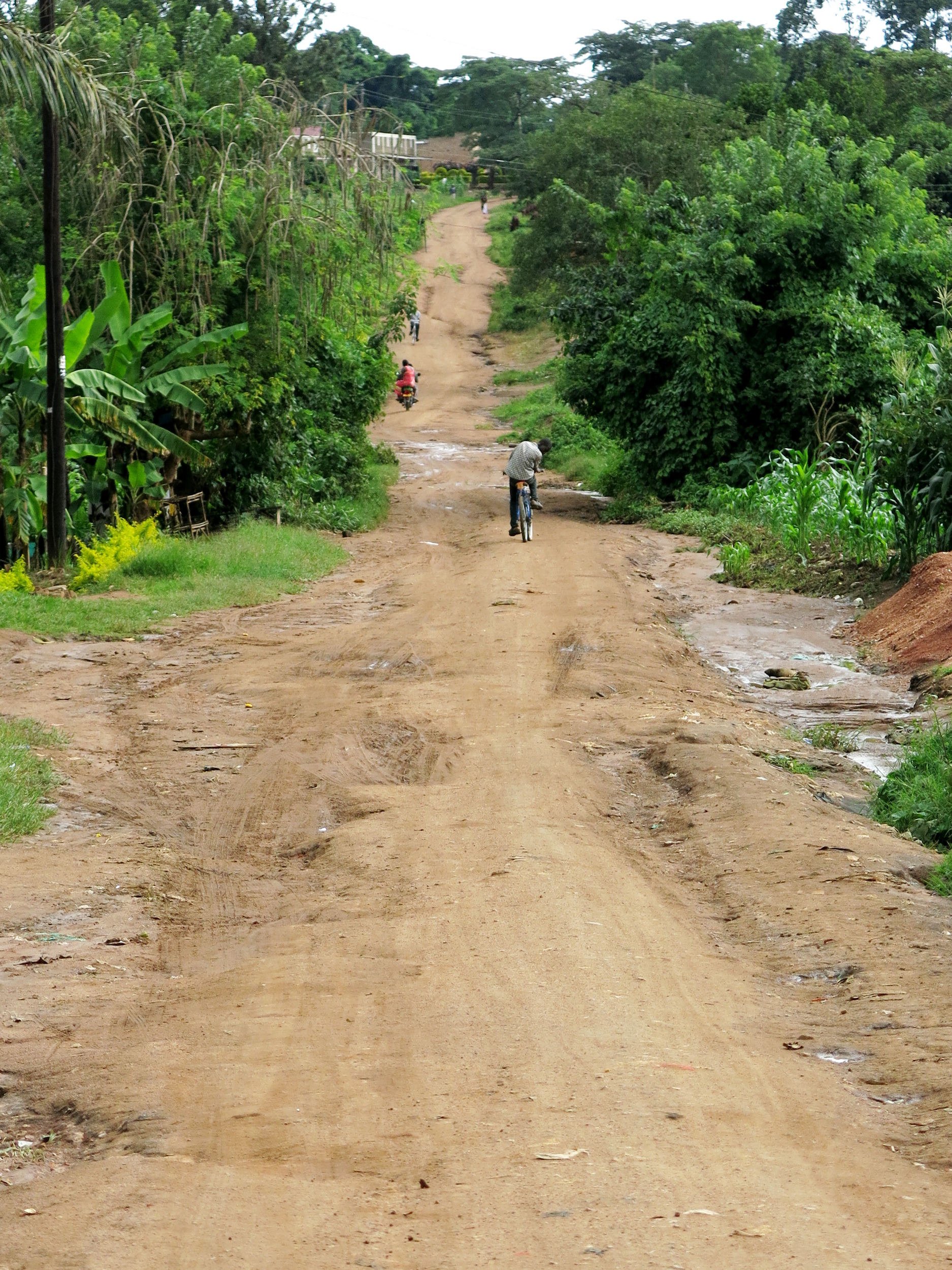
| 15:37, 29 May 2015 | Ea highway path.JPG (file) |  |
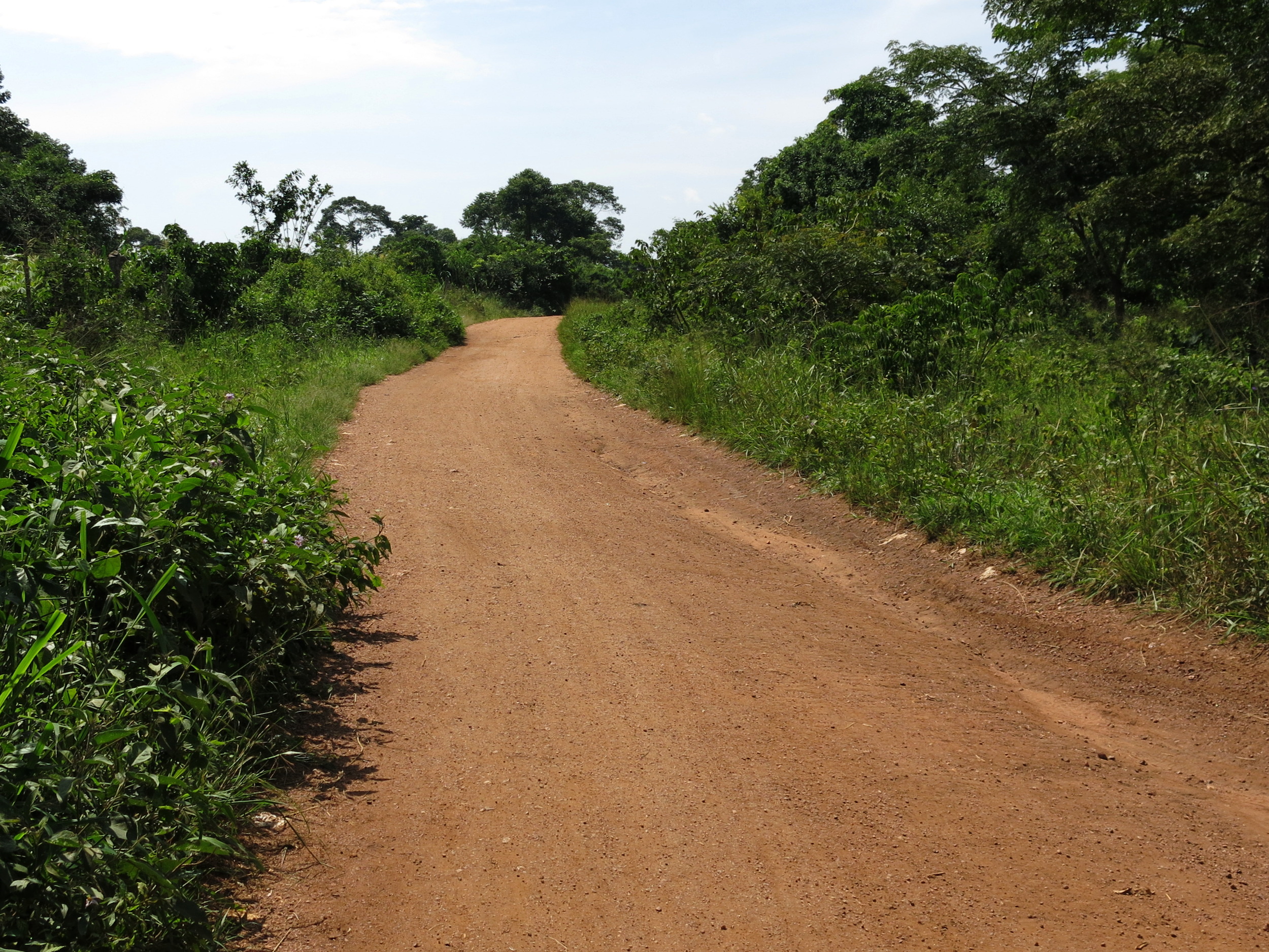
1.5 MB | An example for a generic path East Africa. This picture shows a foot- and cyclepath in Luweero, Uganda. | 1 |
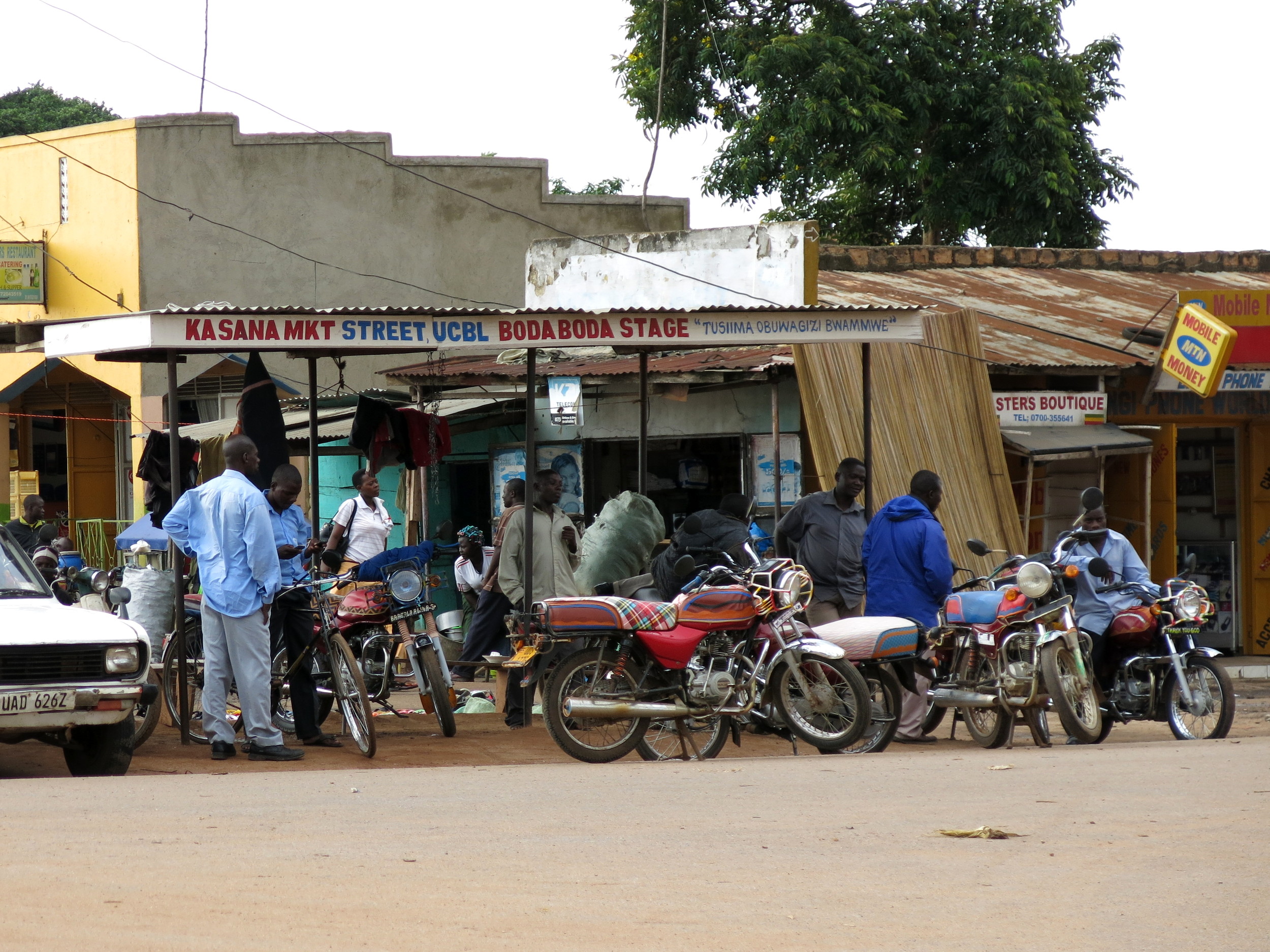
| 14:19, 29 May 2015 | Ea boda-boda-stage.JPG (file) |  |
1.1 MB | An example for a "boda-boda" taxi stage in East Africa. This picture shows the "Kasana Market Street Boda-Boda Stage" in Luweero, Uganda. | 1 |
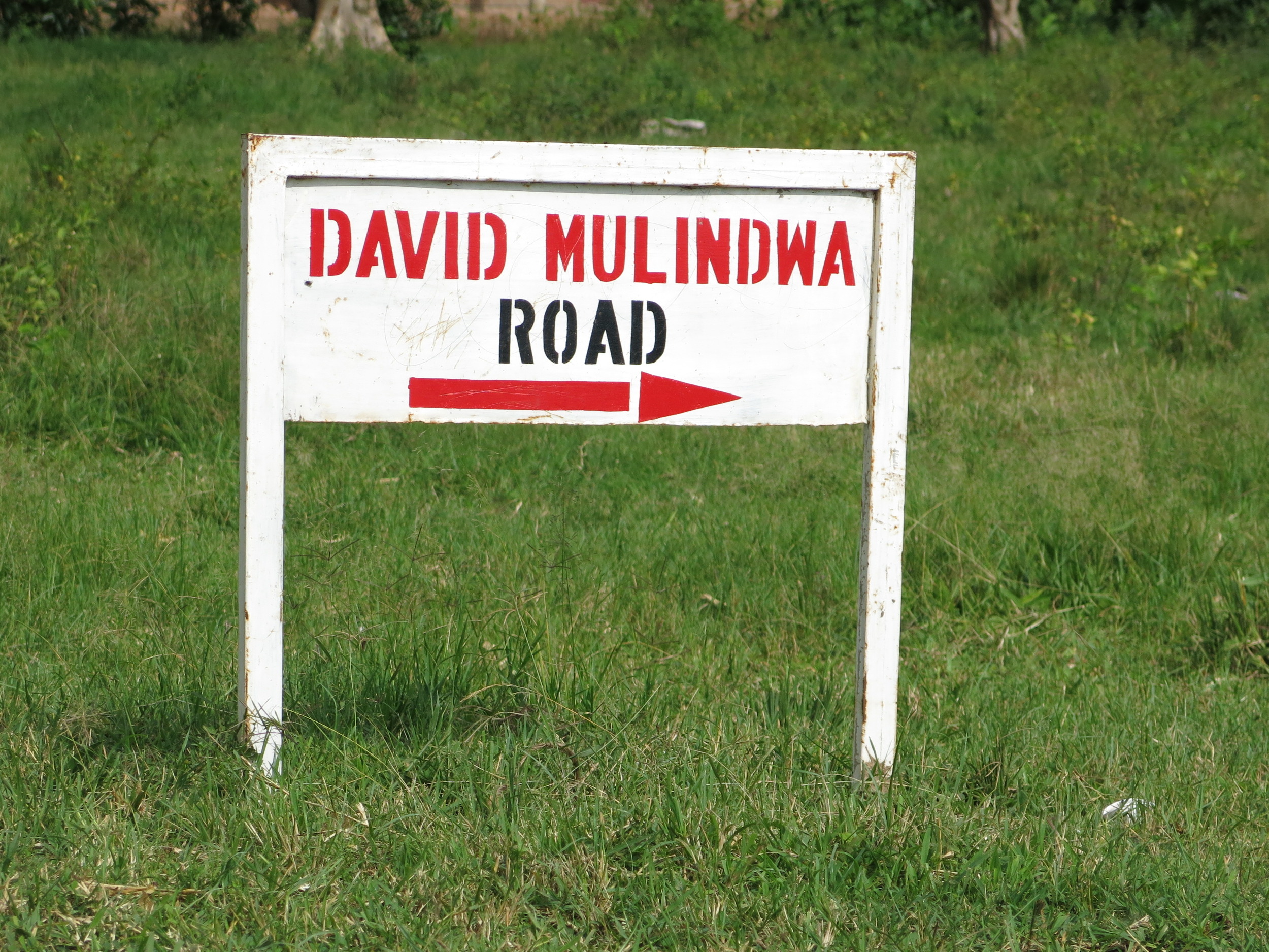
| 14:18, 29 May 2015 | Ea road-sign.JPG (file) |  |
1.38 MB | An example for a street name signpost in East Africa. This picture shows the David-Mulindwa-Road in Luweero, Uganda. | 1 |
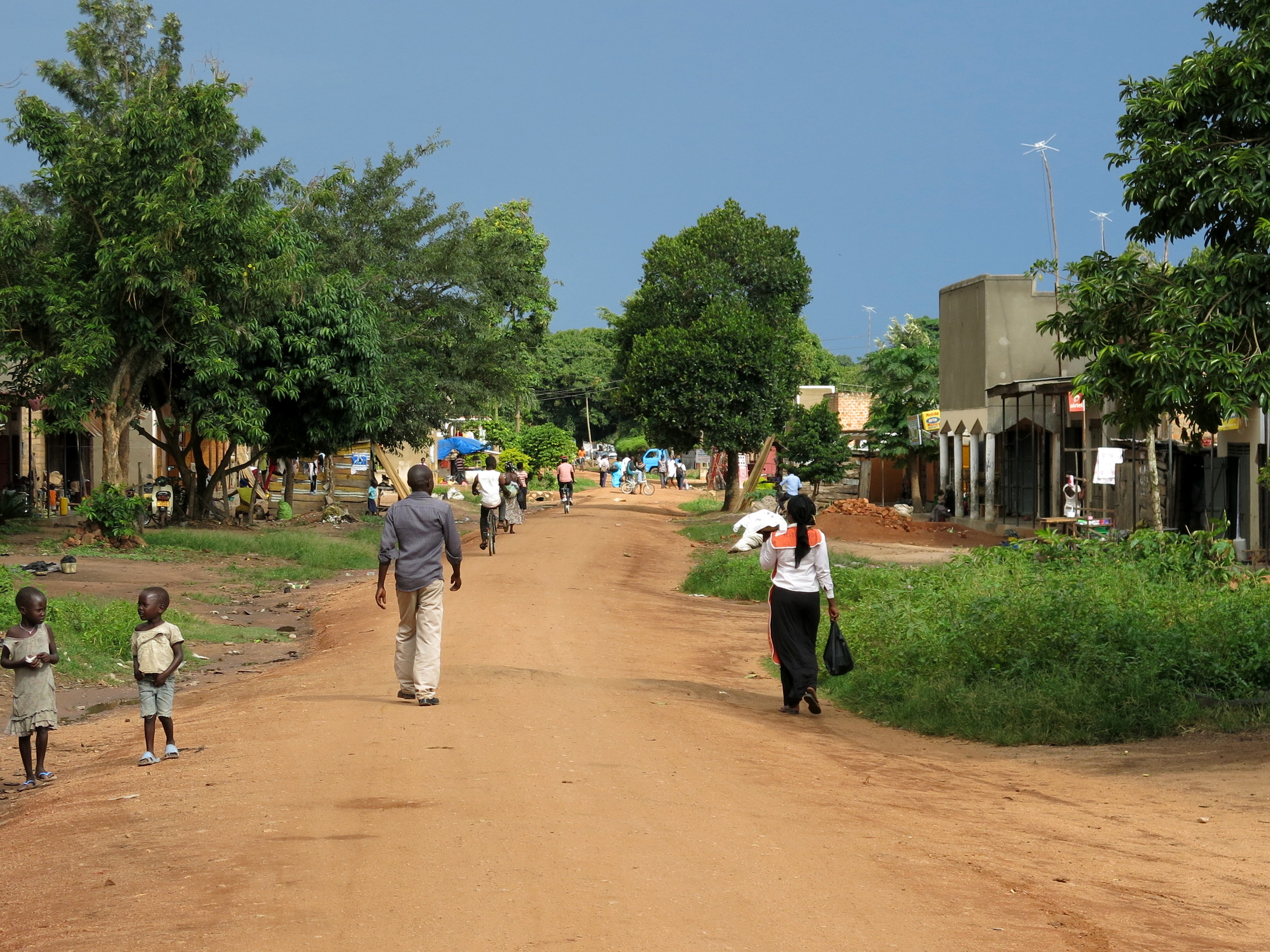
| 14:15, 29 May 2015 | Ea highway residential.JPG (file) |  |
1.26 MB | An example for a residential road in East Africa. This picture shows a residential road in Luweero, Uganda. | 1 |
| 14:13, 29 May 2015 | Ea highway tertiary.JPG (file) |  |
1.64 MB | An example for a tertiary road in East Africa. This picture shows the road between Kasana (Luweero) and Kigombe in Uganda. | 1 |
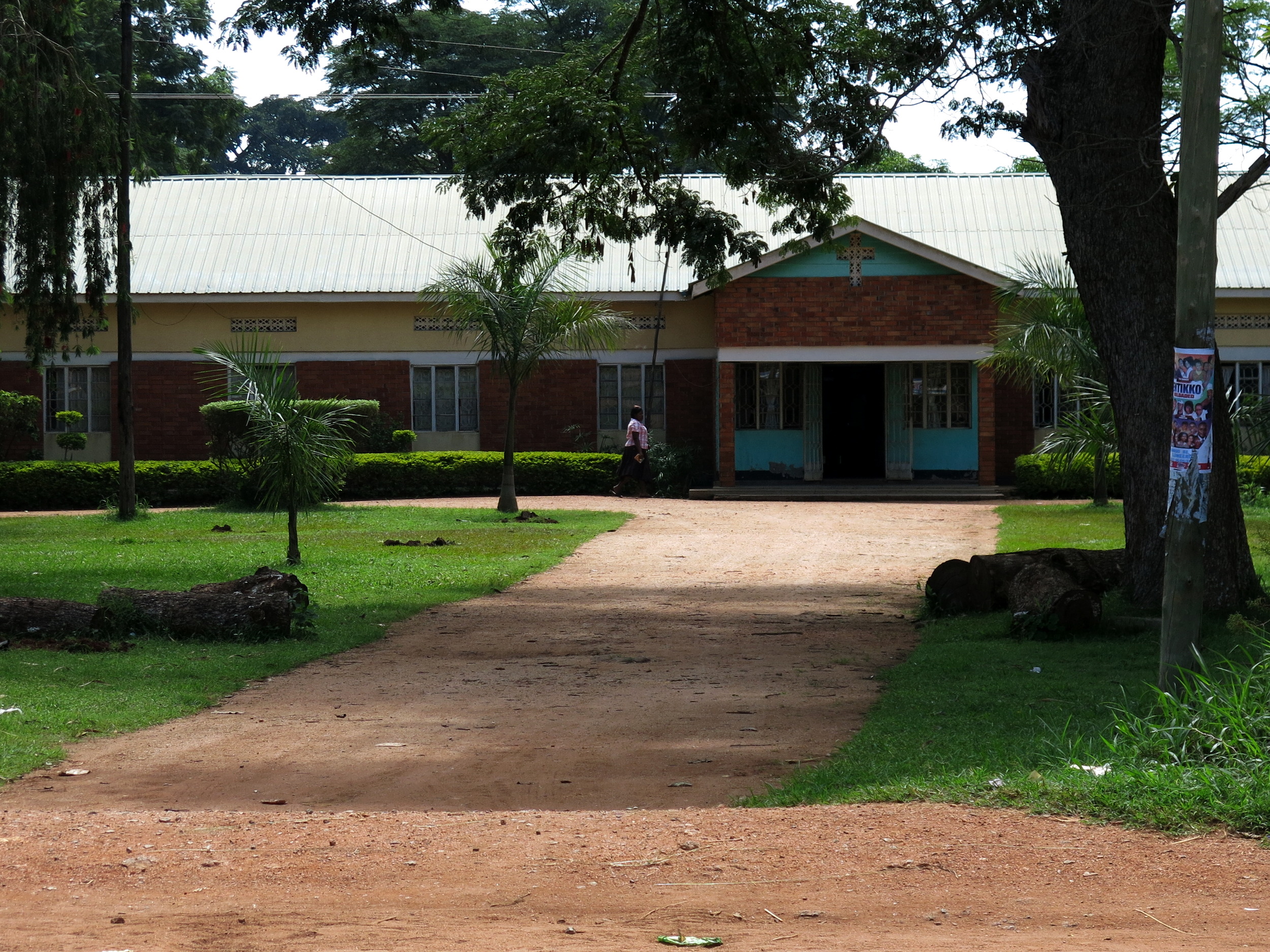
| 11:18, 29 May 2015 | Ea highway service.JPG (file) |  |
1.59 MB | An example for a service road in East Africa. This picture shows the driveway to the Anglican bishop's office in Luweero, Uganda. | 1 |
| 11:10, 29 May 2015 | Ea highway primary.JPG (file) |  |
1,005 KB | An example for a primary road in East Africa. This picture shows the Kampala-Gulu-Highway in Luweero, Uganda. | 1 |
| 07:30, 29 May 2015 | Ea highway secondary.JPG (file) |  |
1.13 MB | An example for a secondary road in East Africa. This picture shows 'Luweero Street' in Luweero, Uganda. | 1 |