Uploads by Ke9tv
Jump to navigation
Jump to search
This special page shows all uploaded files.
| Date | Name | Thumbnail | Size | Description | Versions |
|---|---|---|---|---|---|
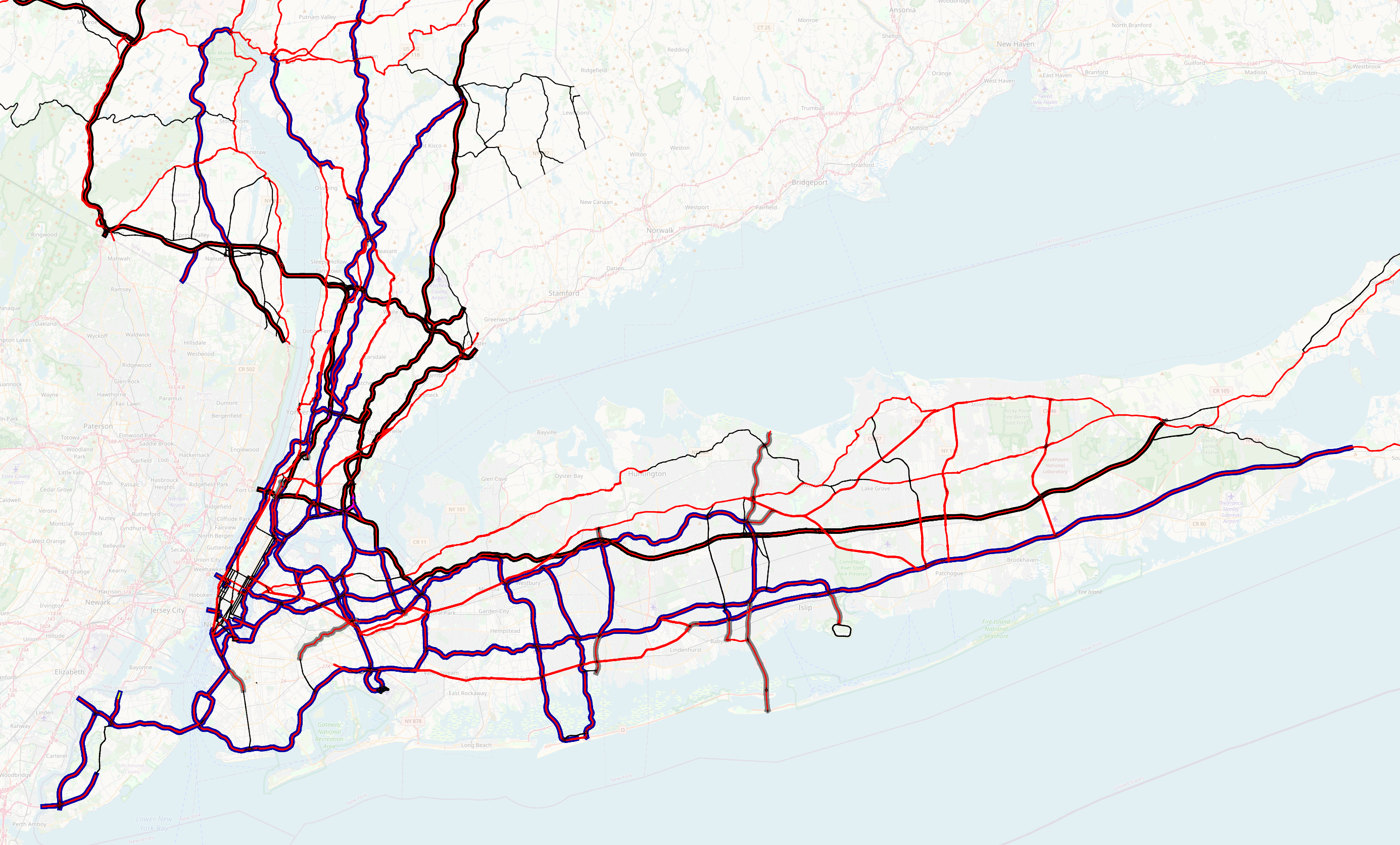
| 04:31, 6 September 2021 | NYC-LI-primary.png (file) |  |
2.97 MB | Map of primary highways in New York City and Long Island | 1 |
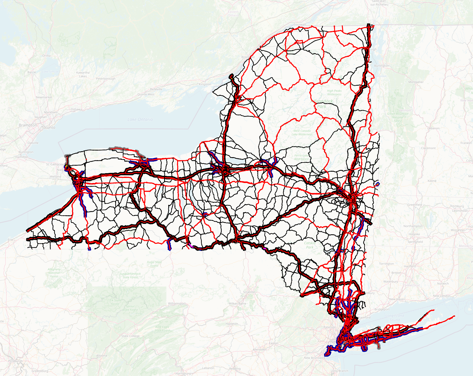
| 04:29, 6 September 2021 | NYS-primary.png (file) |  |
1.93 MB | Map of primary highways in New York State | 1 |
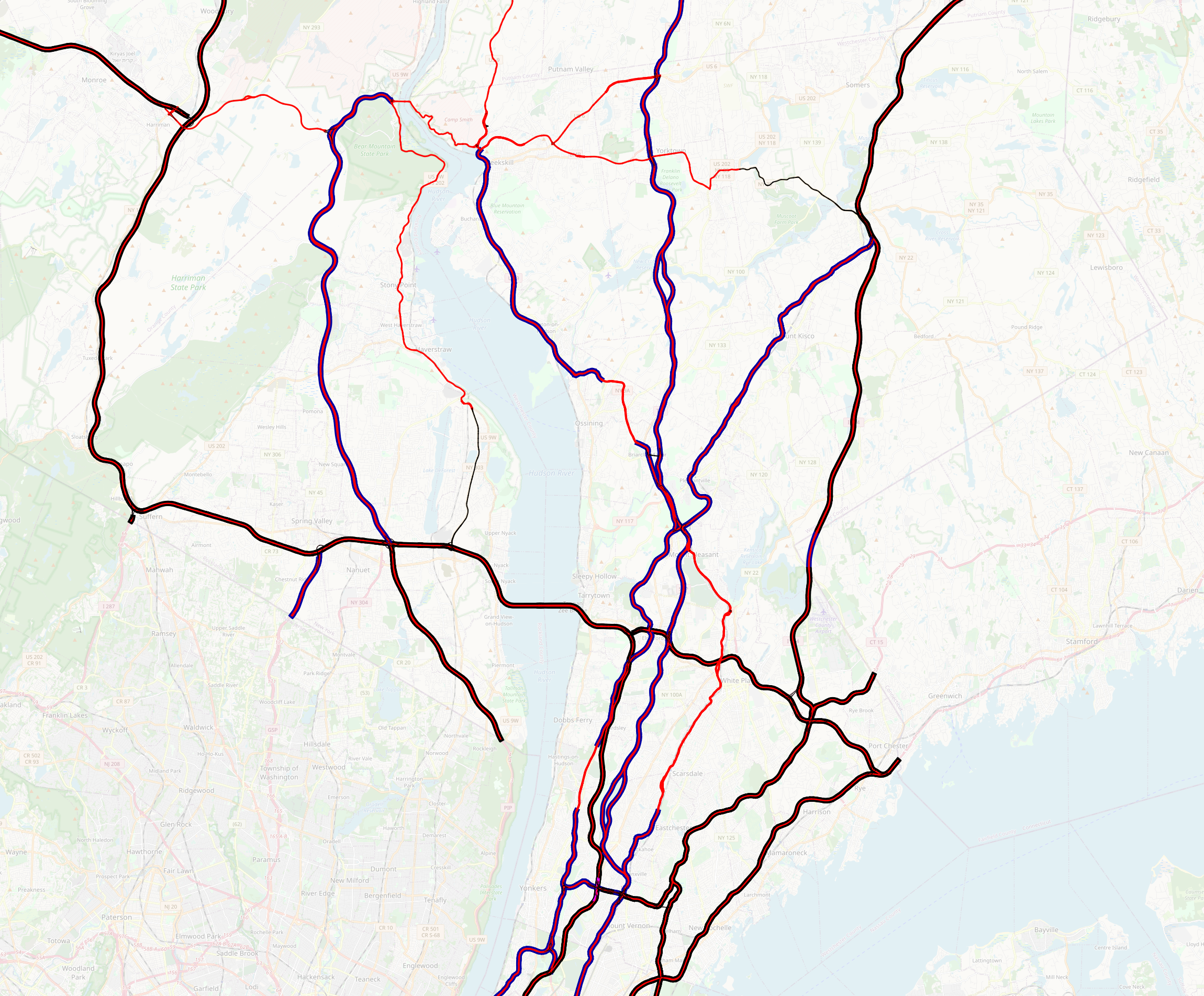
| 04:09, 6 September 2021 | Westchester-Rockland-NY-trunks.png (file) |  |
3.53 MB | Map of motorways and trunk roads in Westchester and Rockland Counties, New York | 1 |
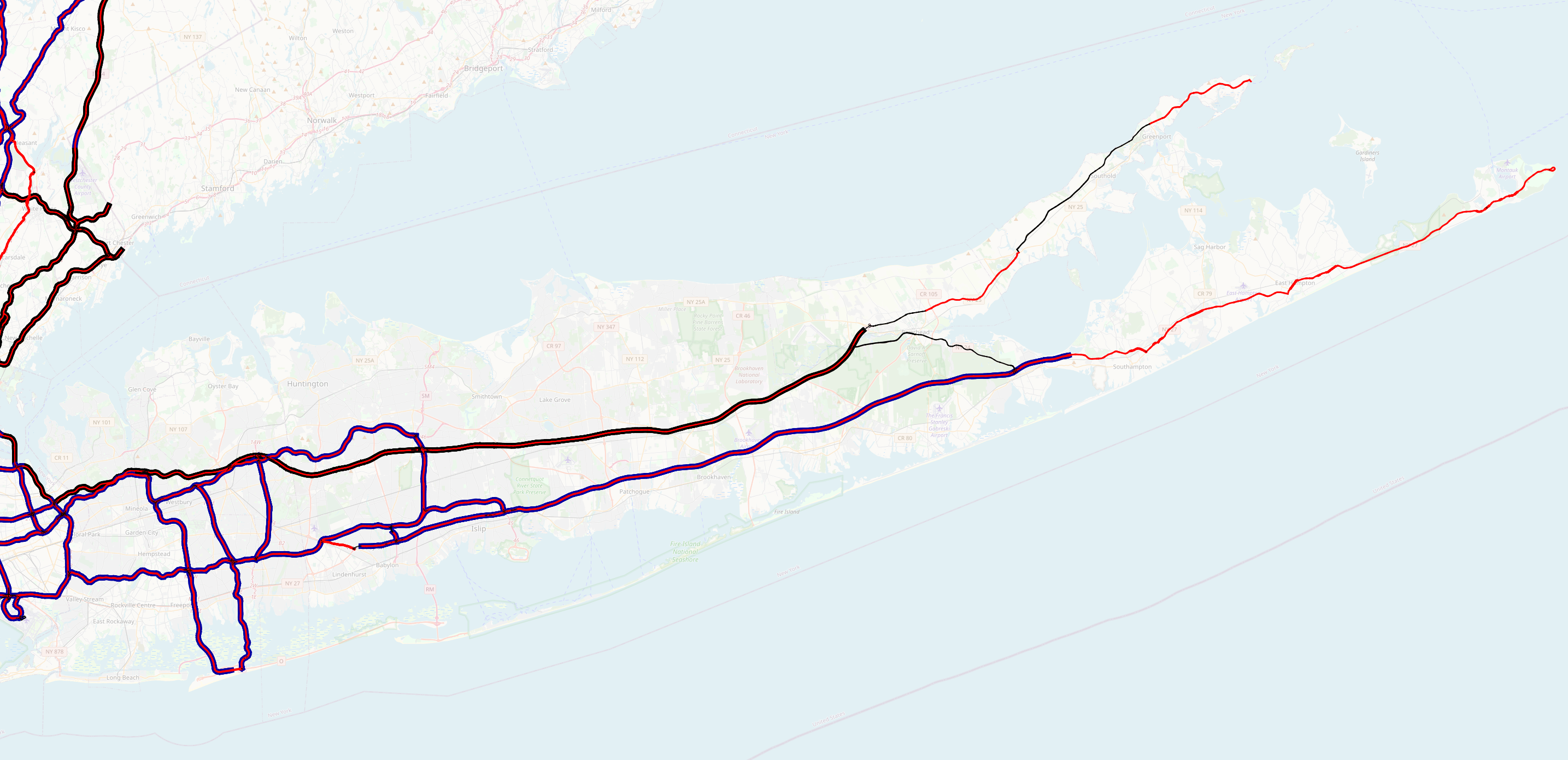
| 04:06, 6 September 2021 | Long-Island-trunks.png (file) |  |
1.46 MB | Map of motorways and trunk roads on Long Island, New York | 1 |
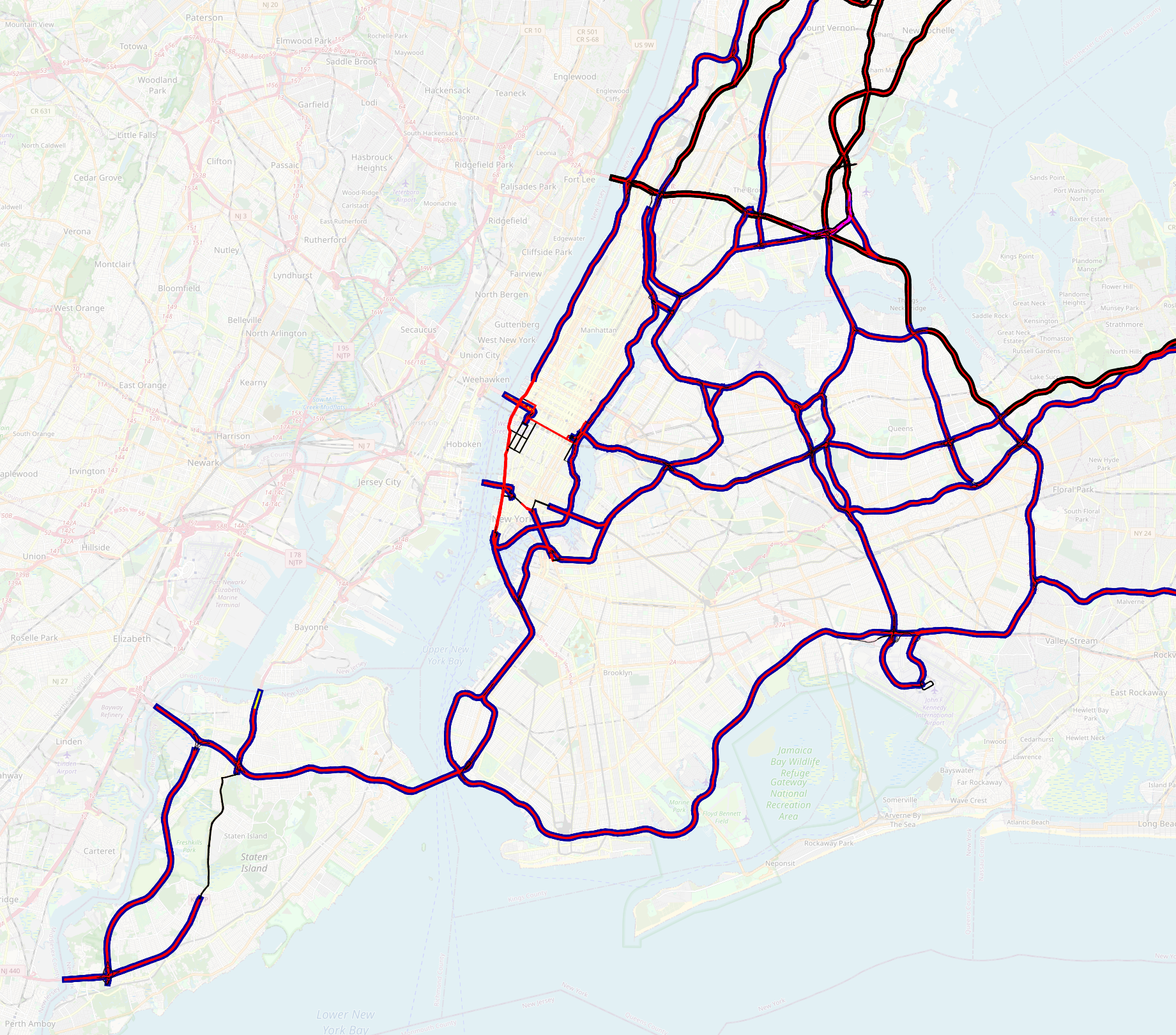
| 03:52, 6 September 2021 | NYC-trunks.png (file) |  |
3.12 MB | Map of motorways and trunk roads within New York City | 1 |
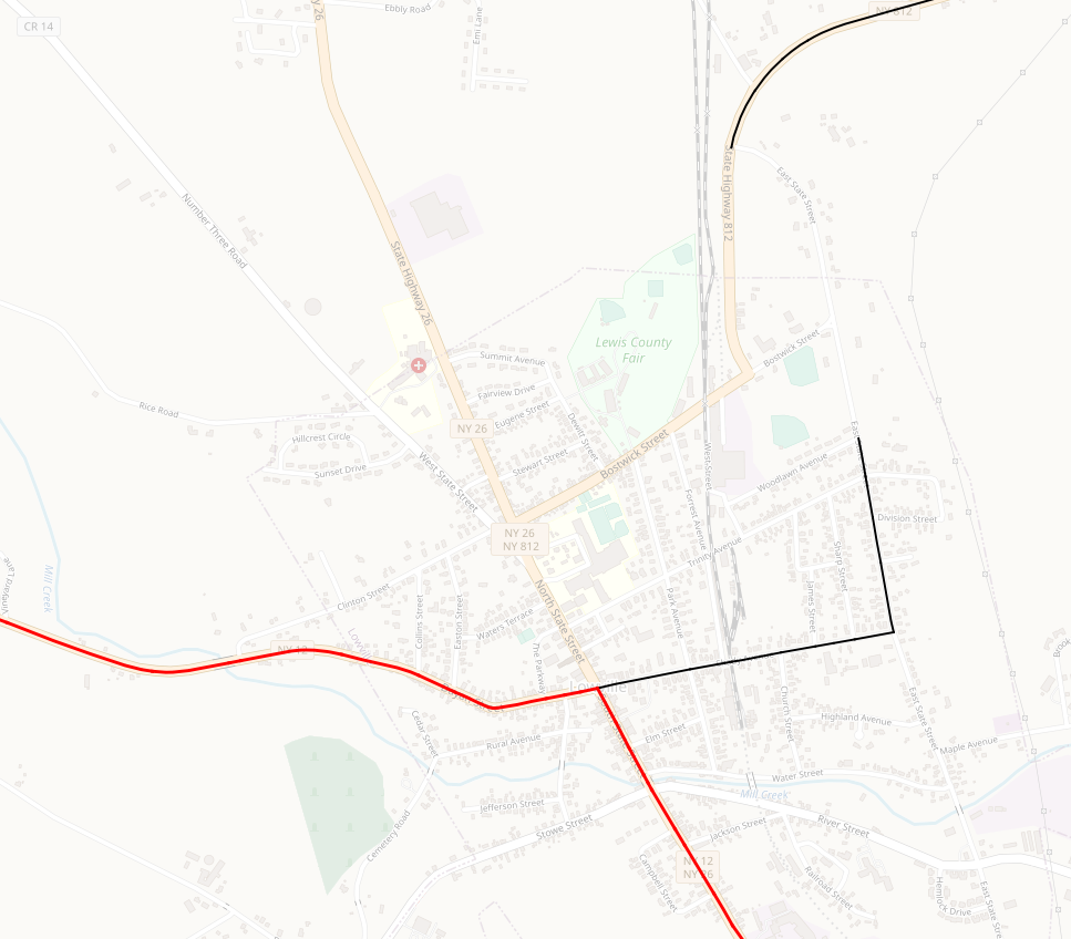
| 03:40, 6 September 2021 | NY-812-trunk-Lowville.png (file) |  |
350 KB | NY 812 arterial status interrupted near its terminus in Lowville | 1 |
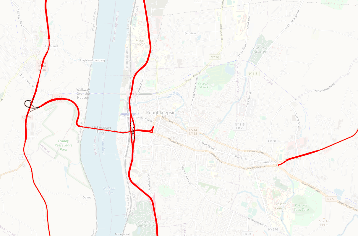
| 03:38, 6 September 2021 | US-44-trunk-Poughkeepsie.png (file) |  |
652 KB | Map showing how New York's arterial class interrupts US-44 in Poughkeepsie. | 1 |
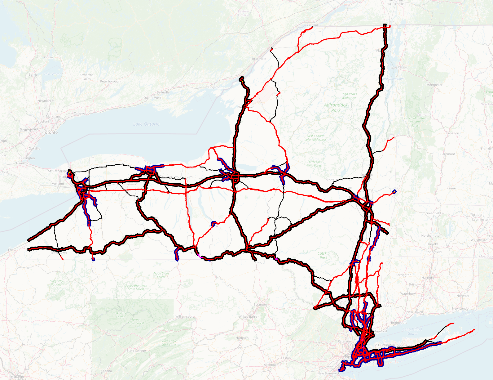
| 03:28, 6 September 2021 | NY-trunks.png (file) |  |
1.68 MB | Map of motorways and trunk roads in New York State. Motorways are shown with casings; trunk roads are treated according to road quality: thick red - multi-lane, divided, with grade crossings. Thin red - multilane, not divided. Thin black - two-lane. | 1 |
| 03:18, 6 September 2021 | NY-motorways-filtered.png (file) |  |
1.61 MB | New York highways at Arterial Classification Code 1. Motorways shown in red with black casings; the handful of trunk roads that remain shown in magenta. | 1 |
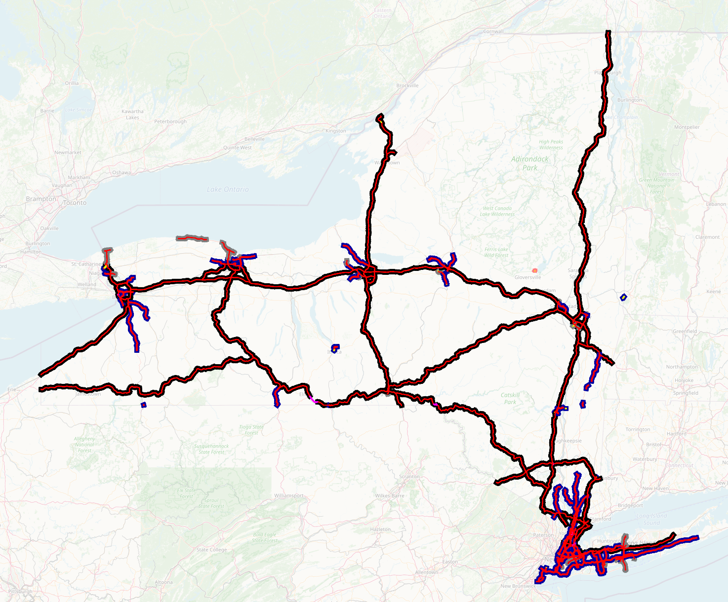
| 02:54, 6 September 2021 | NY-motorways-all.png (file) |  |
1.53 MB | Map showing all motorways in New York State, as defined as NYS DOT feature classes A10 through A18 (red), together with a couple of trunk links with arterial class 1 (magenta). Casing colour indicates arterial class code - black=1 (national significance), blue=2 (regional significance); grey=3 and below. | 1 |