Uploads by LeifRasmussen
Jump to navigation
Jump to search
This special page shows all uploaded files.
| Date | Name | Thumbnail | Size | Description | Versions |
|---|---|---|---|---|---|
| 19:51, 15 July 2019 | Laneconnectivity.svg (file) |  |
17 KB | A logo image representing lane connectivity. Image shows road sign of three lanes merging into two lanes. Original image created by me using Google Slides, downloaded as SVG, and then cropped with vectr.com. | 1 |
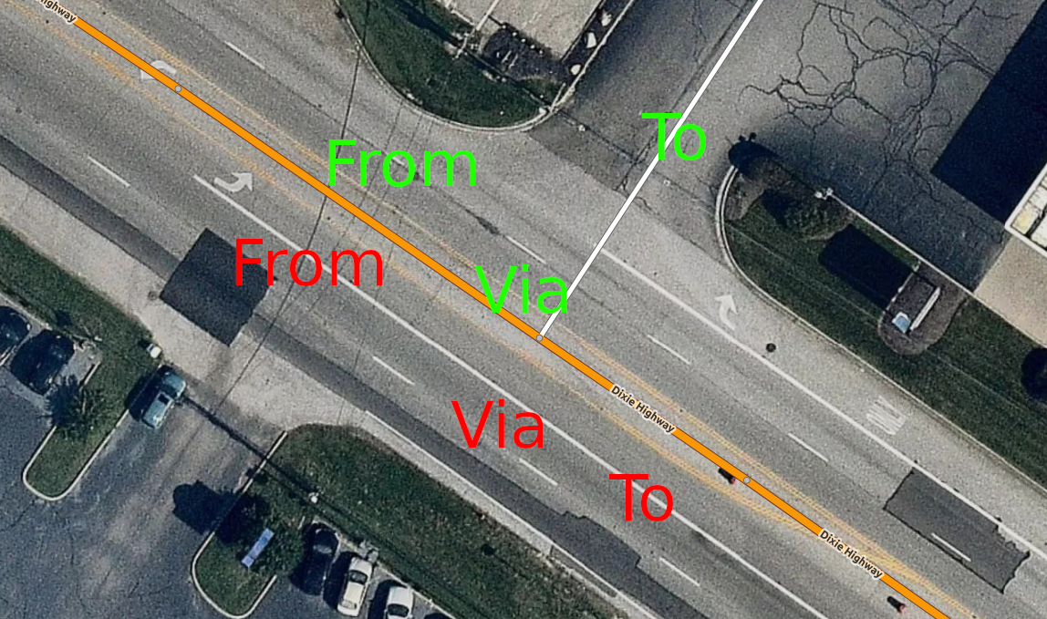
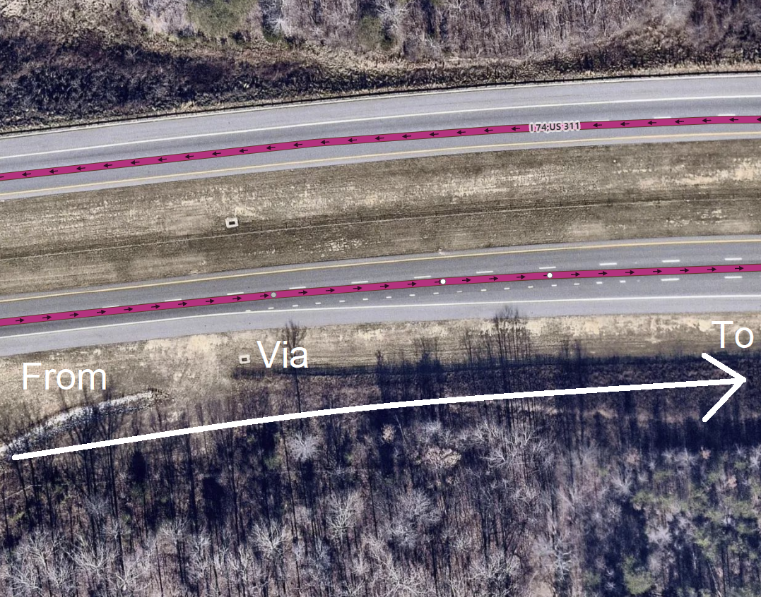
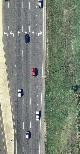
| 08:11, 1 July 2019 | ConnectivityBothWaysExample.png (file) |  |
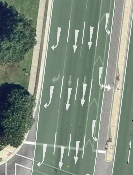
1.37 MB | Mapbox Satellite imagery of this location: https://www.osm.org/#map=19/39.33356/-84.52329 Demonstrates a situation where connectivity relations need both_ways lanes support. {{Mapbox image credit}} | 1 |
| 00:04, 12 June 2019 | ConnectivityExample8.png (file) |  |
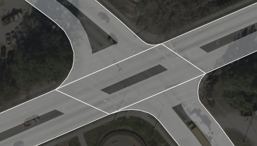
764 KB | A complex intersection where turn:lanes won't work properly unless the intersection is remodeled into some ridiculous shape that would make mapping other things (such as change:lanes) much more difficult. The image is Mapbox Satellite in iD of this loc... | 1 |
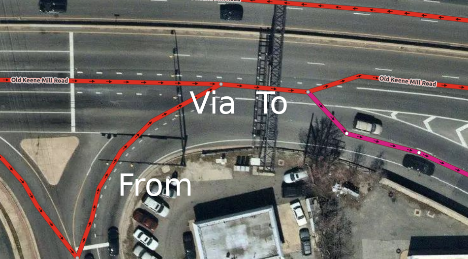
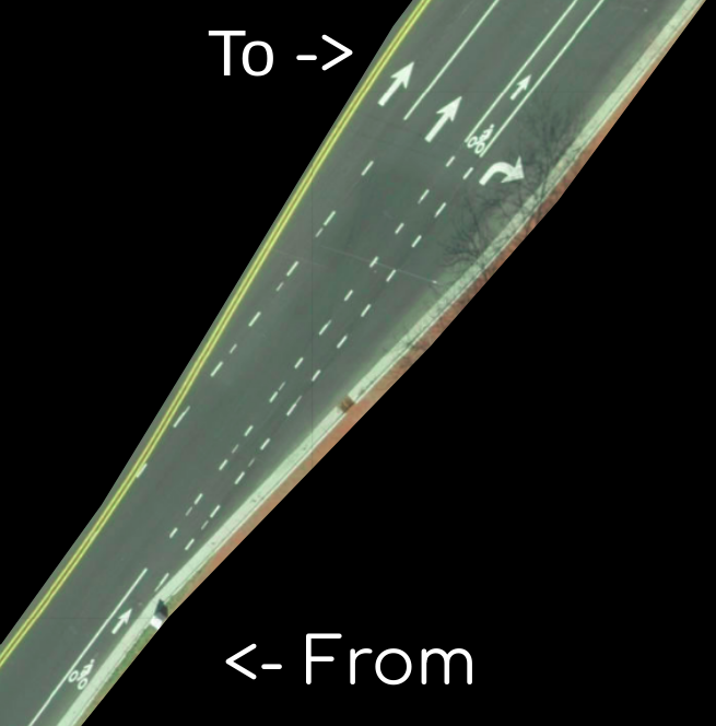
| 12:40, 10 June 2019 | ConnectivityExample7.png (file) |  |
692 KB | An example of where a connectivity relation could make existing lane assist (turn:lanes) more accurate. The left lane of the ''from'' way becomes a left turn lane in ''to'', so lane assist from navigation apps shouldn't suggest using that lane if the... | 1 |
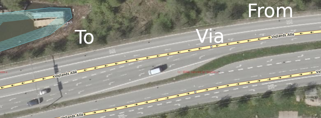
| 16:48, 2 June 2019 | Complex lane connectivity Vejlands Allé.png (file) |  |
434 KB | Updated the image to have a more correct mapping style. | 2 |
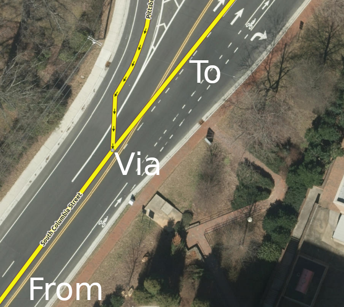
| 16:37, 2 June 2019 | ConnectivityExample4.png (file) |  |
666 KB | Better road alignment to encourage correct mapping. | 2 |
| 19:10, 1 June 2019 | ConnectivityExample5.png (file) |  |
416 KB | Higher resolution imagery and correct roadway mapping. | 2 |
| 18:32, 23 May 2019 | ConnectivityExample6.png (file) |  |
1.4 MB | Mapbox Satellite Imagery of this location: https://www.osm.org/#map=19/35.95352/-78.99353 | 1 |
| 18:30, 23 May 2019 | ConnectivityExample3.png (file) |  |
1.52 MB | Mapbox Satellite imagery of this location: https://www.osm.org/#map=19/35.93705/-79.94073 | 1 |
| 18:27, 23 May 2019 | ConnectivityExample2.png (file) |  |
493 KB | Mapbox Satellite imagery of this location: https://www.osm.org/#map=19/36.04096/-79.81771 | 1 |
| 18:26, 23 May 2019 | ConnectivityExample1.png (file) |  |
1.05 MB | I made north be up instead of down. | 2 |
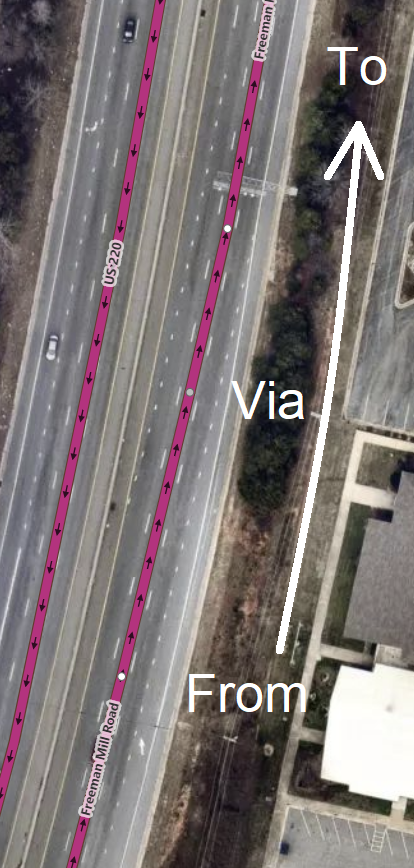
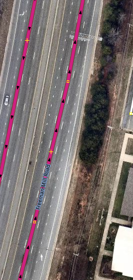
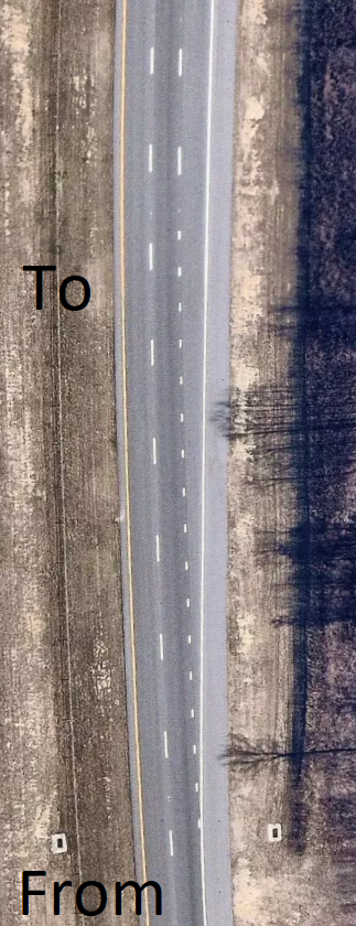
| 03:12, 21 May 2019 | US220 unusual lane connectivity greensboro.png (file) |  |
270 KB | 1 | |
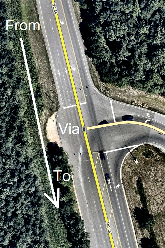
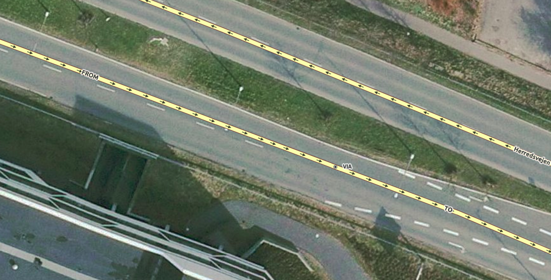
| 18:41, 14 May 2019 | ComplexConnectivityHerredsvejen.png (file) |  |
894 KB | 1 | |
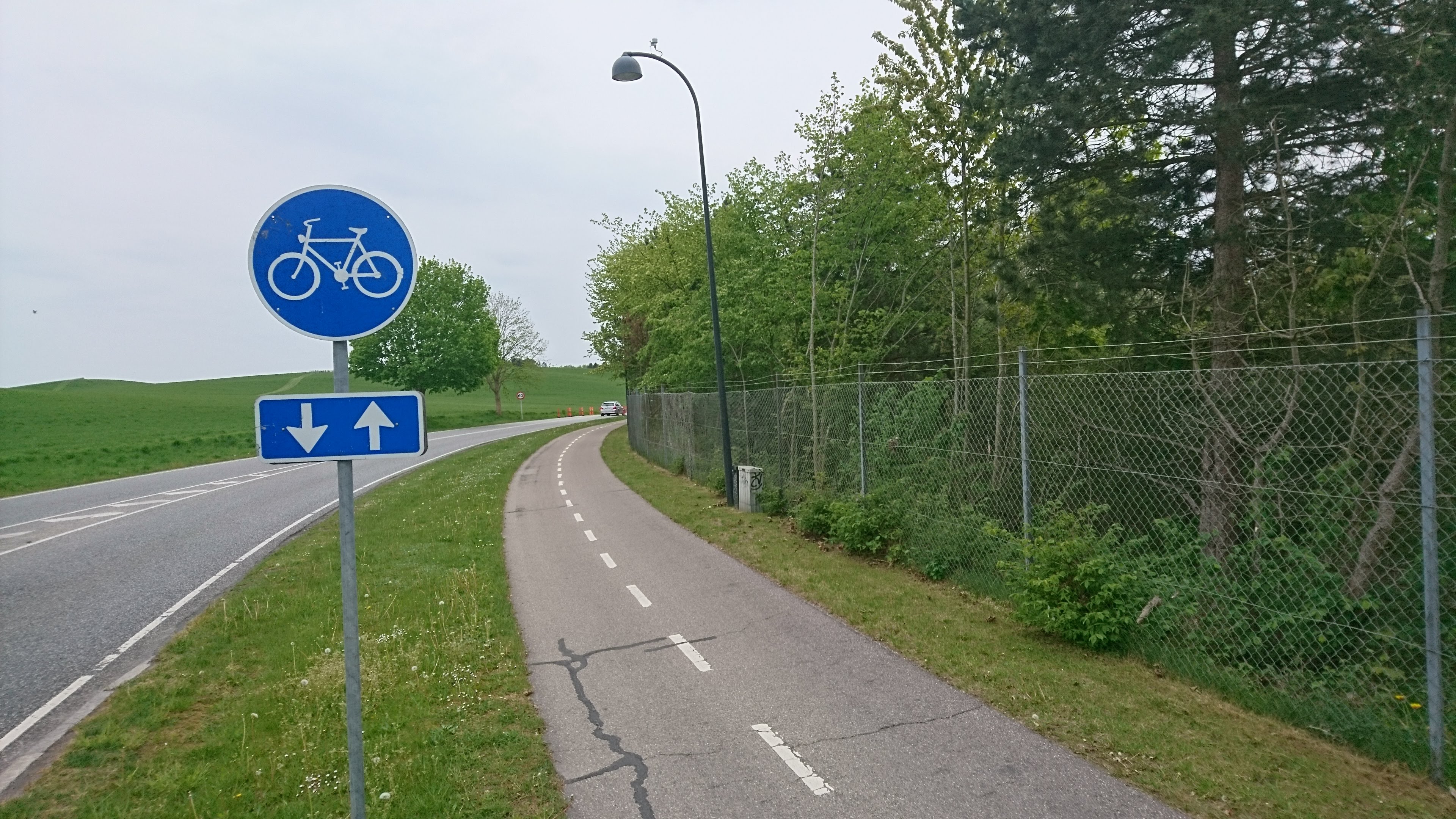
| 13:27, 14 May 2019 | BikePathBirkerod.JPG (file) |  |
1.7 MB | Image of a bike path in Northern Denmark. | 1 |
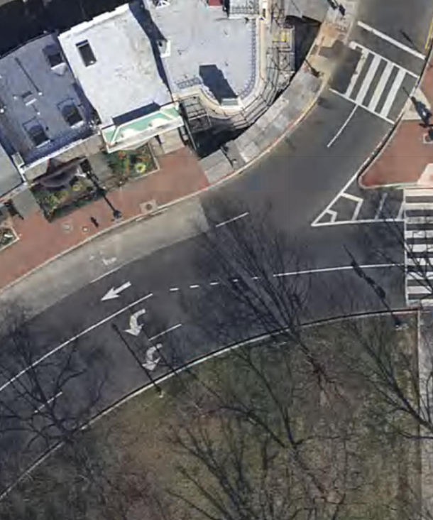
| 13:42, 30 April 2019 | LoganCircleWashingtonDC.png (file) |  |
2.06 MB | 1 | |
| 13:19, 30 April 2019 | Logan Circle DC complex connectivity highways merging together.png (file) |  |
871 KB | 1 | |
| 12:44, 30 April 2019 | Highway with lane opening on right.png (file) |  |
683 KB | 1 | |
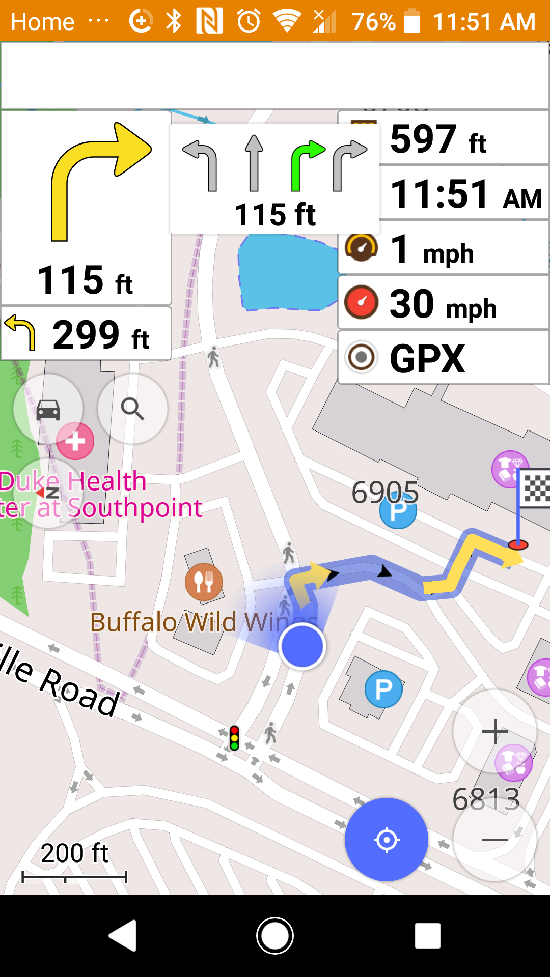
| 15:57, 29 April 2019 | OsmAnd Navigation Lane Assist.png (file) |  |
438 KB | 1 | |
| 15:28, 29 April 2019 | I40 Greensboro Complex Connectivity.png (file) |  |
1.44 MB | 1 | |
| 21:26, 24 April 2019 | Complex Intersection Connectivity Cincinnati Ohio.png (file) |  |
354 KB | 1 | |
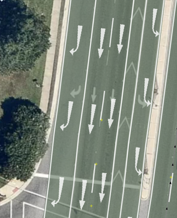
| 16:12, 23 April 2019 | CrossingRoadLanes.png (file) |  |
1.07 MB | 1 | |
| 15:04, 22 April 2019 | 2 Lane Roundabout Eugene Oregon USA.png (file) |  |
1.97 MB | 1 | |
| 22:24, 19 April 2019 | Road transitioning from 3 to 6 lanes.png (file) | 476 KB | 1 | ||
| 20:02, 19 April 2019 | Complicated Lanes changes South Great Jones Street.png (file) |  |
505 KB | 1 | |
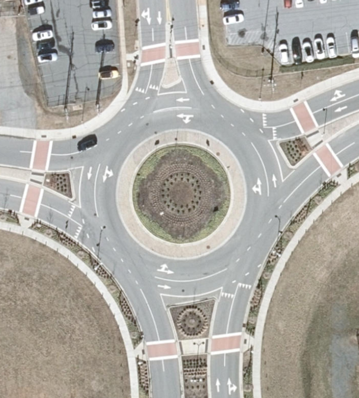
| 03:00, 19 April 2019 | ComplicatedRoundabout.png (file) |  |
712 KB | 1 | |
| 02:35, 19 April 2019 | BikeLaneCrossingDriveLane.png (file) |  |
219 KB | 1 | |
| 14:41, 18 April 2019 | 2-Lane-Roundabout-Winston-Salem-NC-With-Numbers.png (file) |  |
1.02 MB | 1 | |
| 14:36, 18 April 2019 | 2 Lane Roundabout Winston Salem NC.png (file) |  |
1.09 MB | 1 | |
| 20:57, 14 April 2019 | LanesRenderingCorrectlyWithIncorrectTagging.png (file) |  |
490 KB | 1 | |
| 19:02, 14 April 2019 | IncorrectLaneRendering.png (file) |  |
540 KB | 1 | |
| 03:31, 14 December 2018 | Street Area iD.jpg (file) |  |
49 KB | A screenshot of areaːhighway added in iD. All features except "landuse" are disabled. | 2 |
| 00:51, 6 November 2018 | NewiDPreset.png (file) |  |
1.04 MB | This is what a possible iD preset could look like for adding timetable relations to bus stops. | 1 |
| 22:46, 30 October 2018 | BusStopTimetable.jpeg (file) |  |
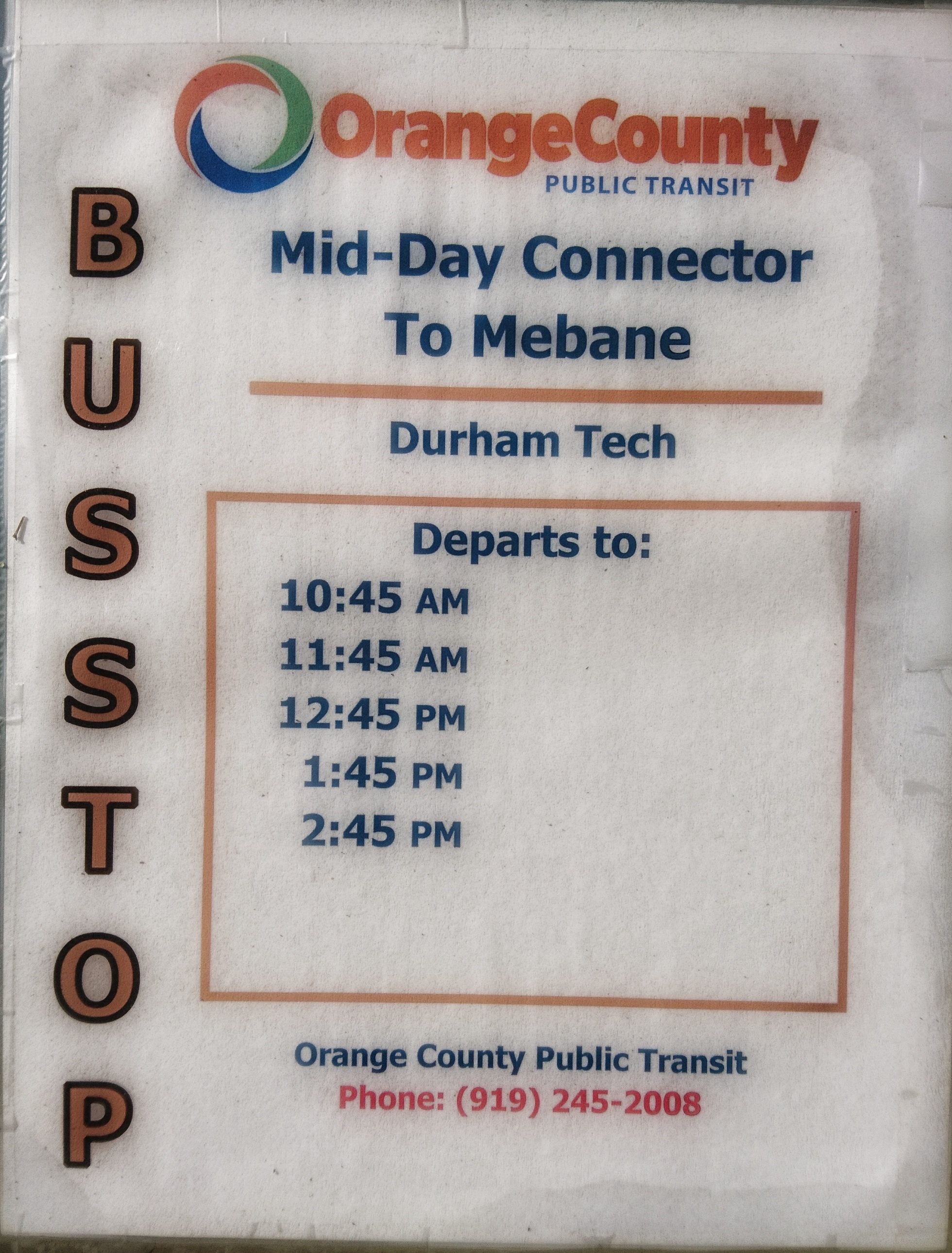
1.68 MB | An image of a list of arrival times for a bus stop in North Carolina, USA. Location of image: https://www.osm.org/node/5526080193 https://osm.org/go/ZS_wBonbm?m= | 1 |