Uploads by Mabull
Jump to navigation
Jump to search
This special page shows all uploaded files.
| Date | Name | Thumbnail | Size | Description | Versions |
|---|---|---|---|---|---|
| 16:07, 16 August 2016 | Mapnik old-tracktype.png (file) |  |
3 KB | '''Please put this image into the TagDescription boxes of Key:tracktype and their language variants!''' | 1 |
| 14:40, 26 February 2016 | Osmose-eg-error-1050.png (file) |  |
20 KB | 3 | |
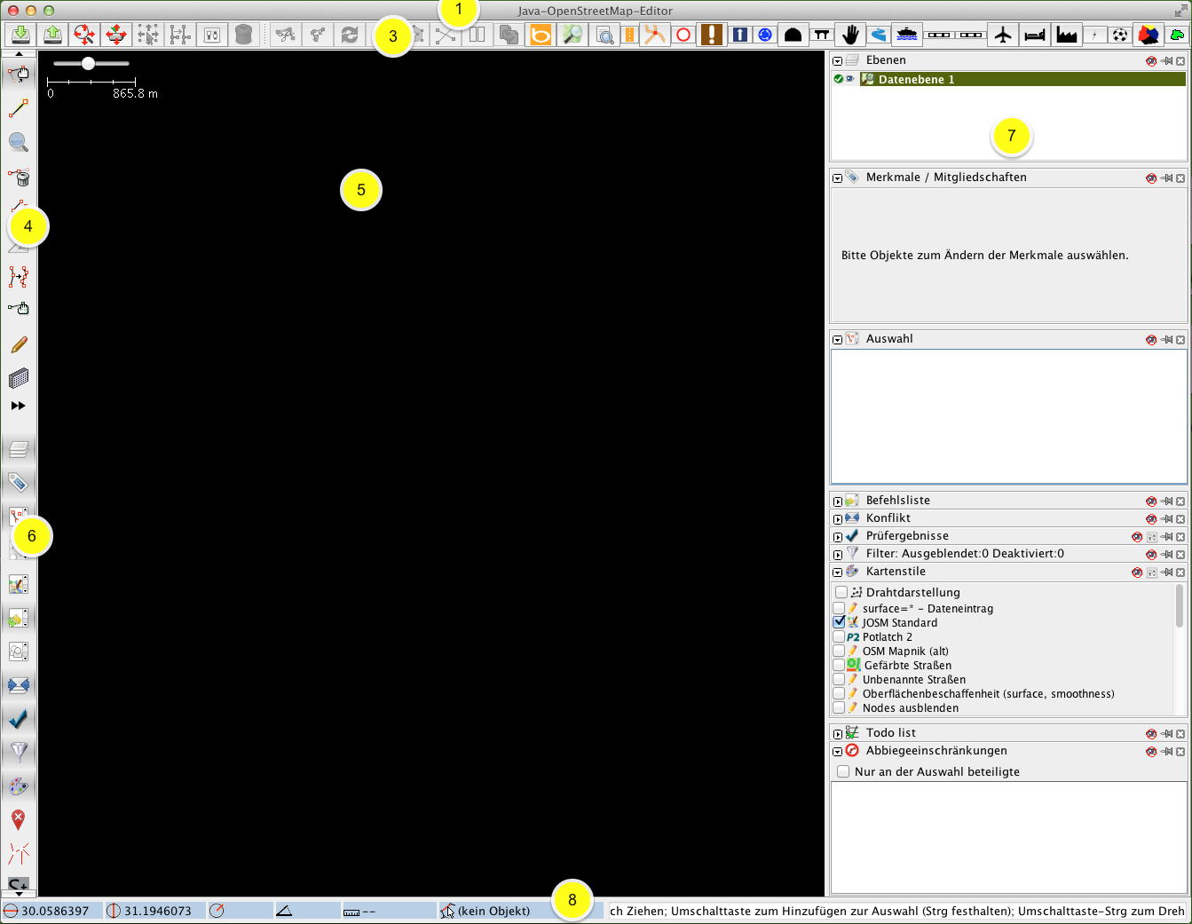
| 12:33, 6 January 2016 | JOSM Programmfenster.png (file) |  |
345 KB | Neuste JOSM-Version auf Mac OS X mit Nummern. Die 2 wurde weggelassen, da die Menüleiste bei meinem Erscheinungsbild nicht mehr ins JOSM-Fenster integriert ist, sondern sich oben in der Kopfleiste des Bildschirms befindet (auf dem Bild nicht sichtbar) | 4 |
| 18:08, 29 December 2015 | Rendering-area-landuse farmyard-mapnik.png (file) |  |
2 KB | Created with Paintbrush | 5 |
| 12:46, 26 December 2015 | Rendering-traffic singals.jpg (file) |  |
3 KB | Created with Paintbrush | 6 |
| 12:44, 26 December 2015 | Rendering-highway-road-mapnik.png (file) |  |
2 KB | Created with Paintbrush | 4 |
| 12:43, 26 December 2015 | Rendering-highway track.png (file) |  |
2 KB | Created with Paintbrush | 5 |
| 12:42, 26 December 2015 | Pedestrian with area osm.png (file) |  |
2 KB | Created with Paintbrush | 4 |
| 12:42, 26 December 2015 | Living street osm.png (file) |  |
2 KB | Created with Paintbrush | 4 |
| 12:39, 26 December 2015 | Rendering-highway service.png (file) |  |
2 KB | Created with Paintbrush | 7 |
| 12:39, 26 December 2015 | Rendering-highway residential.png (file) |  |
2 KB | Created with Paintbrush | 6 |
| 12:38, 26 December 2015 | Rendering-highway unclassified.png (file) |  |
2 KB | Created with Paintbrush | 5 |
| 12:37, 26 December 2015 | Rendering-highway tertiary neutral.png (file) |  |
2 KB | Created with Paintbrush | 6 |
| 12:37, 26 December 2015 | Rendering-highway secondary neutral.png (file) |  |
2 KB | Created with Paintbrush | 6 |
| 12:37, 26 December 2015 | Rendering-highway primary neutral.png (file) |  |
2 KB | Created with Paintbrush | 7 |
| 12:36, 26 December 2015 | Rendering-highway trunk L3005 MF.png (file) |  |
2 KB | Created with Paintbrush | 4 |
| 12:34, 26 December 2015 | Rendering-highway motorway neutral.png (file) |  |
2 KB | Created with Paintbrush | 9 |
| 14:07, 19 October 2015 | Landuse-commercial.png (file) |  |
2 KB | New mapnik rendering: Lighter colour | 4 |
| 14:05, 19 October 2015 | Landuse-retail.png (file) |  |
2 KB | New mapnik rendering | 5 |
| 11:07, 1 September 2015 | Rendering-landuse-quarry-mapnik.png (file) |  |
2 KB | New mapnik rendering: New pattern | 5 |
| 13:42, 16 August 2015 | Path osm.png (file) |  |
1 KB | New mapnik rendering: Same rendering as highway=footway, if it doesn't have the tag bicycle=yes or bicycle=designated. | 4 |
| 13:33, 16 August 2015 | Rendering-area-natural-wood.png (file) |  |
4 KB | New mapnik rendering: Now same rendering as landuse=forest | 3 |
| 08:39, 15 August 2015 | Landuse-forest.png (file) |  |
4 KB | New mapnik rendering: Lighter colour like natural=wood and new pattern | 10 |
| 14:10, 5 August 2015 | Rendering-adminlevel 11-mapnik.png (file) | 2 KB | 1 | ||
| 14:05, 5 August 2015 | 62719.png (file) | 2 KB | 2 | ||
| 09:43, 1 August 2015 | Orchard.png (file) |  |
2 KB | New mapnik rendering: Lighter color | 7 |
| 09:41, 1 August 2015 | Landuse-vineyard.png (file) |  |
2 KB | New mapnik rendering: New pattern and a little bit darker color | 3 |
| 19:19, 28 July 2015 | Rendering-highway steps.png (file) |  |
1 KB | Created with Paintbrush | 7 |
| 18:58, 28 July 2015 | Punkt-grün.jpg (file) |  |
9 KB | Selbst gezeichnet mit Paintbrush | 2 |
| 14:43, 5 July 2015 | Rendering-area-railway turntable-mapnik.png (file) |  |
4 KB | smaller version | 2 |
| 13:05, 4 July 2015 | Leisure-park-osb.png (file) |  |
3 KB | Symbol from the JOSM editor | 1 |
| 07:53, 4 July 2015 | Leisure-nature reserve-osb.png (file) |  |
1 KB | 1 | |
| 07:42, 4 July 2015 | Leisure-water park-osb.png (file) |  |
1 KB | 1 | |
| 20:38, 3 July 2015 | Leisure-slipway-osb.png (file) |  |
2 KB | 1 | |
| 20:33, 3 July 2015 | Leisure-marina-osb.png (file) |  |
2 KB | 1 | |
| 20:20, 3 July 2015 | Leisure-golf course-osb.png (file) |  |
2 KB | 1 | |
| 13:33, 28 June 2015 | Mf way.png (file) |  |
462 bytes | Reverted to version as of 13:50, 18 June 2007 | 6 |
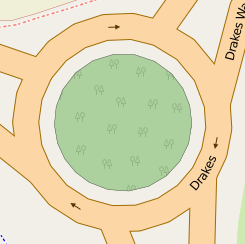
| 11:14, 21 June 2015 | Rendering-natural bay-mapnik.png (file) |  |
2 KB | OSM Mapnik | 1 |
| 11:43, 20 June 2015 | Planned mapnik.png (file) |  |
3 KB | New mapnik rendering: Transparent line | 3 |
| 11:32, 20 June 2015 | Rendering-highway-bus guideway-mapnik.png (file) |  |
761 bytes | Reverted to version as of 04:44, 17 May 2014 | 5 |
| 17:33, 9 May 2015 | Landuse-industrial.png (file) |  |
2 KB | New mapnik rendering: Lighter color | 3 |
| 15:08, 15 March 2015 | Render Weir1.png (file) |  |
4 KB | Actually mapnik rendering: Grey lines on the upper left and on the right side | 2 |
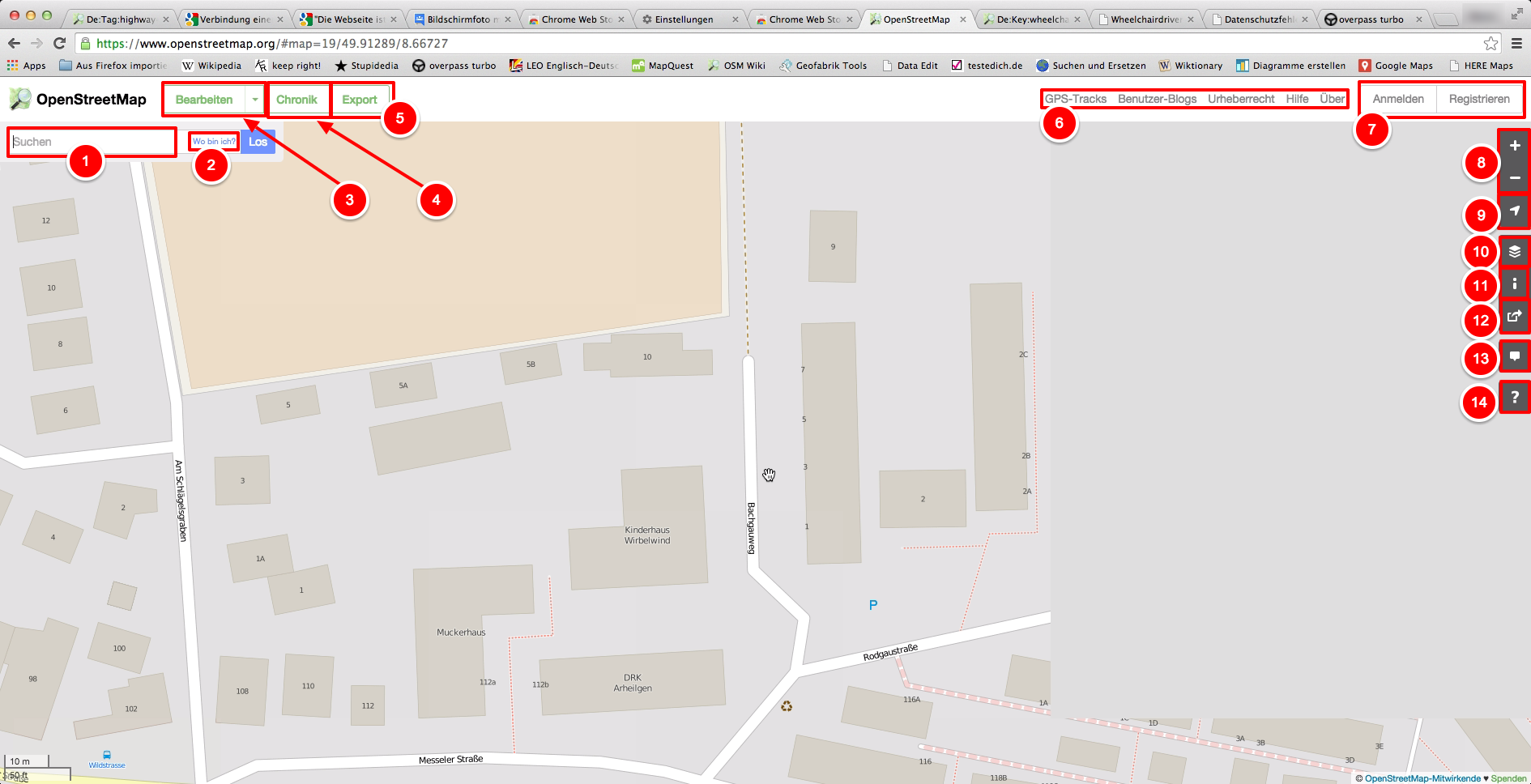
| 15:51, 9 February 2015 | Browsing-de.png (file) |  |
440 KB | Selbst erstellt mit [https://chrome.google.com/webstore/detail/awesome-screenshot-app/afkccfnochoebimhhniekgcegeeiepmi Awesome Screenshot App] | 1 |
| 17:16, 23 January 2015 | Highway service parkingaisle.svg (file) |  |
3 KB | 1 | |
| 14:05, 5 January 2015 | Potlatch2-ErrorCouldntLoadTheMap.png (file) |  |
18 KB | 1 | |
| 14:24, 4 January 2015 | Rendering-area-building-yes.png (file) |  |
5 KB | New mapnik rendering: brighter color | 2 |
| 12:11, 22 November 2014 | Rendering-barrier-hedge.png (file) |  |
3 KB | Transparent version | 2 |
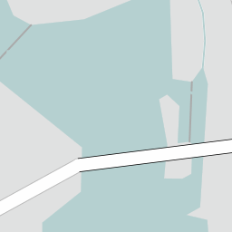
| 13:07, 28 October 2014 | Rendering-highway path bridge yes-mapnik.png (file) | 2 KB | Mapnik map tile from openstreetmap.org | 1 | |
| 12:30, 18 September 2014 | Rendering-highway cycleway.png (file) | 2 KB | 2 | ||
| 12:42, 26 August 2014 | Centre line.jpeg (file) | 3 KB | Another photo | 1 |