Uploads by Mueck
Jump to navigation
Jump to search
This special page shows all uploaded files.
| Date | Name | Thumbnail | Size | Description | Versions |
|---|---|---|---|---|---|
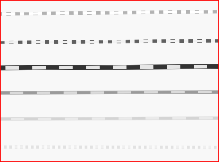
| 18:22, 14 August 2010 | Railway timeline.PNG (file) |  |
26 KB | railway timeline at z17 supported by Osmarender at August 2010: - proposed/planned - construction - ... - disused - abandoned/dismantled - razed License: CC-BY-NC-SA | 1 |
| 23:48, 18 May 2010 | Rendering-Basin-Types.png (file) |  |
49 KB | rendering three types of basin, snipping from screen | 1 |
| 15:47, 18 June 2009 | B3wolf.jpg (file) |  |
59 KB | De: Bsp. für Straßenklassifizierung: B 3 neu, Umfahrung Wolfartsweier En: example for highway tags Source: own photography 2009-06-18 License: CC-BY-NC-SA Place: B 10 Karlsruhe-Wolfartsweier :http://www.openstreetmap.org/?lat=48.98679&lon=8.44395&zoo | 1 |
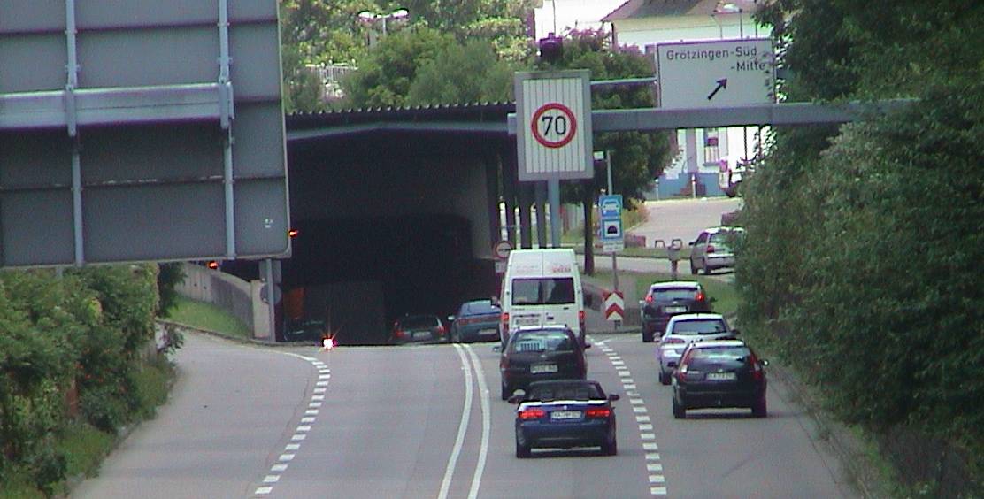
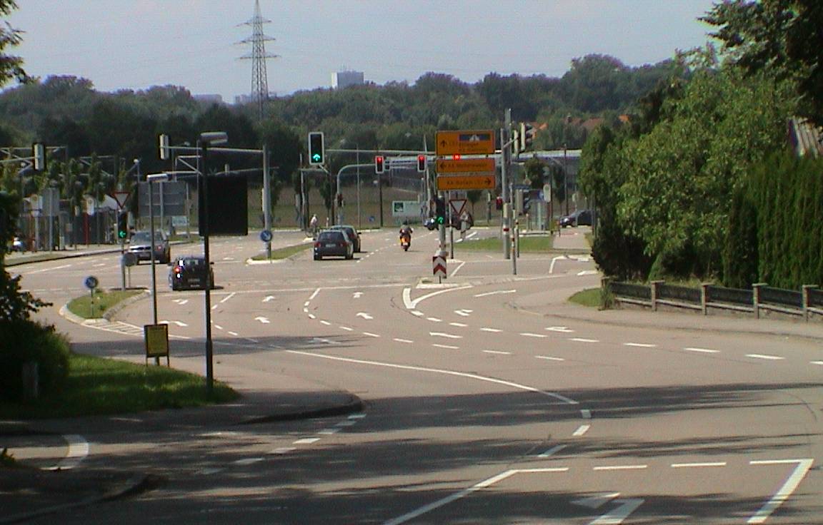
| 15:45, 18 June 2009 | B10groetzb.jpg (file) |  |
99 KB | De: Bsp. für Straßenklassifizierung: Kreuz B 3 / B 10 En: example for highway tags Source: own photography 2009-06-18 License: CC-BY-NC-SA Place: B 10 Karlsruhe-Grötzingen :http://www.openstreetmap.org/?lat=49.00651&lon=8.48844&zoom=17&layers=0B00F | 1 |
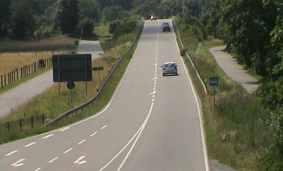
| 15:43, 18 June 2009 | B10groetza.jpg (file) |  |
81 KB | De: Bsp. für Straßenklassifizierung: B 10 vor Grötzinger Tunnel En: example for highway tags Source: own photography 2009-06-18 License: CC-BY-NC-SA Place: B 10 Karlsruhe-Grötzingen :http://www.openstreetmap.org/?lat=49.00572&lon=8.49285&zoom=17&l | 1 |
| 15:41, 18 June 2009 | B10elfc.jpg (file) |  |
100 KB | De: Bsp. für Straßenklassifizierung: Kreuzung B 10 neu / Elfmorgenbruchstr. En: example for highway tags Source: own photography 2009-06-18 License: CC-BY-NC-SA Place: K 9652 Karlsruhe-Hagsfeld :http://www.openstreetmap.org/?lat=49.018284&lon=8.4587 | 1 |
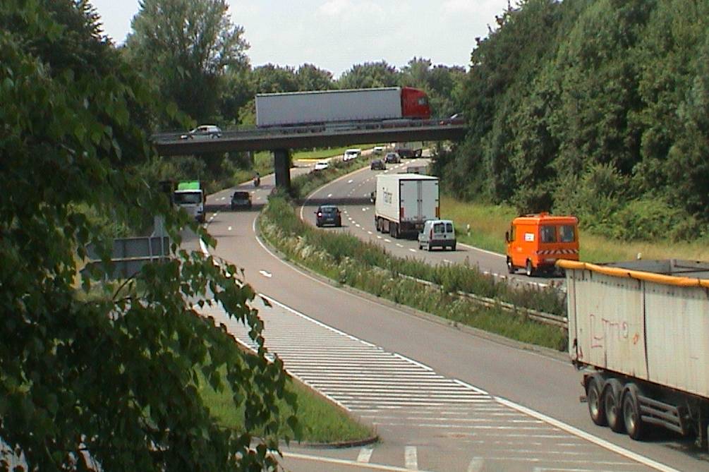
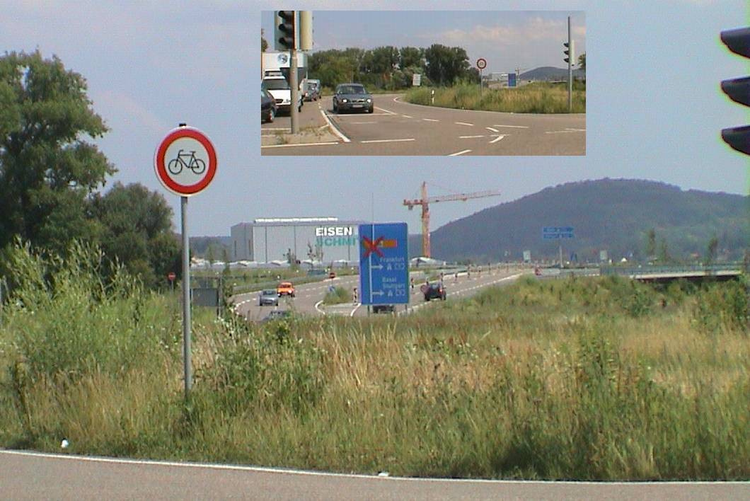
| 15:37, 18 June 2009 | Suedtangente3.jpg (file) |  |
107 KB | De: Bsp. für Straßenklassifizierung: Südtangente, hier B 10, ab hier keine Kraftfahrstraße En: example for highway tags Source: own photography 2009-06-18 License: CC-BY-NC-SA Place: K 9652 Karlsruhe-Knielingen :http://www.openstreetmap.org/?lat=4 | 1 |
| 15:36, 18 June 2009 | Suedtangente2.jpg (file) |  |
89 KB | De: Bsp. für Straßenklassifizierung: Südtangente, hier B 10, ab hier keine Kraftfahrstraße En: example for highway tags Source: own photography 2009-06-18 License: CC-BY-NC-SA Place: K 9652 Karlsruhe-Knielingen :http://www.openstreetmap.org/?lat=4 | 1 |
| 15:35, 18 June 2009 | Suedtangente1.jpg (file) |  |
73 KB | De: Bsp. für Straßenklassifizierung: Südtangente, hier B 10, ab hier keine Kraftfahrstraße En: example for highway tags Source: own photography 2009-06-18 License: CC-BY-NC-SA Place: K 9652 Karlsruhe-Knielingen :http://www.openstreetmap.org/?lat=4 | 1 |
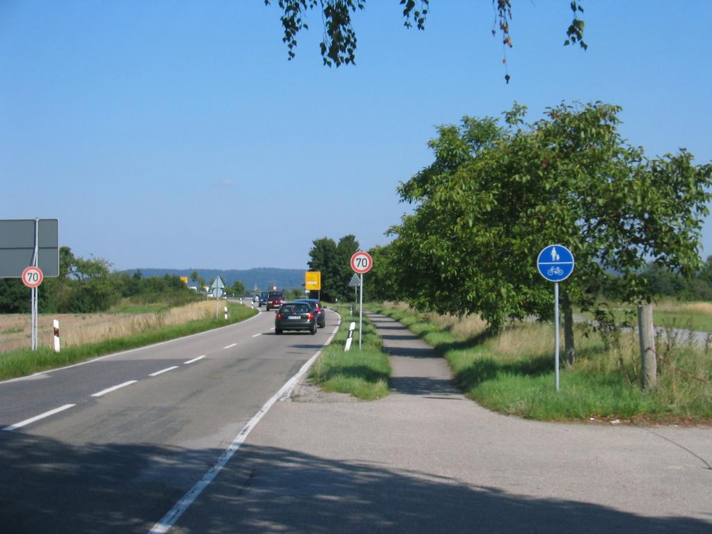
| 15:31, 18 June 2009 | K9652i.jpg (file) |  |
103 KB | De: Bsp. für Straßenklassifizierung: Kreisstraße 9652 an ihrem Westende, wo sie als Südtangente weiter geht, aber als K 9657 (diese von rechts) En: example for highway tags Source: own photography 2009-06-18 License: CC-BY-NC-SA Place: K 9652 Karls | 1 |
| 15:28, 18 June 2009 | K9652h.jpg (file) |  |
122 KB | De: Bsp. für Straßenklassifizierung: Kreisstraße 9652 an Autobahnabfahrt Karlsruhe-Mitte En: example for highway tags Source: own photography 2009-06-18 License: CC-BY-NC-SA Place: K 9652 Karlsruhe-Mitte :http://www.openstreetmap.org/?lat=48.992898& | 1 |
| 15:26, 18 June 2009 | K9652g.jpg (file) |  |
96 KB | De: Bsp. für Straßenklassifizierung: Kreisstraße 9652 an Autobahnabfahrt Karlsruhe-Mitte En: example for highway tags Source: own photography 2009-06-18 License: CC-BY-NC-SA Place: K 9652 Karlsruhe-Mitte :http://www.openstreetmap.org/?lat=48.989198& | 1 |
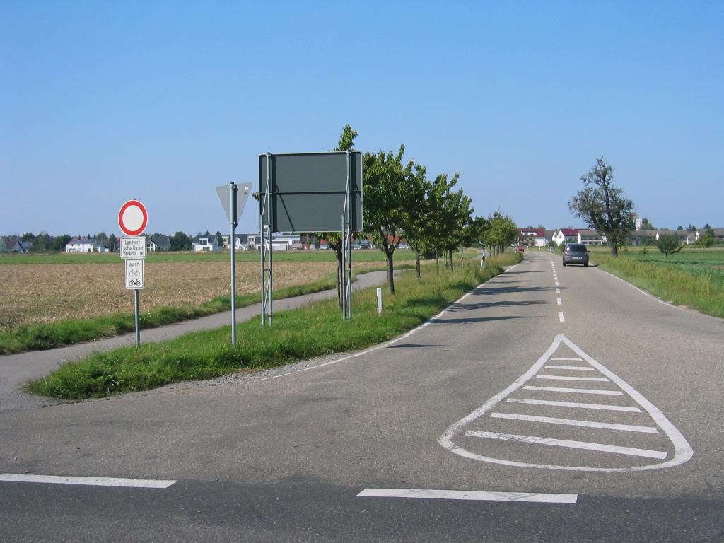
| 15:23, 18 June 2009 | K9652f.jpg (file) |  |
84 KB | De: Bsp. für Straßenklassifizierung: B 3 neu (ex-Kreisstraße 9652) Kreuzung Fiduciastr. En: example for highway tags Source: own photography 2009-06-18 License: CC-BY-NC-SA Place: K 9652 Karlsruhe-Aue Fiduciastr. :http://www.openstreetmap.org/?lat=4 | 1 |
| 15:18, 18 June 2009 | K9652e.jpg (file) |  |
105 KB | De: Bsp. für Straßenklassifizierung: Kreisstraße 9652 Kreuzung Karlsruhe-Zündhütle mit B 3 En: example for highway tags Source: own photography 2009-06-18 License: CC-BY-NC-SA Place: K 9652 Karlsruhe Zündhütle :http://www.openstreetmap.org/?lat | 1 |
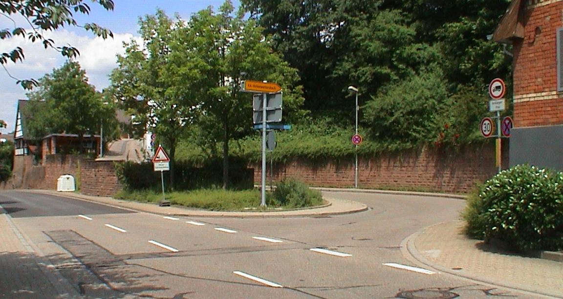
| 15:13, 18 June 2009 | K9652d.jpg (file) |  |
45 KB | De: Bsp. für Straßenklassifizierung: Kreisstraße 9652 Ortsdurchfahrt Karlsruhe-Hohenwettersbach En: example for highway tags Source: own photography 2009-06-18 License: CC-BY-NC-SA Place: K 9652 Karlsruhe-Hohenwettersbach :http://www.openstreetmap. | 1 |
| 15:11, 18 June 2009 | K9652c.jpg (file) |  |
34 KB | De: Bsp. für Straßenklassifizierung: Kreisstraße 9652 Ortsdurchfahrt Karlsruhe-Grünwettersbach En: example for highway tags Source: own photography 2009-06-18 License: CC-BY-NC-SA Place: K 9652 Karlsruhe-Grünwettersbach :http://www.openstreetmap. | 1 |
| 15:11, 18 June 2009 | K9652b.jpg (file) |  |
40 KB | De: Bsp. für Straßenklassifizierung: Kreisstraße 9652 Ortsdurchfahrt Karlsruhe-Grünwettersbach En: example for highway tags Source: own photography 2009-06-18 License: CC-BY-NC-SA Place: K 9652 Karlsruhe-Grünwettersbach :http://www.openstreetmap. | 1 |
| 15:08, 18 June 2009 | K9652a.jpg (file) |  |
119 KB | De: Bsp. für Straßenklassifizierung: Kreisstraße 9652 an ihrem Südende in Karlsruhe-Grünwettersbach von der L 623 abzweigend En: example for highway tags Source: own photography 2009-06-18 License: CC-BY-NC-SA Place: L 623 / K 9652 :http://www.op | 1 |
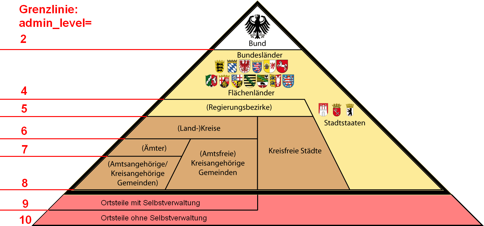
| 18:09, 29 November 2008 | Administrative Gliederung Deutschlands admin level.png (file) |  |
102 KB | added admin_levels in Germany into http://commons.wikimedia.org/wiki/Image:Administrative_Gliederung_Deutschlands.png?uselang=de Licence: CC-BY-SA 2.0 http://creativecommons.org/licenses/by-sa/2.0/de/deed.en | 1 |
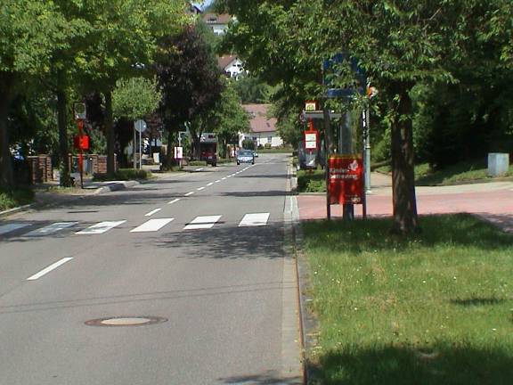
| 11:28, 8 September 2008 | Bsp seitenstreifen.jpg (file) |  |
114 KB | De: Bsp. für Radwege: "Seitenstreifen ohne weitere Angaben", En: example for cycleways: "lane, no specification" Source: own photography License: CC-BY-NC-SA | 1 |
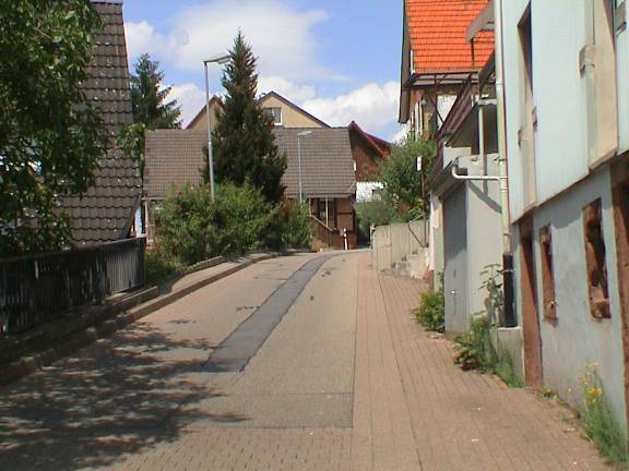
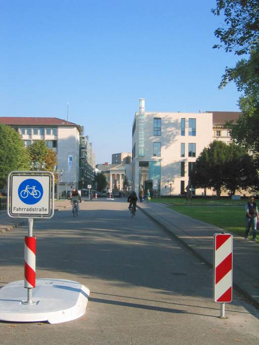
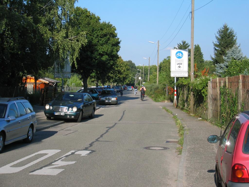
| 11:27, 8 September 2008 | Bsp radstr ohne.jpg (file) |  |
45 KB | De: Bsp. für Radwege: "Fahrradstraße ohne Kfz", En: example for cycleways: "cycle "street", motor=no" Source: own photography License: CC-BY-NC-SA | 1 |
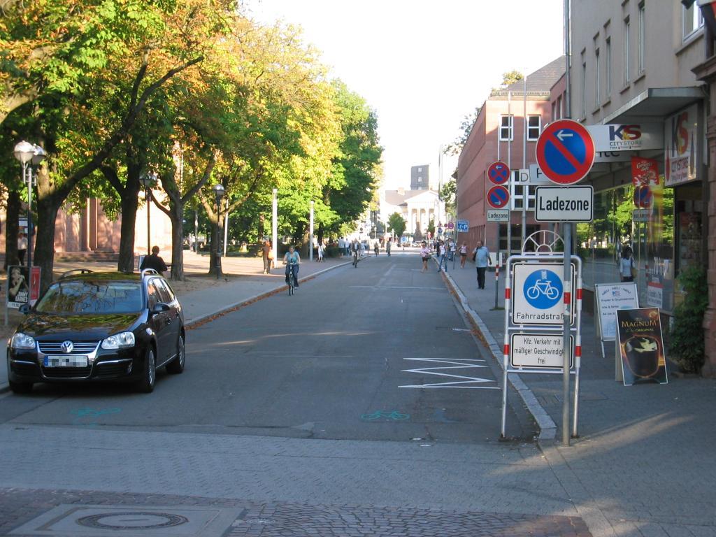
| 11:26, 8 September 2008 | Bsp radstr mit2.jpg (file) |  |
140 KB | De: Bsp. für Radwege: "Fahrradstraße mit Kfz", En: example for cycleways: "cycle "street", motor=yes" Source: own photography License: CC-BY-NC-SA | 1 |
| 11:26, 8 September 2008 | Bsp radstr mit.jpg (file) |  |
149 KB | De: Bsp. für Radwege: "Fahrradstraße mit Kfz", En: example for cycleways: "cycle "street", motor=yes" Source: own photography License: CC-BY-NC-SA | 1 |
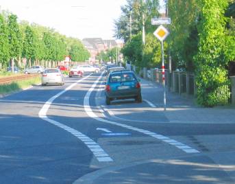
| 11:25, 8 September 2008 | Bsp radspur.jpg (file) |  |
18 KB | De: Bsp. für Radwege: "Radspur innerorts", En: example for cycleways: "cycle lane, mandatory" Source: own photography License: CC-BY-NC-SA | 1 |
| 11:24, 8 September 2008 | Bsp getr radweg.jpg (file) |  |
19 KB | De: Bsp. für Radwege: "getrennter Geh-/Radweg innerorts", En: example for cycleways: "bicycles/pedestrians separated urban" Source: own photography License: CC-BY-NC-SA | 1 |
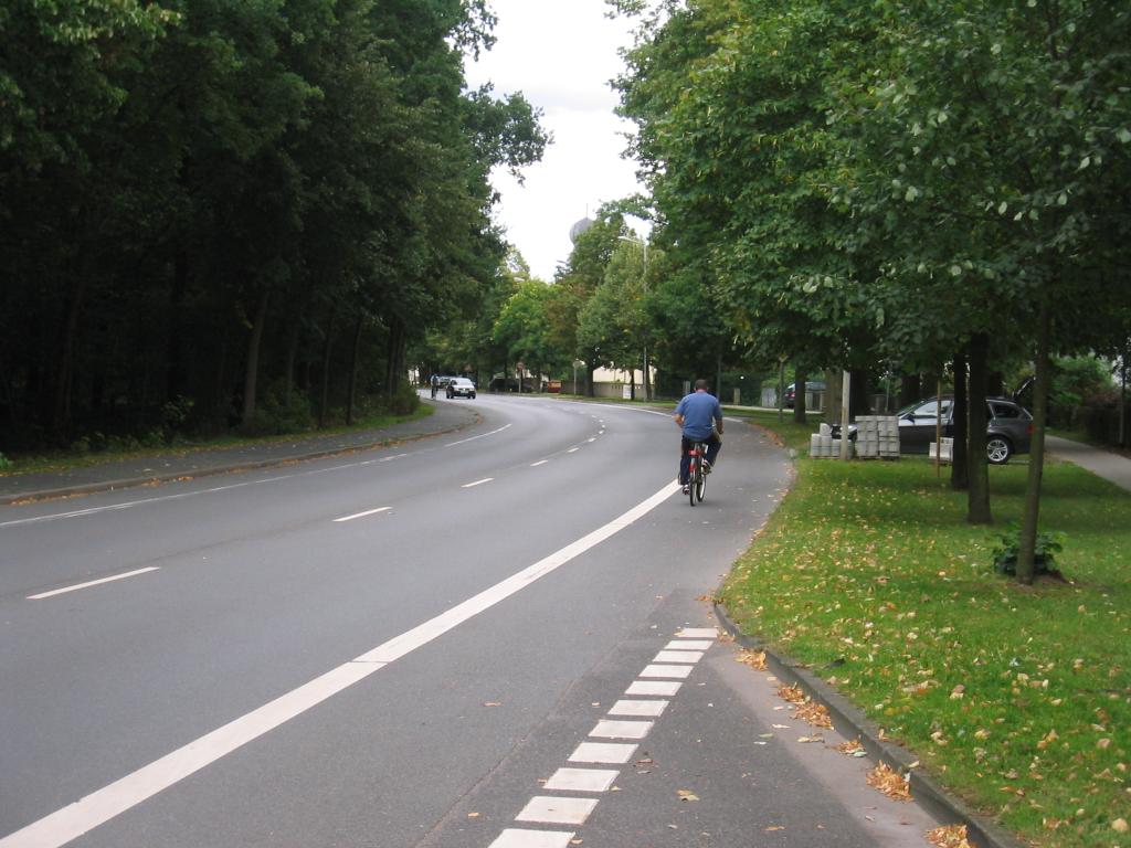
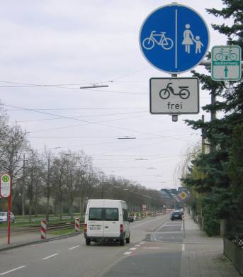
| 11:23, 8 September 2008 | Bsp gem rad ausser.jpg (file) |  |
92 KB | De: Bsp. für Radwege: "gemeinsamer Geh-/Radweg außerorts", En: example for cycleways: "bicycles/pedestrians mixed rural" Source: own photography License: CC-BY-NC-SA | 1 |
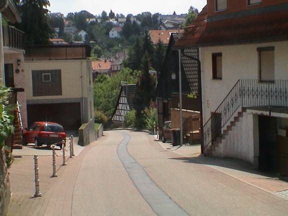
| 11:19, 8 September 2008 | Bsp feldweg.jpg (file) |  |
103 KB | De: "Feldweg", En: "track" Source: own photography License: CC-BY-NC-SA | 1 |
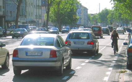
| 11:18, 8 September 2008 | Bsp angebot.jpg (file) |  |
19 KB | De: "Angebotsstreifen/Suggestivstreifen/Schutzstreifen" Source: own photography License: CC-BY-NC-SA | 1 |