Uploads by Multimodaal
Jump to navigation
Jump to search
This special page shows all uploaded files.
| Date | Name | Thumbnail | Size | Description | Versions |
|---|---|---|---|---|---|
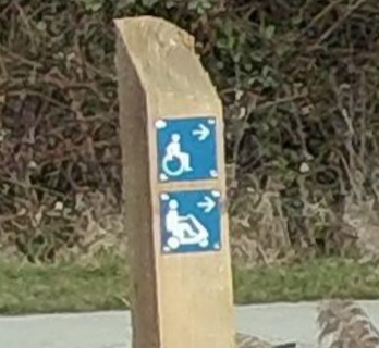
| 09:21, 12 March 2024 | Separate signed routes for wheelchair and mobility scooters.png (file) |  |
171 KB | {{Information | description=Separate signed routes for wheelchair and mobility scooters | source=survey | date=2024 | author=Multimodaal }} | 1 |
| 18:35, 11 March 2024 | Mobility scooter-route.png (file) |  |
322 KB | {{Information | description=Sign indicating Mobility_scooter-route | source=survey | date=2024 | author=Multimodaal }} | 1 |
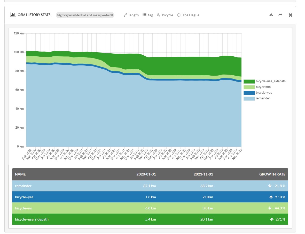
| 00:25, 4 January 2024 | Bicycle-residential-50-Den Haag-Ohsome.jpg (file) |  |
122 KB | {{Information | description=Tagging for bicycle=* on residential-50km/u in Den_Haag | source=ohsome - HeiGIT | date= | author= | other_versions= }} | 1 |
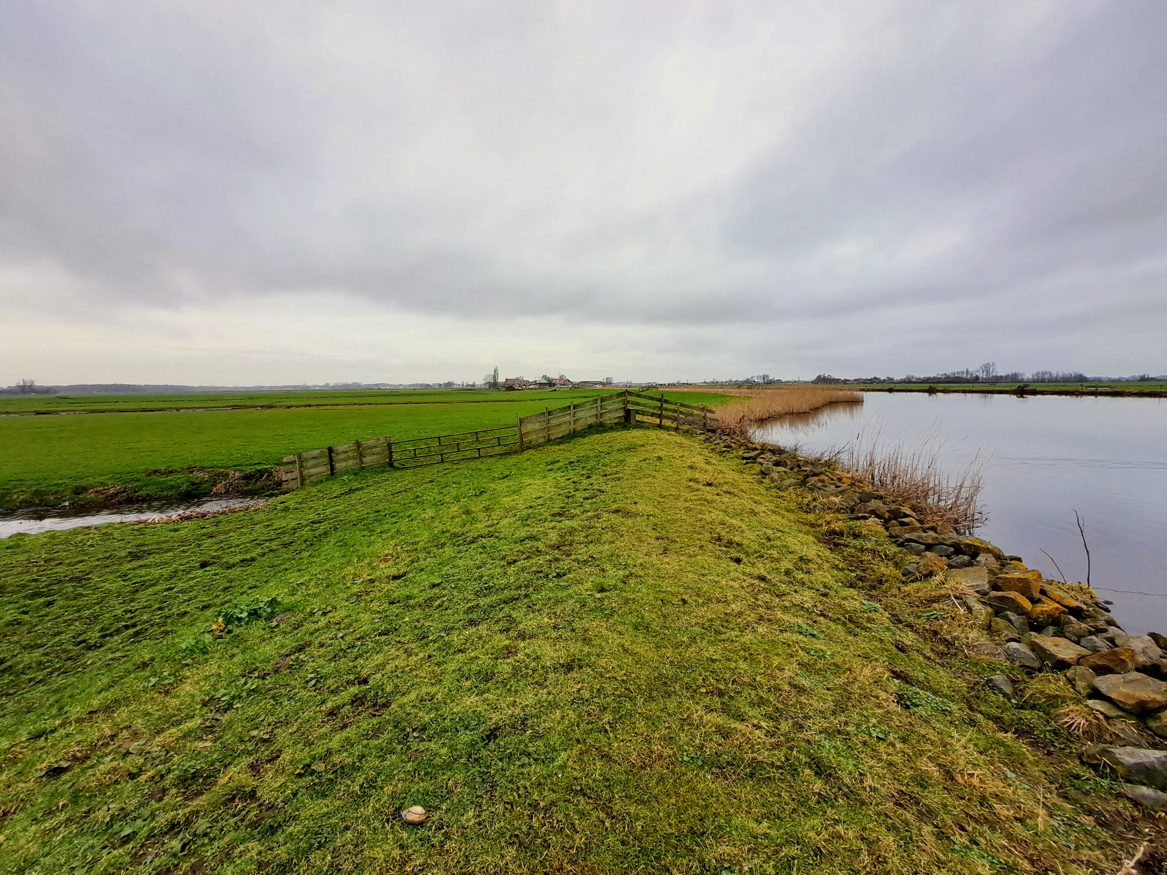
| 22:49, 12 July 2023 | Embankment-convex crest.jpg (file) |  |
1.93 MB | {{Information | description=Embankment with a convex crest (rounded outwards), instead of a crest with a flat area). | source=Own photograph | date=2023-02-04 | author=Multimodaal | other_versions= }} | 1 |
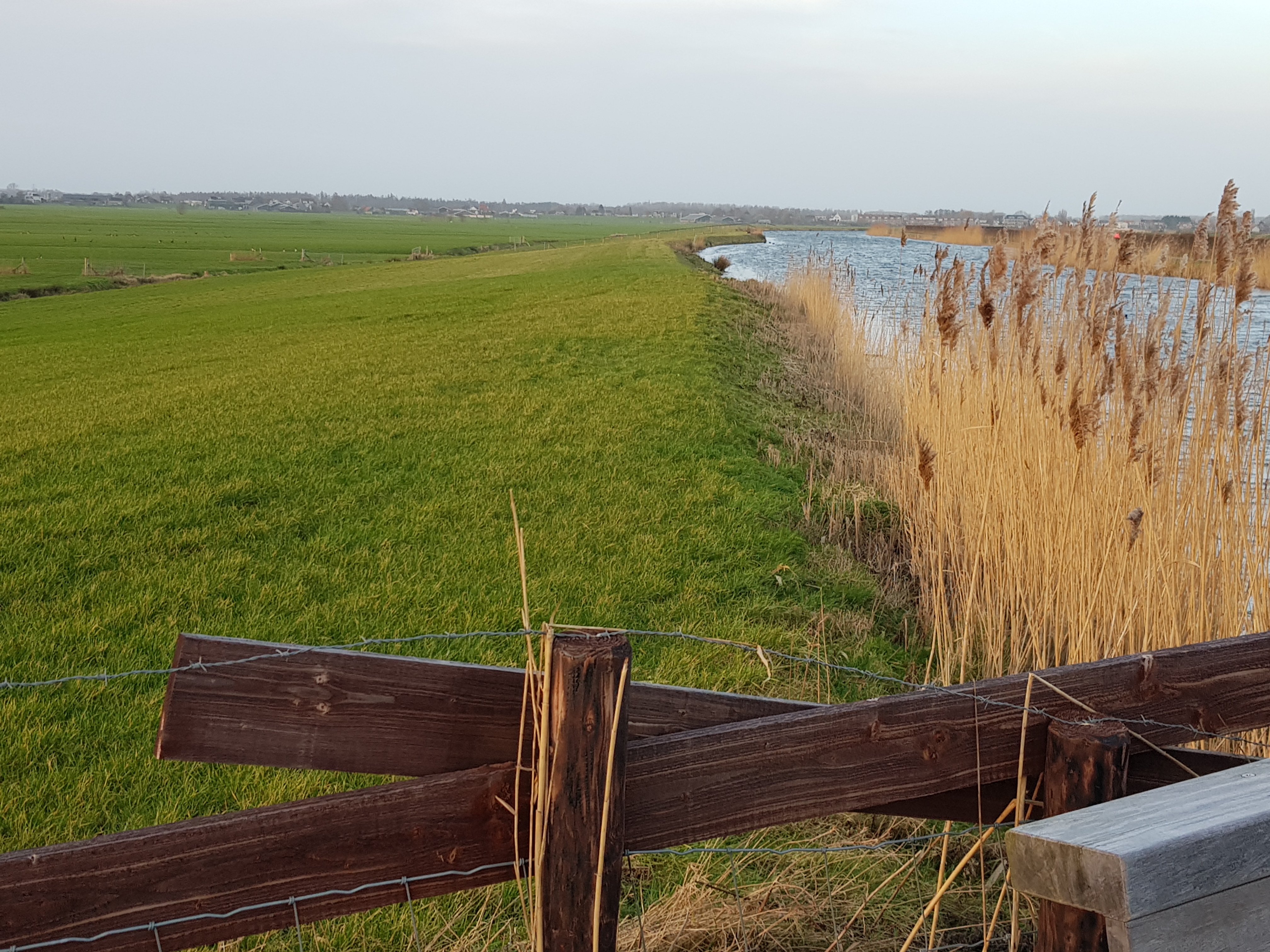
| 21:01, 12 July 2023 | Embankment linear crest.jpg (file) |  |
3.57 MB | {{Information | description=Large embankment with a crest that is not a flat area but more a folded line | source=own photograph | date=2023-02-05 | author=multimodaal | other_versions= }} | 1 |
| 23:20, 17 January 2023 | Diagram of Embankment.png (file) | 18 KB | {{Information | description= Diagram of an Embankment | source=Department for Environment Food & Rural Affairs | date=29/07/2020 | author= | other_versions= | license=Open Government Licence v3.0 }} | 1 | |
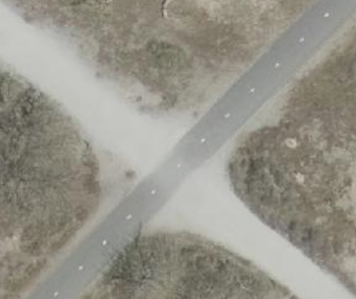
| 10:01, 20 February 2022 | Crossroads-PDOK-Beeldmateriaal.jpg (file) |  |
48 KB | Crossroads of roads with two different surfaces (asphalt / fine gravel), the crosssing itself has asphalt as surface. CC-BY : PDOK Beeldmateriaal https://www.pdok.nl/introductie/-/article/luchtfoto-pdok | 1 |
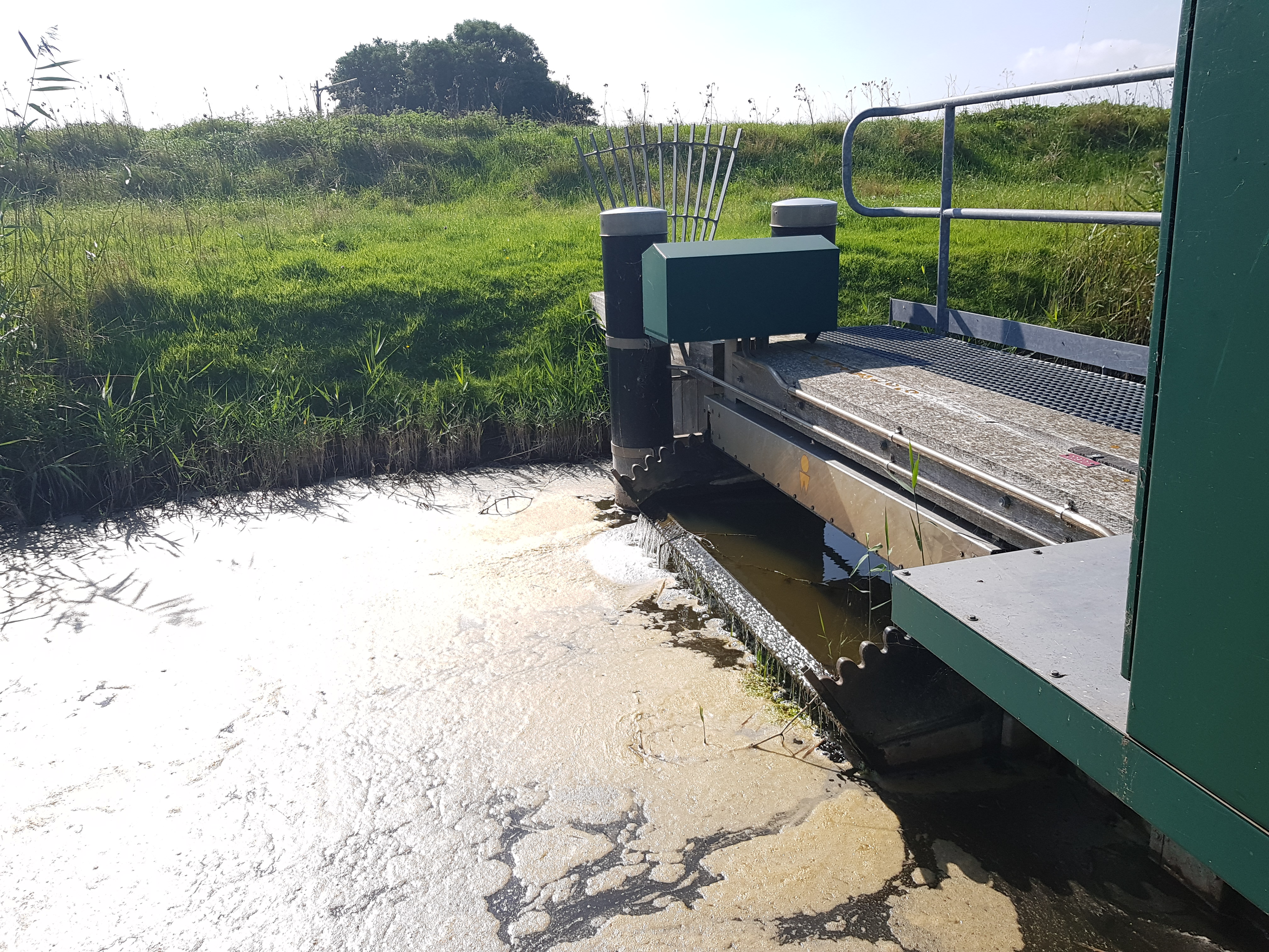
| 09:12, 7 October 2021 | Small movable weir.jpg (file) |  |
3.37 MB | Small movable weir, Location: Texel, the Netherlands | 1 |
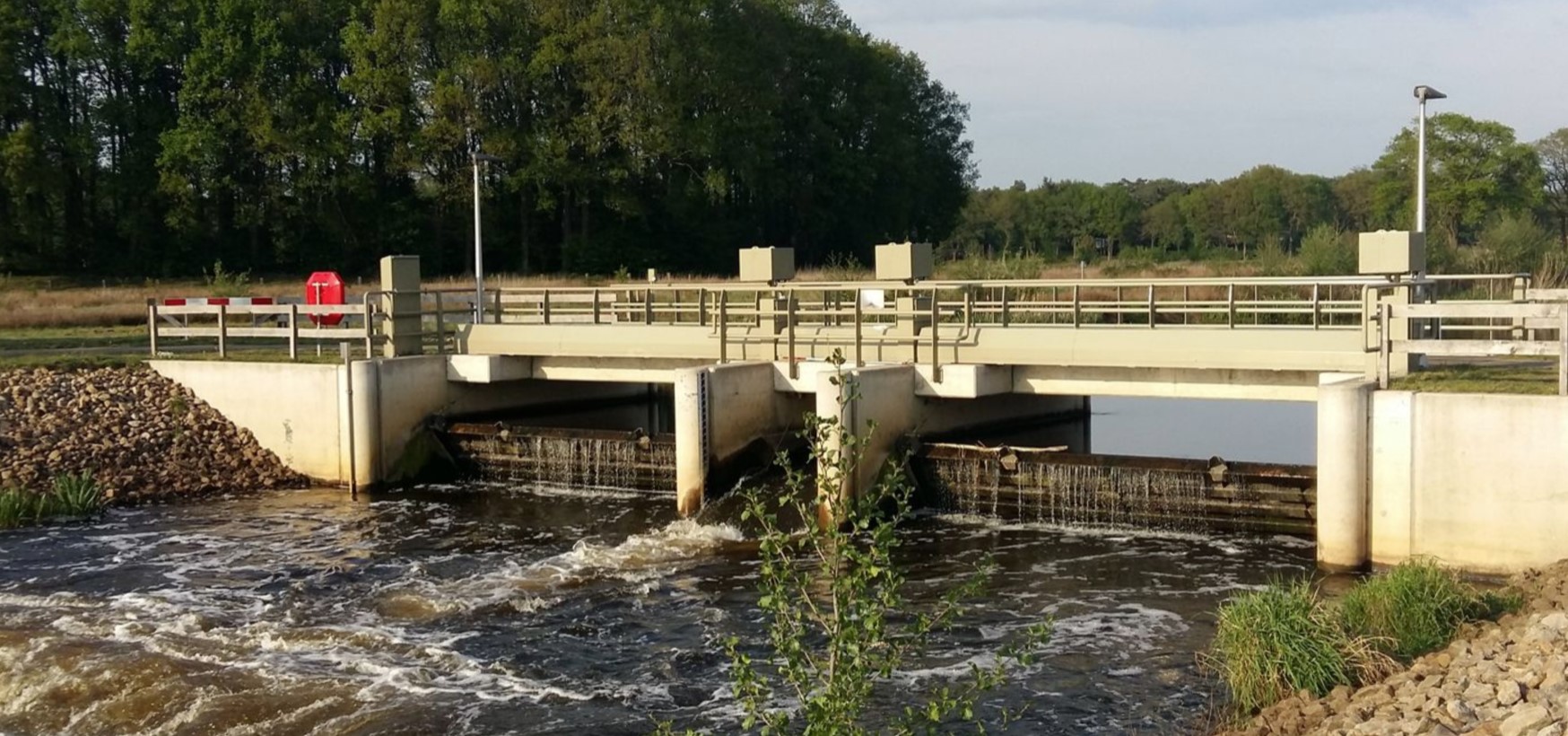
| 09:44, 15 August 2021 | Movable-weir-Vilsteren.jpg (file) |  |
365 KB | A movable (height-adjustable) weir in Vilsteren on the Overijsselsche Vecht | 1 |
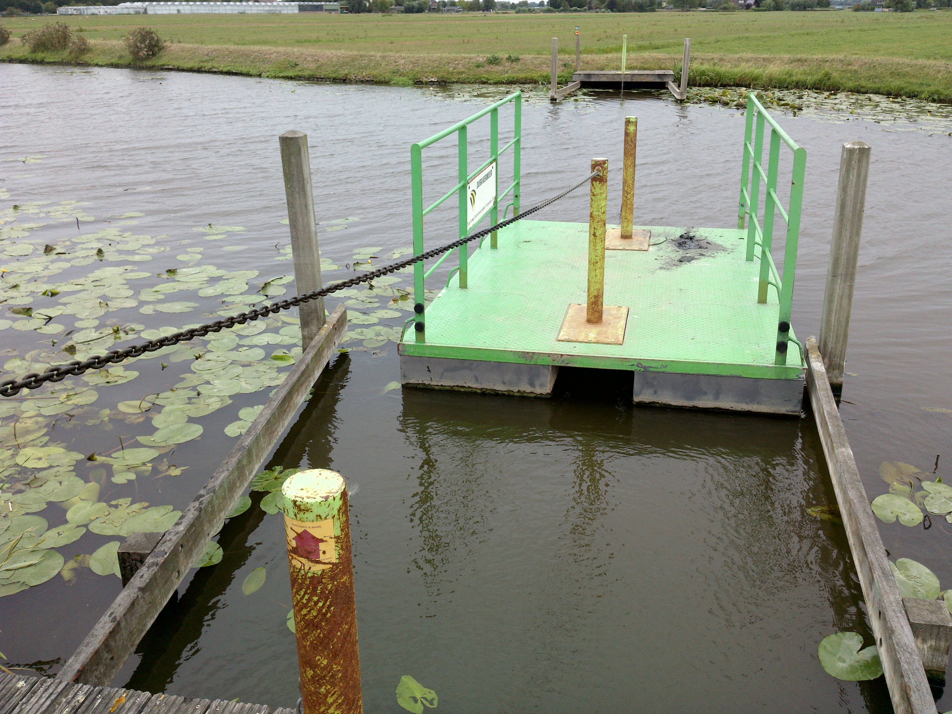
| 09:15, 14 August 2021 | Canoe-portage-pier.JPG (file) |  |
3.24 MB | Pier made for the portage between two lakes on a signposted portage route, Loosdrecht, The Netherlands | 1 |
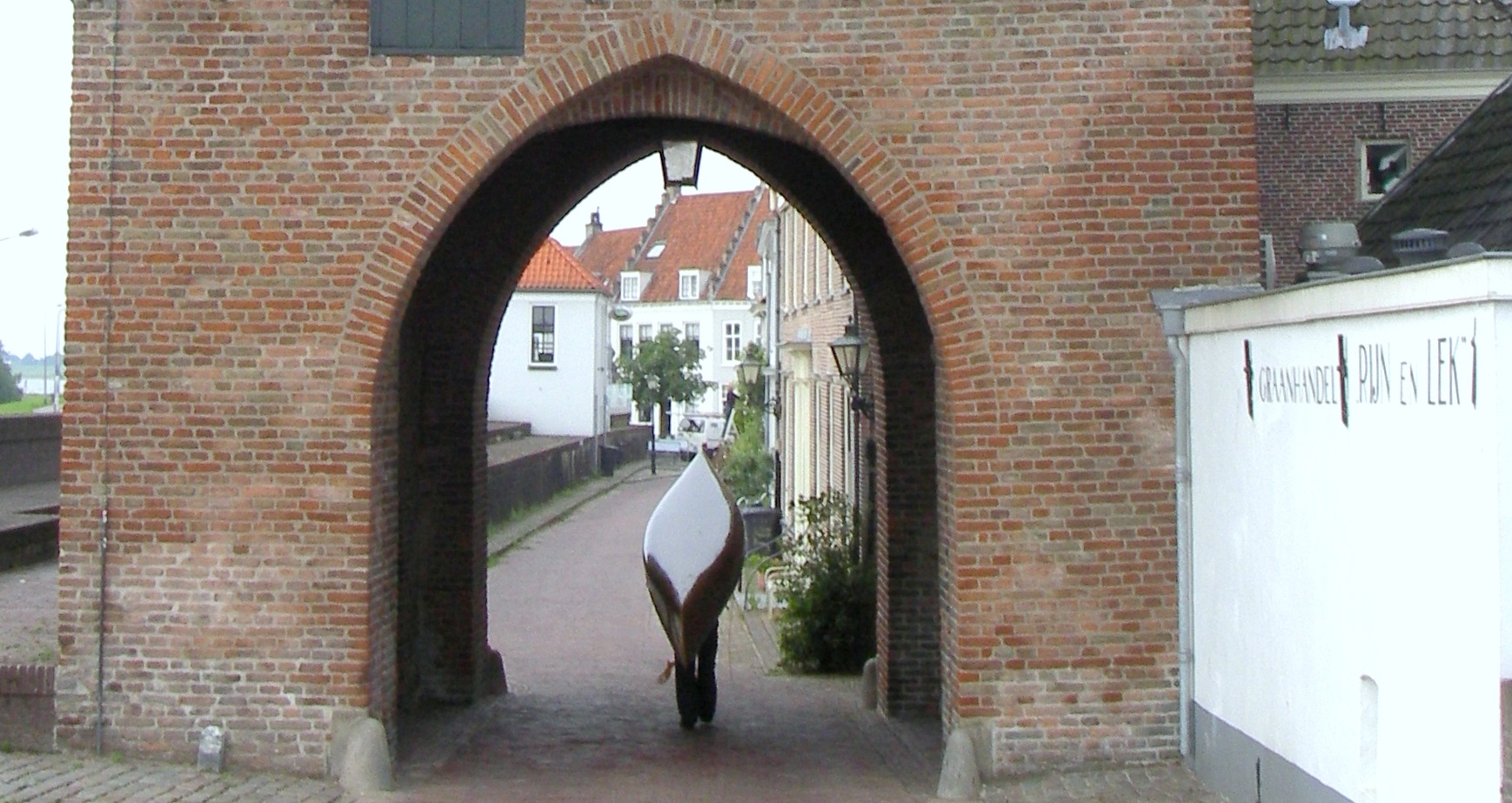
| 09:04, 14 August 2021 | Canoe-portage-Lek-Oude Rijn.JPG (file) |  |
487 KB | Canoe portage between the rivers Lek and Oude Rijn, Wijk bij Duurstede, the Netherlands | 1 |
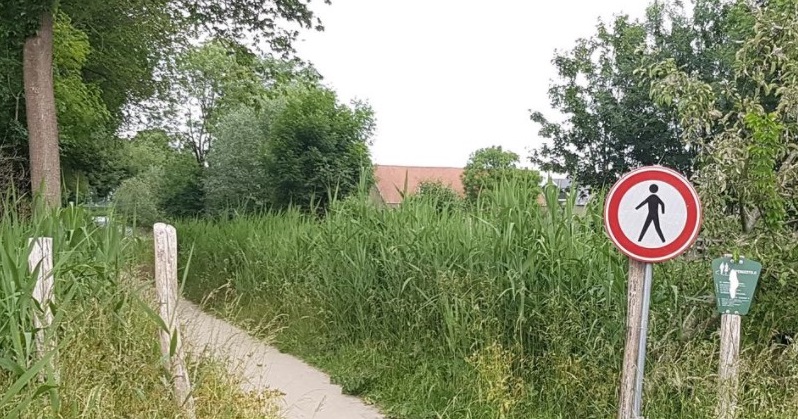
| 22:45, 25 May 2021 | Mandatory oneway for pedestrains with traffic sign.jpg (file) |  |
189 KB | Mandatory oneway direction for_pedestrians as a COVID-19-measure. Since normal traffic oneway-traffic_signs do not apply to pedestrians a prohibitory sign for pedestrians was placed at one end (next to an access_sign allowing foot access) , while at the other end of the path no prohibitory sign was placed. Linschoten, the Netherlands), | 1 |
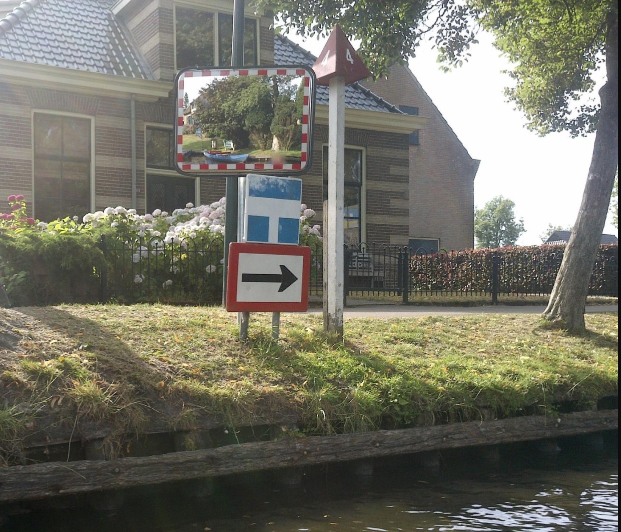
| 14:35, 25 May 2021 | Mandatory-oneway-traffic-on-waterway.jpg (file) |  |
397 KB | Mandatory oneway traffic for boats on a waterway (Giethoorn, the Netherlands) | 1 |
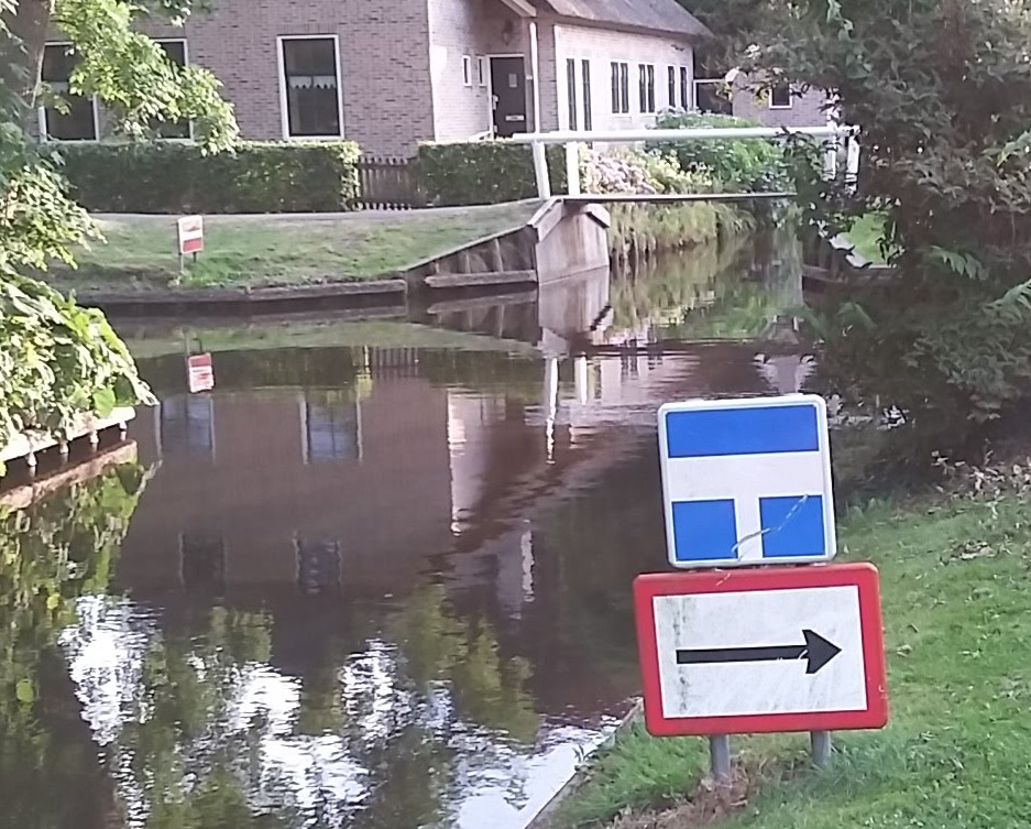
| 13:58, 25 May 2021 | Mandatory-oneway-on-waterway.jpg (file) |  |
283 KB | Mandatory oneway direction for boat traffic on a waterway based on a seamark (sign) | 1 |
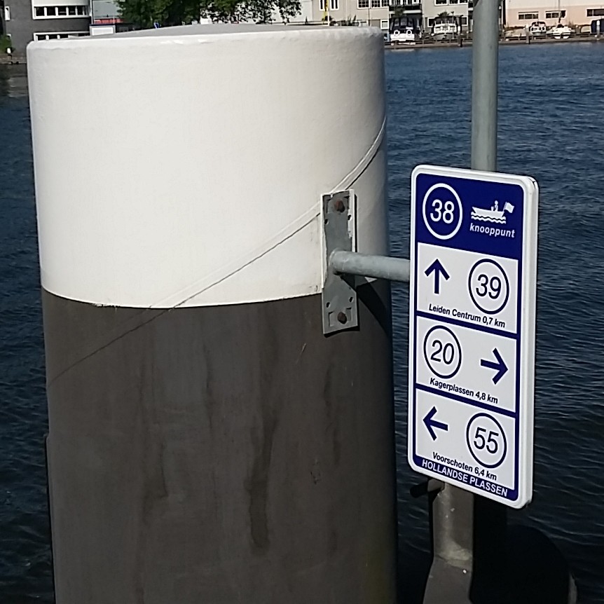
| 16:11, 6 December 2020 | Fairway-beacon.jpg (file) | 61 KB | A fairway across a lake marked by a beacon. Kagerplassen, the Netherlands | 1 | |
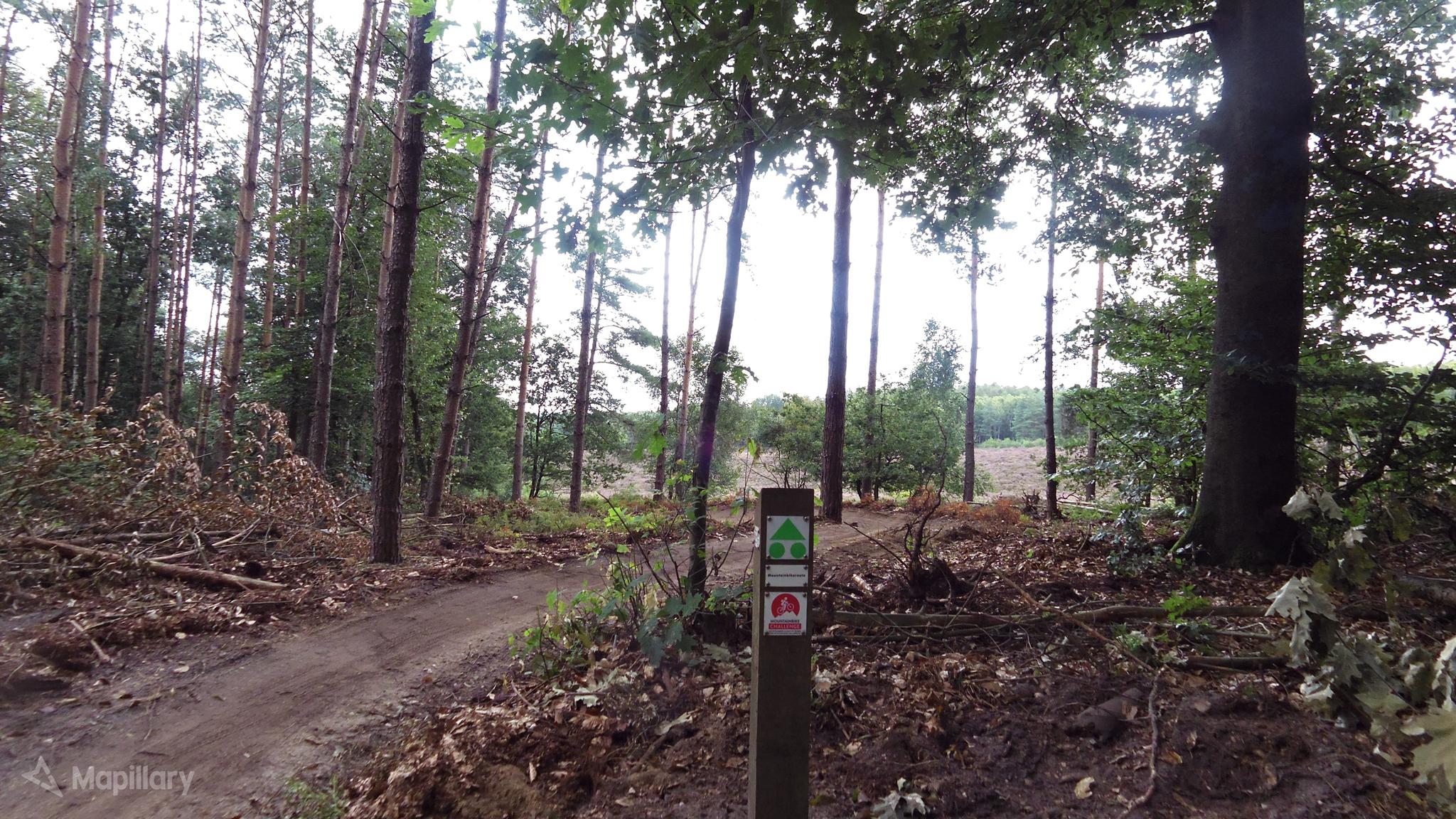
| 22:00, 27 November 2020 | Harry Slinger mtb.jpg (file) |  |
569 KB | Harry Slinger; Designated mtb-trail; Elst, Utrechtse Heuvelrug, The Netherlands | 1 |
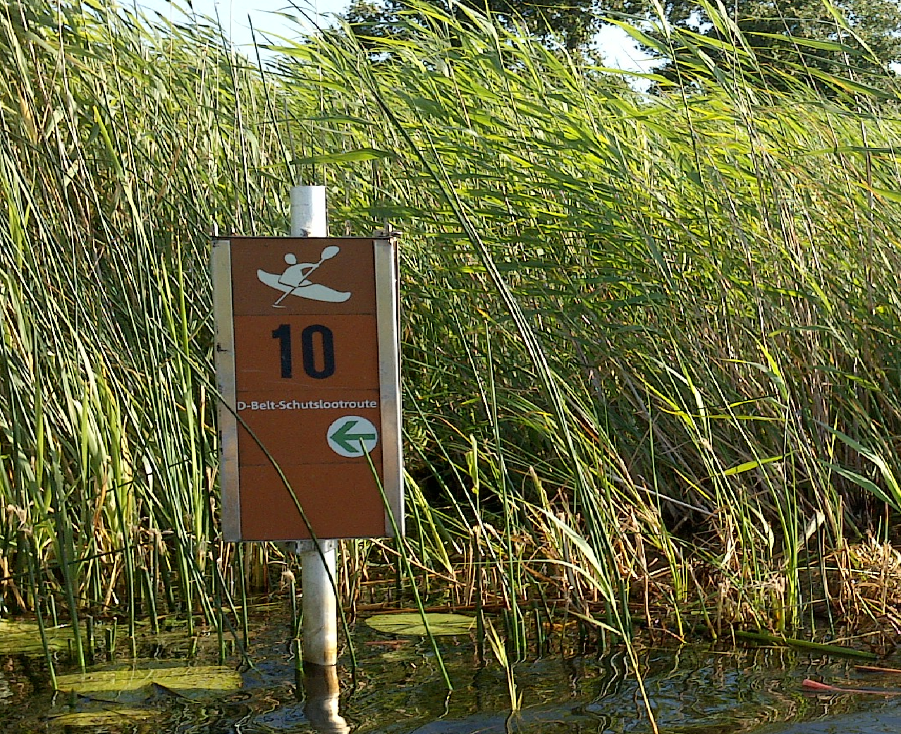
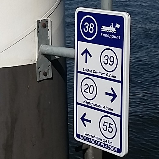
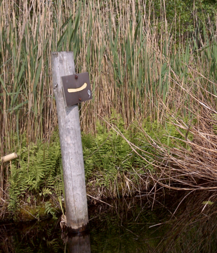
| 20:05, 27 November 2020 | Zijl.jpg (file) |  |
58 KB | Signposted waterway "Zijl", Leiderdorp, the Netherlands | 1 |
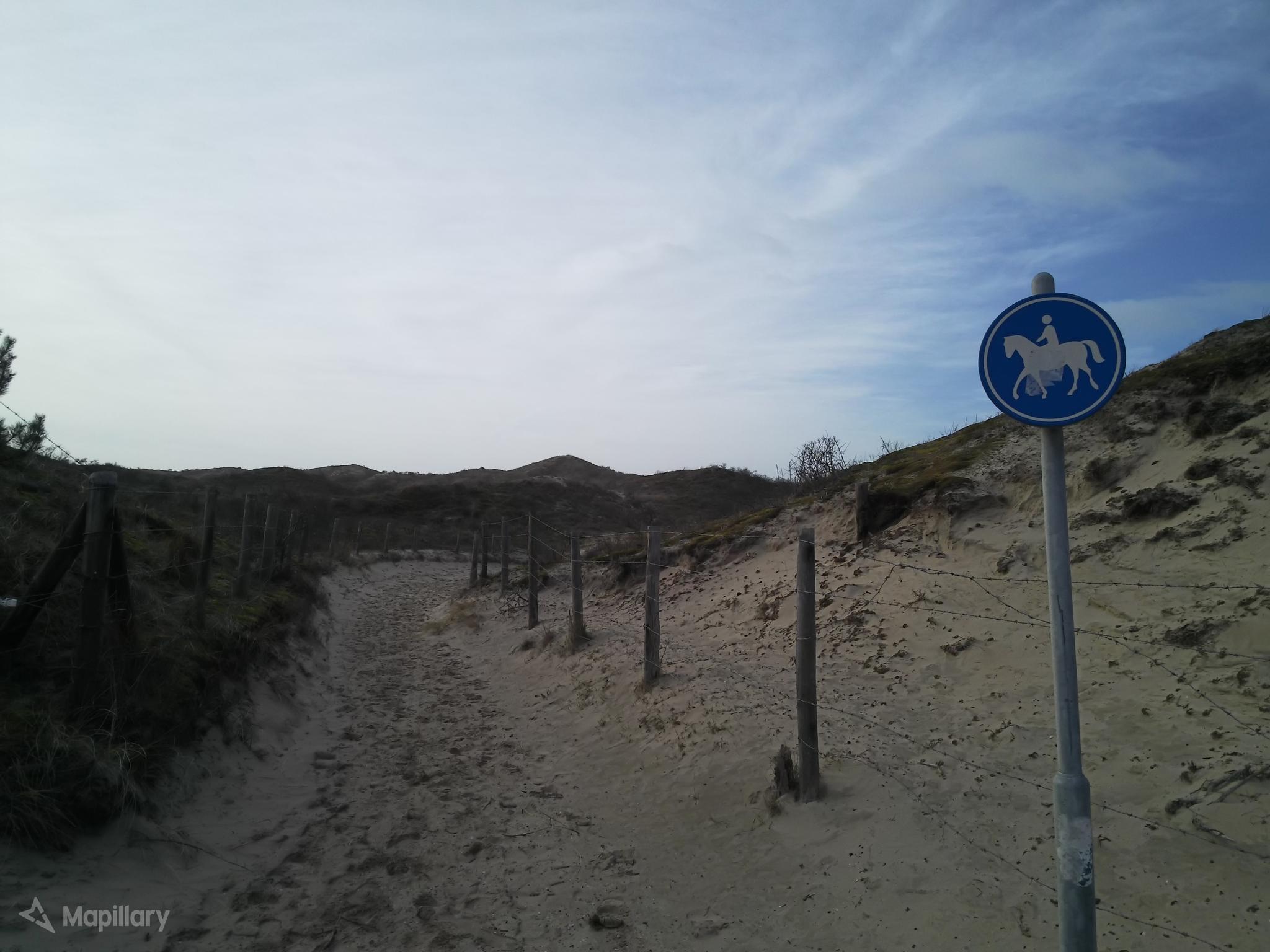
| 19:29, 29 June 2020 | Bridleway-NL.jpg (file) |  |
225 KB | Bridleway in Wassenaar, the Netherlands; RVV-sign G9. Own work, image retrieved via Mapillary | 1 |
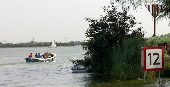
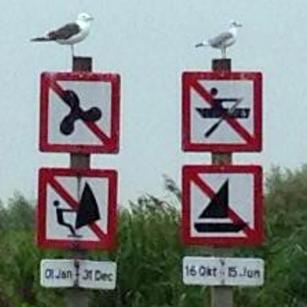
| 11:36, 28 June 2020 | Boating restrictions.jpg (file) |  |
116 KB | Different restrictions for different types of boat. From image at from Mapillary, user @ gott_snack https://www.mapillary.com/map/im/KW-waTZdDEFZMbVsS-FPVw Location: Maasland, the Netherlands | 1 |
| 12:07, 24 June 2020 | Canoe-Access-CEVNI-E.19..jpg (file) |  |
26 KB | Waterway sign CEVNI E.19: "Craft other than motorized vessels or sailing craft permitted" on a canoeing route in Biesbosch, the Netherlands (placed on a construction that limits width of passing craft to approximately 1 meter) | 1 |
| 18:32, 23 June 2020 | Boat-access.jpg (file) |  |
63 KB | Access sign prohibiting water-based access (NL: Binnenvaartpolitiereglement, Annex 7, sign A.1) | 1 |
| 10:08, 8 August 2018 | Lpn ref.png (file) |  |
3.27 MB | 1 | |
| 08:46, 8 August 2018 | Ferry-bicycle.png (file) |  |
2.54 MB | 1 | |
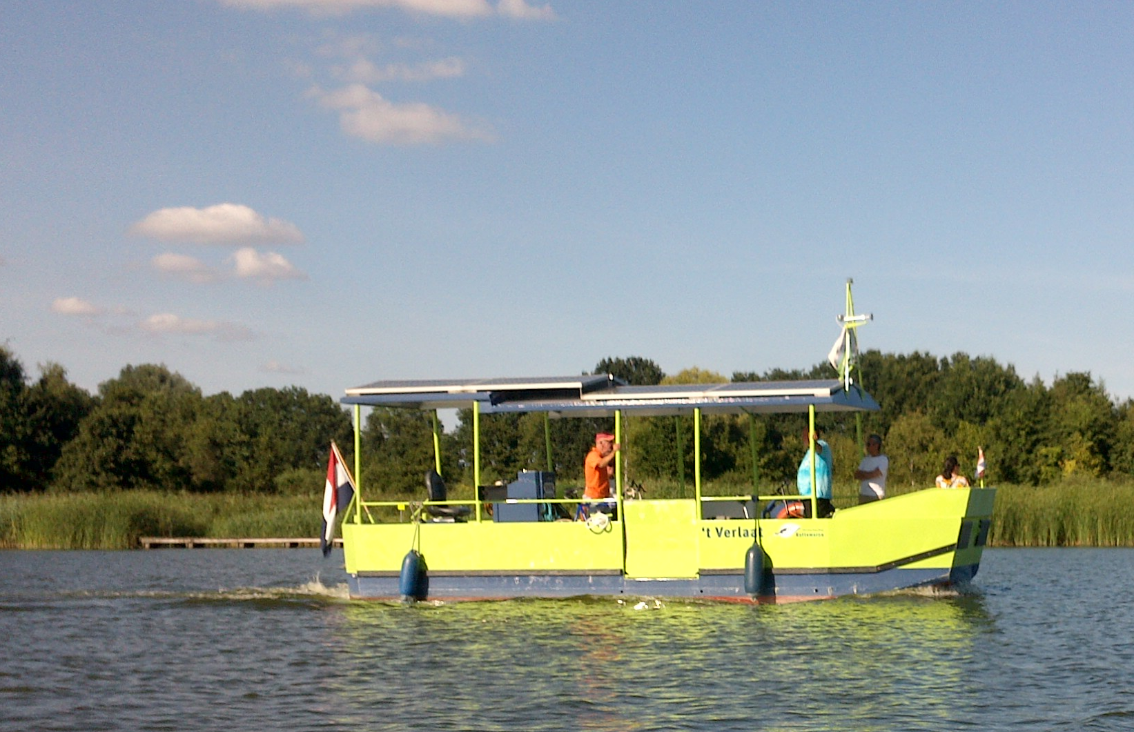
| 08:44, 8 August 2018 | Ferry-foot.jpg (file) |  |
1.83 MB | 1 | |
| 10:28, 8 July 2018 | Route-motorboat-network-rbn.jpg (file) |  |
73 KB | 1 | |
| 10:12, 8 July 2018 | Route=motorboat; network=rmn.jpg (file) |  |
146 KB | 1 | |
| 23:44, 2 July 2018 | Canoe route lkn.png (file) |  |
1.67 MB | 1 | |
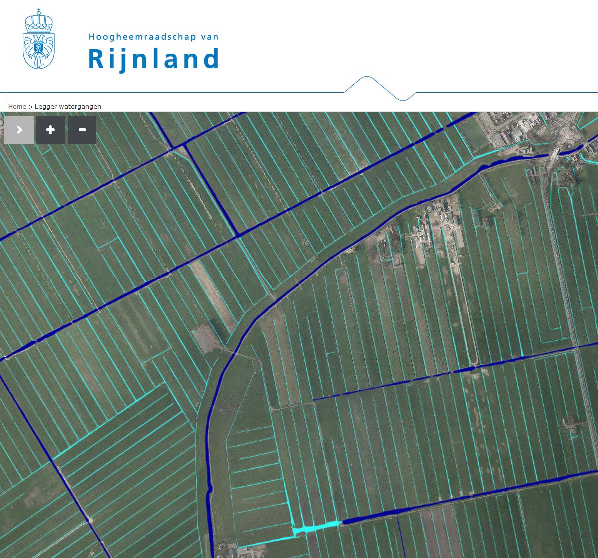
| 17:44, 2 March 2018 | Legger Rijnland-Meerpolder.jpg (file) |  |
276 KB | 1 | |
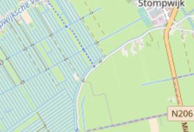
| 17:40, 2 March 2018 | OSM Standard Carto Waterways-z19.jpg (file) |  |
38 KB | 1 | |
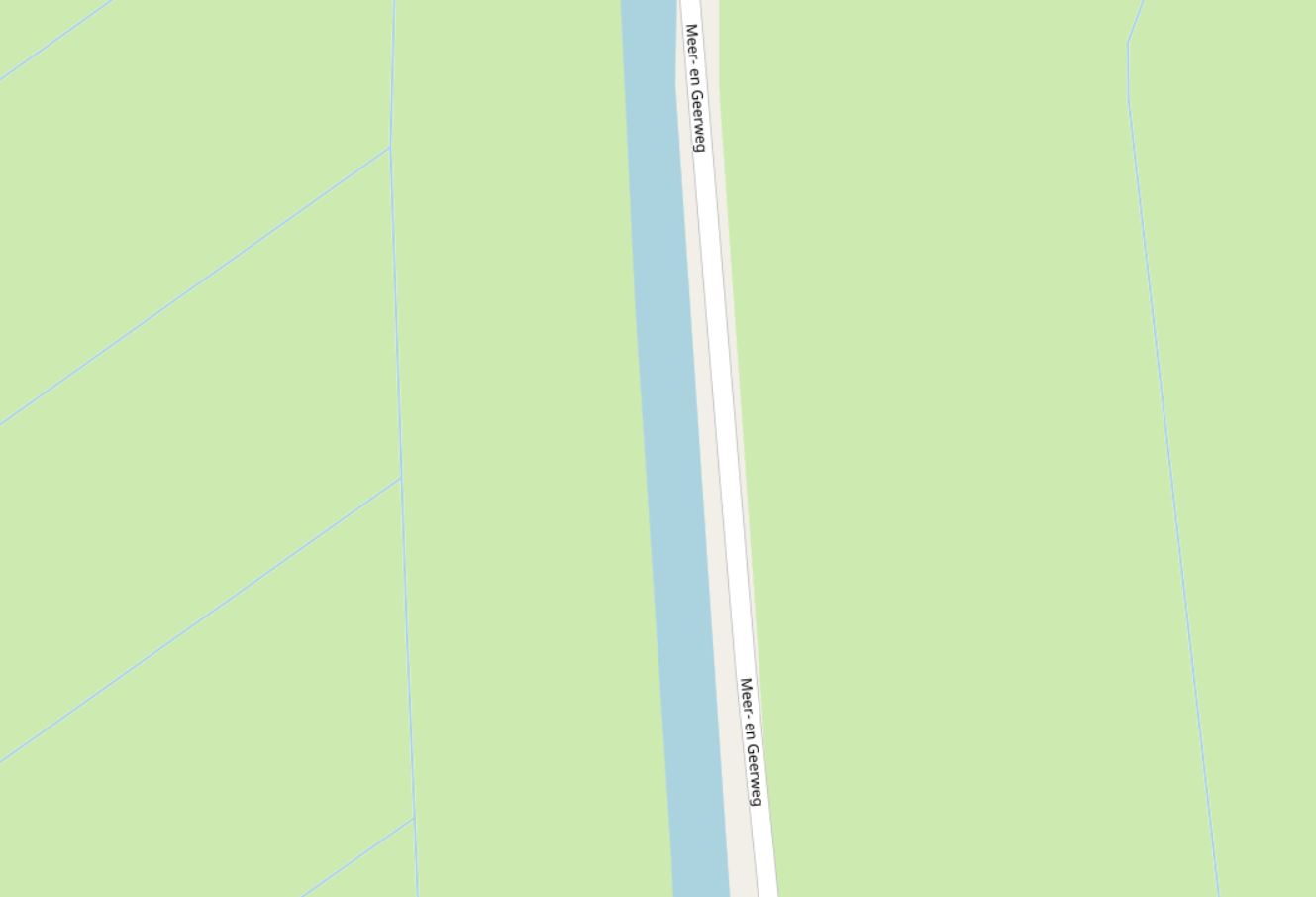
| 17:38, 2 March 2018 | OSM Standard Carto Waterways outside Meerpolder NL - Z=13.jpg (file) |  |
16 KB | 1 | |
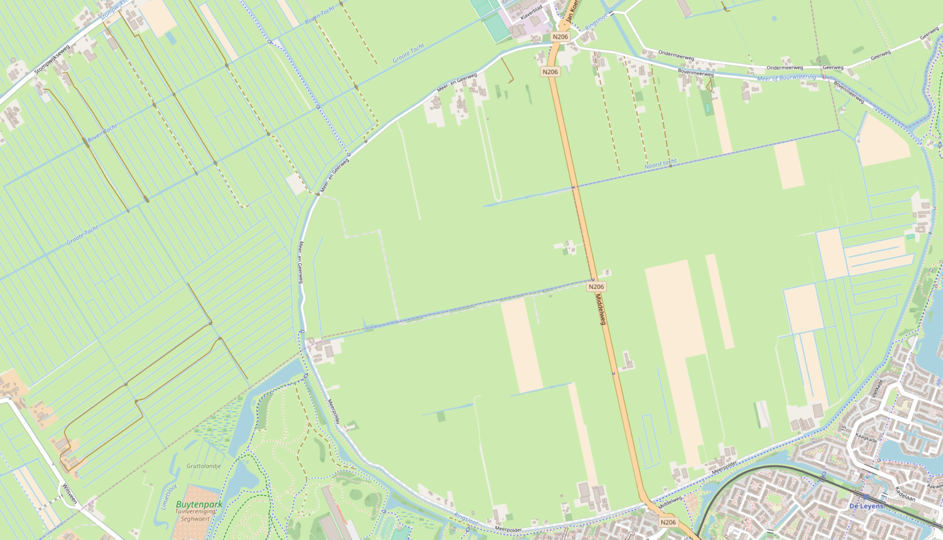
| 17:36, 2 March 2018 | Meerpolder-current-OSM-StandardCarto.png (file) |  |
1.6 MB | 1 | |
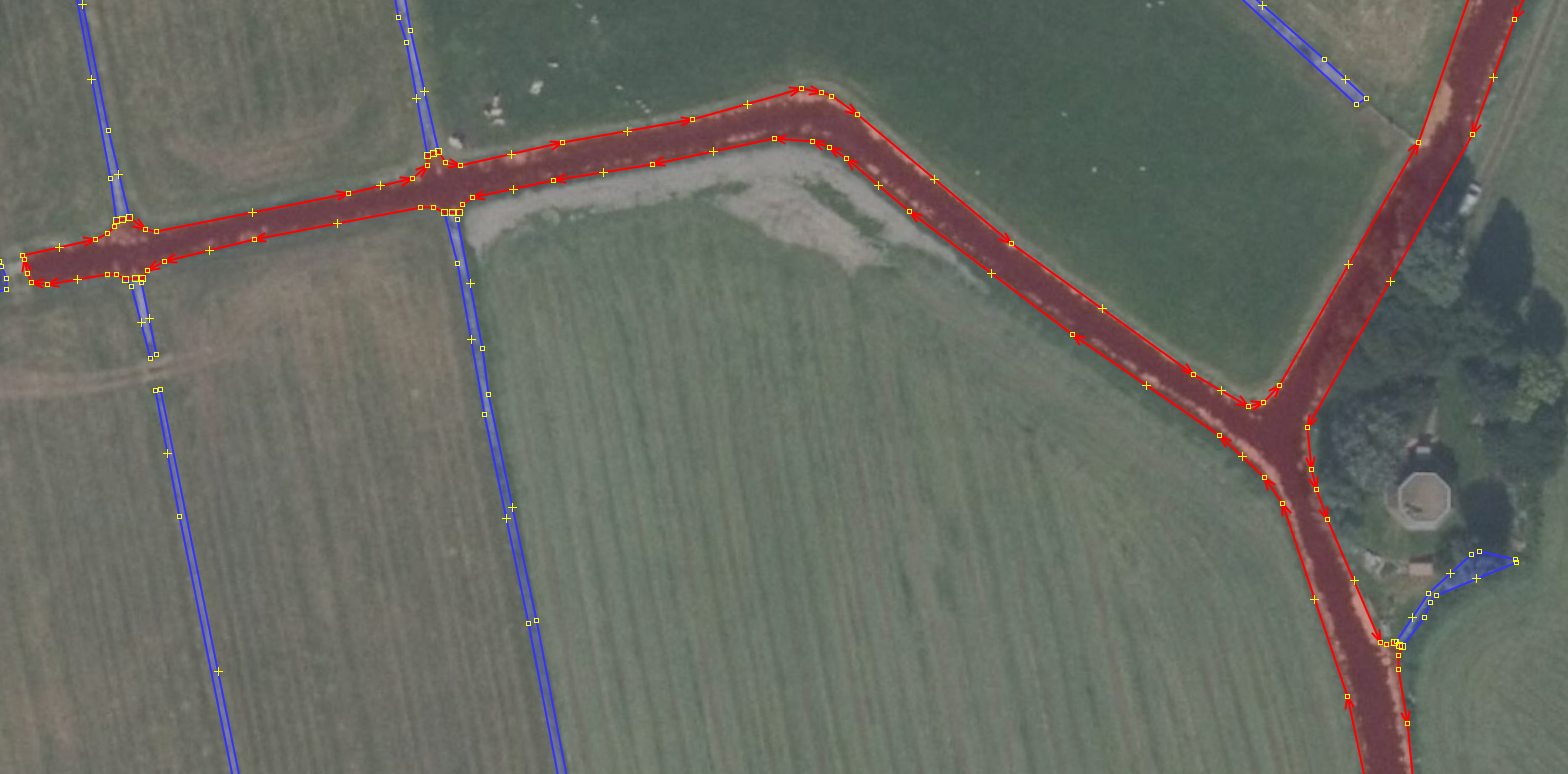
| 22:07, 1 March 2018 | Dissolve-detail.png (file) |  |
1.79 MB | 1 | |
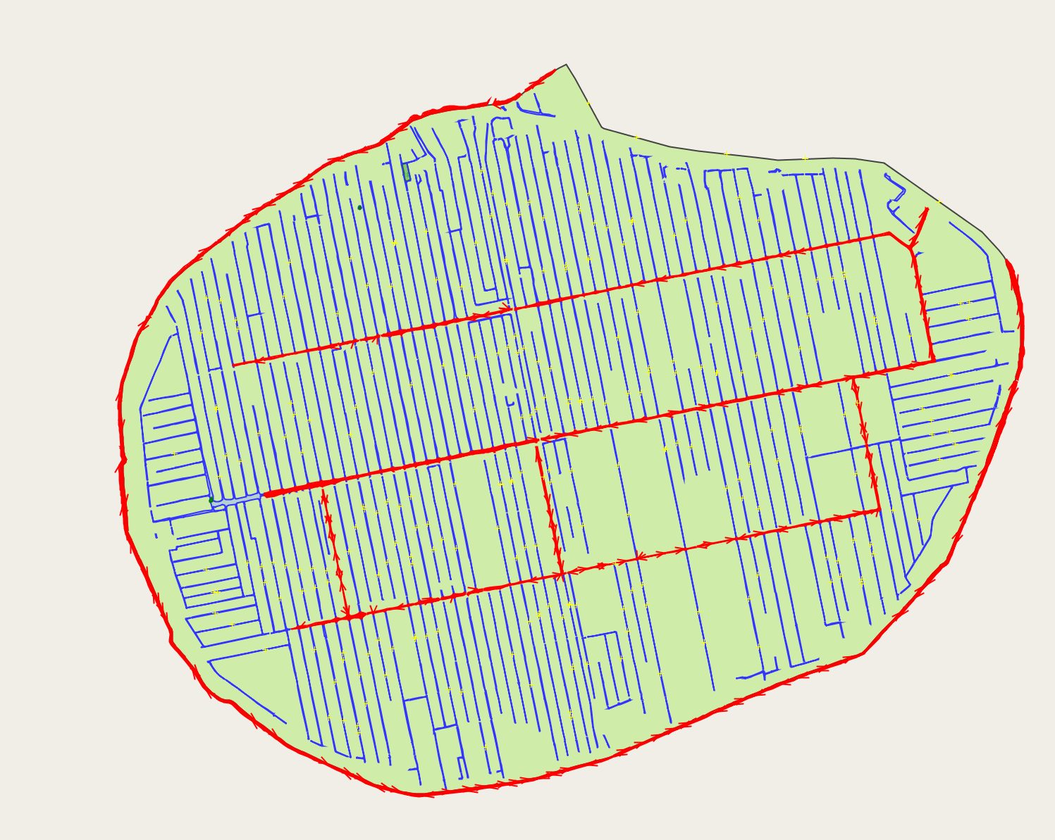
| 19:52, 1 March 2018 | Dissolve.png (file) |  |
334 KB | 1 | |
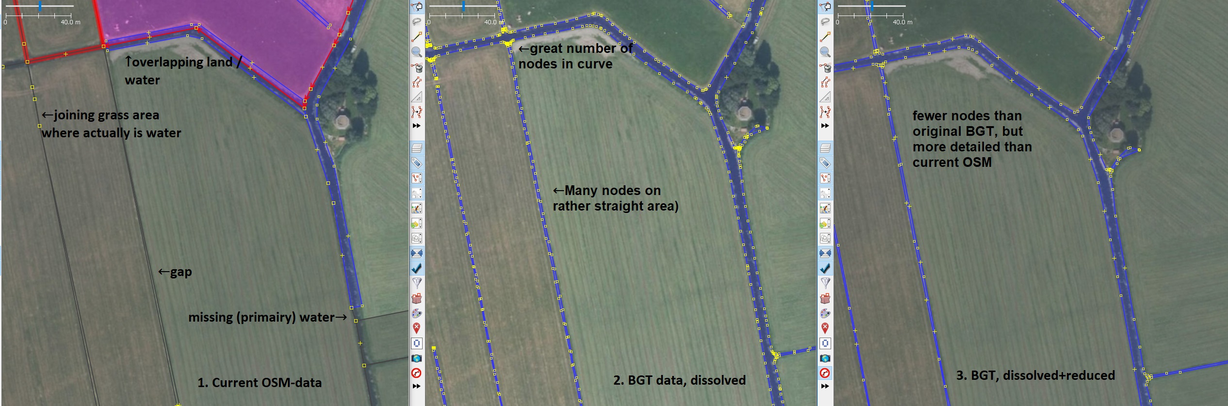
| 19:25, 1 March 2018 | Polderwater-reduce vertices.jpg (file) |  |
511 KB | 1 |