Uploads by Stevefaeembra
Jump to navigation
Jump to search
This special page shows all uploaded files.
| Date | Name | Thumbnail | Size | Description | Versions |
|---|---|---|---|---|---|
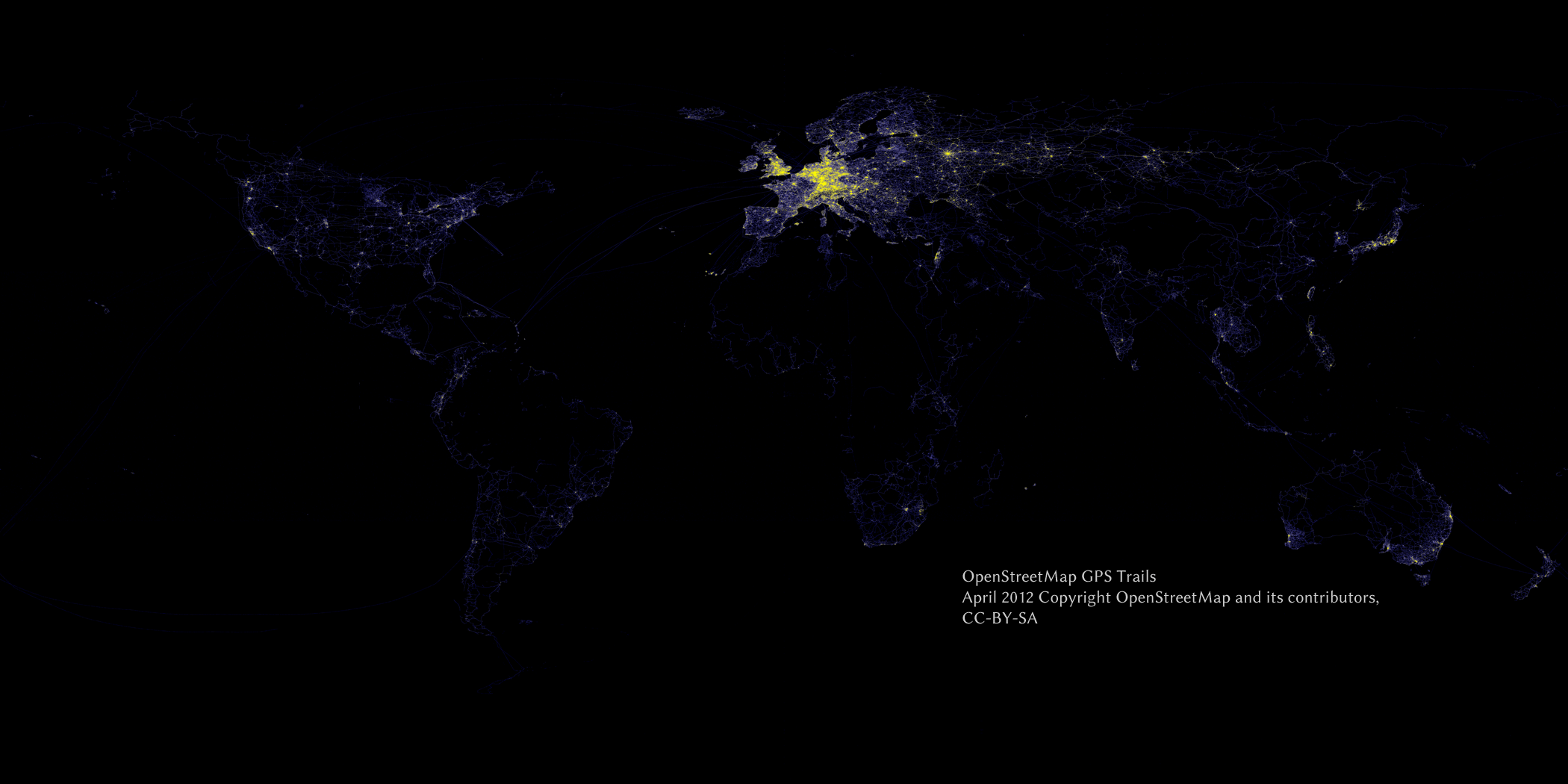
| 19:38, 24 September 2012 | Osm-gps-density-enhanced-scaled.png (file) |  |
699 KB | density plot, 2100x1050, based on the GPS bulk data from April 2012 (10% sample) Yellow areas have high density, blue are lower density. Equirectangular (Plat Caree) projection | 1 |
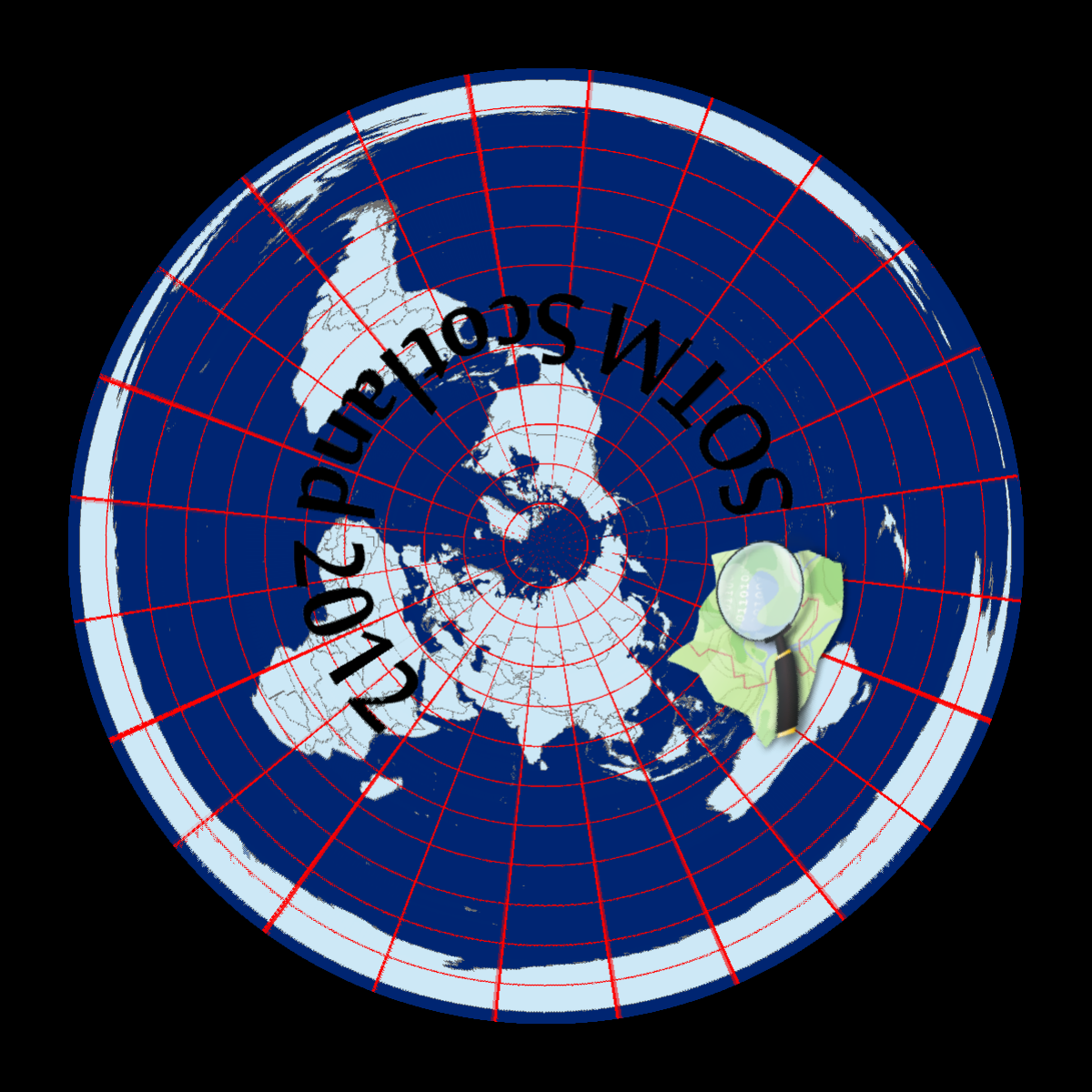
| 21:29, 7 September 2012 | Osm-sotm-scotland-processing-demo-shown-after-warping.png (file) |  |
510 KB | Output of the Processing sketch proof-of-concept for driving the Pufferfish display at State of The Map Scotland 2012 This is the warped output from the sketch, re-projected (in software) into the required polar azimuthal format. | 1 |
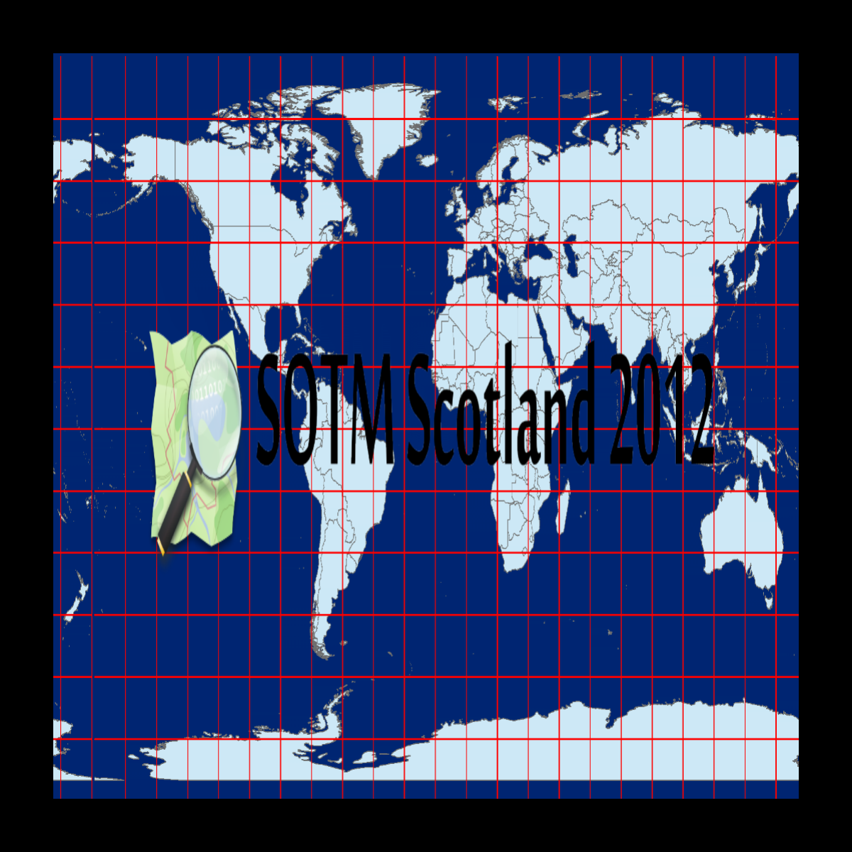
| 21:26, 7 September 2012 | Osm-sotm-scotland-processing-demo-shown-before-warping.png (file) |  |
413 KB | Output from Processing sketch for Pufferfish display. This is the original sketch, prior to warping. | 1 |
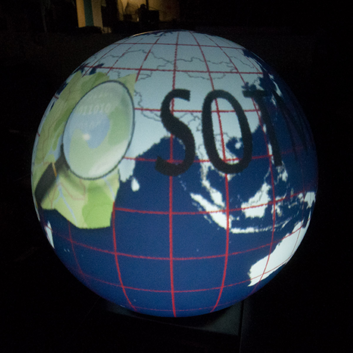
| 21:22, 7 September 2012 | Osm-sotm-scotland-processing-demo-shown-on-pufferfish.jpg (file) |  |
244 KB | Example of the output from the Processing Sketch on a Pufferfish spherical projector display. Derived from OSM logo with OSM coastlines. | 1 |
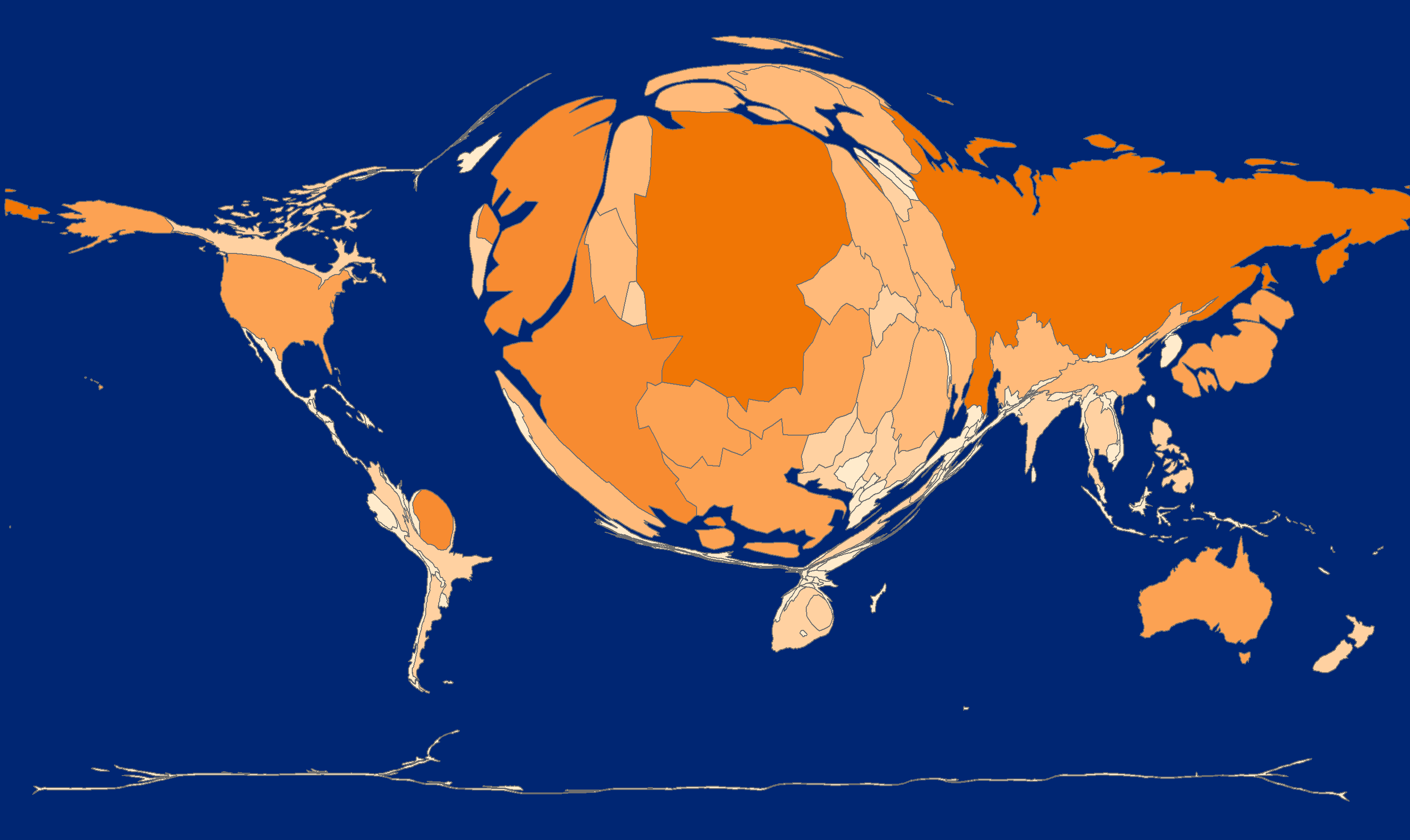
| 18:37, 19 August 2012 | OSM-gps-point-by-country-cartogram.png (file) |  |
124 KB | Cartogram derived from the April 2012 GPS point dataset. Countries are sized in proportion to the number of GPS points falling within their borders. This is a first draft. Caveats :- - this was done using a spatial join on a low resolution grid (1 degr | 1 |
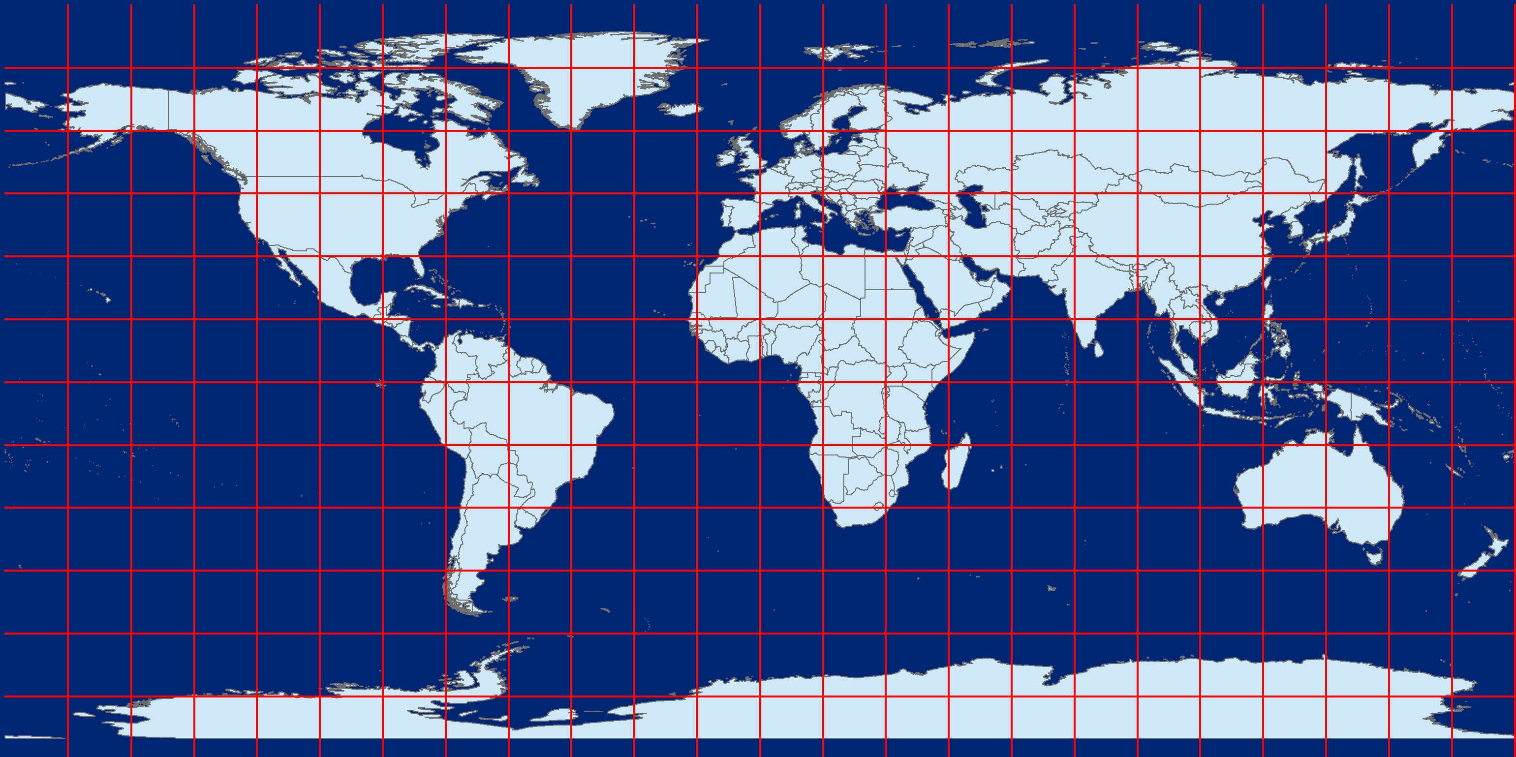
| 19:59, 14 August 2012 | Osm-world-coastlines-with-graticule-test-image.png (file) |  |
134 KB | Example test image, the OSM coastline processed data in equirectangular (plat caree) projection and 15 degree graticules. Data courtesy of the Coastline error checker http://wiki.openstreetmap.org/wiki/Coastline_error_checker#Current_Location | 1 |
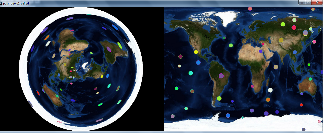
| 19:38, 5 August 2012 | Processing-sketch-polar-output.png (file) |  |
858 KB | example of a processing sketch showing its output in both normal (Equirectangular) projection and in a polar projection side-by-side. | 1 |
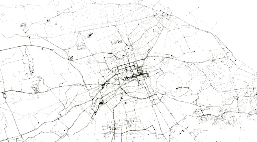
| 20:49, 18 April 2012 | Osm-gps-dump-edinburgh-stevefaeembra.png (file) |  |
195 KB | Plot of Edinburgh, based on the recent OSM Bulk GPS file Shows a random 10% sample of points | 1 |