Uploads by Yourmapper
Jump to navigation
Jump to search
This special page shows all uploaded files.
| Date | Name | Thumbnail | Size | Description | Versions |
|---|---|---|---|---|---|
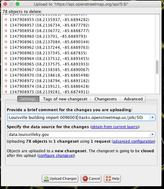
| 19:47, 17 March 2015 | Louisville-JOSM-Upload.png (file) |  |
100 KB | Better comments | 2 |
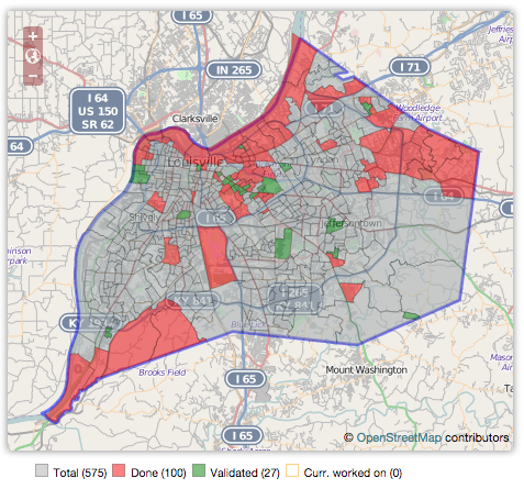
| 14:55, 16 March 2015 | Louisville-taskmanager-tracts.png (file) |  |
316 KB | updates version | 3 |
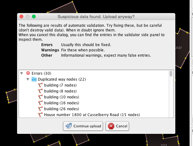
| 17:02, 21 February 2015 | Louisville-JOSM-Fix-Validate.png (file) |  |
21 KB | 1 | |
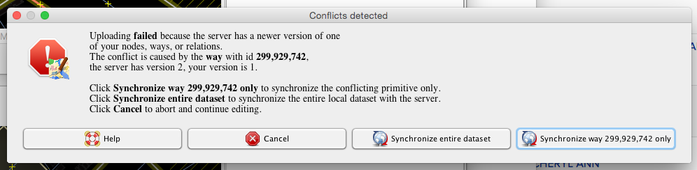
| 21:29, 19 February 2015 | Louisville-JOSM-Conflict-Notice.png (file) | 63 KB | 1 | ||
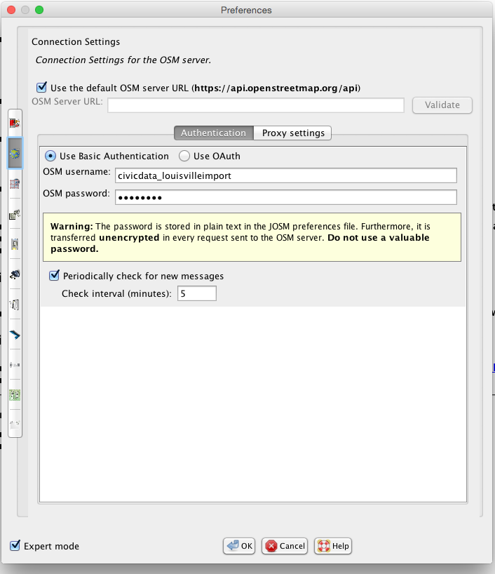
| 17:12, 18 February 2015 | Louisville-JOSM-username.png (file) |  |
80 KB | 1 | |
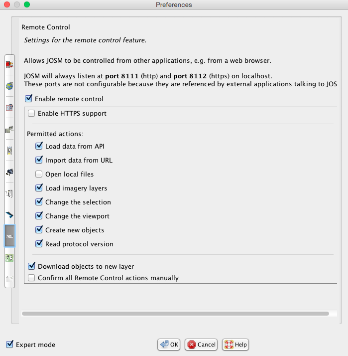
| 02:20, 18 February 2015 | Louisville-JOSM-remote.png (file) |  |
82 KB | 1 | |
| 02:08, 18 February 2015 | Louisville-JOSM-upload-dialog.png (file) |  |
41 KB | 1 | |
| 01:59, 18 February 2015 | Louisville-JOSM-Validate.png (file) |  |
71 KB | 1 | |
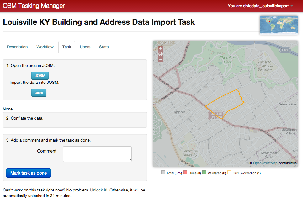
| 01:58, 18 February 2015 | Louisville-Task-Screen.png (file) |  |
300 KB | 1 | |
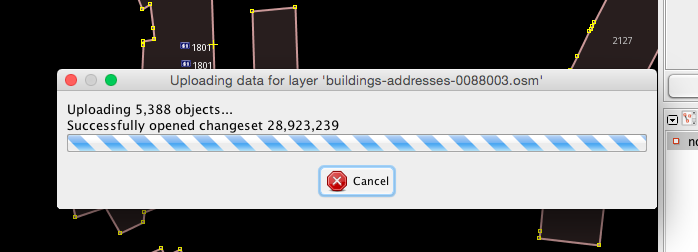
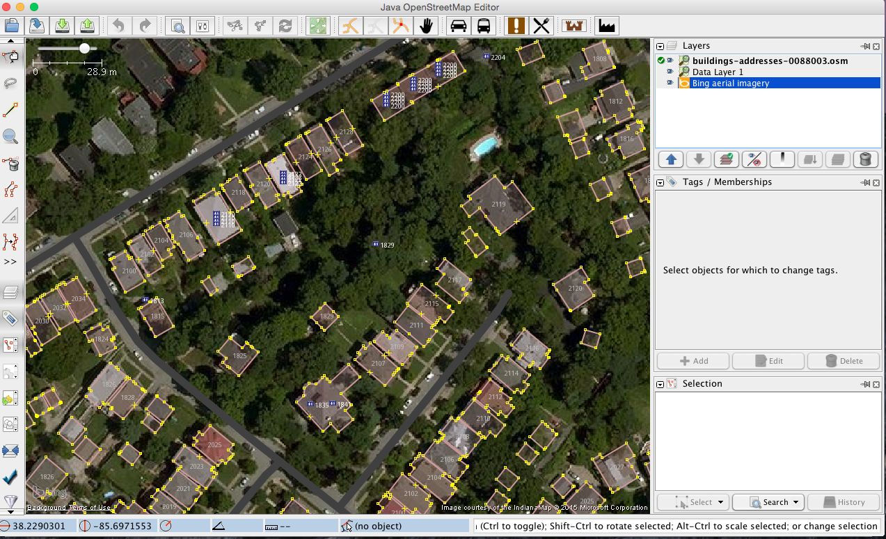
| 01:55, 18 February 2015 | Louisville-JOSM.png (file) |  |
912 KB | 1 | |
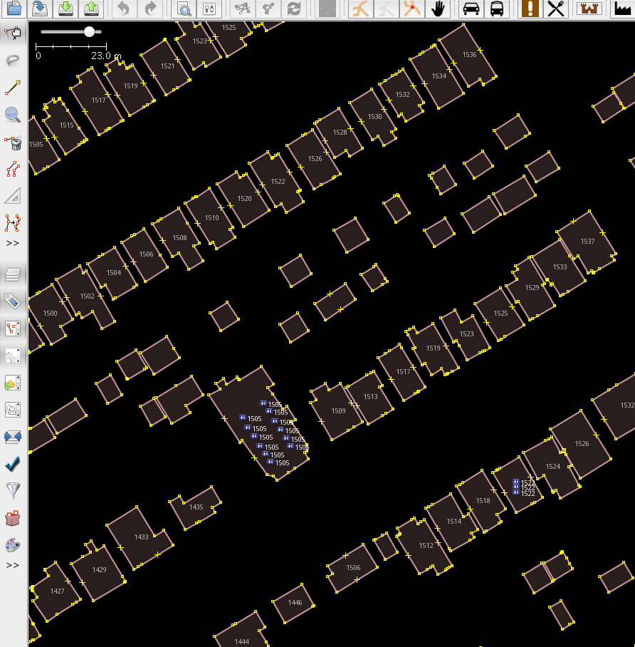
| 01:31, 17 February 2015 | Louisville Address Nodes.png (file) |  |
232 KB | 1 | |
| 15:44, 29 January 2015 | LouisvilleKYJtownGIS.gif (file) |  |
210 KB | 1 | |
| 15:44, 29 January 2015 | LouisvilleKYJtownOSM.gif (file) |  |
153 KB | 1 | |
| 15:43, 29 January 2015 | LouisvilleKYJtownGISTop.gif (file) |  |
198 KB | 1 | |
| 15:43, 29 January 2015 | LouisvilleKYJtownOSMTop.gif (file) |  |
196 KB | 1 | |
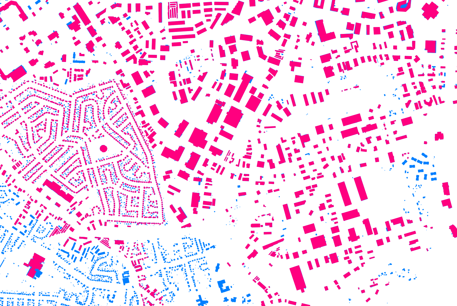
| 15:41, 29 January 2015 | LouisvilleKYHighlandsBuildingDetail.png (file) |  |
1.59 MB | 1 | |
| 21:00, 28 January 2015 | LouisvilleKYAddressAndBuildingSample.png (file) |  |
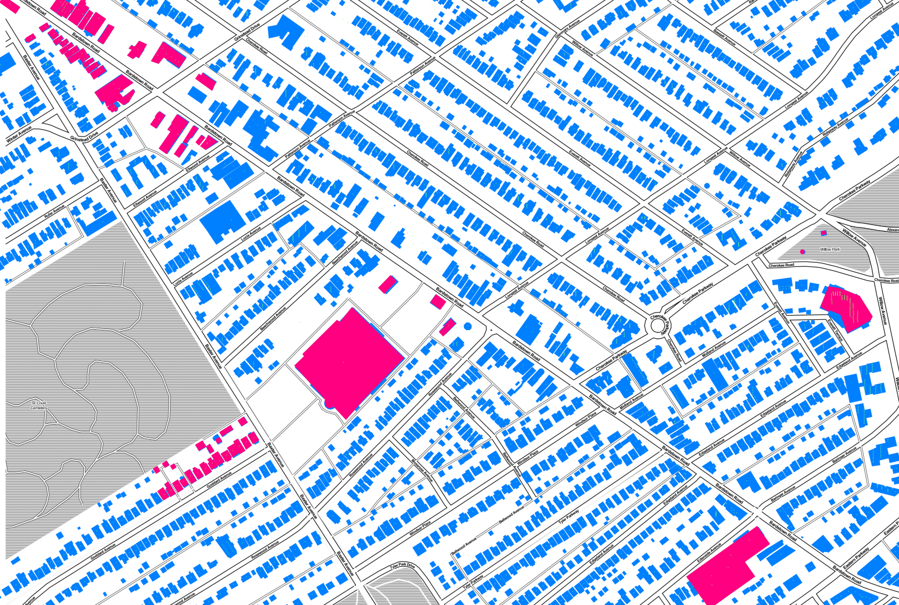
1.09 MB | Sample of address data overlayed on building data. Noe that addresses are centered over the center of the building, if there is a building. Then they are centered on the parcel (parcels not shown in this image). In the case of condo, they are stacked ... | 1 |
| 20:53, 28 January 2015 | LouisvilleKYAddressesInOSM.png (file) |  |
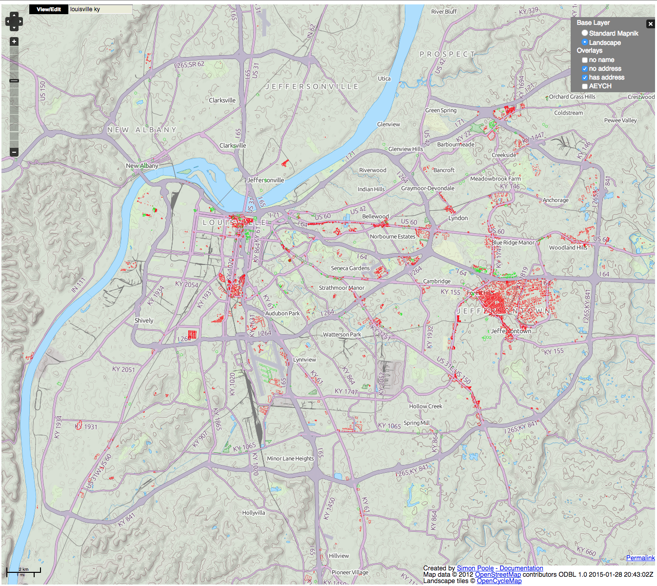
2.06 MB | Bright green = address mapped. Bright red = no address mapped. Everything else has no address in OSM. See http://qa.poole.ch/ for details. | 1 |
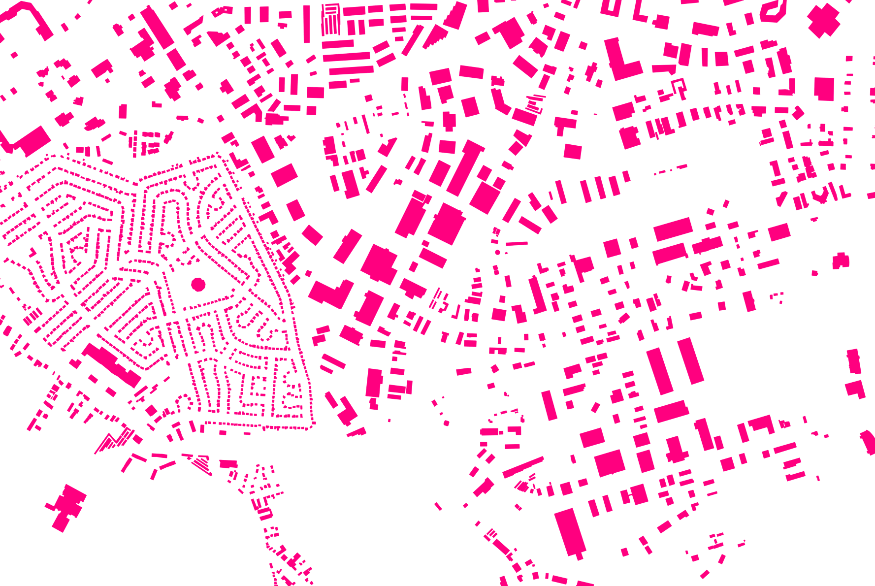
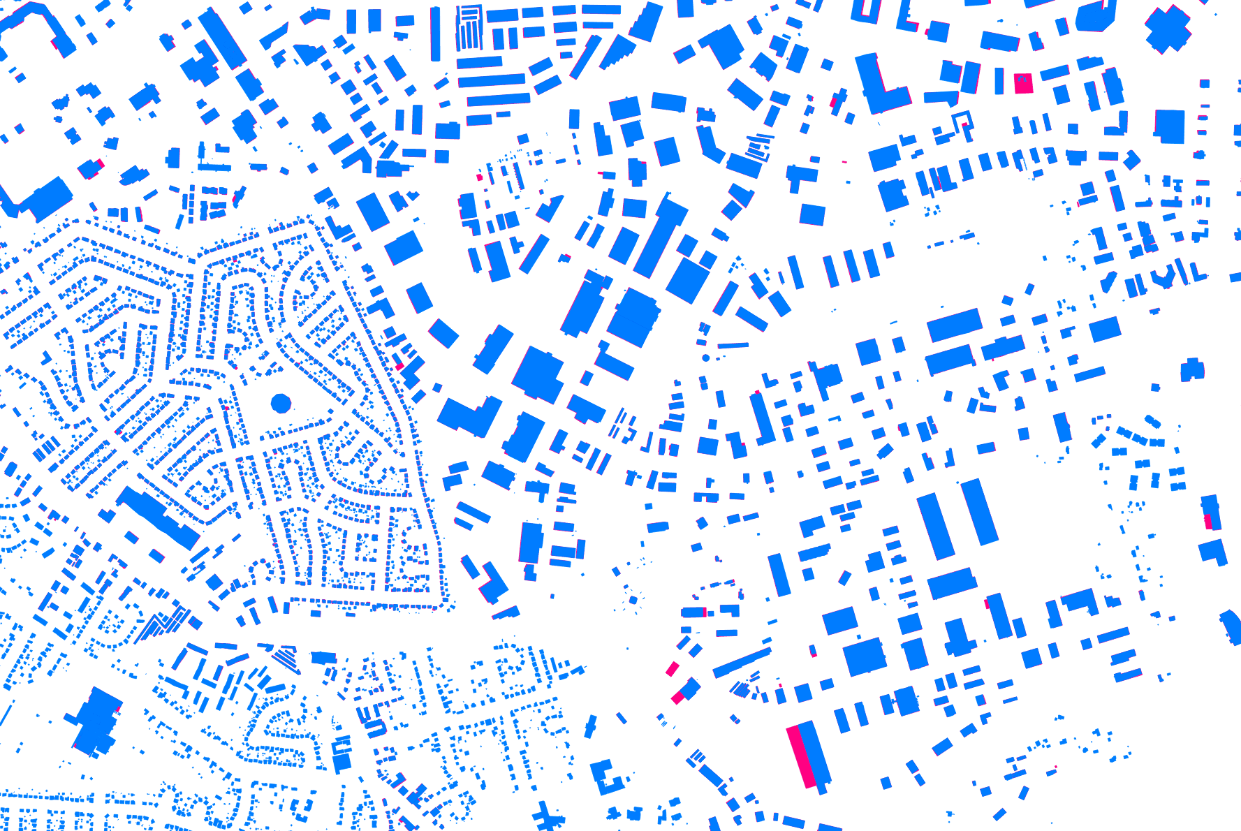
| 18:58, 28 January 2015 | LouisvilleKYExistingVSNewBuildings.png (file) |  |
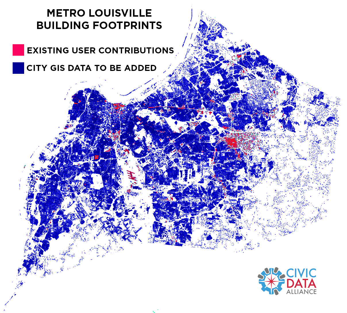
675 KB | Map comparing existing OSM user contributions of building footprints in Louisville, KY vs official city gov's GIS data to be loaded. | 1 |