File:Tracks with descriptive name tags.png
Jump to navigation
Jump to search
Size of this preview: 800 × 409 pixels. Other resolutions: 320 × 164 pixels | 640 × 328 pixels | 1,223 × 626 pixels.
Original file (1,223 × 626 pixels, file size: 119 KB, MIME type: image/png)
Summary
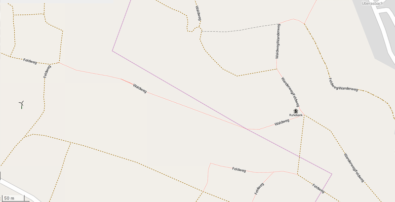
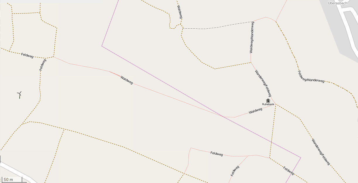
Screenshot of a region where most of highway=track were, at one stage, incorrectly tagged with descriptive name tags (in German).
Licensing
![]()
![]()
This screenshot contains OpenStreetMap Carto rendering.
The OpenStreetMap Carto map style is made available under the Creative Commons CC-0 1.0 Universal Public Domain Dedication.
- Attribution to the map data:
| Contains map data © OpenStreetMap contributors, made available under the terms of the Open Database License (ODbL).
The ODbL does not require any particular license for maps produced from ODbL data, produced maps may be subject also to other licences. |
File history
Click on a date/time to view the file as it appeared at that time.
| Date/Time | Thumbnail | Dimensions | User | Comment | |
|---|---|---|---|---|---|
| current | 11:05, 1 February 2014 | | 1,223 × 626 (119 KB) | Malenki (talk | contribs) | Screenshot of a [http://www.openstreetmap.org/#map=17/50.89753/7.68173 region] where most of highway=track are tagged with descriptive name tags. |
You cannot overwrite this file.