File:WikiMedia Internationalised Maps - Europe in Japanese.png
Jump to navigation
Jump to search

Size of this preview: 780 × 599 pixels. Other resolutions: 312 × 240 pixels | 625 × 480 pixels | 1,000 × 768 pixels | 1,280 × 984 pixels | 1,546 × 1,188 pixels.
Original file (1,546 × 1,188 pixels, file size: 962 KB, MIME type: image/png)
Summary
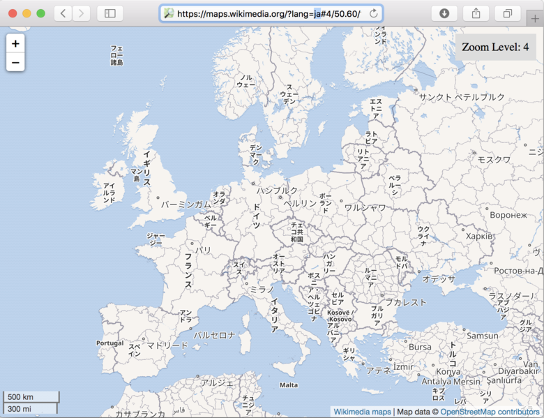
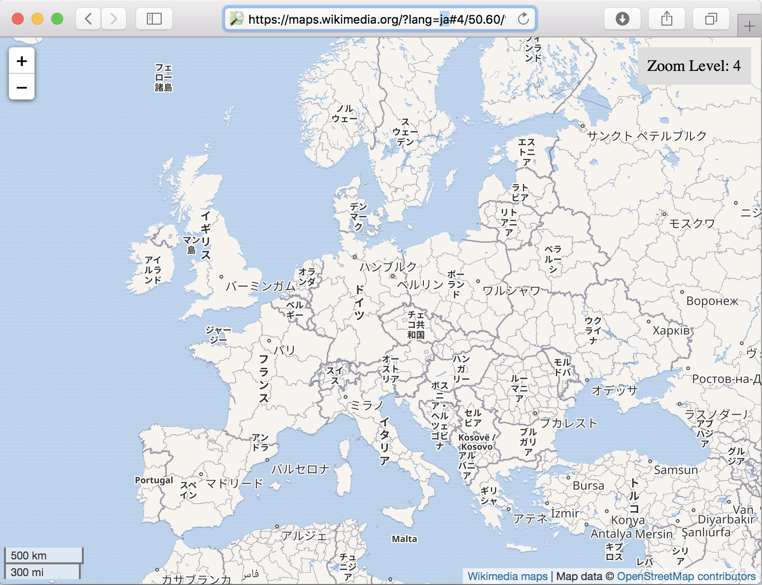
Screenshot of internationalized Wikimedia maps, here with European place names preferably rendered in Japanese: https://maps.wikimedia.org/?lang=ja#4/43.17/17.01
Maps Terms of Use: Where does the map data come from?
This is a Featured image, which means that it has been identified as one of the best examples of OpenStreetMap mapping, or that it provides a useful illustration of the OpenStreetMap project. If you know another image of similar quality, you can nominate it on Featured image proposals.
Front-page image for week 28 of 2018 (9–15 Jul.).
- Image descriptions
- English : The Wikimedia Foundation recently announced new support for internationalized map renderings. E.g. showing European place names in Japanese.
- français : La Fondation Wikimedia a récemment annoncé la nouvelle prise en charge du rendu des cartes internationalisées. Par exemple pour montrer les noms de lieux européens en japonais.
- italiano : La Wikimedia Foundation ha annunciato recentemente la gestione delle mappe internazionalizzate(en), ad esempio si può mostrare l'Europa con i nomi dei luoghi in giapponese.
- 中文(简体) : 维基媒体基金会最近宣布新支援国际化地图渲染。例如欧洲一带显示日文名称。
- 中文(繁體) : 維基媒體基金會最近宣佈新支援國際化地圖渲染。例如歐洲一帶顯示日文名稱。
- فارسی : بنیاد ویکیمدیا بهتازگی اعلام کرد که از شیوهٔ جدیدی برای ساخت نقشههای بینالمللی پشتیبانی میکند. مثلاً نمایش نام مناطق اروپایی به زبان ژاپنی.
Licensing
| Contains map data © OpenStreetMap contributors, made available under the terms of the Open Database License (ODbL).
The ODbL does not require any particular license for maps produced from ODbL data, produced maps may be subject also to other licences. |
File history
Click on a date/time to view the file as it appeared at that time.
| Date/Time | Thumbnail | Dimensions | User | Comment | |
|---|---|---|---|---|---|
| current | 00:52, 10 July 2018 | | 1,546 × 1,188 (962 KB) | Harry Wood (talk | contribs) | Screenshot of wikimedia maps: https://maps.wikimedia.org/?lang=ja#4/43.17/17.01 https://wikimediafoundation.org/w/index.php?title=Maps_Terms_of_Use#Where_does_the_map_data_come_from.3F |
You cannot overwrite this file.
File usage
The following 14 pages use this file:
- Featured images/Jul-Sep 2018
- Key:name:ja
- Ko:지도 다국어화
- List of featured images/2018
- Map internationalization
- Pt:Featured images/Jul-Sep 2018
- Uk:Інтернаціоналізація мапи
- Zh-hans:Featured images/Jul-Sep 2018
- Zh-hant:Featured images/Jul-Sep 2018
- Template:Iotw image/2018-28
- DE:Featured images/Jul-Sep 2018
- FR:Featured images/Jul-Sep 2018
- ES:Featured images/Jul-Sep 2018
- IT:Featured images/Jul-Sep 2018