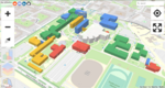
Indoor Mapping
This page is intended to collect all ideas concerning indoor mapping activities.
It is useful for tagging, to refer to the Simple Indoor Tagging schema.
Use cases
Indoor maps or information can be used for various applications, e.g.
- Indoor Navigation/Routing
- 3D Visualization
- 2D Maps
- Public Participation
- Emergency response
- Interested Amenities Display (e.g. Toilets, Fire Extinguisher, First Aid Box)
for different venues, e.g.
- Airports
- Hospitals
- Hotels
- Universities
- Schools
- Museums
- Train and subway stations
- Shopping Malls
- Smart buildings
- multi storey parking decks
- other public buildings
The indoor/use cases page contains a list of venue use case examples, with sample maps from the venues, as well as various components of indoor addressing according to each case.
Apps
| Name | Indoor= | indoors | MapGL Indoor Plugin | OpenLevelUp | OpenStationMap | OSM Indoor Mapping Browser | OsmInEdit |
|---|---|---|---|---|---|---|---|

|

|

|

|

| |||
| Website | Website | Website | Website | Website | Website | Website | |
| Genre | Indoor, Interaction, Renderer | Editor, Indoors, POI | ?
|
Indoor, Interaction, Routing, Slippy map | Indoor, Interaction, Routing, Display, Router | ?
|
Editor |
| Description | indoor= is a map that displays indoor data. | A MapComplete theme: On this map, publicly accessible indoor places are shown. | ?
|
OpenLevelUp allows to navigate inside levels of a building interactively and displays pictures from the web, Mapillary or Flickr. | OpenStationMap is a project to map stations with routing, indoor, 3D and of course station specific features. | ?
|
Simple indoor editor. |
| Supported platforms | Web | ?
|
?
|
Web | Web | ?
|
Web |
| Release date | 2022-08-04 | ?
|
2022-05-02 | 2016-09-13 | ?
|
2014-06-26 | 2022-01-04 |
| Languages | English | Català, Dansk, Deutsch, English, Español, Français, Nederlands, Norsk (bokmål), Česky | ?
|
English | English | ?
|
English, Français |
| Coverage | ?
|
Worldwide | ?
|
?
|
?
|
?
|
?
|
| Author | User:Francois2 | ?
|
?
|
PanierAvide | Roland Wagner, Roland Olbricht | Clement LaGrange | User:PanierAvide |
| License | AGPL v3 | Free | MIT | AGPL-3.0-or-later | ?
|
GPL-3.0-or-later | ISC |
| Source code | </> | </> | </> | </> | ?
|
</> | </> |
This table was generated by the OSM Apps Catalog at 2024-01-06.
Deprecated
| Screenshot | Name | Developer | License | Latest version | Release date | Official website | Note |
|---|---|---|---|---|---|---|---|

|
ID-indoor | PanierAvide | ISC | ? | ? | projets.pavie.info/id-indoor | Replaced with OsmInEdit |
| ? | ? | ? | ? | ? | sisinflab.poliba.it/polibaindoor | ||
|
openindoor.io | openindoor.io | AGPL-3.0-or-later | v1.0 beta | 2022-05-27 | app.openindoor.io GitHub: open-indoor/openindoor6 |
Projects
Currently these users are working on indoor-related topics:
- AddICT Compound facility (CompoundFacility)
- Saerdnaer Indoor Proposal (Proposed features/indoor), Rendering (modified Kothic JS), Routing (modified OSRM, JavaScript UI with Leaflet)
- Gomar1985 Indoor Proposal (IndoorOSM), Rendering of multi-level building maps in 2D (http://indoorosm.uni-hd.de/) and 3D, Indoor Routing/Navigation (http://indoorosm.uni-hd.de/)
- andreas.balzer Extension and aggregation of indoor proposals, see andreas.balzer, Rendering (own render engine in C#, yet to be published), Routing (modified OsmSharp)
- Xianlin NUS Indoor Map, Singapore
- AeroSuch Co-founder of indoor mapping startup BuildingLayer (discontinued 2014-11). Maintains Indoor Navigation Market spreadsheet (last update 2013-09).
- Sutter Working on an indoor map editor Termite This effort has been discontinued.
- Mdiener (Michael Diener) Founder of indoor mapping and indoor routing based on open source software indrz find us on GITHUB at https://github.com/indrz/indrz
- Overflorian Indoor mapping of train stations over the Paris area Open Data SNCF - see also talk from State of the Map 2019: Pedestrian routing in complex areas: the case of Paris railway stations
- TagaSanPedroAko Mostly doing indoor mapping of malls around south Metro Manila, especially Muntinlupa.
- PanierAvide Creator of OpenLevelUp and iD-indoor, also contributing to indoor in France.
- rolandmwagner Roland Wagner, initiator of OpenStationMap, also mapped NYC Grand Central Station, Chicago Union, Sydney Central, Tokyo Ueno, Prague Central, Amsterdam Central, Portland / OR Union, Berlin Hauptbahnhof, London,...
- Exatomos Started indoor mapping of ULB "Plaine" university campus in Brussels.
- Clement.igonet Creator of OpenIndoor S.A.S., contributing to 3D web indoor solution.
Communication
There is now a new subforum for Indoor-Mapping:
Let's try to increase the communication in this project. --Andi 12:03, 3 October 2012 (BST)
There is an API proposal you can implement on your backend to ensure other apps can link to your indoor navigation app.
Talks
- State of the Map 2016
- FOSSGIS 2012: https://www.fossgis.de/konferenz/2012/programm/events/468.de.html
Tagging
For the current consensus see Simple Indoor Tagging. The tags below may be outdated or no longer used.
Tags in use
Please see Tagging above for more detailed information
- level=n - indicates floor level; interpretation of the values varies (see key page)
- <n> is usually an integer number, sometimes also one or two characters, sometimes combined (e.g. A,B,C,1,2,3).
- in any case, <n> should be ascending (towards the sky).
- in some cultures base level is indicated by level 0, in other cultures ground floor is level 1 (or A).
- there are also usages reported where fraction numbers are used (e.g. level=2.5) indicating a "mezzanine" or "intermediate level" (e.g. intermediate stairway platforms).
- room=yes - see key wiki page for additional values to describe the type more detailed. Room number ref=* and room name name=* are tagged as appropriate.
- entrance=yes - building entrance
- window=yes - windows
- door=yes/hinged/sliding/no - interior doorways
- capacity=* - the occupant capacity of a room, storey, building or part of a building defined as the maximum number of persons it is designed to hold
- highway=elevator - elevators
- highway=steps - stairways
- conveying=yes/forward/backward/reversible - escalators
- indoormark=beacon - Bluetooth, NFC, or QR beacon for indoor positioning.
Proposed Tags
- indoor=yes - Indicates any osm object being inside a room, a building (or both) or a shelter.
- highway=corridor - Indoor ways, under some previous indoor tagging schemes, and as of 2019 a de facto standard. Another de facto standard for mapping interior routes is highway=footway+indoor=yes.
Tagging proposals more concerned with the 3D shape of the building
Previous tagging proposals
There are also some abandoned and inactive proposals (oldest last):
- IndoorOSM
- Proposed_features/indoor
- Termite#Indoor_Model
- CompoundFacility
- Relations/Proposed/Level_Map
- Relations/Proposed/Level
Rendering
Available renderers:
- An Overpass API based renderer : OpenLevelUp
- OpenIndoor renderer (MapLibre based): OpenIndoor
Geolocalization
- The altitude value of GPS devices could be used to identify in which level of a parking multi storey a car is located.
Routing
- To go from point A to point B, need to consider:
- levels
- stairs
- escalators (conveying)
- elevators (lifts)
Devices / Technologies
- High sensitivity GPS device
- Step counter
- Compass
- Acceleration sensor
- Counting the number of wheel turns in cars / Tachometer
- Counting the number of floor tiles
- RFID
- WLAN
- Bluetooth
- Camera
- Audio footprint for rooms
- Laser rangefinder (e.g. Hector SLAM [1])
- Visual/Depth/Stereo SLAM (with software like RTAB-MAP [2])
Projects
Indoor actives related to OSM: (please add new ones at the top)
- indoor= (indoorequal.org) - A map that render indoor data with a level selector and an heatmap to locate indoor mapped area.
- indrz.com https://github.com/indrz/indrz Open Source backend (Django python web framework) to manage indoor data for buildings, rooms spaces
- OpenLevelUp (openlevelup.net) - A web viewer display indoor data level by level, written in JavaScript, supports both indoor=* and buildingpart=* tag schemes. Git repository.
- OsmInEdit (osminedit.pavie.info) - A simple web indoor editor, focused on making things easier (floor plan management, dedicated editing modes).
- OpenIndoor (app.openindoor.io) - A 3D web viewer display indoor data level by level, based on mapbox, supports both indoor=* and buildingpart=* tag schemes. Git repositories.
- iD-indoor (projets.pavie.info/id-indoor/ - unmaintained) - A web indoor editor based on iD, with indoor dedicated features (level filtering, specific map and presets).
- BE-free@campus: Barriers and Exclusion-free at campus - A personal assisted navigation to disabled people within the Polytechnic of Bari facilities of the university campus.
- https://www.openstationmap.org for (Railway) Stations including the indoors with the Simple Indoor Tagging, but also extensions, e.g. for doors and for stairwells (steps). Example stations are Berlin Hauptbahnhof, Sydney Central or Tokyo Ueno JR Station.
- http://indoorosm.uni-hd.de indoorOSM project from OSM data - a project of the University of Heidelberg
- FootPath, infrastructureless indoor navigation on OSM data for smart phones (Android) at COMSYS, RWTH Aachen University video
- Ways4All
- OSMTools Indoor: http://osmtools.org/indoor/#lat=51.09447&lon=17.01945&z=18
- Fork of the previous one : https://github.com/clement-lagrange/osmtools-indoor ; demo here : https://clement-lagrange.github.io/osmtools-indoor/ ; fully functional indoor building browser, js only.
Former, inactive and on hold projects:
- Richard Atterer's Leadme project A spare time project by Richard Atterer for home made indoor mapping.
- Termite - an editor specialized for indoor maps. This has been discontinued.
- http://andreas-hubel.de/ba/demo/ levelable indoor maps from OSM data implemented with Kothic JS
demo currently offline.See http://andreas-hubel.de/ba/ for implementation details and screenshots. There is also a virtual server image available which contains all software needed to run the demo. --Saerdnaer 19:35, 15 December 2011 (UTC)- It's now online again. See this screencast for more information (german): https://youtu.be/OSxU99sp0Gc --Andi 11:40, 25 June 2014 (UTC)
- OpenCaveMap project under construction, need volunteers. It's caving mapping Opencavemap.org and all other underground places
Activities outside OSM where moved to Indoor/Projects
Challenges
There is a discussion of challenges of adding indoor maps to OSM at Challenges for Indoor Maps.
Examples
List of places with indoor coverage. Consult indoor= or openindoor to see an heatmap of all mapped indoor area. The following list may be obsolete.
Argentina
Buenos Aires Autonomous City
- Buenos Aires
- Fine Arts National Museum on: OSM OpenLevelUp! Indoor= OpenIndoor
- National Geographic Institute on: OSM OpenLevelUp! Indoor= OpenIndoor
- Eduardo Sívori Plastic Arts Museum on: OSM OpenLevelUp! Indoor= OpenIndoor
Buenos Aires (province)
- Avellaneda
- Alto Avellaneda Shopping Mall on: OSM OpenLevelUp! Indoor= OpenIndoor
Córdoba
- Córdoba
- Math, Astronomy, Physics and Computer Science Faculty on: OSM OpenLevelUp! Indoor= OpenIndoor
- La Cumbre
- Nuestra Señora de Lourdes College on: OSM OpenLevelUp! OpenIndoor
Misiones
- Posadas
- Misiones National University on: OSM OpenLevelUp! Indoor= OpenIndoor
Santa Fe
- Funes
- Rosario International Airport on: OSM OpenLevelUp! Indoor= OpenIndoor
- Fisherton Plaza Chic on: OSM OpenLevelUp! OpenIndoor
Austria
Vienna
- Vienna
- Südtiroler Platz [3] Project:Ways4All on OpenLevelUp! On OSM.cz OpenIndoor
Canada
Alberta
- Calgary
- Northland Village OSMOpenLevelUp
- Edmonton
- Corona LRT station OSM OpenLevelUp
- NAIT Feltham Centre (Centre for Applied Technology) OSM OpenLevelUp
- Red Deer
- Bower Place OpenLevelUp
Ontario
- Toronto
- University of Toronto Medical Sciences Building OpenLevelUp
Colombia
Distrito Capital
- Bogotá
- Catedral Primada de Bogotá on OpenLevelUp! on OSM on OSM.cz OpenIndoor
Costa Rica
San José Province
- San José
- Starbucks on OpenLevelUp! on OSM on OSM.cz OpenIndoor
Ecuador
Pichincha
- Quito
- Quicentro Shopping on OpenLevelUp! on OSM on OSM.cz OpenIndoor
France
| Dep. | Ville | Lieu |
|---|---|---|
| Indre-et-Loire | Chenonceaux | Château de Chenonceau on OpenLevelUp! on OSM on OSM.cz OpenIndoor |
| Loir-et-Cher | Talcy | Château de Talcy on OpenLevelUp! on OSM on OSM.cz osmtools-indoor OpenIndoor |
| Nord | Villeneuve d'Ascq | Bâtiments du LIFL IRCICA OpenIndoor |
| Nord | Villeneuve d'Ascq | Bâtiments du LIFL M3 OpenIndoor |
| Nord | Villeneuve d'Ascq | Bâtiments du LIFL M3 extension |
| Paris | Paris 1er | TGI (partial for tourism) |
| Paris | Paris Vème | ENS - Rue d'Ulm osmtools-indoor OpenIndoor |
| Paris | Paris Xème | Gare du Nord Open Station Map OpenIndoor |
| Paris | Paris XIIème | Gare de Lyon Open Station Map Openindoor |
| Paris | Paris XIIIème | Bibliothèque François Mitterrand (Train station) OpenStreetMap OpenIndoor |
| Paris | Paris XVème | ECE-Paris (Eiffel 2) OpenIndoor |
| Puy-de-Dôme | Clermont Ferrand | Centre Jaude on OpenLevelUp! on OSM on OSM.cz OpenIndoor |
| Rhone | Lyon 3ème | Gare de la Part-Dieu (3D) OpenStationMap OpenIndoor |
| Rhone | Lyon 3ème | Halle Paul Bocuse (OpenLevelUp) OpenLevelUp OpenIndoor |
| Seine-et-Marne | Maincy | Château de Vaux-le-Vicomte OpenIndoor |
| Val-de-Marne | Thiais | Centre commercial "Belle Épine" OSM |
| Yvelines | Vélizy-Villacoublay | Centre commercial "Vélizy 2" OSM |
Germany
Bavaria
- Munich
- TUM Mathematics/Computer Science Department: OSM
- Marienplatz: OSM OpenIndoor
- Karlsplatz (Stachus): OSM
- Hauptbahnhof: OSM OpenIndoor
- Passau
- Dreiflüsse-Einkaufzentrum OSM OpenIndoor
Baden-Württemberg
- Heidelberg
- Institut of Geography OSM OpenIndoor
Berlin
- Berlin
- bcc Berliner Congress Center OSM OpenIndoor
North Rhine-Westphalia
- Aachen
- RWTH Computer Science Center Hörn: https://www.openstreetmap.org/?lat=50.778845&lon=6.060025&zoom=18&layers=M OpenIndoor
- RWTH UMIC Research Center: https://www.openstreetmap.org/?lat=50.778834&lon=6.065266&zoom=18&layers=M OpenIndoor
- Köln
- Einkaufszentrum Rhein-Center (In Work): https://www.openstreetmap.org/#map=18/50.93717/6.83534 OpenIndoor
Thüringen
- Ilmenau
- Technische Universität Ilmenau, Campus https://www.openstreetmap.org/?lat=50.682884&lon=10.937887&zoom=18&layers=M OpenIndoor
Japan
- Tokyo
- Futako Tamagawa rise OSM OpenIndoor
- Shibuya Hikarie OSM OpenIndoor
- AKASAKA Biz Tower OSM OpenIndoor
- Ueno Station OpenIndoor
- University Of Technology OpenIndoor
- National Museum of Emerging Science and Innovation OpenIndoor
México
- Mexico City
- Mexico City Metropolitan Cathedral on OpenLevelUp! on OSM OpenIndoor
Panamá
Panamá Province
- Panamá City
- Multicentro Mall on OpenLevelUp! on OSM on OSM.cz OpenIndoor
Philippines
- Calabarzon
- Batangas
- Batangas City
- SM City Batangas OSM OpenLevelUp
- Batangas City
- Batangas
- Cordillera Administrative Region
- Baguio
- Abanao Square OSM OpenLevelUp
- Baguio
Poland
Wielkopolska
- Poznań
- Politechnika Poznańska Centrum Wykładowe on OpenLevelUp! on OSM on OSM.cz
Mazowieckie
- Warszawa
- Centrum Handlowe Atrium Promenada on OpenLevelUp! on OSM
Spain
Pamplona
- Universidad Pública de Navarra - Aulario in OSM in OpenLevelUp! OpenIndoor
- Universidad Pública de Navarra - Biblioteca in OSM in OpenLevelUp! in OpenIndoor
Switzerland
- Rapperswil
- HSR Hochschule für Technik https://www.openstreetmap.org/?lat=47.2232387959957&lon=8.81700843572617&zoom=18 OpenIndoor
Taiwan
New Taipei City
- Sanxia
- Bei Da Senior School on OSM, on OpenLevelUp OpenIndoor
Ukraine
Luhansk Oblast
- Severodonetsk
- Shopping mall "Jazz" https://www.openstreetmap.org/?lat=48.944006&lon=38.493187&zoom=18&layers=M
United States
Colorado
- Denver
- Colorado Capitol Building on OpenLevelUp! on OSM on OSM.cz OpenIndoor
- Denver Union Station on OpenLevelUp! on OSM OpenIndoor
- Northglenn
- Northglenn High School on OpenLevelUp! on OSM on OSM.cz
Kentucky
- Louisville
- Louisville International Airport Terminal on OpenLevelUp! on OSM on OSM.cz OpenIndoor