OpenRailwayMap/Tagging in the United Kingdom
This page is a draft and only contains suggestions.
Tracks

On Network Rail lines, ref=* can hold the Engineer's Line Reference (ELR). For instance ref=MLN1 or ref=BGK. This is usually marked on bridges and level crossings. An ELR and mileage together define a location on the Network Rail network.
The standard GB electrification system, as defined by GL/RT1210, is electrified=contact_line, voltage=25000, frequency=50.
“Light” railways
Many railways in Great Britain have names ending in “Light Railway” because they were authorised under the Light Railways Acts 1896 and 1921. That doesn’t necessarily mean that they should be tagged railway=light_rail: most of them are operated like main-line railways and should be tagged railway=rail or railway=narrow_gauge.
Tunnels
Tunnels on Network Rail infrastructure usually have names displayed along with the length of the tunnel at the tunnel portals. This can be tagged as tunnel:name=*.
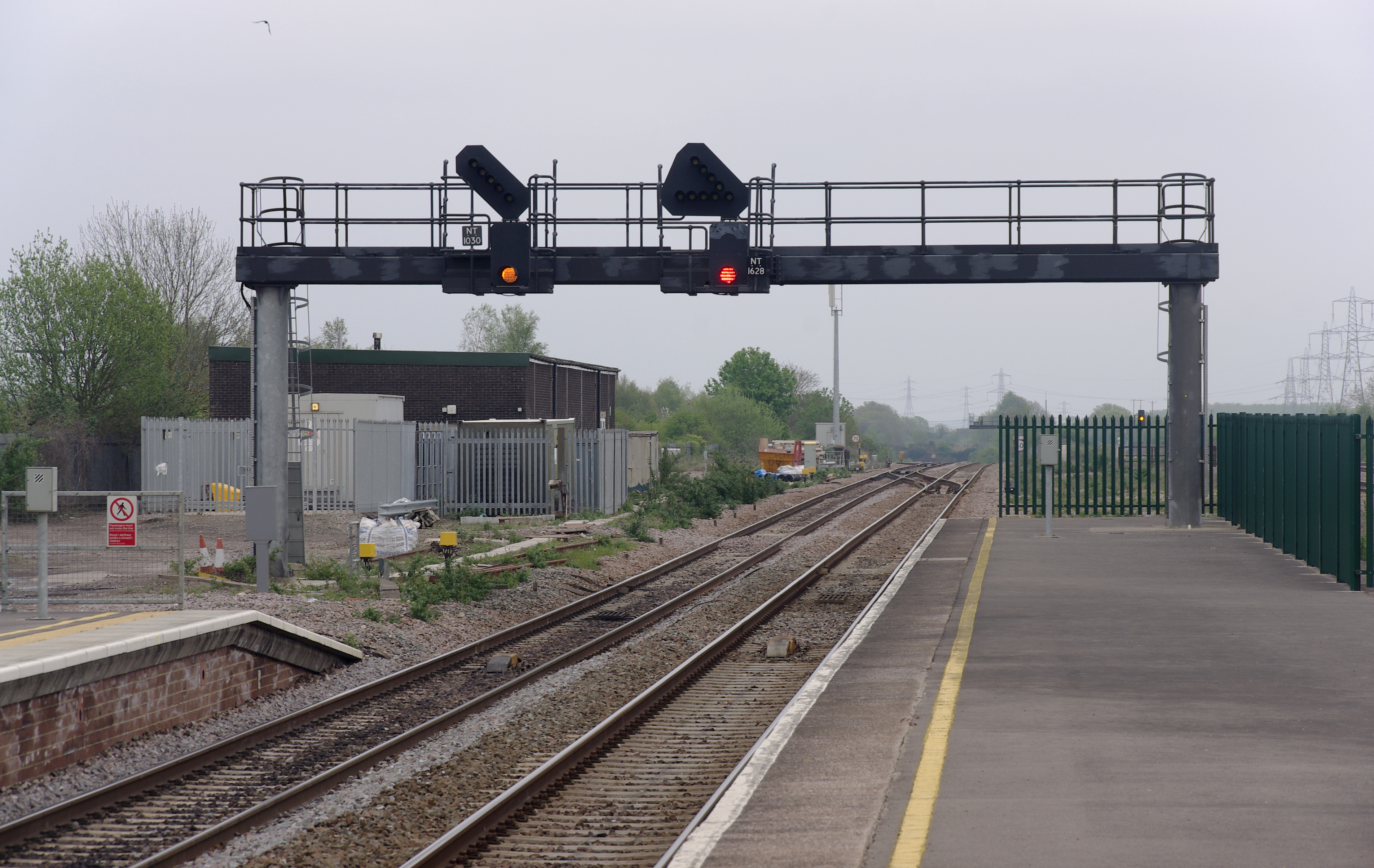
Main Signals

light main signal (combined lenses)

light main signal (individual lenses) with a junction signal

light main signals (combined) with junction signals (open this image and zoom in)
.JPG)


Light Signals
- railway=signal
- railway:signal:main=GB-NR:main
- suggested: railway:signal:main:states=red;green;yellow;flashing_yellow;double_yellow;flashing_double_yellow Only enter the possible aspects at this signal!
- railway:signal:main:form=light
- optional: railway:signal:main:design=individual/combined Does each colour have it's own lamp (older style), or are some of the colours combined into a single lamp (newer style)?
Junction Signals
Light Signals
- all tags of the main signal (see above)
- railway:signal:route=GB-NR:junction
- railway:signal:route:design=feather/theatre Only select position states below if design is feather
- railway:signal:route:states=position_1;position_2;position_3;position_4;position_5;position_6;<numbers/letters> Only enter the possible aspects at this signal! For position numbers see figure 6.42 at railsigns.uk.
- railway:signal:route:form=light
Shunt Signals
Light Signals
Limit of Shunt Signals
Light Signals
- railway=signal
- railway:signal:shunting=GB-NR:limit
- railway:signal:shunting:form=light
- railway:signal:direction=backward Limit of shunt usually on the 'wrong' side of the track, so they're backwards from the normal direction.
Signal Documentations
- railsigns.uk ( Archived here)
- signalbox.org
- Wikipedia
- Official wording can be found at map [ dead link ] by National Rail. Don't copy the map data to OSM, just have a look how NR names the signal types!
Signal boxes
.jpg)
Signal boxes are usually labelled with their names, and sometimes with their signal prefixes as well. The name can obviously be tagged using name=*, and the prefix could be tagged with railway:ref=*.