OpenRailwayMap
| OpenRailwayMap-vector | ||||||||||||||||||||||||||||||||||||
|---|---|---|---|---|---|---|---|---|---|---|---|---|---|---|---|---|---|---|---|---|---|---|---|---|---|---|---|---|---|---|---|---|---|---|---|---|
| Author: | Hidde Wieringa | |||||||||||||||||||||||||||||||||||
| License: | GNU GPL v3 (free of charge) | |||||||||||||||||||||||||||||||||||
| Platform: | Web Mobile | |||||||||||||||||||||||||||||||||||
| Status: | Active | |||||||||||||||||||||||||||||||||||
| Language: | English
| |||||||||||||||||||||||||||||||||||
| Website: | https://openrailwaymap.app | |||||||||||||||||||||||||||||||||||
| Source code: | hiddewie/OpenRailwayMap-vector GitHub | |||||||||||||||||||||||||||||||||||
| Programming languages: | JavaScript, Python, Lua, and SQL | |||||||||||||||||||||||||||||||||||
|
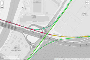
OpenRailwayMap with vector tiles |
||||||||||||||||||||||||||||||||||||
| ||||||||||||||||||||||||||||||||||||
| OpenRailwayMap | ||||||||||||||||||||||||||||||||||||
|---|---|---|---|---|---|---|---|---|---|---|---|---|---|---|---|---|---|---|---|---|---|---|---|---|---|---|---|---|---|---|---|---|---|---|---|---|
| License: | GNU GPL v3 (free of charge) | |||||||||||||||||||||||||||||||||||
| Platform: | Web | |||||||||||||||||||||||||||||||||||
| Status: | Active | |||||||||||||||||||||||||||||||||||
| Website: | https://www.openrailwaymap.org | |||||||||||||||||||||||||||||||||||
| Source code: | openrailwaymap/OpenRailwayMap GitHub | |||||||||||||||||||||||||||||||||||
| ||||||||||||||||||||||||||||||||||||


OpenRailwayMap (previously called "Bahnkarte") is a detailed online map of the world's railway infrastructure, built on OpenStreetMap data. It has been available since mid-2013 at openrailwaymap.org. Since 2024 a reimplementation using vector tiles is available on openrailwaymap.app[1].
Description

This project was founded in December 2011 in order to create a world-wide, open, up-to-date and detailed map of the railway network, based on OpenStreetMap. The domain was registered on April 27th, 2013 and the corresponding website was launched in mid 2013. Since then it has received constant improvement. In February 2014 the project moved to a new server. In April 2014 a dedicated map for mobile phones was launched.
The OpenRailwayMap includes all rail-mounted and automotive vehicles, e.g. railways, subways, trams, miniature railways and funiculars. The map does not include aerialways, monorails, and maglevs. OpenRailwayMap was one of the few renderers that exposes defunct railways (tagged as railway=abandoned or railway=razed), but the vector reimplementation has replaced OSM's coverage of demolished railways with time-enabled OpenHistoricalMap data.
The name OpenRailwayMap mostly refers to the online map, but the project also aims to support railroad-related data in OpenStreetMap. By developing a consistent data model, providing a mailing list for discussions, developing editor plugins, etc. the collection of these data is boosted and the data are made usable for other applications and developers.
Motivation
OpenRailwayMap aims to provide a new quality of railway maps and offers the following benefits:
- Worldwide coverage: So far, there is no railway map covering the whole world, just individual countries.
- Open source and open data: Currently there are also no maps of railway networks providing not just rendered maps, but also the raw geodata. No current maps offer such data under free licenses. This project is based on OpenStreetMap data provided under the Open Database License.
- Up-to-date and detailed: This map aims to benefit from crowdsourcing. Contributors around the world with a good local knowledge are encouraged to edit this map to make it detailed and up-to-date.
- OpenStreetMap: There are already many maps based on OpenStreetMap, e.g. for sailing, cycling, hiking, motorcars, public transport, skiing, power networks and many more. So far, however, there has been no railroad map.
Use cases
There are several good reasons for creating an open, comprehensive railway map of the world, consider the following:
- Simulation: Detailed railroad data are an excellent basis for simulating trains and signal boxes realistically.
- Research: Scientists and researchers can use the data to analyse the railroad network, simulate changes and utilise them for educational purposes.
- Plans for model trains: This detailed railroad data are a good data source for railway enthusiasts wanting to build a railroad line as a model. With these data you do not need to copy the railroad tracks anymore.
- Enthusiasts: There are many people interested in railways, e.g. trainspotters. This map provides them with a detailed information source on the railroad network, as well as the opportunity to contribute.
- Basemap for realtime traffic: Other applications can use this map to track the position of trains or to provide a realtime view of the trains' current position. You can also think of applications showing construction sites, detours, blockings and the traffic density.
- Routing: With detailed mapped railway infrastructure you could develop a routing application.
- Public transport: This map and the data are an important data source for public transport applications like timetables, routing, ... .
Mapping
For the average mapper mapping the railroad network is a bit more complicated than mapping streets or POIs, but there are some suitable ways of mapping:
- Aerial imagery: Railroad tracks can easily be drawn based on aerial imagery, if high-resolution images are available for your area. With those imageries you can map even large yards simply from home. If you have access to very good high-resolution imagery (e.g. Aerowest), you can also see platforms or even signals.
- In trains: In areas without high-resolution aerial imagery you can track the railroad lines with the GPS while sitting in the train. You should give attention to a sufficient GPS signal in the train to generate accurate tracks (see WikiProject_Germany/Railway).
- Along the railroad lines: Especially in rural areas the railroad lines can be accessed easily from ways parallel to the tracks. From there you can map signals or milestones fast, easy and safely. Crossings and bridges are also a good possibility to have a look at a part of the railroad line.
- Stations: In stations you can map a lot of details easy to access and without risk.
- Other sources: Public data, data sources with usage permission, pictures from trainspotters or videos from the driver's cab after getting their permission.
Note: In all ways of mapping, you have to respect some rules:
- Obey the law: Do not trespass on railroad areas and do not disturb or interrupt railroad traffic. Only use data available from public sources (examples are mentioned above)
- Do not put yourself at risk
- Do not use illegal, non-public, confidential or legally doubtful data sources
- Respect copyright laws and do not copy from other maps
For newbies: Would you like to contribute data, but are unsure how to access OSM? Or maybe you have interesting information you can share, but no time to do this yourself? Contact us and send your data with permission and we might be able do some mapping for you.
Features

- Five overlays based on numerous backgrounds (including hillshades)
- for infrastructure (including milestones, switches, track numbers, signal boxes)
- for signals (including train protection systems)
- for maximum track speeds
- for electrification (beta)
- for track gauge (beta)
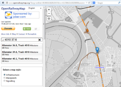
- Numerous search features, stations, milestones and level crossings
- Permalinks
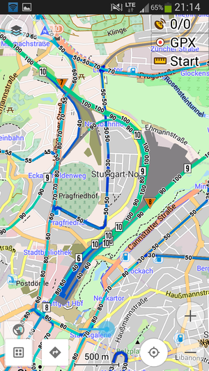
- Dedicated version for mobile phones, open approach for flexible integration in 3rd party applications (such as OsmAnd)
- Daily updates, starting at around 1:00 in the morning (Central European Time), taking about four hours.
- Multiple languages, including: Czech, Danish, Dutch, English, French, German, Greek, N'ko, Polish, Portugese, Russian, Slovenian, Spanish, Swedish, Ukrainian and Vietnamese. As many as 22 translations are available or underway. Translations are coordinated via Transifex.
Some examples

There is still a long way to go for both the software and railway data. However, there are already some quite fine examples of OpenRailwayMap's quality:
- Some of the more or less fully railway-mapped areas include the Dresden station area and the Mannheim-Stuttgart high-speed railway line.
- Examples of smaller fully mapped stations include Neuss Hauptbahnhof (a mid-sized railway station in Germany) and Wernigerode, a small station with many signals.
Tagging
For mappers it is recommended to ignore the complex tagging scheme and to use the JOSM presets made for single countries. The presets simplify the complex and general tagging and help make it easier to edit without learning tags.
Country-specific tagging
There are lists of important objects in different countries with examples of how to tag them. Everybody can add a country or add examples to an existing country.
On these pages you can find country-specific information about mapping signals or working rules correctly. There are also some illustrated practical tagging examples. Everybody is invited to add more countries or add some examples for an existing country.
- Australia (+ draft page for signals)
- Austria, currently only available in German
- Belgium
- China (currently only available in Chinese)
- Czechia (Czech only)
- Denmark
- Finland
- France
- Germany (ESO, i.e. heavy railways and narrow gauge railways), full version currently only available in German, English translation not finished yet
- Germany (BOStrab, i.e. trams, light rails and subways) (under draft), currently only available in German
- Indonesia (incomplete, version in English)
- Italy
- Japan (draft, version in English)
- Luxembourg
- Netherlands
- New Zealand (draft)
- North America (United States, Canada, and Mexico)
- Norway
- Poland, currently only available in Polish
- Russia and post-soviet countries
- Spain
- Switzerland, currently only available in German
- Sweden
- United Kingdom
Mapping presets
For easier mapping you can use the JOSM preset files.
There are several presets available:
- Railways: generated daily from OpenRailwayMap-vector map features. Contains railway tracks, interlocking, (country-specific) signals, operating sites and their facilities and other railway features.
- OpenRailwayMap BOStrab signals: Preset to tag tram signals in Germany.
- OpenRailwayMap Infrastructure DE+AT: Preset to tag German and Austrian railway infrastructure.
- OpenRailwayMap Signale AT V2: Preset to tag Austrian railway signals.
- OpenRailwayMap Signale DE ESO: Preset to tag German railway signals.
- OpenRailwayMap special AVG signals: Preset to tag some special railway signals used by Albtal-Verkehrs-Gesellschaft around Karlsruhe.
Enable the presets in JOSM by following the instructions in the JOSM wiki.
The same presets can also be used with Vespucci for mobile mapping.
Software

The software is split up into the following components and available on GitHub:
- https://github.com/OpenRailwayMap/OpenRailwayMap: website, JOSM tagging preset, JOSM validation rules, MapCSS map style (for JOSM and map key)
- https://github.com/OpenRailwayMap/OpenRailwayMap-CartoCSS: map style for the tile server written in CartoCSS
- https://github.com/OpenRailwayMap/OpenRailwayMap-api: API (for search function)
- https://github.com/OpenRailwayMap/server-admin: Ansible playbook to set up the server
OpenRailwayMap runs on Linux and uses following software:
- website: Leaflet, PHP
- map key on the web site: KothicJS, MapCSS
- tile server: Osmium, Osm2pgsql, PostgreSQL, PostGIS, Mapnik, CartoCSS, Tirex
- API: Osmium, Osm2pgsql, PostgreSQL, PostGIS, Python
To search for operating sites and milestones, you can use our API. There is also a possibility to include the tiles into other applications. For more information about the terms of use and technical details, please read the API documentation.
Bug reports and suggestions should be reported at the GitHub repositories listed above.
Contribute
Contributors are welcome to help as programmers, translators or designers. Please contact us if you want to contribute.
Mapping: The usability of this map depends on the data. Please use your knowledge to keep the mapped information up-to-date and insert more details!
Programming: You created an interesting new feature or fixed a bug in the existing code? Please send me your code and we will add it.
Translating: OpenRailwayMap wants to be available for many users and in many languages. Please translate the application, the preset files or this wiki page to other languages!
Design: The current design is not very good. Please help to improve it or improve the support in many browsers.
Resources: OpenRailwayMap is currently just a project run in my free time, so needed resources like hardware or domains are limited. You are welcome to support me with these resources!
JOSM-Presets: Create JOSM presets and styles for different countries!
Examples: Add images to the tagging examples or create example pages for new countries!
Bug reports, browsertests and feature suggestions are desired. Please contact us.
The authors list contains some of the main contributors.
Donations
This project is operated by the developers in their spare time and has no commercial goals. By making a donation you can show that you appreciate the voluntary work of the developers and can motivate them to continue the project in the future.
But any donation is not only a form of recognition, but also a financial contribution to the costs that are caused by server, domains, etc.. Only with enough donations the project can be provided without advertising and for free also in the future.
Donations can be made via Paypal. On request, donations by bank transfer can be arranged.
Contact
To contact us, please use one of the following ways:
- Wiki-Message
- OSM-Message
- E-Mail to info@openrailwaymap.org
Mailing list and IRC
- openrailwaymap (en)(de) Mailing list for users and developers of OpenRailwayMap, but also other railway related stuff.
Register – Archive, NNTP gateway via Gmane - #OpenRailwayMap (en)(de) IRC channel for users and developers of OpenRailwayMap, but also other railway related stuff.
irc://irc.oftc.net #OpenRailwayMap or webchat (choose "#openrailwaymap")
News
- http://blog.openrailwaymap.org/ - Blog
 @openrailwaymap@en.osm.town (before that on
  @openrailwaymap
 )
)
Events
- OpenRailwayMap meetup, 6. June 2014 in Dresden, Germany
- Mapping Weekend 2014, 11.-13. July 2014 in Cologne, Germany
- Project Meeting 2014, 24.-26. October 2014 in Bad Nauheim, Germany
- Online Meetup SOTM Birds of a Feather 2020
- Online SOTM Birds of a Feather 2022
- World Railway Mapping Online Quarterly Meetup. 15th October, 2022 - 1900 CEST
Fun Fact about ORM
Thanks to a documentary of French TV chanel RMC, we can know that Getlink (operator of the Channel Tunnel) use the OpenRailwayMap layer[2].
See also
- OpenRailwayMap Category
- ÖPNV-Karte: A map of lines running on rail and road networks
- List of OSM-based services
- RailwayHistoryMap
- OpenHistoricalMap
External Links
- OSM Inspector for railways
- Train route analysis based on OSM data
- Train routing, worldwide using the OSRM engine. Useful to check railway correctness in OSM.
- Train station direct connections by Bahn.de
References
- ↑ OpenRailwayMap-vector announcement on OpenStreetMap community forum on https://community.openstreetmap.org/t/openrailwaymap-vector-announcement/126995
- ↑ https://www.rmcbfmplay.com/video/rmc-bfm-play/eurostar-la-techno-du-tgv-qui-defie-la-manche?contentId=Product::NEUF_BFMAVOD_BAV00204488&universe=PROVIDER at 39min47sec

