Tag:railway=light_rail
 |
| Description |
|---|
| Rails of a light rail. |
| Rendering in OSM Carto |

|
| Group: railways |
| Used on these elements |
| Useful combination |
| Status: de facto |
| Tools for this tag |
|
A higher-standard tram system, often separated from other traffic for part or much of the way. It exists between classical tram railway=tram and classical conventional railway railway=rail.
With this tag the rails of a light rail are tagged.
Definition
Definition according to ![]() Transportation Research Board: "A mode of urban transportation utilizing predominantly reserved but not necessarily grade-separated rights-of-way. Electrically propelled rail vehicles operate singly or in trains. LRT provides a wide range of passenger capabilities and performance characteristics at moderate costs."
Transportation Research Board: "A mode of urban transportation utilizing predominantly reserved but not necessarily grade-separated rights-of-way. Electrically propelled rail vehicles operate singly or in trains. LRT provides a wide range of passenger capabilities and performance characteristics at moderate costs."
There is no clear definition of light rail on OSM, the distinctions between conventional rail (rail), tram (tram) and subway (subway) are fuzzy. A light rail system should be mapped consistently, as long as there are no serious differences. Further below are some recommendations from railway mappers which should support the selection. In order to avoid conflict, please seek consensus on the forum or mailing lists before retagging.
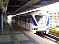
Currently in OSM, some "light metro" systems with fully segregated right of way are mapped as light_rail. Examples include Toronto subway line 3 Scarborough, Docklands Light Railway, Macau Light Rapid Transit, etc, but some similar systems, such as Copenhagen Metro, are tagged as subway instead. In contrast, systems with more light rail characteristics (mostly off-street running with signalled street junctions) are sometimes tagged with tram, including London Trams and Istanbul T4, but some such systems are tagged with light_rail as well, such as Light Rail (MTR) in New Territories, Hong Kong.
Recommendations
The community of OpenRailwayMap has compiled a set of recommendations at their Aktiventreffen 2014 nr. 2.
railway=light_rail is/has:
- neither tram nor rail
- only passenger traffic
- connections of the inner city with the surroundings
- separated from other traffic for part or much of the way, the level crossings have active protection
- simpler construction than railways, but higher standard compared to tram
- the railway signaling is less complex
- Compared to light rail, a subway is predominantly underground, and, while overground, has a separate right of way nearly without level crossings.
- connections to conventional rail are not a factor
Strong criteria for light rail against tram:
- Trams are driving on sight, while light rail has signals.
- Light rails are driving faster than trams because of own right of way and more complex signaling and protection.
Soft criteria for light rail against tram:
- own right of way
- high-floor
- underground railway
- elevated railway
- workrules like conventional rail
- drives overland to the surroundings
- constructed stops rather than simple bus-like stops at the road level.
- stops are separating the passengers from the tracks
- presence of so-called third rails
Tagging
- electrified=contact_line/rail
- gauge=*
- frequency=* (0 for DC)
- voltage=*
- maxspeed=*
- service=yard/siding/crossover
- workrules=*
- embedded=* (for street running)
Routes
For light rail routes use the route relation.
Examples

Docklands Light Railway

Stadtbahn in Stuttgart
Kelana Jaya LRT in Kuala Lumpur

San Diego Trolley in California


No consensus has been reached yet if the urban mass transit systems in Berlin and Hamburg which are operated by Deutsche Bahn and called "S-Bahn" are light rails or heavy rails. The same question occurs in Copenhagen for the "S-tog".
Related tags
Do not use this tag for rail-based systems outside the context of urban transportation.
railway=narrow_gauge can be used for rail-bound systems with narrower gauge than the standard gauge for the country or state, for passenger, freight, or amusement systems.
Rendering
| OSM Carto |
|---|
 |
| Above light rail, below conventional rail. |
Maps
Tools
| ||||||||||||||||||||||||||||||||||||||||||||||