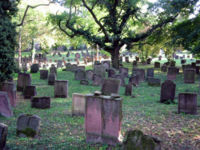
Tag:landuse=cemetery
| Description |
|---|
| A place where people, or sometimes animals are buried that isn't part of a place of worship |
| Rendering in OSM Carto |

|
| Group: landuse |
| Used on these elements |
| Useful combination |
| See also |
| Status: de facto |
| Tools for this tag |
|
This tag is used for a cemetery that isn't part of a place of worship. In most (European) countries, there is a difference between amenity=grave_yard and landuse=cemetery. Cemeteries are usually independent of places of worship (e.g. military cemeteries), while grave yards are usually the yard of a place of worship. Historically, grave yards are older, while modern cemeteries have been introduced during the industrialization in the 19th century.
How to map
Draw the outline of the area ![]() which will include the graves, footways, service roads and even inner green spaces as it is very likely that they will be used for future graves. Do not include the nearby parking areas, but internal parking may be included if considered to be part of cemetery.
which will include the graves, footways, service roads and even inner green spaces as it is very likely that they will be used for future graves. Do not include the nearby parking areas, but internal parking may be included if considered to be part of cemetery.
| Do not add this tag within another instance of landuse=cemetery to mark its individual sectors. For cemetery sections, use cemetery=sector instead. |
Useful combination
- name=*
- religion=*
- denomination=*
- parish=<name of the parish under which the cemetery or chapel is subject>
Rendering
- OSM Carto:
See also
- cemetery=grave
- amenity=grave_yard
- amenity=crematorium
- amenity=funeral_hall
- amenity=place_of_mourning
- landuse=religious - land for religious purposes, that are not cemeteries
- historic=tomb (and subtags for tomb=* on Proposed features/tombs#Subtagging types)
- historic=archaeological_site and archaeological_site=necropolis
- historic:civilization=*
- seamark:landmark:category=cemetery
- cemetery=sector - for tagging sectors of cemeteries (proposed)
- Proposal cemetery sector: Proposed features/Cemetery sector
In discussion / in use
- cemetery=war_cemetery – A burial place for members of the armed forces or civilians who died during military campaigns or operations
- cemetery=wood or cemetery=burial_forest – These values for
 natural burial grave sites (usually in a forest) were discussed in the German OSM forum in 2018 (see [1], [2]) and are used in small numbers, especially in Germany (see Taginfo).
 - cemetery=columbarium – This value for a
 columbarium was discussed in the German OSM forum in 2018 as an alternative to tomb=columbarium (see [3]) and is used in small numbers (see Taginfo).
See also the German page of landuse=cemetery and the sections for natural burial grave sites (in discussion)(de) and columbarium (in discussion)(de).
Common/possible tagging mistakes


