Tag:man_made=paifang
| Description |
|---|
| A traditional style of Chinese architectural arch or gateway structure. |
| Group: man made |
| Used on these elements |
| Useful combination |
| Status: in use |
| Tools for this tag |
|
A paifang(Chinese: 牌坊, sometimes also 牌楼/牌樓) is a traditional style of Chinese architectural arch or gateway structure. Paifangs come in a number of forms. One form involves placing wooden pillars onto stone bases, which are bound together with wooden beams. This type of paifang is always beautifully decorated, with the pillars usually painted in red, the beams decorated with intricate designs and Chinese calligraphy, and the roof covered with coloured tiles, complete with mythical beasts. Another form of paifang is in the form of true archways made of stone or bricks; the walls may be painted, or decorated with coloured tiles; the top of the archways are decorated like their wooden counterparts.
For Chinese style gate with multiple rows of columns, building=guardhouse may be more fitting.
How to map
The main tag to be used should be man_made=paifang.
Tags used in combination
- paifang:gates=*
- paifang:posts=*
- paifang:gables=*
- material=wood/brick/stone/glaze
- height=* for the overall height of the paifang in meters above ground including the chiwen and ornaments on top of the posts
- inscription=*
- historic=monument
- historic=memorial for really small ones that don't qualify as monuments.
- landmark=*
Example
| Picture | Tagging |
|---|---|

|
|

|
|

|
|

|
Render
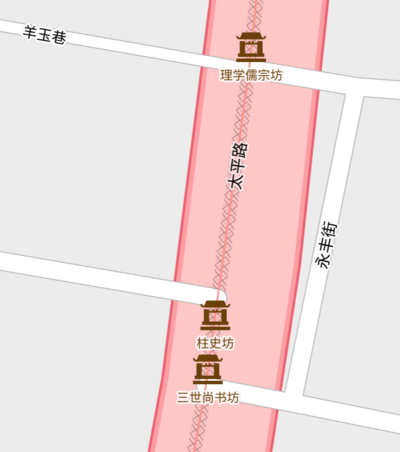
In TracesMap the tag is rendered as following:
See also
- man_made=hongsalmun in Korea
- man_made=pailou
- man_made=iljumun in Korea
- man_made=torii
- Torana
- man_made=gantry for man-made overhead structures / arches
- natural=arch - for natural arches
- Arch - more meanings for arch
Wrong Use
Torii, which originated from Japanese culture, is different from Paifang. If you see this tag in China or in chinatown, this maybe (Indeed, there are a small number of toriis in China) wrong use.

