Talk:Key:junction
Named Simple Junctions
I want to use OSM as well as a kind of repository for POIs for hiking. A lot of times I create POI's for the crossing points of hiking trails, even if they have no visible guidepost (so maybe guidepost is not the correct tag)
Do you think it makes sense to use the junction tag for those POi's or do you propose an other tag ?
The optional data for this kind of junctions would be the names of the trails crossing at this point.
Incomplete Junctions
I would like to mark junctions on hiking trails crossing other, yet unmapped, tracks. This is good for orientation awareness. My proposal is junction=yes with fixme=continue]. The alternative is of course to map few meters of every joining track and to mark unfinished ends with fixme=continue and noexit=no, but this is very time consuming in the outdoor. So, what do you think? --*Martin* 09:01, 18 April 2011 (BST)
Some new values
How about:
- junction=exit for exits on motorways and similar. To replace highway=motorway_junction.
- junction=roundabout also for small roundabouts. To replace highway=mini_roundabout.
--Gorm 19:36, 3 July 2010 (UTC)
Named junctions in Korea
I wanted a placeholder to add some photos of rendered names for junctions in Korea, since the wiki states that junction=yes can be used in conjunction with name=*.
Here is a place in Korea: http://osm.org/go/54z6JgaH7--
- remark: the junction is now shown in mapnik. seems they changed the rendering style! Very good for Japan and Korea! --Golf (talk) 05:05, 19 April 2015 (UTC)
The junction in the centre of the view is tagged as follows:
- junction: yes
- name: 법원사거리 (Court Crossroad)
- name:en: Court Crossroad
- name:ko: 법원사거리
- name:ko_rm: Beopwonsageori
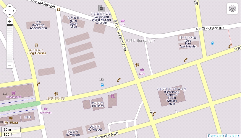
But no label is shown on the map.
Here is a rendering of the area with OSM Mapnik style:

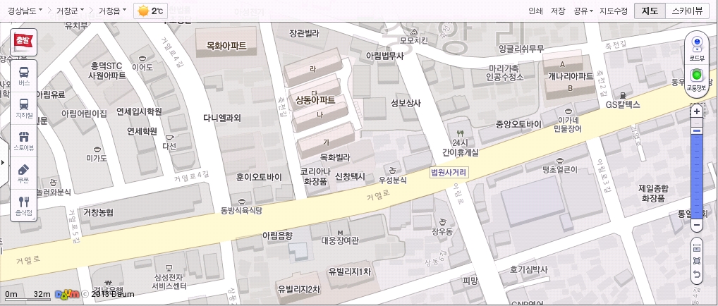
Here is the same area from Daum (a Korean internet portal):

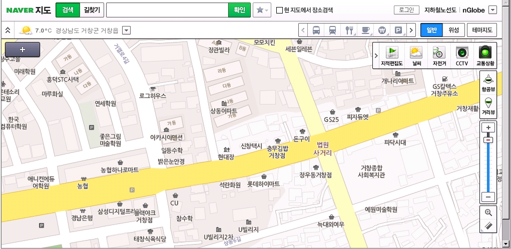
And again, from Naver, another Korean internet portal):

You can see that Daum and Naver display a small label showing "법원사거리" on the junction.