Template:Da:Map Features:emergency
Jump to navigation
Jump to search
Nødhjælp (emergency)
This is used to describe the location of emergency facilities and equipment. See the page Emergency for an introduction on its usage.
| Nøgle(key) | Værdi | Element | Kommentar | Rendering | Foto | |
|---|---|---|---|---|---|---|
Emergency services | ||||||
| emergency | ambulance_station | A ambulance station is a structure or other area set aside for storage of ambulance vehicles, medical equipment, personal protective equipment, and other medical supplies. | ||||
| emergency | defibrillator | Defibrillator, an external and portable electronic device that diagnoses and can correct arrhythmia of the heart automatically (aka Automated External Defibrillator, AED). Previously tagged as emergency=aed or medical=aed. | ||||
Brandweer | ||||||
| emergency | fire_extinguisher | A fire extinguisher is an active fire protection device used to extinguish or control small fires, often in emergency situations. | ||||
| emergency | fire_flapper | A wildland firefighting tool also called a swatter or a beater. It is designed for extinguishing minor fires in rural areas such as heaths. | ||||
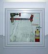
| emergency | fire_hose | A high-pressure hose used to carry water or other fire retardant (such as foam) to a fire to extinguish it. | ||||
| emergency | fire_hydrant | An active fire protection measure, and a source of water provided in most urban, suburban, and rural areas with municipal water service to enable fire fighters to tap into the municipal water supply to assist in extinguishing a fire. | ||||
| emergency | water_tank | A large water basin or tank for a fire department to take water. | ||||
| emergency | fire_water_pond | A man made or natural pond with water for a fire department. | ||||
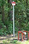
| emergency | suction_point | A preferred point to pump water off a river or other waters for a fire department. | ||||
Reddingsbrigade en strandwacht | ||||||
| emergency | lifeguard_base | The central place for vehicles and facilities of the lifeguard. Can also serve for central communication point. | ||||
| emergency | lifeguard_tower | A guard tower that lifeguards use to watch and monitor swimmers, in order to prevent drowning or other dangers from occurring. | ||||
| emergency | lifeguard_platform | A platform used by lifeguards. | ||||
| emergency | lifeguard_place | The central hub for lifeguards. | ||||
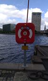
| emergency | life_ring | An inflatable floating device. | ||||
Others | ||||||
| emergency | assembly_point | Assembly point or area in case of emergency | ||||
| emergency | access_point | Sign with an ID which can be used to define your current position in case of an emergency, or as an assembly point for emergency services. (replaces highway=emergency_access_point) | ||||
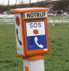
| emergency | phone | An emergency telephone to call the emergency services. | ||||
| emergency | ses_station | State Emergency Service is an Australian non-profit organization that provides assistance during and after explicitly declared natural or man-made disasters. | ||||
| emergency | siren | Instrument capable of producing loud sounds to alert people in case of emergencies. The most modern use case is for civil defense as "air raid" sirens or tornado sirens. | ||||
| emergency | brugerdefineret | Se også Taginfo[1] for mere information. | ||||
This table is a wiki template with a default description in English. Editable here.


