WikiProject Montenegro
| V・T・E |
| latitude: 42.661, longitude: 19.387 |
| Browse map of The Republic of Montengro 42°39′39.60″ N, 19°23′13.20″ E |
| Edit map |
|
External links:
|
| Use this template for your locality |
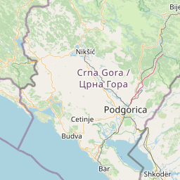
The Republic of Montengro is a country in Europe at latitude 42°39′39.60″ North, longitude 19°23′13.20″ East.
![]() Montenegro is located in Southeastern Europe.
Montenegro is located in Southeastern Europe.
Informacije na maternjem jeziku
- Zumirana mapa Podgorice
- Tema na forumu LUG-a Crne Gore koja je pokrenula mapiranje. Ima pregršt korisnih podataka, posebno za početnike.
- Tema na CDM forumu. Još korisnih podataka.
- Pobjeda je postavila mapu koja koristi OSM.
- Mapa Crne Gore sa OSM u formatima pogodnim za razne GPS uređaje.
Progress
You can view the progress by zooming in to the Montenegro on the map.
People Involved
(Please do not enter your email here, because of SPAM issues)
User:MrLimeni
User:Edin1
User:CPU
Goals
Municipalities
Montenegro is divided into twenty-three municipalities (opština), and two urban municipalities, subdivisions of Podgorica municipality:
- PodgoricaPodgorica (capital)
- TuziTuzi
- Golubovci (Zeta)Golubovci (Zeta)
- AndrijevicaAndrijevica
- BarBar
- BeraneBerane
(included Petnjica before 2013) - Bijelo PoljeBijelo Polje
- BudvaBudva
- CetinjeCetinje
- DanilovgradDanilovgrad
- GusinjeGusinje
(separated from Plav since 2014) - Herceg-NoviHerceg-Novi
- KolašinKolašin
- KotorKotor
- MojkovacMojkovac
- NikšićNikšić
- PetnjicaPetnjica
(separated from Berane since 2013) - PlavPlav
(included Gusinje before 2014) - PljevljaPljevlja
- PlužinePlužine
- RožajeRožaje
- ŠavnikŠavnik
- TivatTivat
- UlcinjUlcinj
- ŽabljakŽabljak