Bangladesh/events/Activation for Bangladesh Flood Response 2022
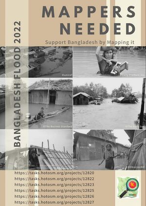
As you already know, Just within a span of three weeks, the northeastern part of #Bangladesh has been hit by seasonal #floods again. Vast areas of Sunamganj, Sylhet, Netrokona, Kurigram, and Lalmonirhat are underwater as bordering rivers have swelled due to heavy rain upstream of Assam and Meghalaya. The met office has forecast more rain in the coming days, which might worsen the flood situation in Sunamganj, Sylhet, and Netrokona. The flood situation is deteriorating at a time when people of the region are still reeling from the shock of the first round of floods that happened just two to three weeks ago. The second round of floods this year has made the situation more challenging to respond to. Sunamganj has been completely disconnected from the rest of the country. Road links to Sylhet also started to collapse after floodwater submerged the roads. The education ministry postponed Secondary School certificates and equivalent exams across the country that were scheduled to begin on Sunday due to the floods. As the disaster management and relief ministry began its work, the government deployed armed forces to speed up flood rescue and relief efforts. Worsening floods in Sunamganj and Sylhet districts have resulted in power outages, closure of many schools as they have been turned into makeshift flood shelters, and vast areas being inundated, with locals saying the flood is worse than the ones they experienced in 1998 and 2004.
Following the grave situation, we from OpenStreetMap Bangladesh (#OSMBD) community decided to push out urgent mapping tasks on the #hotosm tasking manager platform under #BangladeshFloodResponse2022. We are activating multiple tasking projects and more will be following periodically. We would urge you all to put your mapping gears on and support the vulnerable population in distress. We cannot assure direct aid from this, but surely this will assist the ongoing & future aid and recovery works by the different agencies.
Let’s #MapTheDifference and #Map4Resilience.
Here is the list of projects waiting for your response:
https://tasks.hotosm.org/projects/12820
https://tasks.hotosm.org/projects/12822
https://tasks.hotosm.org/projects/12823
https://tasks.hotosm.org/projects/12825
https://tasks.hotosm.org/projects/12826
https://tasks.hotosm.org/projects/12827
For getting connected with the local OSM Community in Bangladesh: OSM Bangladesh
OSM Wiki Bangladesh: Wiki Project Bangladesh
How to contribute buildings in the project areas you can follow the instructions provided here: How to edit buildings?
For a generalized basic training on OpenStreetMap kindly follow the link here: Learn OSM
** Meanwhile any agency that needs mapping support over the osm platform is requested to reach out to Sawan Shariar (sshariar1991 at gmail dot com) Atikur Rahman (arahman.dcc2 at gmail dot com) for communication. We are here to help with any mapping initiatives relating to the flood responses on a pro-bono basis.
