Barakati Indonesia: Mapping with OpenStreetMap in the Miangas Island Region as Indonesia's Outer Islands and Youth Capacity Development in Community Service Missions
Based on the Building Statistics Report from the OpenStreetMap Indonesia (POI) Association as of March 1, 2021, all provinces in Java are among the top 10 provinces with the highest number of mapped buildings in OSM in Indonesia. In Java, the province with the highest and lowest number of mapped buildings are West Java with 6.7 million and Yogyakarta Special Region with 941,054 buildings, respectively. In contrast, neighboring Sumatra Island has a much lower number of mapped buildings. The total number of mapped buildings in Sumatra Island is only 2.8 million across 8 provinces (Aceh, North Sumatra, West Sumatra, Riau, Jambi, Bengkulu, South Sumatra, and Lampung), despite being the second most populous island with a population of 58.6 million people (Katadata, December 2021). The 3T (disadvantaged, frontier, and outermost) regions are likely to show even greater disparities in terms of access, data, and development. This indicates that the data gap on infrastructure in Indonesia remains a national issue and requires concrete mitigation measures. One strategy that can be undertaken is to involve active Indonesian youth in voluntary and community service activities.
Youth, as individuals in the most productive phase of their lives and who are seeking their identity, see volunteerism or community service as a way to channel their time, energy, and thoughts towards addressing local issues. The increasing popularity of volunteer activities in various regions across Indonesia, especially after the pandemic, has brought a new spirit for youth to explore and contribute to social or environmental issues in different parts of the country. Many organizations and communities in Indonesia offer volunteer activities with various schemes and objectives. However, among the numerous volunteer programs available, there are still relatively few that focus on mapping local infrastructure. Yet, data on infrastructure is crucial for improving and supporting the economy and livelihoods of local communities. Such data can be used as a basis for regional development, spatial planning, and disaster mitigation in the future. Therefore, in this opportunity, through the Booster Grants from POI and Open Mapping Hub - Asia Pacific (OMH-AP), Barakati Indonesia aims to become a community that promotes capacity development of youth and mapping using OSM in Indonesia as part of its community service programs.
Problem and Solution
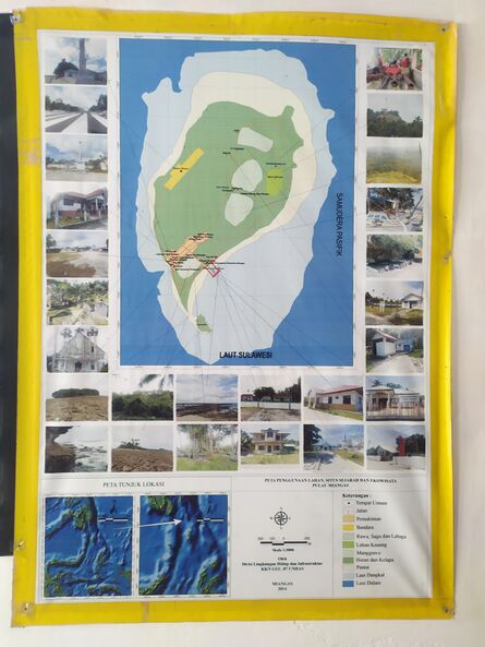
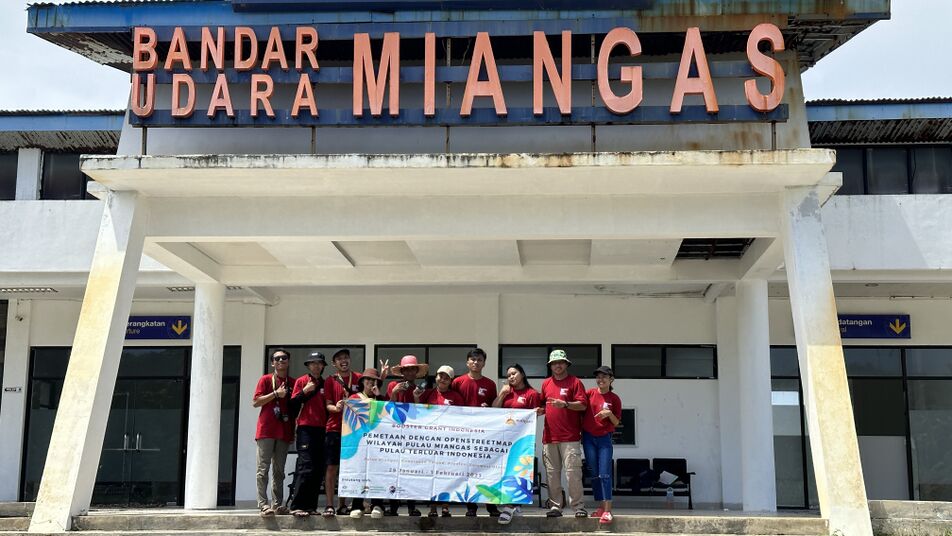
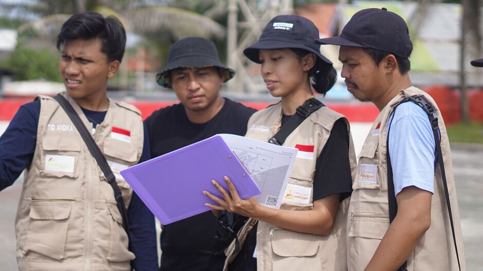
In the expedition, several volunteers from the Environmental Economics Division's EPT #1, along with youth representatives from Miangas Island, will conduct mapping and data validation activities in the field. The results of this mapping activity will then be presented to local representatives in Miangas Island for verification. Through this activity, data on the infrastructure of Miangas Island can be updated and developed for various purposes such as regional development and spatial planning, disaster mitigation, and branding of local potential. Youth representatives, along with local representatives, will also be provided with mapping and OSM usage modules for beginners. The results of mapping activities with OSM in Miangas Island will be used as learning materials and shared during post-field activity socialization. Barakati Indonesia will then conduct socialization on OSM mapping to introduce the potential of mapping using OSM as a work program, followed by online training. This training is conducted to enhance the capacity of youth in data acquisition and utilization of OSM, both in their local areas and in the areas where they serve.
Activity Implementation
Development of OSM Module for Beginners
The development of OSM module for beginners was successfully conducted from March 1st to 15th, 2023, with a team of 3 members who received input from Kak Fatisya and Kak Dido.
Zoom Meeting Training
The Zoom Meeting training was conducted on March 8th, 2023, with a total of 50 participants (including speakers, moderators, and organizers). The participants showed great enthusiasm and actively asked questions during the practical session. Out of the 36 training participants who filled out the attendance, 31 of them stated that the material and explanations were easy to understand, with a scale of 1 being very difficult to understand and 5 being very easy to understand. In addition, participants responded positively to the training activity and some requested that the duration of future trainings be extended. This positive response indicates that the materials and explanations provided during the training were well understood, and the training was considered beneficial.
Processing of Field Mapping Data for Miangas Island and Villages
The results of field mapping in Miangas island and village were updated to OSM using iD Editor, then validated using JOSM, and finally mapped using QGIS to create a map.
Outcomes
- For Barakati Indonesia Community: Barakati Indonesia increases the motivation and capacity of Indonesian youth to conduct mapping using OSM in their region or other community service programs through training programs conducted via Zoom. Members of Barakati Indonesia are able to plan and conduct training activities via Zoom.
- For Activity Participants: Participants become familiar with OSM and understand participatory mapping using OSM. Participants are able to conduct remote mapping using iD Editor and access field papers.
Outputs
- 40 copies of "OpenStreetMap for Beginners" module
- 4 printed copies each of the Miangas Island and Miangas Village maps
- Total of 50 attendees in the training sessions
- Documentation of the activities in the form of screenshots and video recordings of the training sessions.
| Indicators | Contribution After March 17 2023 | Notes |
| Results | ||
| Output | ||
| #total changesets | 21 | |
| #Youth trained | ||
| #women attended | 16 | A total of 50 participants attended the training, but only 36 participants completed the entire session and filled out the attendance sheet. |
| #age < 15 | 0 | |
| #age15 - 24 | 25 | |
| #age 25 - 65 | 11 | |
| #age > 65 | - | |
| #new OSM Account/new Mapper | 37 New accounts from registration link
7 new accounts were accounts recorded in the attendance sheet. |
Based on the online training invitation date (March 1, 2023) |
Challenges
- Preparation and Planning: The main challenge was difficulty in obtaining quotations from suppliers, as some stores do not provide them or only provide them for bulk purchases.
- Online Activity Implementation: The main challenge was scheduling conflicts with community events that were delayed due to uncertain ferry schedules, resulting in the cancellation of the live Instagram session and the rescheduling of the Zoom training to March.
- Report Writing: The main challenge was the tight timeline for final report preparation, as the Booster Grant timeline was delayed from the initial planning and the announcement of the deadline extension was sudden.
Sustainability
The field mapping data for Miangas Island and Miangas Village has been inputted into OSM and map versions have been created to be sent to the representatives of Miangas Youth. With the tools, including GPS and printed OSM modules, Barakati Indonesia will strive to conduct mapping activities using OpenStreetMap in future expeditions.
Through capacity development activities such as module creation and online training, it is hoped that more Indonesian youth will be introduced to and interested in contributing to the open mapping mission of OSM in their respective areas of residence or in areas where community service activities are conducted. The completed OSM modules are also shared with participants and registrants of the training sessions as initial reading materials for learning about open mapping activities using OSM.
Media Partner and Contact
- infovolunteers, nstagram.com/infovolunteers
- seputar.infoid, instagram.com/seputar.infoid
- infolombaevent.id, instagram.com/infolombaevent.id


