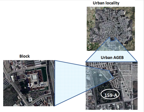
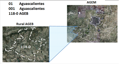
Basic Geostatistical Area (AGEB)
Is the territorial extent corresponding to the subdivision of municipal geostatistical areas. Constitutes the basic unit of the National Geostatistical Framework and depending on its characteristics can be classified into two types:
- Rural Basic Geostatistical Areas (Rural AGEB)
- Urban Basic Geostatistical Areas (Urban AGEB)
Each AGEB is assigned a key composed of three numbers, a dash and a number ranging from 0 to 9 or the letter A. These keys are unique within each municipality, hence, a key will never be repeated in a municipality, regardless of whether the AGEB is urban or rural.
Urban Basic Geostatistical Area
Geographical area occupied by a set of blocks generally ranging from 1-50, perfectly bounded by streets, avenues, walways or any other feature of easy identification in the field and whose land use is primarily residential, industrial, services, commercial, etc. They are assigned only within urban localities.
Rural Basic Geostatistical Area
Subdivision of geostatistical municipal areas located in a rural setting, whose area is variable and is characterized by a type of land for agricultural or forestry use. Contains rural localities and natural extensions such as swamps, lakes, deserts among other, generally bounded by natural features (rivers, streams, cliffs, etc.) and cultural (railroads, power lines, roads, gaps, sidewalks, ducts , property boundaries, etc.).

