Brussels-Capital Region
- For the City of Brussels, see Brussels.
| V・T・E |
| latitude: 50.8387, longitude: 4.3629 |
| Browse map of the Brussels-Capital Region 50°50′19.32″ N, 4°21′46.44″ E |
| Edit map |
|
External links:
|
| Use this template for your locality |
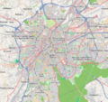
The Brussels-Capital Region (Bruxelles - Brussel) is a region in Belgium at latitude 50°50′19.32″ North, longitude 4°21′46.44″ East.

Languages
Brussels (Bruxelles in French or Brussel in Dutch) is officially a bilingual region. Name of streets, places, government offices must be written in both languages (conventionally "fr - nl" for computer-processability purposes), with a proper separator (" - ", i.e. space hyphen space) and by adding one-language names in name:fr=* and name:nl=*. (Discussions from 2008 about tagging standards can be found here: Belgium project discussion page.)
As a consequence, any name having the " - " separator should be assumed to be a multilingual name. If this is not the case, e.g. a college named "RITCS – Campus Dansaert" you can use the "en dash" sign (U+2013) instead of the hyphen: the name will show up normally on the map and Nominatim searches will find it correctly when people type a hyphen.
Streets that span over several municipalities
Naming streets properly can be tricky near administrative borders. Each municipality will choose how the street is officially named and ground truth (street signs) always prevails. The following issues are to be considered:
- Some long streets which span over several municipalities have a different spelling (Ridderschapslaan in the City of Brussels becomes Ridderschaplaan in Etterbeek and the border is in the middle of the road; Notelaarsstraat in the City of Brussels is written Notelaarstraat in Schaerbeek) or a different way to write the same thing (Waversesteenweg becomes Steenweg op Waver; Waterloosteenweg becomes Steenweg op Waterloo and at the next border becomes Waterloosesteenweg). Most of those variations are for the Dutch name, while the French name stays the same for each municipality.
- Some streets are on the border between Brussels (bilingual) and Flanders (only Dutch).
We have a page with the inventory of those streets, and tagging instructions about how to deal with them: Street Name Variations in Brussels
The current mapping practice for associatedStreet relation is to create one relation per street/municipality/postcode tuple. This is because those relations can be used as a faster alternative to reverse geocoding engines, as a bridge to wikidata (such as the EqualStreetNames project), and for quality control. However, some QA tools such as Osmose only know about a simple tagging scheme with one relation for all the elements. Those warnings should be treated as false positives.
Progress
Colour and symbol legend
The status of each map region is indicated by a symbol, which describes the type of feature, and a colour, which indicates the completeness of that feature in a map region.
Usage
The status is displayed using a template Template:State
{{State|Key=progress}}- progress - 1/2/3/4/NA
Meaning of symbols
 - Street names are labelled. This means that the map can be used to find an address - Key: l
 - All housenumbers are present - Key: h
 - All footways are present - Key: fo
 - All wheelchair access is present - Key: d
 - All cycleways, and field and forest roads suitable for bicycles are present - Key: b
 - Roads for car traffic are present. One way streets and pedestrian streets are present. This means that the map can be used for car navigation - Key: c
 - All public transports are present (including name of the bus stop/station names) - Key: tr
 - All stop/station/harbour names are present - Key: ha
 - All bus lines are present (including name of the bus stop names) - Key: bu
 - All trolley/guided bus lines are present (including name of the station names) - Key: ty
 - All tram lines are present (including name of the tram station names) - Key: tm
 - All fast railway lines transports are present (including name of the train station names) - Key: tn
 - All U-Bahn (subway in Germany) lines are present (including name of the station names) - Key: u
 - All S-Bahn (regional commuter train in Germany) lines are present (including name of the station names) - Key: s
 - All steam railway lines transports are present (including name of the train station names) - Key: st
 - All ship lines are present (including name of the harbour station names) - Key: sh
 - All public institutions are present (Churches, sports facilities, venues, schools, hospitals, city hall) - Key: p
 - All emergency services (hospitals...) are present - Key: em
 - All petrol stations are present - Key: fu
 - All restaurants and hotels are present - Key: r
 - All tourist attractions are present - Key: t
 - All natural resources are mapped (e.g Water, Lakes and Woodland) - Key: n
Meaning of colours
| Background colour | Meaning | Use for navigation | To do | value |
|---|---|---|---|---|
| The map needs checking, status unknown | Availability unknown | Please check | (None) | |
| The map contains no or little data | Not to be used | Please complete | 0 | |
| The map contains partial data | Limited usability | Please complete | 1 | |
| The map is largely complete (please describe missing data) | Use with restrictions | Please complete (missing data, streets etc.) | 2 | |
| The map is complete (in the opinion of a mapper) | Suitable for use | Please check and correct any errors | 3 | |
| The map is complete (verified by 2 mappers) ; please indicate Date when checked) | Suitable for use | Please update as needed | 4 | |
| This attribute does not exist in the mapped area (e.g. no petrol stations) | Suitable for use | Please update as needed | X |
Municipalities
Source for inhabitant data w:List of municipalities of the Brussels-Capital Region
Data sources
CIRB UrbIS
The open license allow us to import data from urbis, see Brussels Capital Region/Open Data.
Buildings and addresses were imported back in 2012-2013. Since 2022, you can update the buildings with the Belgian building import tool. We also use URBIS data to keep track of changes in the road network with the Road Completion project.
Rendering of past versions of the map
-
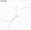 Status on 2006.10.03
 -
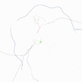 Status on 2006.11.22
 -
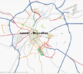 Status on 2007.11.20
 -
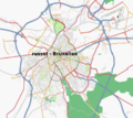 Status on 2008.01.05
 -
 Status on 2009.02.20


