Category:Files composed of esri aerial imagery
Jump to navigation
Jump to search

Files in this category are largely composed of Esri aerial imagery.
Esri imagery is not open licensed (hence those files cannot be – in their state with the Esri aerial imagery). See Template:Esri image for details.
Please do not add files directly here, but instead use {{Esri image}} on the file page.
This category is not shown by default on its member pages. ![]()
Media in category "Files composed of esri aerial imagery"
The following 37 files are in this category, out of 37 total.
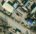
 Averitt Express Aerial.PNG 639 × 654; 1.03 MB
 Brankill crannóg Esri.png 511 × 426; 315 KB
 Buildingmapping-base3.png 640 × 480; 66 KB
 Buildingmapping-base4.png 640 × 480; 75 KB
 Buildingmapping-oblique2.png 531 × 602; 189 KB
 Buildingmapping-r0s1.png 640 × 480; 188 KB
 Buildingmapping-r0s2.png 640 × 480; 188 KB
 Buildingmapping-r0s3.png 640 × 480; 187 KB
 Buildingmapping-r1s1.png 320 × 400; 83 KB
 Buildingmapping-r1s2.png 320 × 400; 82 KB
 Buildingmapping-r2s2.png 320 × 400; 86 KB
 ComplexConnectivityHerredsvejen.png 1,093 × 555; 894 KB
 ConnectivityExample4.png 690 × 616; 666 KB
 Esri imagequality problem josm martin 1.png 2,560 × 1,080; 3.57 MB
 Esri imagequality problem josm martin 2.png 2,560 × 1,080; 986 KB
 ESRI imagery of 53.39499 N, 6.26888 W showing bare soil on a construction site..png 1,132 × 638; 1.19 MB
 ESRI.jpg 969 × 675; 107 KB
 Gas station 39.00087 125.70329 - North Korea, Esri.png 616 × 570; 820 KB
 Historic environment viewer smr record.png 970 × 602; 1.03 MB
 ID Screen Shot from -32.0914374, 116.0129206.png 1,280 × 800; 1.58 MB
 Idp camp esri.jpg 1,274 × 606; 205 KB
 JOSM Elevation plugin - Contour lines on satellite imagery.png 2,288 × 1,625; 6.49 MB
 JOSM.LifeCyclePrefix.png 800 × 622; 639 KB
 JOSM.NaturalFeatures.List.png 600 × 467; 456 KB
 JOSM.StravaGlobalHeatmap.jpg 600 × 339; 126 KB
 JOSM.WorkingArea.png 600 × 480; 430 KB
 Kilvey crannóg Esri.png 607 × 491; 537 KB
 Logan Circle DC complex connectivity highways merging together.png 610 × 732; 871 KB
 Motorway Example 1.jpg 752 × 818; 218 KB
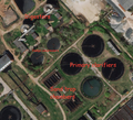 NN Wasterwater plant 001.png 925 × 840; 1.79 MB
 NN Wasterwater plant 002.png 1,075 × 853; 2.04 MB
 Noisy-residential-areas.jpg 1,254 × 801; 217 KB
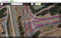
 RapiD screenshot.png 2,476 × 1,606; 4.82 MB
 Storage tank esri.jpg 639 × 386; 114 KB
 Toberbunny Dublin Esri.png 969 × 719; 939 KB
 WK4.png 1,117 × 551; 857 KB
 Woodstock esri nyorthos.jpg 1,973 × 770; 180 KB


