Category:Images for illustration of wiki
Jump to navigation
Jump to search
Created initally for use on Sample areas page
See also individual Humanitarian OSM Project categories, into which images used to illustrate these Projects may be placed.
Subcategories
This category has the following 6 subcategories, out of 6 total.
Pages in category "Images for illustration of wiki"
This category contains only the following page.
Media in category "Images for illustration of wiki"
The following 120 files are in this category, out of 120 total.
 City center - near to Kowon, North Korea, Maxar.png 666 × 586; 1.12 MB
 City center 39.48400 127.49379 - North Korea, Maxar.png 945 × 709; 757 KB
 Communication tower 38.06776 125.73721.png 921 × 647; 990 KB
 Communication tower 38.06853 125.79175.png 977 × 781; 786 KB
 Communication tower 38.50393 126.53215.png 646 × 492; 546 KB
 Communication tower 38.86834 126.15175.png 769 × 599; 784 KB
 Communication tower 39.79514 127.38293.png 603 × 483; 514 KB
 Communication tower 40.38971 127.61146.png 745 × 606; 557 KB
 Dam 38.13020 125.27044 - North Korea.png 722 × 487; 473 KB
 Dam 39.13883 125.79497 - North Korea.png 585 × 519; 521 KB
 Dam 39.40152 126.26525 - North Korea.png 775 × 755; 686 KB
 Dam 39.40436 126.26671 - North Korea.png 747 × 745; 650 KB
 Dam 39.89313 125.30191 - North Korea.png 879 × 767; 848 KB
 Farmland 38.73018 125.54292 - North Korea.png 1,358 × 896; 1.22 MB
 Fast Draw way to use it.png 1,073 × 821; 1.26 MB
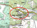 Flou col des limouches 2.png 560 × 432; 335 KB
 Gas station 39.00087 125.70329 - North Korea, Esri.png 616 × 570; 820 KB
 Gas station 39.42592 127.23645 - North Korea, Bing.png 759 × 669; 1.05 MB
 Giant slogan 41.30383 128.15362 - North Korea.png 721 × 561; 849 KB
 Gpsmapedit mit osmkarte.png 960 × 617; 154 KB
 Grass 39.01464 125.65712 - North Korea.png 1,125 × 903; 946 KB
 Ho Chi Minh far chaos 1.png 2,126 × 1,270; 1.83 MB
 Ho Chi Minh far chaos 2.png 2,126 × 1,270; 5.55 MB
 Ho Chi Minh near chaos 1.png 2,126 × 1,270; 595 KB
 Ho Chi Minh near chaos 2.png 2,126 × 1,270; 4 MB
 Ho Tay Maxar 1.png 2,126 × 1,270; 4.43 MB
 Ho Tay Maxar 2.png 2,126 × 1,270; 4.78 MB
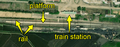
 Illustration of Rail.jpg 432 × 600; 80 KB
 Illustration of Rural.jpg 800 × 534; 109 KB
 Juche Study Hall - near Kowon, North Korea, Maxar.png 570 × 406; 549 KB
 Landuse cemetery - 37.87349 126.13396 - North Korea, Maxar.png 595 × 570; 750 KB
 Landuse cemetery - North Korea, Maxar.png 391 × 214; 203 KB
 Landuse cemetery 2 - North Korea, Maxar.png 335 × 255; 118 KB
 Landuse cemetery 3 - North Korea, Maxar.png 808 × 618; 1.17 MB
 Landuse cemetery 4 - North Korea, Maxar.png 437 × 435; 307 KB
 Landuse cemetery 5 - North Korea, Maxar.png 1,023 × 709; 1.74 MB
 Landuse cemetery 6 - North Korea, Maxar.png 1,279 × 530; 938 KB
 Landuse farmyard - near to Kowon, North Korea, Maxar.png 808 × 641; 1.05 MB
 Landuse farmyard - North Korea, Maxar.png 705 × 484; 489 KB
 Landuse farmyard and cemetry - near to Kowon, North Korea, Maxar.png 650 × 638; 908 KB
 Landuse farmyard bis - near to Kowon, North Korea, Maxar.png 574 × 487; 624 KB
 Landuse farmyard quater - near to Kowon, North Korea, Maxar.png 813 × 645; 1.19 MB
 Landuse farmyard ter - near to Kowon, North Korea, Maxar.png 862 × 669; 1.27 MB
 Market 38.06184 125.78769.png 961 × 641; 928 KB
 Market 38.49070 125.85163.png 959 × 737; 1.44 MB
 Market 38.50811 125.74230.png 941 × 665; 1,007 KB
 Market 39.04210 127.52283.png 967 × 571; 726 KB
 Market 39.45828 126.09764.png 1,119 × 771; 1.04 MB
 Market 39.70266 125.90321.png 753 × 510; 987 KB
 Market 40.86459 129.27243.png 995 × 759; 979 KB
 Maxar Premium North Korea track image (circa 2021).png 1,037 × 818; 1.84 MB
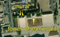 Mural and Tower of immortality - Kowon, North Korea, Maxar.png 804 × 497; 537 KB
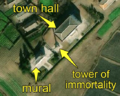 Mural and Tower of immortality - North Korea, Maxar.png 546 × 439; 393 KB
 Power line 38.31294 126.71221 - North Korea.png 663 × 559; 460 KB
 Power line 38.42004 126.56670 - North Korea.png 1,463 × 719; 1.3 MB
 Power line 38.45280 126.07853 - North Korea.png 999 × 653; 877 KB
 Power line 39.13781 125.85457 - North Korea.png 682 × 462; 448 KB
 Power line 39.13811 125.79742 - North Korea.png 803 × 588; 687 KB
 Propaganda stele 38.99134 125.65865.png 880 × 810; 493 KB
 Propaganda stele 39.02767 125.68585.png 1,115 × 913; 1.74 MB
 Pumping station 38.02942 125.28060 - North Korea.png 797 × 531; 563 KB
 Pumping station 38.45124 125.62101 - North Korea.png 838 × 617; 1.03 MB
 Pumping station 38.51802 125.65088 - North Korea.png 593 × 475; 340 KB
 Pumping station 40.78075 129.39410 - North Korea.png 894 × 696; 1.12 MB
 Quarry 38.05026 126.28434 - North Korea.png 930 × 676; 978 KB
 Quarry 38.71175 125.81346 - North Korea.png 770 × 594; 748 KB
 Quarry 39.7382 124.7733 - North Korea.png 847 × 611; 761 KB
 Quarry 41.91287 129.68852 - North Korea.png 831 × 613; 858 KB
 Railway 39.84699 127.43777.png 1,030 × 407; 615 KB
 Railway 39.87747 127.60738.png 1,111 × 514; 759 KB
 Railway 39.90615 127.81897.png 1,215 × 781; 1.24 MB
 Random rural place Vietnam 1.png 2,126 × 1,270; 6.36 MB
 Random rural place Vietnam 2.png 2,126 × 1,270; 4.79 MB
 Reservoir covered 38.97164 125.71428 - North Korea, Maxar.png 742 × 636; 458 KB
 Reservoir covered 38.97170 125.75309 - North Korea, Maxar.png 793 × 697; 501 KB
 Reservoir covered 39.01328 125.66489 - North Korea, Maxar.png 645 × 613; 440 KB
 Reservoir covered 39.02137 125.80560 - North Korea, Maxar.png 622 × 664; 593 KB
 Reservoir covered 39.05426 125.74466 - North Korea, Maxar.png 959 × 737; 855 KB
 Residential 38.73569 125.53380 - North Korea.png 858 × 608; 543 KB
 School - near to Kowon, North Korea, Maxar.png 1,108 × 870; 1.4 MB
 School 38.14973 126.69841 - North Korea.png 637 × 535; 527 KB
 School 39.50567 125.52607 - North Korea.png 749 × 489; 588 KB
 School bis - near to Kowon, North Korea, Maxar.png 701 × 586; 993 KB
 Scrub 38.71122, 126.47705 - North Korea.png 946 × 896; 1.68 MB
 Scrub 38.74029 125.52082 - North Korea.png 777 × 730; 1,017 KB
 Slogan sign 39.37772 127.27519 - North Korea.png 929 × 741; 1.01 MB
 Slogan sign 39.39993 127.41436 - North Korea.png 983 × 691; 1.23 MB
 Sokka pagoda in monastery of Pohyonsa - Hyangsan, North Korea, Maxar.png 599 × 492; 375 KB
 Sports ground 38.99643 125.65344.png 1,255 × 835; 1.39 MB
 Sports ground 39.00931 125.68365.png 1,133 × 903; 2.02 MB
 Sports ground 39.00984 125.69986.png 1,003 × 788; 1,009 KB
 Sports ground 39.01234 125.66002.png 1,251 × 899; 2.15 MB
 Statue of Kim Il-sung - Samjiyon, North Korea, Maxar.png 499 × 429; 229 KB
 Statue of KIS and KJI - Hamhung, North Korea, Maxar.png 545 × 471; 529 KB
 Storage tank 38.71857 125.37507.png 948 × 726; 1 MB
 Storage tank 38.71952 125.36678.png 1,218 × 854; 1.75 MB
 Storage tank 39.00135 125.72158.png 1,322 × 893; 1.48 MB
 Storage tank 39.00219 125.72049.png 1,254 × 782; 1.27 MB
 Substation 37.90155 126.14998 - North Korea.png 611 × 485; 506 KB
 Substation 41.36239 126.55104 - North Korea.png 859 × 667; 698 KB
 Substation 42.11293 129.41747 - North Korea.png 655 × 457; 371 KB
 Substation and power line 40.45118 128.91312 - North Korea.png 918 × 683; 895 KB
 Tank trap 37.81094 126.12203.png 1,096 × 868; 915 KB
 Tank trap 37.85325 126.14190.png 1,275 × 857; 1.56 MB
 Tank trap 37.95947 126.62527.png 1,044 × 676; 1.06 MB
 Tank trap 38.11649 126.46173.png 1,078 × 631; 887 KB
 Tank trap 38.63282 128.34281.png 1,023 × 797; 1.09 MB
 Tower of immortality 38.30078 126.84599 - North Hwanghae, Korea.png 306 × 253; 185 KB
 Traffic park 38.98111 125.71891.png 189 × 187; 79 KB
 Traffic park 39.01315 125.66075.png 927 × 796; 1.1 MB
 Traffic park 39.01861 125.65735.png 767 × 633; 1 MB
 Traffic park 39.01865 125.65724.png 103 × 121; 21 KB
 Traffic park 39.43232 127.24281.png 801 × 741; 821 KB
 Water 38.72010 125.59327 - North Korea.png 1,081 × 911; 1.1 MB
 Weir 39.07352 125.54430 - North Korea.png 743 × 699; 585 KB
 Wetland 38.80627 125.46803 - North Korea.png 949 × 795; 911 KB
 Wood 38.74437 125.53981 - North Korea.png 816 × 627; 1.07 MB


.jpg)


.png)


