Category:ODbL OpenStreetMap
Jump to navigation
Jump to search
This category contains maps or other OSM data extracted after September 12, 2012.
In the past different license was used. See: Category:CC-BY-SA-2.0 OpenStreetMap
- Before 12 September 2012: CC-BY-SA license
- After 12 September 2012: ODbL license
This category is not shown by default on its member pages. ![]()
Subcategories
This category has only the following subcategory.
O
Media in category "ODbL OpenStreetMap"
The following 200 files are in this category, out of 4,491 total.
(previous page) (next page)-
 02 import bus cordoba spain go sync.png 775 × 775; 153 KB
-
 05-add-ways.gif 840 × 438; 2.67 MB
-
 0606 osd screenshot portrait.png 360 × 640; 151 KB
-
 071207tokyo osm.jpg 856 × 552; 87 KB
-
 1 Elbradweg.jpg 986 × 466; 111 KB
-
 1 iPhone 6 OSM London.PNG 750 × 1,334; 1.11 MB
-
 1 offset.png 1,294 × 816; 871 KB
-
 1-Dymaxion-Branco-2970px.jpg 2,970 × 2,100; 607 KB
-
 1-Dymaxion-OSM-Land-2970px.jpg 2,970 × 2,100; 613 KB
-
 1-OSM-BRs atual.png 1,280 × 1,024; 641 KB
-
 1.jpg 489 × 546; 67 KB
-
 100miocs.png 1,224 × 664; 48 KB
-
 10th birthday parties map.png 1,029 × 548; 386 KB
-
 110miocs.png 1,278 × 666; 52 KB
-
 1257.PNG 1,366 × 657; 139 KB
-
 130136185-5117823e-b92c-47c5-90f5-eae06216a6e3.png 3,154 × 742; 425 KB
-
 132191250-c00e5e22-bd63-4be2-ba89-ec2fc33b92bd.png 2,696 × 854; 529 KB
-
 14-1-echarding.jpg 4,961 × 3,509; 1.32 MB
-
 14-2-josephsburg.jpg 4,961 × 3,509; 1.3 MB
-
 14-3-berg-am-laim-ost.jpg 4,961 × 3,509; 1.14 MB
-
 190123 TKM-smaller.jpg 25,309 × 18,000; 21.76 MB
-
 190409 ASB 7000.svg 0 × 0; 6.04 MB
-
 1a.png 292 × 140; 30 KB
-
 1b.png 1,463 × 870; 566 KB
-
 1calle1nombreAndalucía 06022019.jpg 3,507 × 2,480; 742 KB
-
 1calle1nombreAragón 03022019.jpg 3,507 × 2,480; 650 KB
-
 1calle1nombreAsturias 03022019.jpg 3,507 × 2,480; 343 KB
-
 1calle1nombreBurgos 03022019.jpg 3,507 × 2,480; 545 KB
-
 1calle1nombreCanarias 06022019.jpg 3,507 × 2,480; 275 KB
-
 1calle1nombreCantabria 03022019.jpg 3,507 × 2,480; 380 KB
-
 1calle1nombreCastillaLaMancha 03022019.jpg 3,507 × 2,480; 800 KB
-
 1calle1nombreCastillaYLeon 03022019.png 3,507 × 2,480; 2.46 MB
-
 1calle1nombreCastillayLeon 171120.jpg 3,507 × 2,480; 983 KB
-
 1calle1nombreComunidaddeMadrid 03022019.jpg 3,507 × 2,480; 464 KB
-
 1calle1nombreComunitatValenciana 03022019.jpg 3,507 × 2,480; 448 KB
-
 1calle1nombreEspañaProvincial 01122019.jpg 3,507 × 2,480; 462 KB
-
 1calle1nombreEspañaProvincial 29062019.jpg 3,507 × 2,480; 464 KB
-
 1calle1nombreLeón 03022019.jpg 3,507 × 2,480; 490 KB
-
 1calle1nombreMurcia 03022019.jpg 3,507 × 2,480; 329 KB
-
 1calle1nombreNavarra 03022019.jpg 3,507 × 2,480; 477 KB
-
 1calle1nombrePalencia 03022019.jpg 3,507 × 2,480; 467 KB
-
 1calle1nombreRioja 03022019.jpg 3,507 × 2,480; 470 KB
-
 1calle1nombreSalamanca 03022019.jpg 3,507 × 2,480; 618 KB
-
 1calle1nombreSalamanca 07042019.jpg 3,507 × 2,480; 612 KB
-
 1calle1nombreSalamanca 28022019.jpg 3,507 × 2,480; 621 KB
-
 1calle1nombreSalamanca 29042019.jpg 3,507 × 2,480; 607 KB
-
 1calle1nombreSegovia 03022019.jpg 3,507 × 2,480; 513 KB
-
 1calle1nombresoria 01122019.jpg 3,507 × 2,480; 531 KB
-
 1calle1nombreSoria 03022019.jpg 3,507 × 2,480; 501 KB
-
 1calle1nombreValladolid 03022019.jpg 3,507 × 2,480; 445 KB
-
 1calle1nombreZamora 03022019.jpg 3,507 × 2,480; 533 KB
-
 1calle1nombreZamora 25052019.jpg 3,507 × 2,480; 534 KB
-
 1calle1nombreÁvila 03022019.jpg 3,507 × 2,480; 483 KB
-
 1map.png 137 × 357; 36 KB
-
 2 iPhone 6 Navigation imperial uk.PNG 750 × 1,334; 253 KB
-
 2 offset.png 349 × 281; 99 KB
-
 2008 2020urayasu.jpg 1,582 × 1,945; 808 KB
-
 2009 Vogelkundeweg Schautafel.jpg 2,048 × 1,536; 729 KB
-
 20121116 ActiveUsersPop.png 1,065 × 766; 333 KB
-
 2013-08-07-crema.png 1,170 × 750; 0 bytes
-
 2013-08-13Chongqing South Road.jpg 429 × 676; 70 KB
-
 2013-09-21 Cartopartie Die.gif 1,095 × 769; 340 KB
-
 2013-12-de-postals.png 1,481 × 2,094; 2.3 MB
-
 20130223 DSC1072 Looking at Buildings.jpg 2,121 × 1,414; 1.37 MB
-
 20131028 akabane.png 2,103 × 1,374; 1.05 MB
-
 2014 Bolivian Floods Chapare Cochabamba 20140207 022405.png 479 × 441; 56 KB
-
 20140131 000 苗栗大湖.png 1,160 × 790; 284 KB
-
 20140201 000 三義鄉.png 1,159 × 786; 430 KB
-
 20140201 000 公館鄉.png 1,161 × 790; 357 KB
-
 20140201 000 卓蘭鎮.png 1,163 × 788; 346 KB
-
 20140201 000 南庄鄉1.png 1,161 × 790; 255 KB
-
 20140201 000 南庄鄉2.png 1,158 × 792; 140 KB
-
 20140201 000 後龍鎮.png 1,168 × 786; 539 KB
-
 20140201 000 泰安鄉1.png 1,165 × 787; 162 KB
-
 20140201 000 泰安鄉2.png 1,159 × 791; 198 KB
-
 20140201 000 獅潭鄉1.png 1,158 × 794; 231 KB
-
 20140201 000 獅潭鄉2.png 1,160 × 790; 239 KB
-
 20140201 000 竹南鎮.png 1,164 × 790; 583 KB
-
 20140201 000 苑裡鎮.png 1,162 × 787; 481 KB
-
 20140201 000 造橋鄉-三灣鄉.png 1,161 × 791; 491 KB
-
 20140201 000 銅鑼鄉.png 1,163 × 791; 372 KB
-
 20140201 000 頭份鎮.png 1,163 × 780; 564 KB
-
 20140201 000 頭屋鄉-苗栗市.png 1,164 × 789; 475 KB
-
 20140201 000-西湖鄉.png 1,161 × 796; 446 KB
-
 20140524 sc01png.png 652 × 635; 211 KB
-
 20140831 baernischeso.ch.png 1,600 × 900; 1.23 MB
-
 20141104 psc02.png 1,600 × 741; 1.09 MB
-
 2015 Nepal Earthquake USGS map.png 683 × 405; 616 KB
-
 2015-09-15-15-57-04-249.png 480 × 800; 135 KB
-
 2015-09-15-16-07-08-936.png 480 × 800; 134 KB
-
 20150823 000-jazheng.png 1,630 × 847; 495 KB
-
 20150823 000-Zhongho-POI.png 1,631 × 836; 789 KB
-
 20150823 000-林口竹林山觀音寺香客大樓.png 1,626 × 832; 89 KB
-
 20151115 Rettungspunkte Vergleich.png 666 × 857; 63 KB
-
 2016-05-25 Karte Oppingen.PNG 720 × 573; 65 KB
-
 2016-05-30 Karte Oppingen.PNG 1,258 × 1,133; 202 KB
-
 2016-06-20 Karte Oppingen.PNG 1,467 × 1,122; 246 KB
-
 2016-06-30 Obstwiese Tuerkheim.PNG 1,069 × 755; 44 KB
-
 2016-07-12-crema.png.png 1,170 × 765; 764 KB
-
 2016-07-14 obstwiese tuerkheim.png 1,248 × 795; 101 KB
-
 2016-Commercial map of Siena 01.jpg 4,160 × 3,120; 1.34 MB
-
 2016KumamotoEarthquakeEpicentre.png 1,583 × 776; 601 KB
-
 2017091002 04 QSI.png 758 × 446; 228 KB
-
 20170922a RGB.png 440 × 638; 86 KB
-
 20170923a RGB.png 654 × 479; 116 KB
-
 20170923b RGB.png 682 × 403; 116 KB
-
 20170924a RGB.png 1,118 × 779; 356 KB
-
 20170924b RGB.png 1,032 × 399; 433 KB
-
 20170925-QSI.png 789 × 421; 200 KB
-
 20170925a RGB.png 1,091 × 796; 439 KB
-
 20170926a QSI.png 1,013 × 571; 601 KB
-
 20170926a RGB.png 1,178 × 634; 620 KB
-
 20170926b QSI.png 1,283 × 767; 679 KB
-
 20170926b RGB.png 1,162 × 871; 491 KB
-
 20171004 QSI.png 841 × 581; 204 KB
-
 20171006 QSI.png 794 × 405; 217 KB
-
 20171015 QSI.png 764 × 446; 197 KB
-
 20171024 QSI.png 988 × 602; 218 KB
-
 2019-02-23 100228 Lisboa.png 1,198 × 1,128; 1.52 MB
-
 2019-03-21 openstreetmap org banner against uploadfilter.png 800 × 787; 744 KB
-
 2019-03-21 Screenshot openstreetmap.de karte.png 870 × 719; 927 KB
-
 20190622 CHU Grenoble - changesets.png 939 × 758; 845 KB
-
 20190622 CHU Grenoble - partie nord 1.gif 1,992 × 1,993; 762 KB
-
 20190622 CHU Grenoble - partie nord 2.gif 1,343 × 1,079; 337 KB
-
 20190622 CHU Grenoble - partie sud 1.gif 2,387 × 1,488; 853 KB
-
 20190622 CHU Grenoble - partie sud 2.gif 2,504 × 1,460; 888 KB
-
 20190622 CHU Grenoble - partie sud 3.gif 2,103 × 1,892; 900 KB
-
 20190706Inamuragasaki.jpg 1,181 × 787; 171 KB
-
 20190706kamakura.jpg 1,181 × 787; 250 KB
-
 20190802kamakura.jpg 1,181 × 787; 325 KB
-
 20190802namuragasaki.jpg 1,181 × 787; 213 KB
-
 2019nagasaki.jpg 729 × 438; 40 KB
-
 2020-06-05 Freemap Slovakia - digitálna mapa Slovenska.jpg 1,301 × 670; 534 KB
-
 2020-06-21 18-47.png 1,279 × 800; 621 KB
-
 20200608 trailguide overlay selector.jpg 743 × 1,498; 131 KB
-
 2021032324.png 1,005 × 487; 118 KB
-
 2022-12-17-mapping party Reezekne RTA 2.png 600 × 216; 108 KB
-
 2022-12-17-mapping party Reezekne RTA.png 613 × 265; 143 KB
-
 2022年8月31日中国已绘制的输电线网络.png 1,498 × 1,088; 1.3 MB
-
 2023-10-16 OpenRecycleMap.png 1,440 × 3,040; 1.84 MB
-
 2023-11 Piena galdi Latvijā.png 1,372 × 809; 1.72 MB
-
 2023-11-07 OSM Rīgā, norises vieta.png 283 × 315; 67 KB
-
 2024-05-31 Mtbmap Norge (Android) screenshot.jpg 945 × 2,048; 164 KB
-
 2024-09-20 Puzzle Design Skizze 2.jpg 3,507 × 2,480; 1.12 MB
-
 2024-09-20 Puzzle Design Skizze.png 1,292 × 906; 919 KB
-
 2024-09-20-Puzzle-Design-Version-1.png 6,000 × 4,400; 21.44 MB
-
 20240406 OSM sidewalk map-routing graphhopper foot2car2foot-fun.png 1,024 × 540; 945 KB
-
 20240406 OSM sidewalk map-routing graphhopper.png 1,024 × 540; 947 KB
-
 20240406 OSM sidewalk map-routing ors.png 1,024 × 540; 1.02 MB
-
 20240407 OSM sidewalk map-routing graphhopper.png 1,024 × 540; 939 KB
-
 20240409 OSM sidewalk map-routing graphhopper.png 800 × 480; 945 KB
-
 20240409 OSM sidewalk map-routing ors.png 860 × 420; 988 KB
-
 20240410 OSM sidewalk map-routing graphhopper.png 1,200 × 640; 999 KB
-
 20240410 OSM sidewalk map-routing ors.png 860 × 420; 977 KB
-
 20240411 OSM sidewalk map-routing graphhopper.png 1,200 × 639; 987 KB
-
 20240412 OSM sidewalk map-routing graphhopper.png 680 × 740; 925 KB
-
 20240412 OSM sidewalk map-routing ors.png 740 × 420; 972 KB
-
 20240418 OSM sidewalk map-routing graphhopper.png 680 × 740; 923 KB
-
 20240429 OSM sidewalk map-routing ors.png 1,024 × 540; 1.04 MB
-
 20240430 OSM sidewalk map-routing ors.png 740 × 420; 967 KB
-
 20240501 OSM sidewalk map-routing ors.png 860 × 420; 990 KB
-
 20250905-OMO-ecoles-fr.png 417 × 390; 298 KB
-
 21-03.jpg 818 × 543; 61 KB
-
 25kv-substation-mapnik.png 286 × 285; 14 KB
-
 292.png 830 × 799; 281 KB
-
 2a.png 291 × 145; 31 KB
-
 2b.png 293 × 173; 21 KB
-
 2D Data in JOSM.png 9,298 × 3,337; 15.72 MB
-
 3 golf courses.png 729 × 447; 287 KB
-
 3 iPhone 6 Speed cams & warnings Spain.PNG 750 × 1,334; 217 KB
-
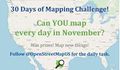 30 days of OSM - November 2020.jpg 431 × 252; 20 KB
-
 336.png 1,165 × 851; 473 KB
-
 341.png 1,014 × 554; 215 KB
-
 345.png 863 × 605; 392 KB
-
 346.png 699 × 500; 296 KB
-
 380kv-bleiswijk-mapnik.png 279 × 187; 13 KB
-
 3a.png 1,456 × 778; 809 KB
-
 3b.png 1,457 × 863; 557 KB
-
 3d print josm - cleanup.png 801 × 750; 231 KB
-
 3d print josm - raw.png 801 × 750; 403 KB
-
 3dHaus.png 802 × 652; 492 KB
-
 3dprint.jpg 640 × 480; 115 KB
-
 3dprint2.jpg 640 × 428; 21 KB
-
 4 duplicate osm.jpg 718 × 500; 23 KB
-
 4 iPhone 6 Download maps.PNG 750 × 1,334; 96 KB
-
 4 offset.png 1,097 × 838; 756 KB
-
 4a.png 293 × 138; 30 KB
-
 4b.png 296 × 174; 22 KB
-
 4umaps.png 1,127 × 917; 1.1 MB
-
 5 delete insert.jpg 1,034 × 683; 40 KB
-
 5 iPhone 6 Traffic.PNG 750 × 1,334; 841 KB
-
 618 BushwickAve OrganicMaps.jpg 1,694 × 952; 453 KB
-
 618 BushwickAve OSM2World-1.jpg 1,022 × 679; 101 KB
-
 618 BushwickAve OSM2World-2.jpg 1,022 × 679; 108 KB
-
 622hibara.png 830 × 774; 111 KB
-
 6451.png 256 × 256; 39 KB
-
 6a.png 299 × 158; 32 KB
-
 700nagasaki01.jpg 700 × 902; 112 KB
-
 7days.png 1,553 × 1,264; 2.36 MB
-
 8 Reunion OSM Latam flyer.png 794 × 1,123; 1,009 KB


_screenshot.jpg)


