Central Pennsylvania OSM

Welcome to Central Pennsylvania OpenStreetMap, an online mapping community based out of State College, PA. This group is open to anyone interested in improving OpenStreetMap coverage in Central Pennsylvania, whether working online or in person at our occasional meetups/map-a-thons. The goals of this group are:
- To build OpenStreetMap in a way that is most useful to local residents and the world community
- To increase awareness of the science and technology benefits of OpenStreetMap
- To have fun!
Like our Facebook page to get updates on the latest activities.
Current projects
Our current project is helping with Humanitarian OSM projects for Ebola relief in Guinea and surrounding countries.
We are also continuing to map downtown State College. This includes:
- Tracing buildings
- Labeling buildings and businesses
- Marking addresses on the buildings
- Marking traffic signals
- Making sure civic services, clinics, churches, and other nonprofit entities are fully covered
If you can't attend the meetups, please still feel free to contribute any of the above efforts as your schedule allows.
Upcoming events
Penn State students: A humanitarian map-a-thon for Ebola relief efforts will be held in 229 Walker Building on Thursday, April 3 from 3-5 PM. The event will begin with a brief OSM training. The majority of the time will be spent working on tracing imagery in Guinea as requested by the Humanitarian OSM team. These maps are used by Doctors Without Borders, the Red Cross/Red Crescent, etc. as they navigate around the country giving health care and education.
Past events

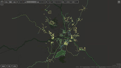
April 3, 2014: Guinea Ebola Outbreak Mapping Party
- Mapped many buildings and landuses in Maumo, Guinea for HOTOSM.
- Changes by us (and many others) can be seen at right (credit to achavi).
March 29, 2014: Meetup at Saints Cafe
- Demo of JOSM
- Demo of Overpass API for downloading OSM data and GDAL for processing
- Planning humanitarian map-a-thon
February 8, 2014: Inaugural map-a-thon:
- Walked through downtown State College and increased details of buildings, businesses, and services
- Added and labeled missing buildings on Penn State campus
- Traced schools, churches, and apartment complexes in State College
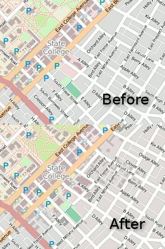
This is a sample of the changes that were made.
Contact
Contact Sterling Quinn for info.
