Colombia/Project-Cienaga-Grande-Bajo-Sinu
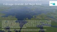
The Ciénaga Grande in the lower basin of the Sinú River in the Department of Córdoba, Colombian Caribbean Coast, is part of a territory of vital social, cultural and ecological importance as a natural drainage.
Project leaded by ReDHUmus.org with a Task at: [1]
Description
The Colombian State characterizes it as one of the most fertile areas of the country, with a strategic location as a regional supplier of "traditional crops". Likewise, the Bajo Sinú is highlighted by the institutions because of its potential and real offer of ecotourism, heritage and architectural services. Simultaneously, multiple human activities has been allowed, affecting in different ways the ecosystem such as, drying, extensive and transhumant cattle ranching, agroindustrial crops. This interventions compete with traditional peasant productive activities as craft phising, low impact crops for food security, and others. In addition, the "Urrá I" hydroelectric project disrupted the hydrological dynamics of the entire basin since 2000.
The communities and grassroots organizations present in this ecosystem have different organizational processes, one of which is the "Movimiento Social el Agua Contando Historias", which aims for the reappropriation of the commons in the Ciénega Grande del Bajo Sinú as a central element for the persistence of the amphibian culture.
We call for volunteers interested in giving support to community efforts for the construction of proposals and plans for the sustainable management of the ecosystem, which at the same time allows maintaining the livelihoods of the families that inhabit this territory. To achieve this, one of the most important tools is the community-based cartography, with which it will be possible to obtain a base map that can be used for multiple purposes in the environmental, socio-productive and participatory management of the territory.
The community mapping tasks are part of a capacity building process being carried out by the "Movimiento Social el Agua Contando Historias", made up of grassroots organizations and communities of the Ciénaga as a strategy to defend the territory.
Objetcives
- Main
Generate situated knowledge from the Ciénaga Grande del Bajo Sinú for the transformation of conflicts over territory, through the critical strengthening of capacities in the generation and administration of data and information.
- Specific
- Form and qualify a permanent technical team for information management: For this purpose, a community mapping team based in the Ciénaga is being formed.
- Generate information products and publish them according to management needs: Appropriate methodologies and tools for the management, modification, publication and exchange of data and derived communication products as part of the communication strategy with other stakeholders and the general public.
- Implement methodologies and technologies for the generation, management and exchange of data based in a sovereignty approach.
Community mapping with OSM
The community mapping tasks will provide an adequate and dense base map to facilitate processes of environmental and social recognition and management of the territory.
- The following mapping task has been activated [2]
Contributors
Coordinacion general:
- Daneris Herrera Maestra. Coordinador del Movimiento Social el Agua Contando Historias.
Equipo técnico de apoyo de la Comunidad OSM:
 OMNIBUS (on osm, edits, contrib, heatmap, chngset com.) - Luis Miguel Sánchez Zoque.
 AngocA (on osm, edits, contrib, heatmap, chngset com.) - Andres Gomez.
- YOUR NAME HERE
Tools
- Tarea en servidor HOTOSM: https://tasks.hotosm.org/projects/13935
- Field photographs with Mapillary: There are photographs taken in the field with Mapillary between 2018 and 2019. Work will continue on the registration of photographs with free software tools that provide the best conditions for open access to published data, for example, OpenStreetCam.
- WMS Layers: https://mapas.redhumus.org/geoserver
- Geonode: https://mapas.redhumus.org/geonode
Hashtags
- #Aguacontandohistorias
- #CulturaAnfibia
Special requirements
- Mapping an ecosystem like this needs information about hydrologic dynamics, then, all contributios from natural sciencies field are welcomed. For mappers this is an ongoing discussion about temporal water sistems, streams.
- This area is affected by different anthropic factors, such as, man made embankments, buildings and roads over water and swaps, outside affectation by an hydroelectric dam in upper basin of the Sinu River
- Mapping in this area needs local knowledge support for remote mappers. For this need, the project is enforcing a local team of mappers to be able lo lead this task. This is a long term project.
- Following last point, the area have some particular caracteristics:
- Buildings: Amphibious culture caracterizes by local uses and styles of living. For example, homes have in general two buildings, one made generally of concrete and a kiosk behind the principak house where is the social area and the kitchen. Bathrooms are generally located outside the house. See an
- Farmlands: There are differ vegetable gardens near the house or "huertas", other than farmlands, generally located a little further away from the houses. They have an elongated rectangular shape and project towards the bodies of water.
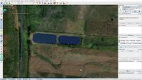
- Water ponds: There are many of these, made for fish farming. Local name for this ponds are "Jagüey", "Jagueyes" in plural. So, we have created a tag preset to map this.


